
Where Flight Simulation Enthusiasts Gather from Around the World!
AVSIM Library - Search Results

| Category: Flight Simulator 2004 - Scenery | |
| Chignik Lake A79 and Port Heiden PAPH - Alaska, USA |

|
Images related to this file:
File Description:
These are two villages in Alaska, in the peninsula that is the start of the Aleutians. Both are east of Perryville, Chignik Lake by 30 miles on the south side of the peninsula and Port Heiden by 75 miles on the north coast. Both are served by Grant Aviation government-subsidised regional flights from King Salmon. Chignik Lake has a population of around 70. There are two buildings on the airfield, but passengers still wait in their car for the plane to arrive as there is no terminal building as such. The runway is 3,300 feet of gravel aligned 08-26, as are so many in this area. Port Heiden is on the north shore of the peninsula, and the population is around 100. FS9 showed the town as being large enough to house 10,000; the new landclass here reduces this to the actual 40 or so houses, one and a half miles south of the airport. The roads are still the FS9 originals, which are approximately in the right place but are brightly lit at night as I was too lazy. The main occupation is fishing. There are buildings on the airfield (mostly old, except for a garage building) but passengers again wait in their cars for the plane to arrive. The two runways are both gravel, and are 05-23 of 6,200 feet, and 13-31 of 4,400 feet.
| Filename: | Chignik_Lake_A79_and_Port_Heiden_PAPH__Alaska_USA.zip |
| License: | Freeware, limited distribution |
| Added: | 30th March 2015, 20:28:47 |
| Downloads: | 292 |
| Author: | Roger Wensley |
| Size: | 5.1 MB |
| Category: Flight Simulator 2004 - Scenery | |
| CYPE - Peace River - Northwest Alberta, Canada |
|
Images related to this file:
File Description:
The Peace River flows east from the Rockies, joining up with the Slave River to empty into Great Slave Lake. The town is on both banks close to a bend, 245 miles northwest of Edmonton. The population is 7,000 and the surrounding area is either farmland or forest and used for winter sports; Peace River hosted the 2004 Alberta Winter Games. The airport is just over 3 miles west of the town. The runway is 5,000 feet of wide asphalt (150 feet) aligned 04/22, lit, and with PAPI. There is a second runway to the south of the main runway, 1,900 feet of grass and aligned 08/26. The apron is to the north of the runway at the eastern end and is large; there is a purpose-built terminal building, plus other hangar buildings along taxiway C that extends westward from the apron. The airport gives the impression that it is under-used; there are no long lines of parked planes waiting for the weekend and few scheduled flights. These are mainly (totally?) by Sunwest Home Aviation, but unfortunately nobody has made the textures for Sunwest and my talents do not run in that direction so I have made believable substitutions. There is also a small but obstinate AI difficulty, described in the notes.
| Filename: | CYPE__Peace_River__Northwest_Alberta_Canada.zip |
| License: | Freeware, limited distribution |
| Added: | 10th November 2013, 23:56:22 |
| Downloads: | 333 |
| Author: | Roger Wensley |
| Size: | 10.83 MB |
| Category: Flight Simulator 2004 - Scenery | |
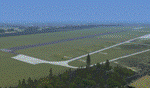
| New Night Textures - Newark Liberty Intl (KEWR) |
|
Images related to this file:
File Description:
Some time ago, I purchased the Newark Liberty Intl (KEWR) by ImagineSim, but the night textures did not seem realistic. I set out to try to make them more so. This is the result of that work. Many of the scenery's night textures have been updated. The cargo areas for FedEx, UPS and UNITED Cargo now look much more realistic. The Marriott Hotel, the centerpiece of the airport and this scenery, looks considerably more realistic, as well as the terminals and the Continental Hanger and maintenance area. One of the nice unexpected results of this change is the light splash effect around the terminals; it definitely outlines the terminal area well. For those who own this scenery, I hope this enhances your flight experiences in and out of KEWR. For those who do not yet own this, but enjoy or would like to fly in and out of KEWR, it is now considered a legacy product by ImagineSim. As a result, the price was cut considerably and for a few shillings and this update, you'll have a nice addition to the airports in your FS2004 environment. I dedicate this work to all the controllers of VATSIM NYARTCC. I hope this brings more traffic your way. I want to thank ImagineSim for giving me permission to release these textures. See Readme.txt for installation instructions.
| Filename: | New_Night_Textures__Newark_Liberty_Intl_KEWR.zip |
| License: | Freeware, limited distribution |
| Added: | 27th October 2012, 03:48:59 |
| Downloads: | 2,290 |
| Author: | Jeffrey S. Bryner, Imagine Simulation |
| Size: | 1.97 MB |
| Category: Prepar3D V1-4 - Aircraft Repaints, Textures and Modifications | |
| jetBlue "My Other Ride Is a JetBlue A320" E190AR (N329JB) |
|
Images related to this file:
File Description:

JetBlue Airways (aka jetBlue), founded in 1998 as "NewAir", is the sixth largest airline in the United States by passengers carried and is a major American low cost airline. It is based on Long Island New York in the borough of Queens, but also has offices in Utah and Florida. Its primary hub is in New York's JFK Airport, and is the whole of Terminal 5. It also has hubs in Boston, Ft. Lauderdale, Orlando and Long Beach CA. JetBlue operates a fleet of 60 Embraer E190's and was a launch customer for the E190. This specific airframe, registration N329JB, bears the slogan "My Other Ride Is a JetBlue A320". The complement aircraft in JetBlue's fleet is an A320-232 reg N793JB bearing "My Other Ride is A JetBlue E190" on the forward fuselage. In the last year, this E190 was the first in the jetBlue E190 fleet to wear the "HighRise" tailfin. The HighRise tailfin represents the New York City skyline and is quite striking. This aircraft is msn 433 and was delivered to jetBlue in 2011. The repainted textures in this package are 32-bit with no mipmaps for best clarity and quality. This is the Version 3 model of the FeelThere Embraer 190. You must own a copy of the Feelthere E-JETS E170 and E190 V3 to enjoy this repaint.
| Filename: | jetBlue_My_Other_Ride_Is_a_JetBlue_A320_E190AR_N32.zip |
| License: | Freeware, limited distribution |
| Added: | 17th April 2020, 03:29:56 |
| Downloads: | 1,120 |
| Author: | Jeffrey S. Bryner, FeelThere |
| Size: | 24.75 MB |
| Category: Flight Simulator 2004 - Scenery | |
| Mustique TVSM in the Grenadines |
|
Images related to this file:
File Description:
Mustique island is one of the northernmost of the group of islands known as the Grenadines, just south of Bequia. Mustique is a small island, less than 3 miles long and even at its widest less than a mile wide; as a result the resident population is less than 500. The island is unique in that it is owned by a company. The company is owned, in its turn, by the owners of the 100 or so private villas on the island. The Queen of England is one owner; her participation is balanced out by Jeremy Clarkson.
The airport is at the northern end of the island; the runway is around 3,240 feet long, aligned 09 (and with the southeast trade winds it is most unlikely that you will ever find yourself using 27) and with a steep and displaced threshold of over 900 feet. The displaced threshold is shown but unfortunately FS9 is not capable of coping with anything other than a prefectly flat airport. The terminal is a steel-framed shed with cladding, but is "quaintly" transformed with a palm frond roof etc. There are connecting flights by SVG to Barbados and the other islands and these are reflected in the AI. The airport has no lighting, and flights are obliged to land and depart in daylight hours only, outside of which the airport is closed.
| Filename: | Mustique_TVSM_in_the_Grenadines.zip |
| License: | Freeware, limited distribution |
| Added: | 11th June 2013, 22:57:37 |
| Downloads: | 512 |
| Author: | Roger Wensley |
| Size: | 2.07 MB |
| Category: Flight Simulator 2004 - Scenery | |
| Kindley Field Bermuda 1955-1962 |
|
File Description:
Kindley Field, on the British Overseas Territory of Bermuda, was built as a joint RAF/USAAF facility during the Second World War. Subsequently the RAF area became the civilian terminal while Kindley Air Force Base was operated by the USAF between 1948 and 1970. It was primarily a staging post between the US and Western Europe for land-based planes unable to cross the Atlantic non-stop, very like Ernest Harmon in Newfoundland and the civilian Gander, and like Harmon it closed when the jet age made such bases redundant. Prior to that it hosted no combat units, but the 59th and then 53rd Weather Reconnaissance Squadrons, the 'Hurricane Hunters', were based there, and also from 1 February 1956 to 15 June 1963 the 303rd ARS Stratotankers were present to support Strategic Air Command and other refueling requirements. After 1970 it became a US Navy facility primarily concerned with tracking Soviet submarines, and was closed at the end of the Cold War. This scenery represents Kindley between 1955 and 1962 and has custom made scenery by Dan French and ai military traffic by Al Von Pingel to add to the downloadable California Classic civilian and MATS traffic available at Tom Gibson's site. Like Harmon and Gander, it was one of the most important airfields of its time.
| Filename: | Kindley_Field_Bermuda_19551962.zip |
| License: | Freeware |
| Added: | 3rd December 2022, 13:10:38 |
| Downloads: | 147 |
| Author: | Ken Lawson, Al Von Pingel, Dan French |
| Size: | 30.31 MB |
| Category: Flight Simulator X - Scenery | |
| EPMO - Modlin 2009 |
|
Images related to this file:
File Description:
EPMO MODLIN 2009 features an extremely detailed scenery of military airfield near Warsaw, Poland, fully compatible with FSX. In the past it was a payware scenery, but Drzewiecki Design decided to provide you that old full product for FREE!
The airport was upgraded around 2012 and currently it has a nice passenger terminal and serves low-cost carriers like Ryanair, however back in 2009 it was an almost abandoned military airfield with some amazing structures inside. This scenery shows the status of Modlin airport in 2009 having many tumble-down buildings, deformed and rusty metal stairs and much more. Nothing has left of that old airport by now but using our scenery you can go back in time and check for yourself how it looked like.
The scenery features accurate positioning, modelling and texturing, high quality photoreal textures of all airport buildings (some buildings include interior) and high quality aerial photos of the airport. The package also includes charts and airfield specification.
The product is equipped with an automatic installer, but you need to manually add the airport into the Flight Simulator Scenery Library (see attached manual or read my text below). Please uninstall all previous versions of this airport you may have installed before. Please make also sure that no duplicate AFCAD files are installed.
Enjoy your virtual flying with Drzewiecki Design!
| Filename: | EPMO__Modlin_2009.zip |
| License: | Freeware, limited distribution |
| Added: | 2nd September 2015, 21:55:26 |
| Downloads: | 655 |
| Author: | Drzewiecki Design |
| Size: | 147.08 MB |
| Category: Flight Simulator 2004 - Scenery | |
| Bethel PABE in southwest Alaska |
|
Images related to this file:
File Description:
There are four main northwestern Alaska towns which have good airports and are serviced by Alaska Airlines. From these airports local flights connect to nearby villages, "nearby" in Alaska meaning up to 200 miles away. The northernmost is Barrow. Southwest of Barrow is Kotzebue, then Nome, and the furthest south is this one, Bethel. The town of Bethel has a population of just over 6,000 and is 50 miles from the sea on the Kuskowim River, that splits and forks into many tributaries. Bethel Airport is close to the town and provides the only contact with the rest of Alaska, as there is no connecting highway system. There are scheduled flights by Alaska Airlines, ERA (now called Ravn) and Grant Aviation, plus others such as Ryan Air. There are cargo flights by Everts, Northern, and Lynden, and redistribution onwards to nearby villages by the smaller locally-based planes; all of these are included in the AI. There are two main runways, one just under 6,400 feet and another just under 3,900 feet, both of them aligned 19-1. The third runway is around 1,800 feet and mainly gravel, aligned 11-29. Parking at PABE is on three aprons, the northern for smaller commercial planes of Grant, ERA, Ryan etc, the central for larger planes of Alaska, Northern, Everts, and Lynden, and the southern for a large collection of GA; each apron has further hangars for maintenance companies and smaller operators. There is also another separate apron for the local military and Coastguard. There is not much photographic information available for PABE, and I have never been there; as a result it was impossible to make detailed photographic textures for some of the buildings. However, for most hangars I have made textures of at least the right colour etc based on the information I assembled and if it is green with white trim and side windows then that is how it now appears here. The exceptions are the Alaska Airlines terminal building which has complicated curved elements, and the two military hangars and workshops where I had to settle for an Alaska terminal building from another airport and the same for the military. There are numerous small villages in the vicinity of Bethel, all of them being beside either a river tributary or the coast. There are two Google Earth screenshots to show the villages that are served by the flights from Bethel and that are (mostly) included in the AI. Some of these airfields were not included in FS9 but AI will still operate in and out of Bethel. The smaller area screenshot shows the villages that are close to Bethel, and of these eight I have so far made six and they are included in this post: Napaskiak PKA, Napakiak WNA, Kwethluk KWT, Atmautluak 4A2, Nunapitchuk 16A, and Kasigluk Z09. I will work my way through the rest of the area.
| Filename: | Bethel_PABE_in_southwest_Alaska.zip |
| License: | Freeware, limited distribution |
| Added: | 8th March 2019, 00:37:58 |
| Downloads: | 303 |
| Author: | Roger Wensley |
| Size: | 32.02 MB |
| Category: Flight Simulator 2004 - Miscellaneous Files | |
| Nick's AI Jet Exhaust With Control Gauge |
|
File Description:
Hanging around the airport watching the A-I traffic and chasing A-I jet aircraft just got a little more interesting. Enjoy watching your entire A-I jet fleet as they display engine heat shimmer effects -after- push-back from the terminal and during taxi to the active runway. All the A-I traffic take off displaying a lite, expanding, frame-rate friendly and nicely scaled high throttle heat/exhaust trail FX which remain with the A-I aircraft during its entire flight. To top off the show, the A-I aircraft that are throttled down and landing display no exhaust from the engines! This package also comes with a gauge that allows pilot throttle control of the taxi heat shimmer/full-throttle exhaust FX for the jet aircraft being flown in the sim by the user. This package does NOT interfere with the logo, taxi or wing lights of any aircraft and comes with 5 all new exhaust effects files which can be applied to just about any size private, commercial or military jet. It requires editing/adding lines in the aircraft.cfg and panel.cfg files. The README files include very complete and comprehensive instructions including a quick and easy copy/paste file for all the Microsoft jet aircraft and tutorial on making custom gauges from the one provided. This package completely replaces my original *Nick's Jet Smoke* package and any/all updates for it.
By Nick Needham
| Filename: | Nicks_AI_Jet_Exhaust_With_Control_Gauge.zip |
| License: | Freeware, limited distribution |
| Added: | 22nd December 2003, 21:16:01 |
| Downloads: | 29,957 |
| Author: | Nick Needham |
| Size: | 894.61 KB |
| Category: Flight Simulator 2004 - Miscellaneous Files | |
| Active ILS - LEBL Simwings/New Spanish Airports (El Prat - Barcelona Airport) |
|
File Description:
This file is made for Barcelona LEBL Aerosoft/Simwings FS9's New Spanish Airports. As most know initiating the ILS at certain airports for AI Traffic or the User Aircraft is not a function at this time when using AFCAD2. If you add a new ILS runway to an airport such as LEBL (El Prat/Barcelona 7R/25L) only the user aircraft can use this runway (without ATC commands) when visibility falls below 3 miles. ATC will no longer use this runway for AI Traffic because FS9 sees it as a visual runway. This will cause ATC to vector all your AI Traffic back to runway 7/25 old numbers, 7L/25R new numbers which is also a Terminal departure runway. This ILS bgl file adds all NAVAIDS for making 7R/25L a Precision Instrument Runway by adding all the radar fixes for both the ILS approach portion and the missed approach procedures, altitudes and intersections as per current published plates. All AI Aircraft/User Planes will now continue to use the new 7R/25L runway when Airport weather conditions are less than 3 miles. ATC will also use the right naming/numbers of the runways. The DME/VOR approaches have also been written using the new BCN/PRA VOR's for runways 7L/25R and 02. Many different default FS9 scenery GUID's added including Taxiway Signs. *** FS2004 Simwings Barcelona Scenery AFCAD2 included with the new 7R/25L runway ***
| Filename: | Active_ILS__LEBL_SimwingsNew_Spanish_Airports_El_P.zip |
| License: | Freeware, limited distribution |
| Added: | 31st December 2004, 04:59:21 |
| Downloads: | 3,943 |
| Author: | Jim Vile |
| Size: | 32.52 KB |
© 2001-2026 AVSIM Online
All Rights Reserved
Privacy Policy |