
Where Flight Simulation Enthusiasts Gather from Around the World!
AVSIM Library - Search Results

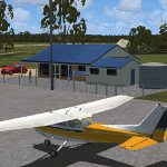
| Category: Flight Simulator 2004 - Scenery | |
| Hewanorra TLPL on Saint Lucia in the eastern Caribbean |

|
Images related to this file:
File Description:
St Lucia island is to the north of the Grenadines, between Martinique and Saint Vincent. St Lucia is nearly 30 miles long and has a population of 175,000, with two airports. Hewanorra International is at the southern end of the island, the end furthest from the capital, Castries. The reason for this is that at the southern end it was possible to build a runway almost 9,000 feet long, while the airport in the north (Vigie) could not be extended further to accomodate the largest jets. The airport was originally a USAAF base, converted to commercial use.
All buildings are made with photographic textures and include the new terminal and a new control tower. The apron has been extended so that 747's etc can be accommodated, and there are regular international flights by Virgin, BA, Air Canada, Air France, etc and local connecting flights by LIAT; the AI includes both major international airlines and LIAT. The towns around the airport (Vieux Fort etc) are included here: the scenery is based on the "Lesser Antilles Mesh" which is required and can be downloaded for free.
| Filename: | Hewanorra_TLPL_on_Saint_Lucia_in_the_eastern_Carib.zip |
| License: | Freeware, limited distribution |
| Added: | 11th June 2013, 16:23:49 |
| Downloads: | 831 |
| Author: | Roger Wensley |
| Size: | 4.25 MB |
| Category: Flight Simulator 2004 - Scenery | |
| Akulivik CYKO in northern Quebec Canada |
|
Images related to this file:
File Description:
This is another of the many airfields that are all around the coast of Hudson Bay, this one being on the eastern, Quebec side. Akulivik is around 110 miles south of Ivujivik, which is on the northeastern corner of the Bay, and some 60 miles north of Puvirnituq. The population is 630 or so and the village grew from a move back to the area by one family in 1973, followed by others in the following years; the closure of the Hudson Bay trading post post in 1952 had pushed all residents to move south to Puvirnituq. The village is unusual in that it has a built harbour instead of the usual beached storage of boats. The village is built on the central prong of a three pronged spear of headlands (from which the village name is derived) while the airfield is a mile or so further inland. I have no information regarding what I think may be a new terminal building, so this includes only the old original one. The runway is just under 3,500 feet of gravel aligned 09-27, and the ai includes the scheduled flight by an Air Inuit Dash 8-300, plus GA.
| Filename: | Akulivik_CYKO_in_northern_Quebec_Canada.zip |
| License: | Freeware, limited distribution |
| Added: | 9th September 2018, 03:43:25 |
| Downloads: | 162 |
| Author: | Roger Wensley |
| Size: | 4.69 MB |
| Category: Flight Simulator 2004 - Scenery | |
| Colville Lake CEB3 in Northwest Territories Canada |
|
Images related to this file:
File Description:
Colville Lake is a small village of around 150 Dene, located to the northwest of the Great Bear Lake and east of the Mackenzie River, 120 miles north of Norman Wells. The village and the airfield are next to each other and to the lake shore. I recently discovered which of the standard terminal buildings had been used there and this, along with information I already had, enabled me to now make the scenery, which is based on an approximate 2010 date. The gravel runway is lit and around 2,800 feet long, aligned 10-28. North Wright Air serves the village from it's headquarters at Norman Wells with daily flights by de Havilland Twin Otters, or "twotters" as they were quickly named among the northern Canadian airline personnel when they were first produced. The approximate time of this scenery is 2010. While testing this scenery I discovered that Tulita (previously called Fort Norman) which is another Mackenzie River airfield to the south of Norman Wells, needs to be reposted due to a terrain fault. If you find an error here then email me please, and note that my email address has been changed to rogwens at Gmail dot com.
| Filename: | Colville_Lake_CEB3_in_Northwest_Territories_Canada.zip |
| License: | Freeware, limited distribution |
| Added: | 31st July 2021, 18:23:48 |
| Downloads: | 68 |
| Author: | Roger Wensley |
| Size: | 4.51 MB |
| Category: Flight Simulator 2004 - Scenery | |
| Carp CYRP in Ontario Canada (updated October 2011) |
|
Images related to this file:
File Description:
This version further updates the post of 2006 and the 2009 update with more bespoke buildings for the west GA apron plus the revised fuelling area, and corrected surroundings with large forested areas and a modified airfield grass shape. This is a stand-alone version and does not require you to have downloaded and installed the previous posts; this REPLACES those versions. Carp airfield is fifteen miles west of Ottawa and two miles south of the town of Carp. There are two runways, 10/28 which is asphalt and almost 4,000 feet long and 100 feet wide, and 04/22 which is gravel and 2,000 feet long. The airfield has a fairly large population of general aviation residents and is slowly expanding under new ownership. This version models the large hangar beside the terminal, the "Touch'n Go" aviation warehouse that has opened more recently, and the ramshackle collection of hangars and sheds that make up Westair, the maintenance facility. The nearby pagoda-roof flight school building has in fact now been demolished, but I like it too much to do that, at least until something else has been built on that space.
| Filename: | Carp_CYRP_in_Ontario_Canada__updated_October_2011.zip |
| License: | Freeware, limited distribution |
| Added: | 25th November 2011, 09:25:34 |
| Downloads: | 587 |
| Author: | Roger Wensley |
| Size: | 7.59 MB |
| Category: Flight Simulator 2004 - Scenery | |
| Antique Scenery, San Jose de Buenavista, Antique, Philippines |
|
File Description:
ANTIQUE SCENERY,Full Version 2.0
October 10,2003
Enjoy this ANTIQUE SCENERY located at San Jose de Buenavista,Antique,Philippines.This scenery features the new EVELIO B. JAVIER airport terminal,ATO building, and the Antique airport CRASH AND FIRE RESCUE STATION with full night lighting.
This scenery is designed to optimize framerates.Special thanks goes to CAPT. JOHN L. MAKANI for the AERIAL and CLOSE UP shots he made at this new Antique airport.
Asian Spirit now serves this airport three times a week. Using the ASIAN SPIRIT YS-11, or sometimes using the ASIAN SPIRIT LET-410,it serves antique airport on Mondays, Wednesdays and Fridays.Install the included TRAFFIC TOOLS FILES and watch out for the ASIAN SPIRIT YS-11 land perfectly in this airport M-W-F at 11:35 a.m.from Manila and take off again at 12:05 p.m. back to Manila.Install the included AFCAD files and watch your favorite genav aircraft land and take off perfectly at the center of the runway.Install the included Editvoicepack VCPMOD file and hear the Antique Tower pronounce the word "Antique" correctly or hear the ATC say "Antique" instead of "Romeo Papa Victory Sierra".
| Filename: | Antique_Scenery_San_Jose_de_Buenavista_Antique_Phi.zip |
| License: | Shareware, time limited |
| Added: | 11th October 2003, 02:08:18 |
| Downloads: | 4,112 |
| Author: | Ver Walter L. Gulfan |
| Size: | 1.73 MB |
| Category: Flight Simulator X - Scenery | |
| West Coast Victoria v2 for ORBX v2 YWBL Warrnambool YPOD Portland YPFA Port Fairy |
|
Images related to this file:
File Description:

'West Coast Victoria v2' is made to match ORBX Australia v2 scenery. Use 'West Coast Victoria' for ORBX v1 or no ORBX. There are 3 airports YWBL Warrnambool YPOD Portland YPFA Port Fairy. ORBX has done 2 of these (YWBL, YPOD) as they have done every airport included with FSX in Australia to a reasonable standard. If I had not already done them for ORBX V1 I would not have bothered. However these are better than ORBX because the surroundings have been modified to match real life. Towns have been added or shifted. Forests cut down or added. There are also custom accurate versions of the actual terminal buildings. Included are AI traffic files that cover all 3 airports + YHML Hamilton nearby (little or no traffic from ORBX). In short a lot more time spent. ORBX had to do every airport has in Australia! Recommend installing the excellent YHML Hamilton (by Anthony Lynch). These files are for Flight Simulator X. Made using Airport Design Editor using some objects borrowed from Robert Budd's excellent Baccus Marsh and 'Static aircrafts' by Jean-Pierre Fillion. REQUIRED The scenery is designed to interface with ORBX FTX_AU V2 scenery for Australia (payware).
| Filename: | West_Coast_Victoria_v2_for_ORBX_v2____YWBL_Warrnam.zip |
| License: | Freeware |
| Added: | 8th October 2019, 20:00:14 |
| Downloads: | 321 |
| Author: | Colin Jeffery |
| Size: | 8.56 MB |
| Category: Flight Simulator X - Scenery | |
| East Coast Victoria v2 for ORBX v2 YLKE Lakes Entrance YGRL Great Lakes Airport YORB Orbost YMCO Mallacoota |
|
Images related to this file:
File Description:
'East Coast Victoria v2' is made to match ORBX Australia v2 scenery. For ORBX v1 or no ORBX use 'East Coast Victoria'. There are 4 airports. YLKE Lakes Entrance YGRL Great Lakes Airport YORB Orbost YMCO Mallacoota. ORBX has done 2 of these (YORB, YMCO) as they have done every airport included with FSX in Australia to a reasonable standard. If I had not already done them for ORBX V1 I would not have bothered. However these are better than ORBX because the surroundings have been modified to match real life. Towns have been added or shifted. Forests cut down or added. There are also custom accurate versions of the terminal buildings. Included is an AI traffic files that covers the airports (little or no traffic from ORBX). In short a lot more time spent by me as I did not have to do every airport in Australia! These files are for Flight Simulator X. Made using Airport Design Editor using some objects borrowed from Robert Budd's excellent Baccus Marsh. REQUIRED The scenery is designed to interface with ORBX FTX_AU V2 scenery for Australia (payware).
| Filename: | East_Coast_Victoria_v2____for_ORBX_v2____YLKE_Lake.zip |
| License: | Freeware |
| Added: | 16th September 2019, 16:27:48 |
| Downloads: | 388 |
| Author: | Colin Jeffery |
| Size: | 6.32 MB |
| Category: Flight Simulator X - Scenery | |
| Sioux Falls South Dakota Regional Airport - Joe Foss Field for FSX |
|
Images related to this file:
File Description:
Sioux Falls South Dakota Regional Airport - Joe Foss Field for FSX. Several improvements have been made to the default airport. The default terminal buildings have been replaced with buildings created in FSDS; aircraft gates have been correctly coded using Airport Design Editor 1.70.6042; a new airport vehicle network has been built; extra fuel trucks have been added throughout the airport; the tower view has been changed to display from the roof of the control tower; a static FedEX truck in two different color schemes has been placed in the cargo area; all taxiway signs are correctly placed and all taxiway designators are correctly named; there is the option to open all three runways to AI traffic; the 114th Fighter Wing of the South Dakota Air National Guard is represented; optionally, a set of GA flight plans is included using all default FSX aircraft to liven up the GA area; also included is a set of military flight plans for the 114th Fighter Wing; and Jim Dhaenen's excellent ramp lights are also included. Please read the README FIRST.txt and Installation.txt files to insure proper installation of all files.
| Filename: | Sioux_Falls_South_Dakota_Regional_Airport__Joe_Fos.zip |
| License: | Freeware, limited distribution |
| Added: | 14th April 2017, 07:16:53 |
| Downloads: | 969 |
| Author: | Patrick Finch |
| Size: | 3.56 MB |
| Category: Flight Simulator X - Scenery | |
| Whakatane Airport (NZWK), New Zealand |
|
File Description:
Whakatane Airport (ICAO: NZWK) is a small airport serving the town of Whakatane in the Bay of Plenty, New Zealand. It consists of a Asphalt runway flanked with a parallel grass strip and a helipad. While not a particularly busy aerodrome, there are daily movements by Air New Zealand/Eagle Airways Beech 1900Ds, general aviation movements including agricultural aircraft, training flights from the flight school and scenic flights to White Island off the coast of the Bay of Plenty.
Of particular interest is the main terminal, designed by Roger Walker in the modernist style. It has survived in its original form since its construction in the 1970’s and gives a cheerful welcome to visitors disembarking to discover the many natural and cultural attractions in the region.
This particular airport is of interest to me as I began my real world flying training there originally with Scott Air and later with Air Discovery (www.airdiscovery.co.nz) As well as flight training, they also fly scenic tours of White Island and Mount Tarawera.
This Scenery Features: High resolution 10cm imagery for the airport including night map, Custom made buildings including night lighting and window reflections, extensive trees and grass.
| Filename: | Whakatane_Airport_NZWK_New_Zealand.zip |
| License: | Freeware, limited distribution |
| Added: | 24th December 2008, 13:20:53 |
| Downloads: | 3,128 |
| Author: | Tim Barnes |
| Size: | 34.5 MB |
| Category: Flight Simulator 2004 - Miscellaneous Files | |
| Active ILS - KMIA v2.0 |
|
File Description:
UPDATED KMIA see the readme file -- By design KMIA is now the most advanced ATC controlled airport in the FS9 database. As most know initiating the ILS at certain airports for AI Traffic is not a function at this time when using AFCAD2. If you add a new ILS runway to an airport such as KMIA (Miami International Airport 8L/26R) only the user aircraft can use this runway when visibility falls below 3 miles. ATC will no longer use this runway for AI Traffic because FS9 sees it as a visual runway. This will cause ATC to vector your AI Traffic back to 9L/27R (old numbers) 8R/26L (new numbers) which is also a Terminal departure runway. All 4 runways for KMIA are now simultaneously active for both departure and arrival. The many options (written in the XML compiled to bgl) are to numerous to list for KMIA so follow the instructions in the README and just sit back (or fly) and plane spot either VMC or IMC for a very active airport. *** FlyTampa-Miami Scenery AFCAD2 and special ILS bgl also updated and included ***
| Filename: | Active_ILS__KMIA__v20.zip |
| License: | Freeware, limited distribution |
| Added: | 26th July 2004, 16:20:37 |
| Downloads: | 5,939 |
| Author: | Jim Vile |
| Size: | 129.61 KB |
© 2001-2026 AVSIM Online
All Rights Reserved
Privacy Policy |