
Where Flight Simulation Enthusiasts Gather from Around the World!
AVSIM Library - Search Results

| Category: Flight Simulator X - Scenery | |
| Grise Fiord Airport CYGZ |

|
File Description:
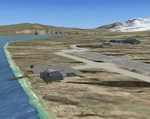
Grise Fiord, NWT Canada scenery - CYGZ (FSX).
This is a fictitious rendition of the actual and VERY REMOTE Airport at Grise Fiord in the Canadian NWT - CYGZ.
Grise Fiord is the most northerly community in Canada.
Only operators with considerable experience should use this aerodrome at all. Bring your Twin Otter. There are places to fly your helocopters too. (Explore the oil rigs or see if you can land on one of the destroyers passing by).
See the whales!
See: http://www.copanational.org/PlacesToFly/airport_view.php?pr_id=13&ap_id=288
For great photo's of the area: http://www.arcticcircle.ca/Baffin/Grise/
Virtual improvements have finally come to this area where the ice never melts.
This is freeware. I hope you enjoy it.
Designed with the FS X Sdk Scenery function of the Mission builder and the Abacus Scenery shortcut tool.
This scenery is frame rate friendly.
| Filename: | Grise_Fiord_Airport_CYGZ.zip |
| License: | Freeware |
| Added: | 26th January 2007, 02:37:13 |
| Downloads: | 1,520 |
| Author: | Bob Caparoula |
| Size: | 2.47 MB |
| Category: Flight Simulator X - Original Aircraft | |
| Bristol F2B Mk.1 Part 1 |
|
File Description:
Flight Simulator X version of the Bristol Fighter Mk.1 or 'Biff' as it was called by its crews in WW1. This file is part 1 of a 4 part download and contains visual models and textures depicting 3 aircraft with the earlier short form exhausts. No other downloads are required to make this functional. The other 3 downloads are optional variants. This aircraft was modeled using 3DS Max 8.0 and compiled using FSX SDK tools and will only work in FSX or higher. It is NOT compatible with FS2004. The aircraft makes full use of FSX materials and also features skinned animated crew members in the external model. It also features a detailed virtual cockpit. All instruments, levers and selectors are modeled in the 3D model. It does not use the FSX gauge system and there is NO 2D cockpit.
| Filename: | Bristol_F2B_Mk1__Part_1.zip |
| License: | Freeware, limited distribution |
| Added: | 2nd February 2007, 03:22:25 |
| Downloads: | 7,366 |
| Author: | Robert Bruce |
| Size: | 22.04 MB |
| Category: Flight Simulator 2004 - AFCAD Files | |
| W88 Air Harbor - Greensboro NC |
|
File Description:
I decided to make this modification to W88 (Air Harbor, Greensboro NC) simply because the stock airport was done completely wrong. The default version has way too much ramp area where there should be grass runway. According to Airnav ( http://www.airnav.com/airport/W88 ), the runway is 2460' x 65', composed of "asphalt/turf." MS put in a 20' wide asphalt strip, but put a huge ramp right next to it. I've done two things to the airport. First, I severly reduced the size of that ramp. Second, due to the limitations in FS, I simply added a 40' wide grass runway adjacent to the asphalt strip. This gives you the total width called for by Airnav's spec, and also gives two more starting points as a bonus! There's still more ramp than in real-life, but I just consider that "artistic license." :)
| Filename: | W88_Air_Harbor__Greensboro_NC.zip |
| License: | Freeware |
| Added: | 30th March 2006, 00:19:53 |
| Downloads: | 229 |
| Author: | Tom Clayton Jr |
| Size: | 102.74 KB |
| Category: Flight Simulator X - Scenery | |
| KMHV Mojave Airport v2.0 |
|
File Description:
This remote former World War II desert airfield has developed some very interesting and unusual features. It is a center for civilian aviation R&D, a major aircraft storage and scrap yard (possibly the largest nonmilitary one in the country), a busy film site, and is the home of the National Test Pilot School, the largest civilian test pilot school in the world. Also located here is Burt Rutan's Scaled Composites company, where many innovative aircraft designs have been conceived and constructed. Mojave Airport is also where many commercial carriers store surplus or otherwise in- limbo airliners. There are currently around 90 airplanes waiting to be sold, repaired or reused here, including several 747s. This file has been designed to work on both FS2004 and FS-X platforms. Requires RWY 12 Object Placer program (available at www.avsim.com) for full enhancement.
| Filename: | KMHV_Mojave_Airport_v20.zip |
| License: | Freeware |
| Added: | 12th November 2006, 22:19:46 |
| Downloads: | 2,609 |
| Author: | Brian C. Selb |
| Size: | 377.72 KB |
| Category: Combat Flight Simulator 1 and 2 - Aircraft | |
| Bell P-39F-1-BE 39th FS - UPDATE |
|
File Description:
Bell P-39F-1-BE 39th FS - UPDATE, 35th FG, 5th Air Command, USAAC. Serial: X (41-7170). Pilot: Boyd Wagner. New Guinea, early 1942. The plane was operative with the 39th Fighter Squadron, 35th Fighter Group, 5th Air Command, during the first half of 1942 in Australia and New Guinea. This Squadron was re-equipped with the P-38F Lightning during July 1942, in Townsville (Australia), and returned to operational active duty in late October 1942 from 14 Mile Drome (Schwimmer Field) - Port Moresby, New Guinea. Painted over The B24 Guy's P39D Overhaul Model. This is an update, as the original file was not that of the "Miss Helen" as stated in the description. Also, texture files have been corrected for proper nav. lights. Sorry for any confusion. Complete Texture Folder, with Damage Files, included. By revev. Enjoy!
| Filename: | Bell_P39F1BE_39th_FS__UPDATE.zip |
| License: | Freeware |
| Added: | 13th August 2006, 21:17:36 |
| Downloads: | 110 |
| Author: | Evan G. Butterbrodt |
| Size: | 1.72 MB |
| Category: Civil Flight Simulators - Looking Glass Flight Unlimited 3 | |
| FU3 Outer Terrain Tag File Information |
|
File Description:
These Excel spreadsheets contain information about the contents of the outer terrain's 3 tag files:
- outtaga.tag
- outtagb.tag
- outtagc.tag
The file outer_tag_offsets.xls contains a complete list of the file offsets of each file within the three tag files, i.e. the starting position (as byte number) of the level 0, level 2, level 5 .geo files and corresponding gtl files within each tag file. The last three columns of each worksheet contain the relevant information: filename, file position, and file size.
The file outer_tag_x&y.xls lists all the L0 .geo megatiles within each tag file and provides the position of each megatile within the OT region as an X and Y co-ordinate. Columns K, T, U and V provide the relevant information.
These spreadsheets may be of use to anyone wishing to develop the outer terrain region.
| Filename: | FU3_Outer_Terrain_Tag_File_Information.zip |
| License: | Freeware |
| Added: | 21st November 2009, 23:24:58 |
| Downloads: | 29 |
| Author: | Jonathan Stonehouse |
| Size: | 1.08 MB |
| Category: Flight Simulator X - Aircraft Repaints, Textures and Modifications | |
| C-130E Evergreen |
|
Images related to this file:
File Description:
This is a repaint for the captain sim C-130 X-perience (http://www.captainsim.com/products/c131/), to use this repaint, BASE pack is required. This repaint contains an Evergreen International Airlines livery. The particular aircraft included is the one with registration number N130EV. This particular aircraft, USAF serial 64-0552 (c/n 382-4047), was built for the USAF in 1965 and immediately converted into a WC-130E. In 1999 it was acquired by Evergreen International Airlines and registered N130EV (this repaint). The aircraft was purchased by Sabena Technics in 2007 as a replacement for the C130 (CH-02) lost in a hangar fire on Brussels Airport on May, 5th, 2006. Sabena technics converted the aircraft to the Belgian C-130H state, and it now serves as CH-13 with the Belgian Air Component. Repaint by Lars Domen
| Filename: | C130E_Evergreen.zip |
| License: | Freeware, limited distribution |
| Added: | 18th March 2010, 09:04:33 |
| Downloads: | 1,694 |
| Author: | Lars Domen |
| Size: | 4.52 MB |
| Category: Flight Simulator X - Scenery | |
| Salmon Point, Chenega, Alaska |
|
Images related to this file:
File Description:
Salmon Point, Chenega, Alaska is fictitous. It has a completely new airport with a 3500' gravel runway, 2 landable helipads, NDB (309.0) and VOR/DME (115.60), runway has night lights and an aircraft service/maintenance area with a ramp for floatplanes which leads up to an elevated platform. The area is filled with private homesites with docks and boats/floatplanes, a few fishing boats at dock and at sea, cabins, a lighthouse, windmill and an old nickel mine with buildings and a few other objects. A couple of crashed plane remnants too.
Salmon Point is locted approx 70 miles east Seward and 65 miles SSW Valdez.
Designed without addons such as Ultimate Alaska X so objects may appear where they were not intended to be if you have such addons.
Designed to enhance your flight sim world. Please enjoy........savagegle
| Filename: | Salmon_Point_Chenega_Alaska.zip |
| License: | Freeware |
| Added: | 20th August 2010, 22:26:09 |
| Downloads: | 488 |
| Author: | Tim Durham |
| Size: | 1.09 MB |
| Category: Flight Simulator X - Scenery | |
| Victoria International Airport (CYYJ) |
|
File Description:
This airport was made using Airport Design Editor. Victoria International Airport is an airport located in Victoria, British Columbia. It has scheduled airline flights for a few airlines. I replaced all the default buildings and put more accurate ones. I also made the main terminal with two jetways. I put the genaral aviation and the terminal in the correct locations. At the genaral aviation, I put static aircraft and aircraft hangers. If you choose to start at the DOCK gate, you will start off in the hanger. To the west, I put helipads that are used for military. I also put the Aviation Museum that is located to the southeast. I used Google Earth and Bing maps for the airport. Please read the readme for instructions on how to install. This download is for Flight Simulator X only.
| Filename: | Victoria_International_Airport_CYYJ.zip |
| License: | Freeware |
| Added: | 22nd December 2011, 19:57:20 |
| Downloads: | 1,885 |
| Author: | Tyler Lawrence |
| Size: | 6.8 MB |
| Category: Flight Simulator X - Utilities | |
| Taxi Navigation (+Destination Weather Reporter) for FSX/FS9 V1.0 |
|
Images related to this file:
File Description:

Do you prepare airport charts of every airport you visit, or just follow the progressive taxi to do taxiing?
This utility will make taxiing easy and realistic by providing simple taxi navigation information in text.
While taxiing, press "Ctrl + Shift + X", then taxi navigation information will be displayed.
It includes current taxiway name, intersecting taxiways' name and distance
(e.g. "On R7 : R2 (250m), R1 (643m), A (748m), A7 (748m)").
And one more thing, it also provides destination weather report.
It can be very helpful to set up exact T/D(Top of Descent), by assuming expected runway with wind information.
Enter destination airport before flight, and press "Ctrl + Shift + W" while flying,
then destination weather information will be displayed.
It looks like METAR and includes wind direction and speed, visibility, temperature, dew point and pressure
(e.g. "RKPK 29403KT 47SM 32/23 1010mb").
| Filename: | Taxi_Navigation_Destination_Weather_Reporter_for_F.zip |
| License: | Freeware |
| Added: | 3rd August 2012, 06:47:24 |
| Downloads: | 2,940 |
| Author: | Dongjin Shin |
| Size: | 4.88 MB |


© 2001-2026 AVSIM Online
All Rights Reserved
Privacy Policy |