
Where Flight Simulation Enthusiasts Gather from Around the World!
AVSIM Library - Search Results

| Category: Miscellaneous Files - Demos from Commercial Vendors | |
| Aeroflot Russian Airlines Airbus A350 |

|
File Description:
Demoversion with banners, new VOR gauge, with new PANEL and GAUGES, new external model, sound and virtual cockpit. The A350 XWB (Xtra Wide-Body) is Airbus’ response to market demand for a medium capacity long range wide-body family. Designed with airlines’ priorities in mind, the A350 XWB confronts the challenges of high fuel prices, rising passenger expectations and increasing environmental concerns. Available from 2013, it has an entirely new, uncompromised, 21st Century design with a wider and taller fuselage for extra space and passenger comfort. A complete family of airliners sized to generate cost reductions and provide unprecedented operating flexibility for airlines; three basic passenger versions are being offered. With a range of up to 8,300nm/15,380km they include the A350-800 for 270 passengers in a spacious three-class configuration; the A350-900 for 314 passengers and the A350-1000 seating 350 passengers. An ultra long-range version, the A350–900R, will fly even further while a freighter version, the A350–900F, will complement the passenger models.
As befits the most advanced aircraft family in its segment, the A350 XWB is able to provide greater economy on long-range markets and is equally attractive as a route opener or as part of a multi-type Airbus fleet offering optimized network solutions. Thanks to the application of the latest innovations, the A350 XWB is able to offer 20 per cent lower cash operating costs per seat than competing aircraft in this size category and fuel efficiency improvements of up to 25 per cent per seat. The fly-by-wire A350 XWB Family is a significant addition to the Airbus product range. A member of the Airbus FBW Family of aircraft, it benefits from the same operational commonality as the other members of the Family. This handling and flight deck commonality allows airlines to benefit from the unique Airbus Family concept of cross crew qualification and mixed fleet flying, and will ensure smooth introduction into service. Panel, GAUGES, model, sound and textures by www.afs-design.de - Author: A.Meyer.
| Filename: | Aeroflot_Russian_Airlines_Airbus_A350.zip |
| License: | Commercial demo |
| Added: | 3rd May 2008, 02:23:35 |
| Downloads: | 3,041 |
| Author: | Andreas Meyer |
| Size: | 2.15 MB |
| Category: Prepar3D V1-4 - Aircraft Repaints, Textures and Modifications | |
| North American P-51D 3rd ACG (C) 'Bad Angel' |
|
Images related to this file:
File Description:
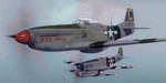
This folder contains a second repaint for the A2A WoP3 P-51D Mustang, in the colors of P-51D-20 44-63272 “Bad Angelâ€, flown by Lt. Louis Curdes of the 4th Fighter Squadron, 3rd Air Commando Group. He is one of a very few American pilots to have kills against each of the three major Axis powers, and I believe the only US pilot to display an American flag among his victory markings.
While serving in the MTO, Curdes downed several Fw-190’s, and one of the Macchi C.202’s he downed is now on display at the National Air & Space Museum in Washington DC. He was shot down over Italy and spent a short time as a POW before escaping. Because he was an escaped POW, he couldn’t fly again against the Germans for security reasons.
He was transferred to the PTO, and on February 10, 1945, during a sweep to Bataan Island, he saw a P-51 pilot parachute into the sea. Curdes circled around him to pinpoint his position to rescuers. While circling, he saw a USAAF C-47 that was preparing to land on the Japanese-held strip on Batan. The C-47 crew didn’t respond to repeated attempts at radio contact and, unable to shepherd the C-47 to safety, Curdes saw only two possibilities – first that it was a Japanese plane bearing false US markings (the DC-3 having been built under licence in Japan prior to the war), or it was a US plane whose crew was unaware the field had fallen to the Japanese. He therefore carefully shot out both engines, causing the plane to land in the sea. All 13 people on board the C-47 were rescued – and they were indeed Americans, including a nurse Curdes had previously dated. Repaint by Jan Kees Blom.
| Filename: | North_American_P51D_3rd_ACG_C_Bad_Angel.zip |
| License: | Freeware |
| Added: | 3rd November 2018, 23:18:24 |
| Downloads: | 48 |
| Author: | Jan Kees Blom |
| Size: | 6.11 MB |
| Category: Microsoft Flight Simulator (2020) - Aircraft Repaints, Textures and Modifications | |
| Goodyear FG-1D Corsair VF-17 #29 Lt Kepford |
|
Images related to this file:
File Description:
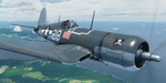
This folder contains a repaint for the FG-1D Corsair by Milviz, in the colors of F4U-1 BuNo 55995 of VF-17, the aircraft flown by Lt (jg) Ira C. Kepford, Bougainville, February 1944. Ira Cassius Kepford was born in Harvey, Illinois, on May 29, 1919, son of George Raymond and Emma McLaughlin Kepford. His family moved to Muskegon, Michigan, shortly after he was born. An all-around athlete at Muskegon High School from 1935-1937, he capped his prep career by being named an All-State back in his senior year. He enrolled at Northwestern University in 1938 to study for a dentistry career.
He enlisted in the U.S. Naval Reserve on August 18, 1941, and was honorably discharged on April 29, 1942, to accept appointment as Aviation Cadet, U.S.N.R. After flight training at the Naval Air Stations, Corpus Christi, Texas, and Miami, Florida, he became a Naval Aviator on November 5, 1942, and was commissioned Ensign, U.S.N.R., with date of rank October 16, 1942.
Detached from Naval Air Station, Miami, Florida, in December 1942, he served with Fighting Squadron 17 in the Pacific War Area until March 1944, where he became the U.S. Navy's leading ace, scoring a record 16 confirmed Japanese planes destroyed. That squadron won the Navy Unit Commendation and he was personally awarded the Navy Cross, a Gold Star in lieu of the second Navy Cross, the Silver Star Medal and the Distinguished Flying Cross.
From March until June he was attached to the Fleet Air, Alameda, Command, and the last six months of that year served with Fighting Squadron 84. In December 1944 he was transferred to the staff of Commander Fleet Air, West Coast, and remained in that assignment throughout the remaining period of hostilities. Repaint by Jan Kees Blom.
| Filename: | Goodyear_FG1D_Corsair_VF17_29_Lt_Kepford.zip |
| License: | Freeware |
| Added: | 4th April 2021, 15:38:23 |
| Downloads: | 63 |
| Author: | Jan Kees Blom |
| Size: | 41.83 MB |
| Category: Flight Simulator 2004 - Aircraft Repaints, Textures and Modifications | |
| Grumman Mallard (ZK-CDV) |
|
Images related to this file:
File Description:
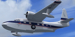
This folder contains a repaint for the freeware Grumman Mallard by Milton Shupe and LDR development. It shows ZK-CDV, Mallard c/n J13. It was imported into New Zealand by the Utah-Williamson-Burnett Ltd for transportation to its Manapouri Power Station project.
This airframe was constructed in late 1946 and delivered to Canada on 25-01-1947 as CF-FFG. By mid 1951 it was in Indonesia as PK-AKG with an offshoot of Shell Oil. It then moved to the Netherlands New Guinea register as JZ-POB in 1955. It eventually became VH-TGA in 1962 with East Coast Airlines followed by a transfer to Trans Australia Airlines in mid 1963 and used on the "Coralair Service". It was ferried into Auckland on 13-10-1963 and became ZK-CDV on the 15th for Utah-Williamson-Burnett at Invercargill. It still had some hydraulic problems as its nosewheel collapsed on 07-10-1964 at Invercargill. It was purchased in about 1969 by the Department of Internal Affairs and went to NAC in Christchurch for some refurbishment and a paint job before being cancelled on 21-02-1969 and marked up as VQ-FBC. This was for Air Pacific with whom it carried the name "Na Secala". It was withdrawn from use in Fiji on 04-10-1970 and cancelled from their register on 31-03-1971 for transfer to the US as N2442H the following day. It has soldiered on ever since; moving to Canada as C-GRZI for about a year in 1978 before returning to the US again. In June of 1993 it was sold to Steve Hamilton of Reno Nevada. Steve re-registered it as N2950 in March of 1998. It is still current.
Repaint by Jan Kees Blom, based on the white textures that came with the model
| Filename: | Grumman_Mallard_ZKCDV.zip |
| License: | Freeware |
| Added: | 19th July 2018, 13:24:17 |
| Downloads: | 140 |
| Author: | Jan Kees Blom |
| Size: | 11.48 MB |
| Category: Flight Simulator X - Scenery | |
| 2 Fronson Hangars |
|
Images related to this file:
File Description:
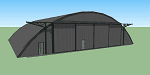
This model was created to be placed in FSX as airport scenery using Airport Design Editor.
I created it for my own use when i was re-creating RNAS HMS Nuthatch which was a Naval Airstation near Anthorn on the Solway Coast in Cumberland (now Cumbria), United Kingdom.
History of RNAS HMS Nuthatch...
Work began on building an airfield at Anthorn for the Fleet Air Arm in late 1943, with Royal Naval Air Station Anthorn, or HMS Nuthatch opening on 7 September 1944, with three tarmac runways.
It was the base of No. 1 Aircraft Receipt and Despatch Unit (No. 1 ARDU), which had the job of receiving aircraft fresh from manufacturers, modifying them to Service standards and despatching them to operational squadrons, with the unit specialising in the Vought F4U Corsair.
No. 1 ARDU continued to operate from Anthorn following the end of the Second World War, while a number of Fleet Air Arm Squadrons were also based at the airfield in the immediate post war years.
The airbase shut down in March 1958.
The Airfield is now the site of a VLF/LF transmitter used for transmitting orders to Submarines, it is also home to three atomic clocks for transmitting Britains time signal transmissions.
None of the Hangars (11 Pentad and 22 Fromson) survive at the site but their concrete standings are still visable.
Depicted here are representations of the Fromson type hangers created from dimensions in a 1947 survey.
I created the model using Google Sketchup and converted it for use in FSX using Model ConverterX.
This is my 1st attempt at scenery creation and is therefore pretty basic.
There are no known issues and it works fine in FSX.
| Filename: | 2_Fronson_Hangars.zip |
| License: | Freeware |
| Added: | 8th June 2014, 07:13:54 |
| Downloads: | 251 |
| Author: | Mark John Byers |
| Size: | 1.4 MB |
| Category: Flight Simulator 2004 - AFCAD Files | |
| CYZD |
|
File Description:
Downsview Airport or Toronto/Downsview Airport, (IATA: YZD, ICAO: CYZD), is located in Toronto, Ontario and has been exclusively used and owned as a testing facility by Bombardier Aerospace since 1994. Downsview Airport has its own fire service (Bombardier Emergency Services) which covers airport operations (using two airport fire rescue vehicles) and plant operations (using two SUV emergency vehicles). Bombardier Emergency Services employs robust employees who are trained as fire fighters, paramedics, and as peace officers (despite being a private airport, its security force is sworn in as Peace Officers per Canadian Airport Standards as well as being sworn fire fighters under the authority of the Ontario Fire Marshall).
The Downsview Airport was developed in 1939 as an airfield next to an aircraft manufacturing plant operated by de Havilland Canada. In 1947, the Department of National Defence purchased property surrounding the airfield and expanded it, creating RCAF Station Downsview to provide an air base for Royal Canadian Air Force units. The base was renamed Canadian Forces Base Toronto (Downsview) in 1968 and retained this name until its closure in 1994.
Since 1998, the property has been administered by a civilian Crown corporation Parc Downsview Park, which co-manages the airfield with Bombardier Aerospace (the successor to de Havilland Canada). In recent years the property has been undergoing various landscape usage plans and some redevelopment has taken place.
The airfield was used in recent years to host the 1984 and 2002 Papal visits by Pope John Paul II, as well as to host the 2003 SARS concert headlined by the Rolling Stones.
The airfield has also served as a test site for several famous aircraft produced by de Havilland, including the Beaver, the Twin Otter, and the Dash 8. The airport is available to pilots only with prior permission.
Discription By Wikipedia.
| Filename: | CYZD.zip |
| License: | Freeware, limited distribution |
| Added: | 30th May 2007, 01:11:04 |
| Downloads: | 812 |
| Author: | Max Udaskin |
| Size: | 346.78 KB |
| Category: Flight Simulator X - Original Aircraft | |
| "Janet Airways" Boeing 737-600 BBJ-ER |
|
Images related to this file:
File Description:
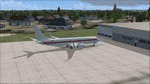
A highly classified small fleet of passenger aircraft known as "Janet" is operated for the United States Air Force to transport military and contractor employees. It mainly serves the Nevada National Security Site (most notably Area 51 (AR51) and Tonopah Test Range (TNX), from their terminal at Las Vegas' McCarran International Airport (KLAS). The planes are also used to fly to/from Air Force Plant 42 (KPMD), Naval Air Weapons Station China Lake (KNID), Hill Air Force Base (KHIF), and Edwards Air Force Base (KEDW). I encourage you to locate, download, and install the AFCAD files or scenery add-ons associated to these airports from any source you desire, but make sure they are designed for FSX. The fleet's "Janet" call sign, from which its de facto name comes, is said to stand for "Just Another Non-Existent Terminal", or more likely "Joint Air Network". Everything is realistic in this model, now, and most simmers know how inaccurate the original FSX 737-800 was. However, this aircraft simulates the accuracy of a 737-600 BBJ-ER, if there ever was one built. I modified everything to fit that aspect, except for the visual model. The engine characteristics are correct as well as all weight/balance and MOI. I even fixed the wheels to be accurate in base, track and pressure size. Everything I've done here is for educational purposes without any expectation of any monetary gain, and offered publicly for free. Read the Readme.txt file for installation and details. All persons involved with this and the original design are credited, unless they are unknown and have offered no credit details. Sounds by: Christoffer Petersen, Panel by: Pasquale Rinaldi, Redirected Texture by: Microsoft (Unknown Staff Member Names), Real World Engine/Aerodynamics by: Douglas E. Trapp, FS Flight Dynamics Engineer [email protected] July 2017
| Filename: | Janet_Airways_Boeing_737600_BBJER.zip |
| License: | Freeware |
| Added: | 8th July 2017, 20:04:30 |
| Downloads: | 1,919 |
| Author: | Douglas E. Trapp |
| Size: | 39.16 MB |
| Category: Flight Simulator 2004 - Scenery | |
| Silver City CFQ5 in Yukon Territory Canada |
|
Images related to this file:
File Description:
Silver City is a ghost town in the Yukon Territory, Canada, amid the Rocky Mountains and around 35 miles northwest of Haines Junction. It is on the southern end of Kluane Lake and in the Kluane National Park and this probably explains it's (minimal) survival after what appears to have been the shutdown of mining for silver. There is little information readily available. The date of this scenery is, as usual, around 2010. There was no recent regular service by Yukon Air North or any other airline, and the primary user of the airfield adjacent to the lake is a company called Icefield Discovery Tours. Their activity is probably very similar to the company at Haines Junction and involves trips to the National Park amid mountains and glaciers. There is also another organisation at the airfield, the Kluane Lake Research Station of the Arctic Institute. They have four buildings there but it is unclear how much aerial activity they generate, or if in fact they fly at all for their work. The runway is 3,000 feet of unlit gravel, aligned north-south. This post will be followed by Burwash, which is at the far northwestern end of the lake. There is no video of the Silver City airfield on Youtube, and it is not the most exciting airfield in the world, but the location is enough in real life for a visit to be made. On YouTube there is a series of posts by Angle of Attack showing the preparation and then the flight of an old Cessna 172 from Homer to Oshkosh for the installation of modern instruments. Interesting for me as they visit or fly over airfields I have made: Homer, Merrill, Tok Junction, Burwash, Silver City, Haines Junction, Watson Lake, Fort Nelson, and Grande Prairie. But they fly in the winter so it all looks very different.
| Filename: | Silver_City_CFQ5_in_Yukon_Territory_Canada.zip |
| License: | Freeware, limited distribution |
| Added: | 22nd January 2022, 21:57:41 |
| Downloads: | 97 |
| Author: | Roger Wensley |
| Size: | 9.86 MB |
| Category: Flight Simulator 2004 - Scenery | |
| Alaska South Slope 9; Wales IWK |
|
Images related to this file:
File Description:
There are four main northwestern Alaska towns which are serviced by Alaska Airlines, and from which local flights spread out. The northernmost is Barrow. Southwest of Barrow is Kotzebue, then Nome, and the furthest south is Bethel (not yet made). This is the second in a series for local flights from Nome, and it is on the furthermost mainland western point of Alaska, Wales IWK. It is 110 miles northwest of Nome and on the eastern shore of the Bering Strait, with a view of the two Diomede Islands. Wales is a small village with a population of only around 145, strung along the beach on a single road. The airfield is at the northwestern end of the village, with a runway of 4,500 feet of lit gravel aligned 35-17 and an apron at the southern end. There are scheduled flights by the usual Era and Bering Air, both of them originating in Nome and also visiting Shishmaref. The AI includes these flights along with Northern Air Cargo and GA. The runway is just long enough to accomodate a DC6 (as is Shishmaref) and I have revised the AI to include this, along with a revision of the parking at Shishmaref. To the southeast of Wales is Tin City, which was built as a base for the support of radar on the hills between the two. The radar is now automatic and unmanned and the base is unused except for the annual maintenance and fuel supply; I have left the airfield untouched but I have added the hilltop radar and the remains of the cable lift, which was used to get the material for the original station up to the top from the beach below.
| Filename: | Alaska_South_Slope_9_Wales_IWK.zip |
| License: | Freeware, limited distribution |
| Added: | 22nd October 2016, 01:26:24 |
| Downloads: | 570 |
| Author: | Roger Wensley |
| Size: | 3.77 MB |
| Category: Flight Simulator 2004 - Scenery | |
| Stephenville CYJT in Newfoundland Canada |
|
Images related to this file:
File Description:
Stephenville is on the east coast of Canada, and the airport was an American base from 1941, when it was built, until 1966. It was named the "Ernest Harmon Airforce Base" and I will leave that for you to research if you wish to know more. Operating in my version (around 2010?) as a civilian airport, it's main features are a long 10,000 feet 09-27 runway (with ILS on 27) and acres of empty space. The runway was one of those designated as an emergency space shuttle landing runway if required. There is a shorter 20-02 runway (3,000 feet) that is not maintained during the winter (and which would be closed in 2018). The revised perimeter fence of the airport now encloses less than half of the original area, with the northern parts replanned as an industrial park. The attached screenshot from Google Earth shows this, and also that the main operating part of the airport is at the western end of the main runway, with only one hangar connecting to the runway from the eastern end. Like Gander, the airport is still shrinking, with taxiways and aprons not maintained (particularly in the winter) or even formally closed, and flight numbers falling. Until the early 1990's Stephenville was serving most of western Newfoundland and Air Canada, for instance, was one of the airlines that flew there. Deer Lake took over this task for western Newfoundland when the Provincial Government so decided. Stephenville remains as a port of entry, and planes with a total of 30 or less passengers can still be serviced there. My version is a mixture that cannot be precisely dated. For instance, I know there was a large hangar there until 2013 but as I do not have any photos to make it I have shown only the concrete square where it formerly stood. So 2008 or 2013, or somewhere in between? I have the airport being served by Provincial Airlines and also by Porter, though in fact Porter only flew there during the Summer months; I say "flew" as right now all flights are of course almost totally non-existent. As with Gander, I have made it clear which of the taxiways and aprons are still in regular use by showing them as asphalt, while those in the process of decaying disuse or removal are in the darker gravel or tarmac textures; this is somewhat realistic as when asphalt aprons are "ploughed" for removal the darker underside becomes visible. I have also shown the areas that now form part of the Industrial Park as cement, as this better matches the Ultimate Terrain road texture. It may seem odd that the new Canadian Coastguard hangar is not properly served by an asphalt taxiway instead of sitting on an apron that is not cleared in the winter, but it caters (mainly?) for helicopters. The original coastguard hangar is the large and decrepit one in the northeastern corner of the airport. Almost all of the buildings within the original perimeter of the airport are fairly accurately replicated here, whether still in use (Road Maintenance Department, Garbage Disposal, Armour Trucking Company, etc) or vacant (including the very strange atom-bomb-proof buried shelter) or still part of the airport (the east side of the main apron with Shell to the north, then the terminal, the Marine Institute, etc). The AI included here (a revised Gander AI) is for daily flights by Provincial Airlines, Porter, and some charter planes and GA. You will see, once the scenery is installed, that like Gander there two scenery folders called "Scenery summer" and "Scenery winter". Obviously in August you will want the summer scenery and you get this by editing the folder name down from "scenery summer" to just "scenery" and FS9 loads the summer ground textures. If FS9 decides that there is snow on the ground then you need the winter textures which do not show the aprons or taxiways that do not receive winter maintenance. One thing you must NOT DO is to edit both folders down at the same time.
| Filename: | Stephenville_CYJT_in_Newfoundland_Canada.zip |
| License: | Freeware, limited distribution |
| Added: | 24th June 2020, 18:01:58 |
| Downloads: | 235 |
| Author: | Roger Wensley |
| Size: | 43.78 MB |


© 2001-2026 AVSIM Online
All Rights Reserved
Privacy Policy |