
Where Flight Simulation Enthusiasts Gather from Around the World!
AVSIM Library - Search Results

| Category: Flight Simulator X - AFCAD Files | |
| Fla-Net Airport (0NJ5), NJ |

|
File Description:
This another weird airport entry in the FSX database. The real 0NJ5 is the Meadowlands Sports Complex Heliport #2, and this just shows up as a random turf strip up near Netcong/Flanders in northern NJ. I could not find any specific information regarding the airport online, and while it does appear to once harbour the room and terrain for a grass strip, it's largely overgrown, even in the current MegaScenery Earth textures. So I've removed the strip entirely. There is still a start at the northwest end of where the strip used to be if you want to travel there, but that's it.
Scenery constructed with use of satellite images/streetview, the author has not been there in person.
This scenery is meant to be used in conjunction with MegaScenery Earth New York 005. It is not required, but apron use is minimized to allow satellite scenery to show through as much as possible, and objects are placed based on the MSE textures - lack of it may make scenery look out of place.
| Filename: | FlaNet_Airport_0NJ5_NJ.zip |
| License: | Freeware |
| Added: | 21st October 2010, 23:23:44 |
| Downloads: | 188 |
| Author: | Drew Sikora |
| Size: | 199.2 KB |
| Category: Flight Simulator X - AFCAD Files | |
| Woodbine Municipal Airport (1N4), NJ |
|
File Description:
Located 02 miles SE of Woodbine, New Jersey on 700 acres of land, Woodbine Municipal Airport serves small to large GA craft as well as gliders and ultralights. Tie downs are the only option for transient aircraft. The main parking area of the airport is located in the center tarmac area near the fuel station. The parking spots can accomodate aircraft with wingspans up to 50 feet. Anything larger should park off the side of the taxiway. Fuel is available by stopping near the fuel tank. It should be noted that this airport's real ICAO is KOBI.
Scenery constructed with use of satellite images/streetview, the author has not been there in person.
This scenery is meant to be used in conjunction with MegaScenery Earth New Jersey/Delaware 005. It is not required, but apron use is minimized to allow satellite scenery to show through as much as possible, and objects are placed based on the MSE textures - lack of it may make scenery look out of place.
| Filename: | Woodbine_Municipal_Airport_1N4_NJ.zip |
| License: | Freeware |
| Added: | 22nd October 2010, 06:03:35 |
| Downloads: | 202 |
| Author: | Drew Sikora |
| Size: | 352.7 KB |
| Category: Flight Simulator X - AFCAD Files | |
| Central Jersey Regional Airport (47N), NJ |
|
File Description:
Located 01 miles S of Manville, New Jersey on 119 acres of land, Central Jersey Regional Airport is a public asphalt strip. Hangars and tiedowns are offered for transient craft. The open hangar at the north of the airport is available for parking - it can be a bit of a tight fit taxiing in so I have disabled collision with the two planes nearby. You can also select the DOCK parking space to start inside the hangar. Fuel is available on the north tarmac by the fuel truck in front of the hangar, and on the south tarmac by the fuel tank. Trees are summertime ONLY.
Scenery constructed with use of satellite images/streetview, the author has not been there in person.
This scenery is meant to be used in conjunction with MegaScenery Earth New Jersey/Delaware 001. It is not required, but apron use is minimized to allow satellite scenery to show through as much as possible, and objects are placed based on the MSE textures - lack of it may make scenery look out of place.
| Filename: | Central_Jersey_Regional_Airport_47N_NJ.zip |
| License: | Freeware |
| Added: | 25th November 2010, 14:15:25 |
| Downloads: | 295 |
| Author: | Drew Sikora |
| Size: | 1.92 MB |
| Category: Flight Simulator X - AFCAD Files | |
| Coombs Airport (7NJ7), NJ |
|
File Description:
Located 04 miles NE of Elmer, New Jersey, Coombs Airport is a private turf field 2000' in length wilth clear 20:1 approach and departure at each end of the runway. You'll find some surrounding buildings but they are all located several hundred yards from the runway. This is a good strip to keep in mind for emergencies if you're in the area. You will be landing on terrain so having your mesh complexity set as high as possible is recommended. This airport is not lit at night, daytime VFR operations only are suggested. There are no transient services offered.
Scenery constructed with use of satellite images/streetview/aerial photos - the author has not been there in person.
This scenery is meant to be used in conjunction with MegaScenery Earth New Jersey/Delaware 004. It is not required, but apron use is minimized to allow satellite scenery to show through as much as possible, and objects are placed based on the MSE textures - lack of it may make scenery look out of place.
| Filename: | Coombs_Airport_7NJ7_NJ.zip |
| License: | Freeware |
| Added: | 16th February 2011, 00:03:55 |
| Downloads: | 191 |
| Author: | Drew Sikora |
| Size: | 756.22 KB |
| Category: Flight Simulator X - AFCAD Files | |
| Rainbow's End Airport (JY39), NJ |
|
File Description:
Located 07 miles S of Salem, New Jersey on 20 acres of land, Rainbow's End Airport is a private turf strip 2200' in length. There are no services for transient aircraft and the airport is not lit at night, so daytime VFR operations only are recommended. If you have an aircraft with 40' or less of wingspan you can start at one of the parking spaces east or west of the runway by the hangars. Otherwise it is suggested you start on the runway. There is no hard surfaced runway so set your terrain mesh as high as possible.
Scenery constructed with use of satellite images/streetview/aerial photos - the author has not been there in person.
This scenery is meant to be used in conjunction with MegaScenery Earth New Jersey/Delaware 005 & New Jersey/Delaware 004. It is not required, but apron use is minimized to allow satellite scenery to show through as much as possible, and objects are placed based on the MSE textures - lack of it may make scenery look out of place.
| Filename: | Rainbows_End_Airport_JY39_NJ.zip |
| License: | Freeware |
| Added: | 12th May 2011, 00:58:29 |
| Downloads: | 173 |
| Author: | Drew Sikora |
| Size: | 626.46 KB |
| Category: Flight Simulator 2004 - AFCAD Files | |
| LPPT by PPP, and EDDH |
|
File Description:
AFCAD2 File for :
Lisbon, Portela Intl Airport, Portugal ( LPPT )
for PPP Scenery of Portugals's LPPT, LPPR and LPFR airports.
Although Runway 17/35 is rarely used, I have decided to open it for Take-off and landing .
Primarily 21 and secundary 35 ( Can't make 3 and 17 work, though I haven't tested it with wind.
Can be found on Avsim as ppp30.zip ( PPP version 3.0 )
All credits to the PPP team for LPPT/LPPR/LPFR sceneries, many many thanks .
( Not to bo used with the default scenery )
You may have to delete Airport.bgl in the scenery file of PPP, otherwise this Afcad file will not work .
For that reason also back-up Afcad files for PPP's LPPR and LPFR included.
Also included Hamburg, Fuhlsbuttel airport, Germany ( EDDH ) for Jan Martin's
jtacof_4.zip ( Jetways & Terminals For ACOF Package Four ) ( can also be used with default scenery )
Primarily Runway 15 and secundary 05 ( again I am not sure if 33 and 23 work , haven't tested
it with wind .
Tested them in my own FS2004, and it works well .
Have fun!
| Filename: | LPPT_by_PPP_and_EDDH.zip |
| License: | Freeware |
| Added: | 10th October 2004, 03:42:57 |
| Downloads: | 1,640 |
| Author: | Silvester van Wijk |
| Size: | 26.7 KB |
| Category: Civil Flight Simulators - Looking Glass Flight Unlimited 3 | |
| New Elevation data GeoTiles.tag for FU3 Seattle Region |
|
File Description:
The test elevation meshes for Switzerland and UK Region using the data from
NASA SRTM_V2 program ( 3 arc second resolution, about 90m grid ) was so successful that I have tried to do a new elevation file for the Seattle Region using the 1 arc second elevation from the same source ( US area only ) 30m grid resolution. Each elevation point ( 64m grid in FU3 ) is now converted from the UTM coordinate to the exact Lat/Long WGS84 coordinate and for this point the elevation data are picked up and stored.
The Geotiles.tag file residing in the /region/seattle/geos/ folder contains this data.
To benefit from this new elevation experience FIRST RENAME YOUR ORIGINAL GEOTILES.DAT FILE INTO XGEOTILES.DAT then copy the geotiles.tag from this zip into the geos folder of the Seattle region. Start FU3 and enjoy the new perfect fitted landscape. Best way is to start directly from the air and not from an airport then all airport are no more flat, have hills and holes. Models and runways are floating over the ground or are into the ground.
| Filename: | New_Elevation_data_GeoTilestag_for_FU3_Seattle_Reg.zip |
| License: | Freeware, limited distribution |
| Added: | 26th September 2006, 23:37:55 |
| Downloads: | 168 |
| Author: | Andre Meystre |
| Size: | 19.28 MB |
| Category: Prepar3D V1-4 - Scenery | |
| LTFE - Milas Bodrum Airport - Turkey |
|
Images related to this file:
File Description:
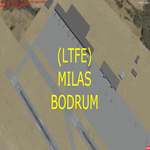
LTFE - Accurate positioning according to the latest charts, google map coordinates and the Navigraph runway coordinates data.
Upon planning a flight from Istanbul to Bodrum, I realized that the airport has been developed with the addition of the international terminal, and the conversion of the old taxiway A into a runway (10R - 28L), and thus decided to quickly make this update.
Milas–Bodrum Airport (IATA: BJV, ICAO: LTFE) is an international airport that serves the Turkish towns of Bodrum and Milas. The airport is situated 36 km northeast of the town of Bodrum, and 16 km south of Milas.
The airport is surrounded by beautiful scenery of hills, with a steep approach of 3.90 degrees due to the surrounding terrain.
Please read the included README file for the simple install instructions.
| Filename: | LTFE__Milas_Bodrum_Airport__Turkey.zip |
| License: | Freeware, limited distribution |
| Added: | 5th July 2017, 17:46:12 |
| Downloads: | 768 |
| Author: | Ahmed Abdessalam |
| Size: | 945.88 KB |
| Category: Flight Simulator 2004 - Scenery | |
| Murray Field KEKA |
|
Images related to this file:
File Description:
FS2004 Scenery - Murray Field (IATA: EKA, ICAO: KEKA, FAA LID: EKA) is a county-owned public-use airport in Humboldt County, California, United States. Murray Field Airport serves Eureka and Humboldt County. The airport has more than one runway. The longest is a paved runway extending 3000 feet. The facility is at an elevation of 7 feet at a distance of about 3 miles from Eureka. The airport is primarily used for general aviation. Also FedEx Express utilizes the small airport as a stop for package delivery from and to Humboldt County. Murray Field was first established in 1919 by pilot Dayton Murray, and was later renamed in his honor. It has a restaurant and a charter service, Northern Air, as well as a Civil Air Patrol office. Created by John B. Loney, Jr.
| Filename: | Murray_Field_KEKA.zip |
| License: | Freeware, limited distribution |
| Added: | 20th March 2012, 01:35:39 |
| Downloads: | 346 |
| Author: | John B. Loney, Jr. |
| Size: | 5.92 MB |
| Category: Flight Simulator 2004 - AFCAD Files | |
| Boston Logan Int'l (KBOS) with active Crosswind Runways |
|
Images related to this file:
File Description:
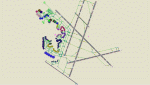
This is a high spec AFCAD2 for the (Freeware) FS2004 Boston Logan Int'l Airport (KBOS) scenery by Fly Tampa / George Grimshaw. This afcad has been built using FAA Charts and information from the Airport Website. All gates are named and have airlines assigned to them. The Fedex and UPS aprons are represented and can accommodate many cargo aircraft. The final parking area is random GA parking and the various maintenance areas to the north of the airport. This airport now features an accurate tower view. Finally, by using the crosswind runway technique, all runways can be used simultaneously for take-off and landing (see brief). Enjoy!!
This file will work with version 2.1 of the airport ONLY (adds the new runway 14/32, new American Eagle gates).
| Filename: | Boston_Logan_Intl_KBOS_with_active_Crosswind_Runwa.zip |
| License: | Freeware |
| Added: | 4th March 2010, 13:26:27 |
| Downloads: | 2,246 |
| Author: | Lee Brompton |
| Size: | 40.32 KB |


© 2001-2026 AVSIM Online
All Rights Reserved
Privacy Policy |