
Where Flight Simulation Enthusiasts Gather from Around the World!
AVSIM Library - Search Results

| Category: Flight Simulator 2004 - Scenery | |
| Vernon Regional Airport (CYVK) - Vernon, B.C.; Canada | Updated Version |

|
File Description:
Scenery add-on for Vernon Regional Airport (CYVK) - Vernon, B.C.; Canada. Vernon Regional boasts over 120,000 square feet of land and has become the center for aviation manufacturing and maintenance in the Pacific Northwest. This add-ons places the Vernon Flying Club building, plus a number of hangars on the airport grounds. Includes AFCAD file to add aircraft parking. Scenery was designed to reflect the current placement of buildings at CYVK within the limitations of the flight simulator terrain. Consideration was also given to system effects and framerates. This package requires the NovaSim Gold textures (Not included-directions provided in ReadMe file). This update fixes the missing BGL problem. Full Update- not a patched version.
| Filename: | Vernon_Regional_Airport_CYVK__Vernon_BC_Canada__Up.zip |
| License: | Freeware, limited distribution |
| Added: | 3rd January 2004, 20:41:03 |
| Downloads: | 1,686 |
| Author: | Jeff Shields |
| Size: | 48.75 KB |
| Category: X-Plane - Scenery | |
| BR RO SBVH - Vilhena Airport v1.0.0 |
|
Images related to this file:
File Description:
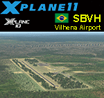
This is an X-Plane 11 and X-Plane 10 scenery package for Vilhena - Brigadeiro Camarão Airport (IATA: BVH, ICAO: SBVH), that serves the city of Vilhena, in Brazil. It includes corrected aprons, ramps, gates, taxiways, lighting system, city buildings, ortho-photoscenery for the airfield area, and (XP11 only) airport ground services (like push back). This scenery was tested and is operational (as of May 14, 2017) in "X-Plane 11.01 64 bit", Windows 10 Home. It was also tested and is also operational (as of May 13, 2017) in "X-Plane 10.51 64 bit", Windows 10 Home. Only the default X-Plane 11 libraries, by Laminar Research, are needed. No third party libraries are used.
| Filename: | BR_RO_SBVH__Vilhena_Airport_v100.zip |
| License: | Freeware |
| Added: | 14th May 2017, 20:12:21 |
| Downloads: | 93 |
| Author: | Rui Mesquita |
| Size: | 10.5 MB |
| Category: X-Plane - Scenery | |
| BR DF SIQE - Brasilia Botelho Airfield v1.0.0 |
|
Images related to this file:
File Description:
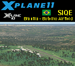
This is an X-Plane 11 and X-Plane 10 scenery package for Brasilia's Botelho Airfield (ICAO: SIQE), which is a general aviation private airport serving Brazil's capital city: BrasÃlia, DF - Brasil. It includes corrected aprons, ramps, gates, taxiways, lighting system, ortho-photoscenery for the airfield area, and (XP11 only) airport ground services (like push back). This scenery was tested and is operational (as of Sep 09, 2017) in "X-Plane 11.05 64 bit", Windows 10 Home. It was also tested and is also operational (as of Sep 09, 2017) in "X-Plane 10.51 64 bit", Windows 10 Home. Only the default X-Plane 11 libraries, by Laminar Research, are needed. No third party libraries are used.
| Filename: | BR_DF_SIQE__Brasilia_Botelho_Airfield_v100.zip |
| License: | Freeware |
| Added: | 9th September 2017, 18:43:40 |
| Downloads: | 69 |
| Author: | Rui Mesquita |
| Size: | 9.15 MB |
| Category: Flight Simulator X - Scenery | |
| Paris Le Bourget LFPB France |
|
Images related to this file:
File Description:
Scenery of a famous French airport Le Bourget, the home of a well-known air show. It is located 12 kilometers southeast of Paris and primarily used by business jets (but can easily accomodate A380 or large cargo planes). Due to close proximity of Charles de Gaulle international airport, Le Bourget has unusual approach to runway 25 to avoid de Gaulle traffic. Oh, and you can see the Eiffel Tower from here! This scenery has super-accurate layout, taxiways, markings and navaids according to the latest charts (May 2017; included) and satellite images. Made for P3Dv3, but works fine in FSX:SE and should work in vanilla FSX and P3Dv4 too. Made by Dmitriy Kozyrev.
| Filename: | Paris_Le_Bourget_LFPB_France.zip |
| License: | Freeware |
| Added: | 8th September 2017, 17:52:01 |
| Downloads: | 4,528 |
| Author: | Dmitriy Kozyrev |
| Size: | 5.31 MB |
| Category: Flight Simulator 2004 - Scenery Design | |
| Update of Turbigo's Power Station - VFR LIMC Malpensa, Italy |
|
Images related to this file:
File Description:
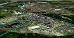
This scenery has been revised with complete new ground that solves the previous flickering problems; some objects, buildings and trees have been added. It DOES NOT INCLUDE any airport. Scenery requests Tree_v3 library; a special re-mesh file has been included, for users of special meshes (i/e Ragot Alps or Lod11)
Infos: the Turbigo's power station is placed approx 8 miles South LIMC Malpensa international airport of Milan, on the usual approach way for runways 35L and 35R.
content: new complete image of the ground; power station blocks 1, 2 & 3 with related 4 stacks with lights & smokes; boilers, esp, some ductworks & pipes, oil tanks, water treatment basins, bridges, some buildings and trees
| Filename: | Update_of_Turbigos_Power_Station__VFR_LIMC_Malpensa_Italy.zip |
| License: | Freeware |
| Added: | 25th September 2011, 14:39:16 |
| Downloads: | 1,803 |
| Author: | Aldo Della Vedova & Daniele Lanfranchi |
| Size: | 3.05 MB |
| Category: Flight Simulator X - AFCAD Files | |
| Fla-Net Airport (0NJ5), NJ |
|
File Description:
This another weird airport entry in the FSX database. The real 0NJ5 is the Meadowlands Sports Complex Heliport #2, and this just shows up as a random turf strip up near Netcong/Flanders in northern NJ. I could not find any specific information regarding the airport online, and while it does appear to once harbour the room and terrain for a grass strip, it's largely overgrown, even in the current MegaScenery Earth textures. So I've removed the strip entirely. There is still a start at the northwest end of where the strip used to be if you want to travel there, but that's it.
Scenery constructed with use of satellite images/streetview, the author has not been there in person.
This scenery is meant to be used in conjunction with MegaScenery Earth New York 005. It is not required, but apron use is minimized to allow satellite scenery to show through as much as possible, and objects are placed based on the MSE textures - lack of it may make scenery look out of place.
| Filename: | FlaNet_Airport_0NJ5_NJ.zip |
| License: | Freeware |
| Added: | 21st October 2010, 23:23:44 |
| Downloads: | 188 |
| Author: | Drew Sikora |
| Size: | 199.2 KB |
| Category: Flight Simulator X - AFCAD Files | |
| Woodbine Municipal Airport (1N4), NJ |
|
File Description:
Located 02 miles SE of Woodbine, New Jersey on 700 acres of land, Woodbine Municipal Airport serves small to large GA craft as well as gliders and ultralights. Tie downs are the only option for transient aircraft. The main parking area of the airport is located in the center tarmac area near the fuel station. The parking spots can accomodate aircraft with wingspans up to 50 feet. Anything larger should park off the side of the taxiway. Fuel is available by stopping near the fuel tank. It should be noted that this airport's real ICAO is KOBI.
Scenery constructed with use of satellite images/streetview, the author has not been there in person.
This scenery is meant to be used in conjunction with MegaScenery Earth New Jersey/Delaware 005. It is not required, but apron use is minimized to allow satellite scenery to show through as much as possible, and objects are placed based on the MSE textures - lack of it may make scenery look out of place.
| Filename: | Woodbine_Municipal_Airport_1N4_NJ.zip |
| License: | Freeware |
| Added: | 22nd October 2010, 06:03:35 |
| Downloads: | 202 |
| Author: | Drew Sikora |
| Size: | 352.7 KB |
| Category: Flight Simulator X - AFCAD Files | |
| Central Jersey Regional Airport (47N), NJ |
|
File Description:
Located 01 miles S of Manville, New Jersey on 119 acres of land, Central Jersey Regional Airport is a public asphalt strip. Hangars and tiedowns are offered for transient craft. The open hangar at the north of the airport is available for parking - it can be a bit of a tight fit taxiing in so I have disabled collision with the two planes nearby. You can also select the DOCK parking space to start inside the hangar. Fuel is available on the north tarmac by the fuel truck in front of the hangar, and on the south tarmac by the fuel tank. Trees are summertime ONLY.
Scenery constructed with use of satellite images/streetview, the author has not been there in person.
This scenery is meant to be used in conjunction with MegaScenery Earth New Jersey/Delaware 001. It is not required, but apron use is minimized to allow satellite scenery to show through as much as possible, and objects are placed based on the MSE textures - lack of it may make scenery look out of place.
| Filename: | Central_Jersey_Regional_Airport_47N_NJ.zip |
| License: | Freeware |
| Added: | 25th November 2010, 14:15:25 |
| Downloads: | 296 |
| Author: | Drew Sikora |
| Size: | 1.92 MB |
| Category: Flight Simulator X - AFCAD Files | |
| Coombs Airport (7NJ7), NJ |
|
File Description:
Located 04 miles NE of Elmer, New Jersey, Coombs Airport is a private turf field 2000' in length wilth clear 20:1 approach and departure at each end of the runway. You'll find some surrounding buildings but they are all located several hundred yards from the runway. This is a good strip to keep in mind for emergencies if you're in the area. You will be landing on terrain so having your mesh complexity set as high as possible is recommended. This airport is not lit at night, daytime VFR operations only are suggested. There are no transient services offered.
Scenery constructed with use of satellite images/streetview/aerial photos - the author has not been there in person.
This scenery is meant to be used in conjunction with MegaScenery Earth New Jersey/Delaware 004. It is not required, but apron use is minimized to allow satellite scenery to show through as much as possible, and objects are placed based on the MSE textures - lack of it may make scenery look out of place.
| Filename: | Coombs_Airport_7NJ7_NJ.zip |
| License: | Freeware |
| Added: | 16th February 2011, 00:03:55 |
| Downloads: | 191 |
| Author: | Drew Sikora |
| Size: | 756.22 KB |
| Category: Flight Simulator X - AFCAD Files | |
| Rainbow's End Airport (JY39), NJ |
|
File Description:
Located 07 miles S of Salem, New Jersey on 20 acres of land, Rainbow's End Airport is a private turf strip 2200' in length. There are no services for transient aircraft and the airport is not lit at night, so daytime VFR operations only are recommended. If you have an aircraft with 40' or less of wingspan you can start at one of the parking spaces east or west of the runway by the hangars. Otherwise it is suggested you start on the runway. There is no hard surfaced runway so set your terrain mesh as high as possible.
Scenery constructed with use of satellite images/streetview/aerial photos - the author has not been there in person.
This scenery is meant to be used in conjunction with MegaScenery Earth New Jersey/Delaware 005 & New Jersey/Delaware 004. It is not required, but apron use is minimized to allow satellite scenery to show through as much as possible, and objects are placed based on the MSE textures - lack of it may make scenery look out of place.
| Filename: | Rainbows_End_Airport_JY39_NJ.zip |
| License: | Freeware |
| Added: | 12th May 2011, 00:58:29 |
| Downloads: | 173 |
| Author: | Drew Sikora |
| Size: | 626.46 KB |


© 2001-2026 AVSIM Online
All Rights Reserved
Privacy Policy |