
Where Flight Simulation Enthusiasts Gather from Around the World!
AVSIM Library - Search Results

| Category: Flight Simulator 2004 - AI Flight Plans | |
| American Eagle Airlines - Summer 2013 |

|
Images related to this file:
File Description:

Include Optimize speed version,Season-Summer 2013,Callsign-EAGLE FLIGHT,ICAO-EGF,IATA-MQ,Weekly flights-9865,Hubs-Dallas/Fort Worth International Airport-John F. Kennedy International Airport-LaGuardia Airport-Los Angeles International Airport-Miami International Airport-O'Hare International Airport
| Filename: | American_Eagle_Airlines__Summer_2013.zip |
| License: | Freeware, limited distribution |
| Added: | 13th August 2013, 13:25:48 |
| Downloads: | 926 |
| Author: | Michael 'Pushen' Babitskiy.UTT |
| Size: | 2.6 MB |
| Category: Flight Simulator X - Scenery | |
| VVBM - Buon Ma Thuot Airport, Daklak, Vietnam |
|
Images related to this file:
File Description:
Buon Ma Thuot Airport (IATA: BMV, ICAO: VVBM) (Vietnamese: Sân bay Buôn Ma Thuá»™t) is a public airport in Vietnam. The airport is located in Äắk Lắk Province and has one functional runway. A second incomplete runway (marked with a faded 27 R) is not in use. Two aprons are located on the south side of the airport with buildings that appeared to be used for aircraft storage. A barracks-like camp is located to the north side of the airport. This airport handled 860,000 passenger in 2016. There are Vietnam Airlines, Vietjet Air, Jetstar Pacific Airlines flying from and to here every day.
| Filename: | VVBM__Buon_Ma_Thuot_Airport_Daklak_Vietnam.zip |
| License: | Freeware |
| Added: | 1st July 2017, 07:08:23 |
| Downloads: | 994 |
| Author: | VNFS |
| Size: | 6.75 MB |
| Category: Flight Simulator X - Scenery | |
| Virac Airport RPUV with Photoreal Scenery |
|
Images related to this file:
File Description:

This is my reworked version of RPUV Airport. Now with Photorealistic Scenery, latest colors and updated terminal.
Virac Airport (IATA: VRC, ICAO: RPUV) is the only airport serving the island province of Catanduanes in the Philippines. It is located in the capital, Virac. The airport is classified as a Class 1 principal (major domestic) airport by the Civil Aviation Authority of the Philippines, a body of the Department of Transportation and Communications that is responsible for the operations of not only this airport but also of all other airports in the Philippines except the major international airports.
On October 27, 2013, Cebu Pacific launched the first ever Airbus flight in Virac.
| Filename: | Virac_Airport_RPUV_with_Photoreal_Scenery.zip |
| License: | Freeware |
| Added: | 26th November 2018, 16:20:24 |
| Downloads: | 837 |
| Author: | Aeron M. Tumanut |
| Size: | 35.35 MB |
| Category: Flight Simulator X - Scenery | |
| Centrair RJGG V3.0 complete |
|
Images related to this file:
File Description:
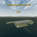
Chubu Centrair International Airport (IATA: NGO, ICAO: RJGG) is an airport on an artificial island in Ise Bay, 22 miles south of Nagoya in central Japan. Chubu is Japan's third off-shore airport, after Nagasaki Airport and Kansai International Airport, and is also the second airport built in Japan on a man-made island.
In this final version are added:
cars on parking garages
parking areas
static Air stairs
more realistic bagage loader
ANA logo on ground vehicles
Changed Skychefs catering trucks to NAC ( Nagoya Air Catering) catering trucks as in real life
benches on Chubu Airport's Sky Deck
lights on some static vehicles at night
fixed the readme desciption
| Filename: | Centrair_RJGG_V30_complete.zip |
| License: | Freeware |
| Added: | 20th November 2011, 00:13:22 |
| Downloads: | 8,079 |
| Author: | Morten Thomas van der Linden |
| Size: | 43.07 MB |
| Category: Prepar3D V1-4 - Utilities | |
| Flightplan Visualizer 1.13 |
|
Images related to this file:
File Description:
Flightplan Visualizer (FV) version 1.13.0. Copyright 2018-2019 by Pelle F. S. Liljendal ([email protected]), all rights reserved.
FV comes with 586 pre-imported Commercial AI flightplans (+380 BizJet flightplans are available as a separate download). However you are able to import additional (AI) flightplans yourself. Once imported these (AI) flightplans can be visualized on a map-view, and the user will be able to search accross all these. Hence you can use the program as inspiration as to which routes to fly. E.g. you can search across all imported flightplans to find all flights in an A321 flying into/out from LDDU, or simply to look for all flights in a Boeing 747-8F.
Simply run the included installer to install the software. The program will be installed into "C:\Program Files (x86)\Flightplan Visualizer" and all datafiles will be installed into: "C:\Users\[UserName]\AppData\Roaming\FlightplanVisualizer". The program comes with a full manual explaining everything, and a 3 page quick manual to get you started. The first 3 times you run the program the quick manual will automatically open. The forum is hosted here: https://forum.aerosoft.com/index.php?/forum/919-flightplan-visualizer/
Version 1.13 Contains the following changes: Flightplans can now be exported in AIFP/TrafficTool-format (the same format that FV is able to import). It means if you have made any changes to a flightplan (e.g. redirected some airports) the flightplan can be exported from FV, and imported into AIFP (AI Flight Planner, by Don Grovestine) where it can be compiled into an AI-traffic bgl-file (traffic "scenery"). A new setting called "Adjust flight-time on airport-redirect" have been added. This setting defaults to "false" (un-checked), however if changed to "true" (checked) the flight-time will be changed if/when departure/destination-airports are changed due to airport-redirections (both automatic and manually). The flight-time is the result of the difference between departure-/destination-time, hence if the flight-time is changed either- or both departure-/destination-time will change as well. The original flight-time is scaled based on the original- and the redirected distance between the departure/destination-airports. When importing/editing flightplans you can now select one or multiple aircraft and delete them. When deleting an aircraft all schedules attached to that aircraft will be deleted as well. One use of this feature could be to remove aircraft you don't have a AI aircraft, prior to exporting the flightplan in AIFP/TT-format, and loading it into AIFP. When importing/editing flightplans a "Similar" button will appear next to the flightplan name if a similar named flightplan exists (e.g. "same name", but different season), or other flighplans exists for the same airline (ICAO). Hoovering the mouse over this button will show the names of these flightplans as a tool-tip, and if you click the button the list will be shown in a window (with some additional information), from where it can be copied to the clipboard if you need to. On the Edit/Import-flightplan form, the Aircraft- and Airport tab-sheets have been swapped, and a new tab-sheet was added to list all routes of the flightplan. For each route the distance is listed along will all aircraft types of the flightplan servicing that route. The "Aircraft" tabsheet of the form to import/edit flightplans now contains a button called: "Fleet report". Pressing this button will generate a report showing the fleet of an airline (based on the flightplan), that is sorted by Aircraft type and registration. For each aircraft it will show a list of all the airports served by that particular aircraft. A "Word-wrap" check-box have been added to the Result-viewer to toggle word-wrap on/off (word-wrap defaults to "on"). In previous versions any changes made in the settings form resulted in all flightplans having to reload (while showing the splash-screen). Changing the path for MakeRunway-files still results in an automatic "reboot" of the program. The combo-box for choosing default direction (outbound/inbound/both) for the leg-search (on reset) have been removed from settings, and it now defaults to "Outbound or Inbound". However in the search legs form you can now save your own preferred "Reset" criteria. When you press the reset-button, it will load this Reset-file (with your preferred reset criteria). If you hold SHIFT while pressing the reset-button (or you have not saved a personal reset-file), it will reset to the default factory-criteria. In the traffic tabsheet of the airport info form there is a combo-box letting you switch between "Selected flightplan" or last-search on main-form" and "All flights to/from this airport". In previous versions it did not perform the search of flights to-/from- the viewed airport until you selected the 2nd item from the combo-box. Now this search is performed in the background as soon as the form is opened, hence choosing the 2nd item in the combo-box is now instantaneous. The "Nearby Airports" tab-sheet in the "Airport Info" form, now have a column listing direction (from the airport to the nearby airports). When listing number of runways and gates (e.g. in the form showing nearby airports, or in the redirection-report), the radius of the largest gate is now included, as there is no need to redirect any 747 traffic to an airport where the largest gate is 23m (a 747 requires a gate with a radius of at least 36m). The frequency-count was removed from the before mentioned listing of runways and gates, to make more room for listing the aircraft serving each airport. The search for airport browse now have a new optional column listing comments (e.g. length of longest rwy and largest gate). The "show" combo-box lets you choose to show comments in stead of "Size/Rank/Traffic" or "Hint-text". Opening the search airport browser from the import/edit flightplan form, will automatically choose to show the comments column, as information regarding rwy length/gate radius can be relevant when redirecting airports. Form "Nearby Airports" now show the GPS-position in the caption of the form. Added runway/gate summary to caption-bar of airport info form, so you no longer need to look at both the runway- and gate- tab-sheet in order to see: number of runways, longest runway, number of gates and largest rate (radius). New check-box added to settings allowing you to include the before mentioned runway/gate info in the airport marker tool-tip on the main map. Region/sub-region added to "Airport Info" form (top/left corner). A new setting (default to disabled) lets you add region/sub-region to the airport marker-hint on the map as well. Added a button to the "airport info" to show the airport at flightradar24 (opens the default browser), and the button on the leg info form to show route the route at flightaware (also using the browser) have been replicated on the route info form. The METAR-/TAF-buttons on the leg info form now shows the raw METAR/TAF-message - as a tool tip - when you hoover the mouse over the buttons. As before, when you press these buttons it will open a window showing the decoded messages. Various minor changes to the leg info form: added info regarding longest runway and largest gate for each airport, and re-positioned some of the fields. Likewise the info copied to the clipboard when you click the appropriate button have been re-ordered as well. Changed flightplan format to accommodate additional information, but the format remains backward compatible. Button added to about-box allowing the user to copy version-info to the clipboard. Managed to "shave off" approx ½ a second during start-up (on my pc). Not a lot but still an improvement :-) Fixed: In the form for importing/editing flightplans the leg-page showed the original distance even if the airports were redirected. Fixed: On leg info form "Dest.Country" and "Dest.Apt" column-order were swapped. Fixed: Tweaked aircraft type detecting to better detect 740-400 and 767-200/300 freighters. In previous versions a few aircrafts were wrongly detected as pax, when they should have been detected as freighter. Data: Airbus 330-800/900 Neo, Boeing 747-400LCF (Dreamlifter), and Embraer 175/190/195-E2 have been added as supported aircraft, and a few additional airlines and airports were added as well. Flightplans: Installer comes with +70 new pre-imported (Summer 2019) flightplans of which some are replacements of obsolete flightplans (from previous installers), and 2 of the "old" flightplans have been marked as defunct, as "Adria Airways" and "Aigle Azur" have filed for bankruptcy and ceased their operations. Flightplans: Among the added flightplans you will find the first flightplan I have made myself, a flightplan for Airbus Transport International covering their 5 Beluga's an 2 Beluga XL's (the latter 2 are stil performing test-flights and have yet to be implemented into their "normal schedule").
| Filename: | Flightplan_Visualizer_113.zip |
| License: | Freeware, limited distribution |
| Added: | 13th October 2019, 17:50:53 |
| Downloads: | 355 |
| Author: | Pelle Liljendal |
| Size: | 30.45 MB |
| Category: Flight Simulator 2004 - Scenery | |
| Mountain Empire Airport (KMKJ) |
|
File Description:
Mountain Empire Airport (KMKJ) is located between the towns of Wytheville and Marion, Virginia. This scenery tries to accurately re-create the buildings and taxiways at the airport. My first scenery, so look forward to more!
| Filename: | Mountain_Empire_Airport_KMKJ.zip |
| License: | Freeware |
| Added: | 29th May 2006, 05:49:48 |
| Downloads: | 547 |
| Author: | Jon Raines |
| Size: | 1.02 MB |
| Category: Flight Simulator 2004 - AFCAD Files | |
| Opa Locka Airport (KOPF) AFCAD |
|
File Description:
This AFCAD will re-wire Opa Locka Airport (KOPF) directly next to the Miami International Airport, after installation, you will see an improvement in all visual performance and effects, as well as traffic capacity and efficiency.
| Filename: | Opa_Locka_Airport_KOPF_AFCAD.zip |
| License: | Freeware |
| Added: | 25th September 2008, 09:19:48 |
| Downloads: | 585 |
| Author: | Dakota Smith / Smith Graphics |
| Size: | 94.81 KB |
| Category: Flight Simulator X - AFCAD Files | |
| PAPH - Port Heiden Airport | Port Heiden, AK |
|
File Description:
PAPH - Port Heiden Airport | Port Heiden, AK. This AF2 update will add a significant amount of parking, and will improve FPS and traffic handling speed at this airport. Designed using Flight 1's payware AFX program.
| Filename: | PAPH__Port_Heiden_Airport_____Port_Heiden_AK.zip |
| License: | Freeware |
| Added: | 29th January 2009, 11:25:29 |
| Downloads: | 336 |
| Author: | Dakota Smith / Smith Graphics |
| Size: | 88.18 KB |
| Category: Flight Simulator X - AFCAD Files | |
| PAPB - St George Airport | St George, AK |
|
File Description:
PAPB - St George Airport | St George, AK. This AF2 update will add a significant amount of parking, and will improve FPS and traffic handling speed at this airport. Designed using Flight 1's payware AFX program.
| Filename: | PAPB__St_George_Airport_____St_George_AK.zip |
| License: | Freeware |
| Added: | 29th January 2009, 11:27:11 |
| Downloads: | 393 |
| Author: | Dakota Smith / Smith Graphics |
| Size: | 85.78 KB |
| Category: Flight Simulator X - AFCAD Files | |
| PAGB - Galbraith Lake Airport | Galbraith Lake, AK |
|
File Description:
PAGB - Galbraith Lake Airport | Galbraith Lake, AK. This AF2 update will add a significant amount of parking, and will improve FPS and traffic handling speed at this airport. Designed using Flight 1's payware AFX program.
| Filename: | PAGB__Galbraith_Lake_Airport_____Galbraith_Lake_AK.zip |
| License: | Freeware |
| Added: | 2nd February 2009, 14:12:38 |
| Downloads: | 345 |
| Author: | Dakota Smith / Smith Graphics |
| Size: | 86.07 KB |


© 2001-2026 AVSIM Online
All Rights Reserved
Privacy Policy |