
Where Flight Simulation Enthusiasts Gather from Around the World!
AVSIM Library - Search Results

| Category: Flight Simulator X - AFCAD Files | |
| CZBB Boundary Bay Airport, BC |

|
File Description:
This is a complete redo of the default FSX CZBB Boundary Airport, BC using ADE v1.37, Google Earth satellite image and the latest airport chart effective as of 31 July 2008. The airport center and boundary repositioned. Control tower moved and replaced. Runway 07/25 extended to 5606 ft from 3540 ft and new taxiway E added. VASI Added to Runway 07/25. Taxiway signs added and/or corrected. Airport aprons resized and added where necessary. Taxiways and roads added. Static airport library objects and vegetation added for an improved look. XWind runways activated. Airport views are from the roof of the control tower when in tower view. A fuel truck has been added - Shift-F will bring this truck to your aircraft for refueling and will automatically refuel AI aircraft after landing and before take off. Airport chart and history included.
| Filename: | CZBB_Boundary_Bay_Airport_BC.zip |
| License: | Freeware |
| Added: | 26th March 2009, 08:31:55 |
| Downloads: | 491 |
| Author: | Robert Catherall |
| Size: | 137.2 KB |
| Category: Flight Simulator X - AFCAD Files | |
| CZBB Boundary Bay Airport, BC, Canada |
|
File Description:
This is a complete redo of the default FSX CZBB Boundary Bay Airport, BC using ADE v1.37, Google Earth satellite image and the latest airport chart effective as of 31 July 2008. The airport center and boundary repositioned. Control tower moved and replaced. Runway 07/25 extended to 5606 ft from 3540 ft and new taxiway E added. VASI Added to Runway 07/25. Taxiway signs added and/or corrected. Airport aprons resized and added where necessary. Taxiways and roads added. Static airport library objects and vegetation added for an improved look. XWind runways activated. Airport views are from the roof of the control tower when in tower view. A fuel truck has been added - Shift-F will bring this truck to your aircraft for refueling and will automatically refuel AI aircraft after landing and before take off. Airport chart and history included.
| Filename: | CZBB_Boundary_Bay_Airport_BC_Canada.zip |
| License: | Freeware |
| Added: | 5th November 2009, 02:16:37 |
| Downloads: | 448 |
| Author: | Robert Catherall |
| Size: | 381.61 KB |
| Category: Navigation and ATC - Navigation | |
| Caribbean and Puerto Rico VI TAC Chart Chunks for Moving Map Application |
|
File Description:
The chart chunks are from the latest Puerto Rico Virgin Islands TAC and World Aeronautical charts at the original scale, formatted in the WGS84 lat/long geographic coordinate system for GPS, moving map application for flight simulation use. Coverage is the Bahamas, Cuba, Jamaica, Haiti, the Dominican and the Guadeloupe island areas. See the Miami sectional chart chunks download which compliment this region. The chart chunks were converted to the JPEG format for compatibility and size. Included is also the projection files and world files. Note: This type of map is an equal grid and no further calibration is needed, only the two points referenced in the world file.
| Filename: | Caribbean_and_Puerto_Rico_VI_TAC_Chart_Chunks_for_.zip |
| License: | Freeware |
| Added: | 12th March 2010, 21:08:08 |
| Downloads: | 478 |
| Author: | David Myers |
| Size: | 52.33 MB |
| Category: Flight Simulator 2002 - Scenery | |
| South Africa Scenery |
|
File Description:
Wonderboom Airport (FAWB), Pretoria, South Africa. A highly detailed airport containing photorealistic ground textures, hangars and buildings. Wonderboom is a General Aviation Airport located north of Pretoria, South Africa. It is a fairly busy airport being used by various flying schools.
| Filename: | South_Africa_Scenery.zip |
| License: | Freeware, limited distribution |
| Added: | 12th April 2003, 22:12:39 |
| Downloads: | 2,052 |
| Author: | Henning van Rensburg and Johan van Wyk, Aeroworx |
| Size: | 5.36 MB |
| Category: Flight Simulator 2004 - AFCAD Files | |
| Florida - General Aviation Airports |
|
File Description:
Package includes 4 Floridian general aviation airports: (KDAB) Daytona Beach Int'l Airport, (KISM) Kissimmee Gateway Airport, (KVRB) Vero Beach Municipal Airport, (KCRG) Craig Municipal Airport. Accomodations made for Embry Riddle Aeronautical University (ERAU), FlightSafety Academy, and Airline Transport Professionals (ATP).
| Filename: | Florida__General_Aviation_Airports.zip |
| License: | Freeware |
| Added: | 12th March 2006, 04:48:41 |
| Downloads: | 2,015 |
| Author: | Eliot Jacobs |
| Size: | 955.63 KB |
| Category: Prepar3D V1-4 - Scenery | |
| Loreto Marche Italy N 43.26.27 E 13.36.36 |
|
File Description:
Loreto Marche Italy (N 43.26.27 E 13.36.36) Loreto is an Italian town in the province of Ancona in the Marche region
and is famous for being the headquarters of the Basilica of the Santa Casa, one of the most important and ancient places
of Marian pilgrimage in the Catholic world. The city rises on the top of a gentle hill, with a wide countryside around
characterized by the cultivation of the olive tree. The shape of the dome and the bell tower of the Basilica, whose
top is the figure of the Madonna, stands out for its height and majesty. The Basilica houses the famous relic of the
"Holy House" of Nazareth where, according to tradition, the Virgin Mary was born and lived where he received the
announcement of the miraculous birth of Jesus. The panorama that can be enjoyed ranges from the Adriatic Sea to Monte
Conero, up to the Umbrian-Marche Apennines. Important VFR point for approaching airport Ancona Falconara. Within the
downloaded package you will find readme files for scenery installation. Good fly VFR. Pasquale Marrulli.
| Filename: | Loreto_Marche_Italy_N_432627_E_133636.zip |
| License: | Freeware |
| Added: | 4th May 2018, 04:42:54 |
| Downloads: | 165 |
| Author: | Pasquale Marrulli |
| Size: | 19.22 KB |
| Category: Flight Simulator 2004 - Scenery | |
| New! AVIOSUPERFICI ITALIANE 2026 (The Methuselah Project) - Aviosuperficie di Le Chatelair |
|
Images related to this file:
File Description:
2nd upload and step of ITALIAN AIRSTRIPS 2026 (The Methuselah Project)
Aviosuperficie di Le Chatelair (città NUS, provincia Aosta, regione Valle d’Aosta - Italia)
This airfield is home to the Corrado Gex Aeroclub and the International Mountain Flying School; it is just over 4 km (east) from the Aosta Valley Airport and about 8 km (northeast) from the Chamois Altiporto, the first in Italy at an altitude of 1,820 m. Radio frequency 130.00 active; hangar facilities are available, but not mechanics or refueling.
Pay attention when maneuvering to the nearby power lines, parallel to runway 28; railway line on the opposite side of the power line; hangar opening with Com2 radio freq. 115.
This scenery was created using A.D.E. v1.65 and integrated libraries.
The third and final airfield in the Region is Aereoporto Valle di Aosta, which is already available for FS9 (see the details in the project summary table... https://drive.google.com/file/d/1qT7ZCUhE6ZqCzfjZe9kJM_Y0qhBNNnnN/view?usp=sharing
| Filename: | AVIOSUPERFICI_ITALIANE_2026_The_Methuselah_Project.zip |
| License: | Freeware |
| Added: | 2nd November 2026, 14:51:37 |
| Downloads: | 4 |
| Author: | Aldo Della Vedova and Gian Mario Verga |
| Size: | 3.26 MB |
| Category: Flight Simulator X - Scenery | |
| EGKH Headcorn/Lashenden |
|
File Description:
This package adds the apron & Hangars & the local road has been added to allow road access to the airfield.
I have also included the village/town of nearby Headcorn
It also provides lots of parking spots using FSX Panner and ATC interaction along with some AI traffic.
All additional Buildings were placed using default objects.
AI traffic uses default aircraft which was scheduled by hand using the TrafficDatabaseBuilder from the SDK tools provided by FSX Deluxe.
Any additional roads and modified Landclass & water features were created using FSX-KML.
| Filename: | EGKH_HeadcornLashenden.zip |
| License: | Freeware, limited distribution |
| Added: | 6th October 2007, 16:41:35 |
| Downloads: | 1,345 |
| Author: | Len Hickman |
| Size: | 15.38 KB |
| Category: Flight Simulator 2004 - Scenery | |
| KSHN Sanderson, WA Emma Field Add On |
|
File Description:
KSHN, Sanderson, WA for use with Lago's FSE for 2004. This was made as a present for the guys over at the Emma Field Flying Club but can be enjoyed by all who love to fly in the state of Washington. Included are full seasonal day/night sounds as well as dynamic scenery and plenty of eye candy. This is very dense scenery but mid level machines to high level machines should see no frame loss at all. Lago's FSE for 2004 required and FSGenesis US Landclass is recommended (freeware or payware) for full enjoyment.
| Filename: | KSHN_Sanderson_WA_Emma_Field_Add_On.zip |
| License: | Check within download |
| Added: | 6th January 2004, 20:19:48 |
| Downloads: | 2,542 |
| Author: | Lauren Robison |
| Size: | 2.77 MB |
| Category: Flight Simulator X - AFCAD Files | |
| CYKA - Kamloops Airport / Kamloops, British Columbia, Canada (v1.1) |
|
Images related to this file:
File Description:
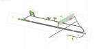
CYKA - Kamloops Airport / Kamloops, British Columbia, Canada (version 1.1)
This airport update was made with the latest version of ADE (Airport Design Editor) and made for FSX as a replacement for the stock (default) airport. I've made several changes to the
airport which are listed below. All these enchancements are as close to the real airport as I can get with stock library objects. I've used satellite images, terminal photos and
maps throughout the whole process so building locations are as accurate as possible. Happy landings in the beautiful Canada!
Features:
*Expanded parking apron
*Main terminal building with parking for commercial traffic
*Seperate parking aprons for GA traffic
*Helipad
*Hangar and other airport buildings added
*Airport vehicles and objects throughout the airport
*Parking lots with static vehicles
*Airport fire station with fire truck
*Static de-icing vehicles & runway plow
*Static aircraft/helicopters
*Corrected communication frequnces (v1.1)
| Filename: | CYKA__Kamloops_Airport__Kamloops_British_Columbia_.zip |
| License: | Freeware |
| Added: | 28th July 2012, 07:29:39 |
| Downloads: | 674 |
| Author: | Jaison Diaz / Endeavour ai |
| Size: | 118.33 KB |


© 2001-2026 AVSIM Online
All Rights Reserved
Privacy Policy |