
Where Flight Simulation Enthusiasts Gather from Around the World!
AVSIM Library - Search Results

| Category: Flight Simulator X - AFCAD Files | |
| KIAH - Houston/George Bush Intercontinental - Houston, Texas - USA |

|
Images related to this file:
File Description:
This is an AFCAD update for FsDreamteam's Houston/George Bush Intercontinental Airport. I have reworked the original AFCAD, so that all airlines should use the appropriate gates now. I have also edited the parking spots so that the United Express gates are used by old FS9 models with their larger parking radius.
| Filename: | KIAH__HoustonGeorge_Bush_Intercontinental__Houston.zip |
| License: | Freeware, limited distribution |
| Added: | 5th July 2014, 16:27:30 |
| Downloads: | 731 |
| Author: | Sebastian Szucs | FSDT |
| Size: | 608.48 KB |
| Category: Flight Simulator 2004 - Scenery | |
| Dixie A05 Forest Service airfield in Idaho USA |
|
Images related to this file:
File Description:
This airfield is in the mountains of Idaho, the first in a series. There are not many mountain airfields that can be succesfully modelled in FS9 because the FS9 terrain does not always match reality; no creek for instance, or the valley too small. There are others where the grass strip is all there is, so there is nothing to model apart from resizing the cleared area. Some are well known, well maintained, have clean shower facilities, and are well used for a weekend by small planes with two people and a tent on board, for instance Johnson Creek. Others are less well known but still in good condition, such as Dixie or Big Creek. And there are also some with cabin rental facilities, such as Sulphur Creek Ranch. Other names come to mind, such as Flying B and Pistol Creek, but unfortunately for one reason or another these could not be made. The other difficulty involving hills is succesful AI landings and take offs. At Johnson Creek, for instance, the wind should be from the south to make AI landings more likely to succeed. Dixie is south of the village of the same name, and not to be confused with the dirt strip that is just beside the village. The runway is at 5,148 feet ASL, just over 4,000 feet long and aligned 18-36, and the parking area is at the northern end, opposite the Forest Service buildings. There is a chart of the area included, and to the south of Dixie is the next in the series, Big Creek U60.
| Filename: | Dixie_A05_Forest_Service_airfield_in_Idaho_USA.zip |
| License: | Freeware, limited distribution |
| Added: | 25th May 2017, 17:53:48 |
| Downloads: | 153 |
| Author: | Roger Wensley |
| Size: | 8.69 MB |
| Category: Flight Simulator 2004 - AFCAD Files | |
| KORD - Chicago O'Hare - Chicago, USA - Runway 10C / 28C |
|
File Description:
This is the second of my two KORD AFCADs, the first for FSX and this one for FS9. Both add the newly opened runway 10C-28C and change the old runway10-28 to runway10L-28R. In this one, as in the FSX version. I use completely default objects, so no additional downloads of scenery are required. All Taxiways have been correctly identified using ADE9X and taxiway signs placed to reflect the ground situation as of the 1311 AIRAC Cycle that ends Nov 14, 2013. I added RNAV and CATIII ILS/DME approaches for both Rwy 10C and Rwy 28C you can select in the default GPS. In the default FS9 file for KORD runway 32L, which still exists, is given as an ILS/DME approach using 108.95, the same frequency as the new runway 10C-28C. I could not delete the ILS/DME for 32L (cannot delete stock navaids in FS9). It interfered with the CAT III ILS/DME for 10C-28C, so I simply changed the ILS frequency for 32L to the same frequency as for 14R. Please note further that in the 1311 AIRNAV supplement for KORD there are no approaches listed for 32L, so I deleted all approaches for 32L, but the waypoints for those approches remain in place (since they are stock navaids and, hence, cannot be deleted).
| Filename: | KORD__Chicago_OHare__Chicago_USA__Runway_10C__28C.zip |
| License: | Freeware |
| Added: | 13th November 2013, 22:03:13 |
| Downloads: | 766 |
| Author: | Randy Tyndall |
| Size: | 60.25 KB |
| Category: Flight Simulator X - AFCAD Files | |
| KCVS - Cannon AFB - Clovis, New Mexico - USA v2.0 |
|
Images related to this file:
File Description:
Located in the high desert of eastern New Mexico, Cannon AFB is home to the 27th Special Operations Wing, which operates a wide range of manned and unmanned aircraft from MQ-9 Reapers to CV-22 Ospreys to AC-130H gunships. This is a complete airport rebuild with new runways, taxiways, and ramps. It includes a fire station, POL facilities, access roads, enhanced approach scenery, and parking,(including covered parking) for over 75 aircraft.
| Filename: | KCVS__Cannon_AFB__Clovis_New_Mexico__USA_v20.zip |
| License: | Freeware |
| Added: | 1st November 2014, 00:52:35 |
| Downloads: | 620 |
| Author: | Allen Laughmiller |
| Size: | 35.03 KB |
| Category: Flight Simulator 2004 - Scenery | |
| KFCS - Butts Army Airfield - Fort Carson, Colorado - USA |
|
Images related to this file:
File Description:
This project represents Fort Carson Colorado featuring Butts Army Airfield (KFCS), Red Devil Assault Landing Strip, Pinion Canyon Landing Stip and two other landing locations.
Included are paints and flightplans for many of the units housed here. To use the AI you will need the NBAI AH-64D models, NBAI CH-47 models and the ACG MAIW AI BH Family-US Army Black Hawks (jyai_blackhawk_family_fs9_1.zip or jyai_blackhawk_family_fsx_1.zip on Avsim)
**The UH-60 paints are provided in both FS9 and FSX versions.**
| Filename: | KFCS__Butts_Army_Airfield__Fort_Carson_Colorado__U.zip |
| License: | Freeware |
| Added: | 27th October 2015, 12:21:10 |
| Downloads: | 730 |
| Author: | Brent Newman |
| Size: | 24.65 MB |
| Category: Flight Simulator X - AFCAD Files | |
| KSTC - St. Cloud Rgnl - St. Cloud, MN, USA |
|
File Description:
Enhancements include:
-National Guard added to south end of the airport
-Jetway and west terminal extension added
-Aircraft parking updated
-General aviation area updated
-Runways and taxiways updated with asphalt edging
-Updated RWY 31 frequency to 111.9 and removed backcourse (I-STC ident)
-SIYON and OSACA terminal waypoints added (IAF and FAF respectively for ILS 13)
-Default ILS 13 backcourse approach replaced with ILS or LOC/DME RWY 13 approach with frequency 111.9 (I-BPM ident)
-LOC/DME antennea added
-Tower replaced and moved
-PAPI lights moved
-Asphalt and concrete aprons added/updated
-Asphalt, concrete, and gravel roads and parking lots added
-All applicable runway signs updated
-Added vehicles
-Airport perimeter fencing updated
-Flag and trees added
-Beacon adjusted
This is an update of the default FSX KSTC airport.
| Filename: | KSTC__St_Cloud_Rgnl__St_Cloud_MN_USA.zip |
| License: | Freeware |
| Added: | 4th December 2013, 07:13:36 |
| Downloads: | 342 |
| Author: | Jason Boche |
| Size: | 922.93 KB |
| Category: Flight Simulator X - AFCAD Files | |
| KEGE - Eagle County Regional - Eagle, Colorado USA * FIX * |
|
File Description: KEGE - Eagle County Rgnl - Eagle, CO, USA version 1.1 by Jason Boche
This is an update of the default FSX KEGE airport.
Enhancements include:
-Runway 7/25 lengthened to current, displaced threshold and markings added
-Blast pads added
-Updated taxiways to current
-PAPI lights moved to right/north side of runway 25
-Updated LOC frequency for runway 25 to 109.75
-Moved and added additional LOC antennea to the west end of runway 7
-Tower moved and model replaced
-Realistic terminal parking spots 1-10
-Asphalt and concrete aprons added/updated, ground lighting updated
-Asphalt, concrete, and gravel roads added
-Many bulidings updated
-All applicable runway signs updated
-Added airport, civilian, and construction vehicles
-Airport perimeter fencing updated
-Runway demolition fencing added
-National Guard helipads added
-GA refueling moved to the north end of the field
Please provide any feedback and suggestions to me at the email address listed
in the readme.txt. Thank you.
Acknowledgements:
Airport Design Editor (ADE -Freeware) - Jon Masterson.........http://www.scruffyduck.org.uk/
This also has a download centre for many other ADE files.
Please visit here for more information...........http://www.airportdesigneditor.co.uk
Any questions relating to ADE can be answered at www.fsdeveloper.com/forum......look
for Airport Design Editor author
Ray Smith for providing so many freeware airports and airport updates which
inspired me to give ADE a try.
Jason Boche
| Filename: | KEGE__Eagle_County_Regional__Eagle_Colorado_USA__F.zip |
| License: | Freeware |
| Added: | 30th November 2013, 10:42:48 |
| Downloads: | 1,477 |
| Author: | Jason Boche |
| Size: | 373.01 KB |
| Category: Flight Simulator X - AFCAD Files | |
| KNQI - Naval Air Station Kingsville - Kingsville, Texas, USA |
|
Images related to this file:
File Description:
Along with NAS Meridian, NAS Kingsville provides primary jet training (and carrier qualification) for new Navy, Marine, and selected foreign pilots. This is a complete airport rebuild with enhanced runways, new taxiways, ramps, signage, and tower and administration buildings. It features a fire station, POL facility, access roads, new terrain masks, and parking,(including covered parking) for over 130 aircraft.
| Filename: | KNQI__Naval_Air_Station_Kingsville__Kingsville_Tex.zip |
| License: | Freeware |
| Added: | 21st June 2015, 15:11:06 |
| Downloads: | 622 |
| Author: | Allen Laughmiller |
| Size: | 27.17 KB |
| Category: Flight Simulator 2004 - Scenery | |
| USA Landclass AddOn - Vegetation Part 1 UPDATE 1.5 |
|
Images related to this file:
File Description:
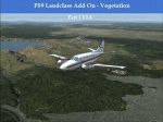
Complete Update, please delete all the old scenery folders. Compatible with Ultimate Terrain, incl. some fixes for UT. Sorry for the update 1.4 called final. Pleas note the readme file. Udate V1.5 concerns mainly British Columbia, the boring LC from CYLW to CYKA to CYWL to CYQZ and to CYXS. Now it is varied, made again with satellite maps. Also change the wrong green LC from KASE (Aspen) to KRIL (Glenwood Springs) and some LC Border correction. BC requires for one LC good replacement textures(026b2.bmp) to enjoy the changes or do it by yourself. Birds Eye View textures includes a good texture. For GEpro Users there is a example picture how to make it with texture 024b2 and 052b2 and a Paintshop Software. For a fast Textureswitch, Batch files are included, also inf and raw files for changing for your according to your taste.
| Filename: | USA_Landclass_AddOn__Vegetation__Part_1_UPDATE_15.zip |
| License: | Freeware |
| Added: | 5th March 2015, 19:32:31 |
| Downloads: | 292 |
| Author: | Markus Balz |
| Size: | 4.01 MB |
| Category: Prepar3D V1-4 - Scenery | |
| Davis-Monthan AFB, Tucson, Arizona USA Prepar3d v4 |
|
File Description:
This is a update scenery for the default Davis-Monthan AFB (KMDA) in Tucson, Arizona for Prepar3d v4. I have included accurate A-10 Warthog storage hangars along with the aircraft maintenance and boneyard facility. Details accurate as possible and tested frame rate friendly. Enjoy and Happy Flying!
| Filename: | DavisMonthan_AFB_Tucson_Arizona_USA_Prepar3d_v4.zip |
| License: | Freeware |
| Added: | 19th September 2020, 16:00:36 |
| Downloads: | 205 |
| Author: | Wendell Melton |
| Size: | 38.65 MB |


© 2001-2026 AVSIM Online
All Rights Reserved
Privacy Policy |