
Where Flight Simulation Enthusiasts Gather from Around the World!
AVSIM Library - Search Results

| Category: Flight Simulator X - AFCAD Files | |
| KPSO - Stevens Field, Pagosa Springs, Colorado, USA - V2.0 |

|
Images related to this file:
File Description:
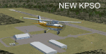
Updated scenery of Stevens Field, Pagosa Springs Airport nested in the high-altitude Rocky Mountains of Colorado. This scenery includes the airport and land class for surrounding areas to include the many small lakes, the city of Pagosa, and nearby inhabited areas. Airport features runway distance markers, new taxiways, taxiway signs, realistic parking, scenery objects, hangars, and FBO. How is your high-altitude flying? Enjoy! Version 2 includes updated taxiway structure circa 2013, signage, major roads added, and land class tweaks.
| Filename: | KPSO__Stevens_Field_Pagosa_Springs_Colorado_USA__V.zip |
| License: | Freeware |
| Added: | 30th May 2013, 06:10:06 |
| Downloads: | 536 |
| Author: | AJ Cook |
| Size: | 17.21 KB |
| Category: Flight Simulator 2004 - Scenery | |
| USA Landclass AddOn - Vegetation Part I update 1.3 |
|
Images related to this file:
File Description:
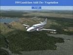
It replaces the update 1.2
Update of the Kootenay Range from KFCA to CYXC and CYGE
and some light landclass enhancements from CYYJ to CYBL.
| Filename: | USA_Landclass_AddOn__Vegetation__Part_I_update_13.zip |
| License: | Freeware |
| Added: | 23rd February 2015, 13:36:07 |
| Downloads: | 191 |
| Author: | Markus Balz |
| Size: | 1.38 MB |
| Category: Flight Simulator X - Scenery | |
| KAUS Austin–Bergstrom and Americas F1 Circuit, USA |
|
Images related to this file:
File Description:

Photorealistic scenery for FSX (should work on P3D V 1-4).
Overlapping edges from photo into default scenery.
Enhanced airport close to real with custom buildings and some static objects.
Day and Night textures.
Some autogen at airport, circuit and surrounding areas.
FTX Global and Vector compatible.
| Filename: | KAUS_AustinBergstrom_and_Americas_F1_Circuit_USA.zip |
| License: | Freeware |
| Added: | 24th June 2021, 16:15:32 |
| Downloads: | 161 |
| Author: | Ignacio Del Muro |
| Size: | 19.99 MB |
| Category: Flight Simulator 2004 - Scenery | |
| Veazie Airfield, Maine, USA === Maine Short Hops 4 |
|
File Description:
This scenery is fictitious. It is located at the edge of town by the train station. Nice candies. Night flying is done with lit fires in old barrels.
Specially made for Golden Wings but should work also in FS2004. Details in the download.
| Filename: | Veazie_Airfield_Maine_USA__Maine_Short_Hops_4.zip |
| License: | Freeware |
| Added: | 19th November 2005, 00:08:16 |
| Downloads: | 864 |
| Author: | Leon Louis |
| Size: | 2.66 MB |
| Category: Flight Simulator 2004 - Miscellaneous Files | |
| Puzzle - an aircraft factory in the USA, 1943 |
|
File Description:
From 1943, at an aircraft assembly plant somewhere in the USA, this stunning large format Kodachrome photo poses a female worker having a coffee break against a background of engine nacelle pressings. The photograph comes from US Government archives and is provided courtesy of www.shorpy.com. The puzzle runs straight from the file and neither installation nor other files are required. A ReadMe with the simple instructions is included. 460 pieces.
| Filename: | Puzzle__an_aircraft_factory_in_the_USA_1943.zip |
| License: | Freeware |
| Added: | 25th April 2007, 12:54:37 |
| Downloads: | 370 |
| Author: | Bruce Kennewell |
| Size: | 974.03 KB |
| Category: Flight Simulator 2004 - Flight Plans | |
| Complete NFDC Preferred Routes for USA, cycle 0903 |
|
File Description:
Includes the complete set of Preferred Routes within the USA as periodically published by the NFDC for use in FSBuild, PMDG 737/747 and FS9/FSX. They are directly compiled from the official data sets and include all flight combinations for which Preferred Routes exist. This is a massive set of more than 5900 routes. Instructions how to include them in FSBuild as a separate flightplan category included.
| Filename: | Complete_NFDC_Preferred_Routes_for_USA_cycle_0903.zip |
| License: | Freeware |
| Added: | 1st March 2009, 19:58:19 |
| Downloads: | 1,216 |
| Author: | Christoph Schmidt |
| Size: | 3.9 MB |
| Category: Flight Simulator X - AFCAD Files | |
| KIAH - Houston/George Bush Intercontinental - Houston, Texas - USA |
|
Images related to this file:
File Description:
This is an AFCAD update for FsDreamteam's Houston/George Bush Intercontinental Airport. I have reworked the original AFCAD, so that all airlines should use the appropriate gates now. I have also edited the parking spots so that the United Express gates are used by old FS9 models with their larger parking radius.
| Filename: | KIAH__HoustonGeorge_Bush_Intercontinental__Houston.zip |
| License: | Freeware, limited distribution |
| Added: | 5th July 2014, 16:27:30 |
| Downloads: | 731 |
| Author: | Sebastian Szucs | FSDT |
| Size: | 608.48 KB |
| Category: Flight Simulator 2004 - Scenery | |
| Dixie A05 Forest Service airfield in Idaho USA |
|
Images related to this file:
File Description:
This airfield is in the mountains of Idaho, the first in a series. There are not many mountain airfields that can be succesfully modelled in FS9 because the FS9 terrain does not always match reality; no creek for instance, or the valley too small. There are others where the grass strip is all there is, so there is nothing to model apart from resizing the cleared area. Some are well known, well maintained, have clean shower facilities, and are well used for a weekend by small planes with two people and a tent on board, for instance Johnson Creek. Others are less well known but still in good condition, such as Dixie or Big Creek. And there are also some with cabin rental facilities, such as Sulphur Creek Ranch. Other names come to mind, such as Flying B and Pistol Creek, but unfortunately for one reason or another these could not be made. The other difficulty involving hills is succesful AI landings and take offs. At Johnson Creek, for instance, the wind should be from the south to make AI landings more likely to succeed. Dixie is south of the village of the same name, and not to be confused with the dirt strip that is just beside the village. The runway is at 5,148 feet ASL, just over 4,000 feet long and aligned 18-36, and the parking area is at the northern end, opposite the Forest Service buildings. There is a chart of the area included, and to the south of Dixie is the next in the series, Big Creek U60.
| Filename: | Dixie_A05_Forest_Service_airfield_in_Idaho_USA.zip |
| License: | Freeware, limited distribution |
| Added: | 25th May 2017, 17:53:48 |
| Downloads: | 153 |
| Author: | Roger Wensley |
| Size: | 8.69 MB |
| Category: Flight Simulator 2004 - AFCAD Files | |
| KORD - Chicago O'Hare - Chicago, USA - Runway 10C / 28C |
|
File Description:
This is the second of my two KORD AFCADs, the first for FSX and this one for FS9. Both add the newly opened runway 10C-28C and change the old runway10-28 to runway10L-28R. In this one, as in the FSX version. I use completely default objects, so no additional downloads of scenery are required. All Taxiways have been correctly identified using ADE9X and taxiway signs placed to reflect the ground situation as of the 1311 AIRAC Cycle that ends Nov 14, 2013. I added RNAV and CATIII ILS/DME approaches for both Rwy 10C and Rwy 28C you can select in the default GPS. In the default FS9 file for KORD runway 32L, which still exists, is given as an ILS/DME approach using 108.95, the same frequency as the new runway 10C-28C. I could not delete the ILS/DME for 32L (cannot delete stock navaids in FS9). It interfered with the CAT III ILS/DME for 10C-28C, so I simply changed the ILS frequency for 32L to the same frequency as for 14R. Please note further that in the 1311 AIRNAV supplement for KORD there are no approaches listed for 32L, so I deleted all approaches for 32L, but the waypoints for those approches remain in place (since they are stock navaids and, hence, cannot be deleted).
| Filename: | KORD__Chicago_OHare__Chicago_USA__Runway_10C__28C.zip |
| License: | Freeware |
| Added: | 13th November 2013, 22:03:13 |
| Downloads: | 766 |
| Author: | Randy Tyndall |
| Size: | 60.25 KB |
| Category: Flight Simulator X - AFCAD Files | |
| KCVS - Cannon AFB - Clovis, New Mexico - USA v2.0 |
|
Images related to this file:
File Description:
Located in the high desert of eastern New Mexico, Cannon AFB is home to the 27th Special Operations Wing, which operates a wide range of manned and unmanned aircraft from MQ-9 Reapers to CV-22 Ospreys to AC-130H gunships. This is a complete airport rebuild with new runways, taxiways, and ramps. It includes a fire station, POL facilities, access roads, enhanced approach scenery, and parking,(including covered parking) for over 75 aircraft.
| Filename: | KCVS__Cannon_AFB__Clovis_New_Mexico__USA_v20.zip |
| License: | Freeware |
| Added: | 1st November 2014, 00:52:35 |
| Downloads: | 620 |
| Author: | Allen Laughmiller |
| Size: | 35.03 KB |


© 2001-2026 AVSIM Online
All Rights Reserved
Privacy Policy |