
Where Flight Simulation Enthusiasts Gather from Around the World!
AVSIM Library - Search Results

| Category: Flight Simulator X - Scenery | |
| Albany International Airport (KALB) Albany, New York |

|
Images related to this file:
File Description:
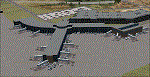
This airport was made using Airport Design Editor, Google Sketchup, and Instant Scenery 2. Albany International Airport, Is an airport located near Albany, New York. The airport has scheduled airline flights. Almost all of the buildings are custom made with photo textures to make it closer to real life. At the main terminal, I added more gates and put moving jetways. The gates have assigned parking codes. There is a parking lot next to the terminal full of cars. I put the airport access road in between the parking lot and the terminal. At the southwest ramp, I put hangars and some you can taxi inside of. If you choose to start off from the southwest DOCK gate, You will start off inside the Million Air Aviation FBO. I also put static aircraft on the ramp too. To the northwest, I put the New York Police hangar. You can start off inside this hangar by choosing the Northwest DOCK gate. Taxiing into or starting off inside a hangar will not cause a crash unless you touch the sides. To the Northeast, I put the cargo terminal with trucks. At the cargo section, I put three FedEx Cessna Caravans. I also put the control tower and the buildings. Tower views are from the roof of the control tower. To the southeast, I put small hangars and the Air National Guard Section with UH-60 helicopters. I extended runway 1/19 to the correct length of 8,500 feet. I also put red, blue, green, and purple Cessna 172s in different places around the airport. There will be more objects if your scenery complexity is set to normal (such as jetways, aircraft, and vehicles). This was all made based on Google Earth Imagery and Bing Maps. There are no night textures for the buildings. This will be added in a future version. An installer program is included to install the airport for you. There will be more versions of this that include night textures and static business jets. This is for Flight Simulator X only. By Tyler Lawrence.
| Filename: | Albany_International_Airport_KALB_Albany_New_York.zip |
| License: | Freeware |
| Added: | 2nd June 2012, 08:14:12 |
| Downloads: | 4,346 |
| Author: | Tyler Lawrence |
| Size: | 47.69 MB |
| Category: Flight Simulator 2004 - Scenery | |
| Dutch Harbour PADU and St Paul PASN - UPDATES |
|
Images related to this file:
File Description:
This has revised runway circulation for both Dutch Harbour (dutchplus.zip) and St Paul (st_paul.zip) to better reflect reality in helicopter and aircraft operation. It is not realistic for a helicopter to land, continue in a straight line along 6,000' of runway, turn at the far end, then taxi back along the same 6,000' to the aprons. Similarly, a Cessna does not need the same runway length as a 747.
This fix incorporates intermediate turnaround points to allow helicopters and small aircraft to turn around soon after slowing to taxi speed and to taxi back to the aprons at the end of the runway, instead of trudging along the whole length of the runway twice. There are some things that cannot be improved; a plane or helicopter will always taxi all the way from the aprons to the far end of the runway before turning and taking off, and a helicopter or light plane will not "land long" to minimise the taxi length.
The pictures show different turning points. There are also revised AI bgl's to provide better time separation between flights.
| Filename: | Dutch_Harbour_PADU_and_St_Paul_PASN__UPDATES.zip |
| License: | Freeware, limited distribution |
| Added: | 16th August 2012, 19:37:32 |
| Downloads: | 941 |
| Author: | Roger Wensley |
| Size: | 2.53 MB |
| Category: Flight Simulator 2004 - Scenery | |
| Herb's Field C417 near Ottawa in Ontario, Canada |
|
Images related to this file:
File Description:
Herb's is on the 417 between Ottawa and Montreal at the junction with highway 34, which is south of Hawkesbury. Herb's is a truckstop and a repair garage and a restaurant and a gas station, and is still (but only just!) an airfield. Which is to say there is still a runway, some 1,200 feet long and 30 feet wide. Do not go in your Cessna 172 as only the northern half is usable, and that after inspection from the air for any obstacles, parked cars, dogs, and similar obstacles. The southern half is the way in for trucks and cars, so make sure you can stop well before the ex-hangar which is now for truck repairs only. The planes all belonged to Herb's father, and even a casual inspection will reveal that they haven't moved for some time. If there is anything using the service road immediately to the north of the runway go around again, you won't be able to clear a vehicle and then land on the threshold.
| Filename: | Herbs_Field_C417_near_Ottawa_in_Ontario_Canada.zip |
| License: | Freeware, limited distribution |
| Added: | 14th February 2010, 14:39:56 |
| Downloads: | 386 |
| Author: | Roger Wensley |
| Size: | 2.02 MB |
| Category: Flight Simulator 2004 - Sounds | |
| Rolls-Royce Merlin Sound Package |
|
File Description:
A few weeks ago at an airshow, I had the opportunity to get up close up to the Spitfire and get some recordings of that beautiful Rolls Royce Merlin engine. I have used some of these sounds for this sound pack and the result is absolutely amazing. Now I've got a spitfire which truly sounds like it should. This is a small file but don't be fooled, you'll love it, guaranteed! Obviously I don't know how a Spitfire sounds on the inside, so I've tried using FS9 default sounds along with some sounds downloaded from the internet and from a sound effects disk and wow, what a result. This file was created using the Alpha Spitfire as a test bed, so I'm not sure what it will be like in any other model. If you want to know what it sounds like, try putting these sounds into the Cessna 182S model as they run perfectly in that plane except it doesn't have retractable landing gear! I promise, you won't be disappointed!!
| Filename: | RollsRoyce_Merlin_Sound_Package.zip |
| License: | Freeware |
| Added: | 26th August 2006, 21:02:42 |
| Downloads: | 4,036 |
| Author: | Des Braban |
| Size: | 6.85 MB |
| Category: Flight Simulator 2004 - Scenery | |
| Alaska North Slope 4: Lonely Air Force Station (AK71) |
|
Images related to this file:
File Description:
The town of Barrow is in the far north of Alaska, and these are coastal villages or radar installations to the west, south, and now east of Barrow. There will be further additions. Lonely Air Force Station AK71 is 80 miles east of Barrow and on the coast. It was, and at first sight appears still to be, a DEW station until you are close enough to see that the gravel apron is deteriorating. There is a gravel runway around 5,000 feet long, a large hangar, the DEW buildings, radar under the domes, the remains of huge line-of-sight communications reflectors, and oil tanks. Some DEW sites are not worth a visit; others are surprisingly intact and this is one of those. The AI takes place three days a week and is a C130, in which case the DEW site is still functioning or under mothball maintenance, a chartered Reeve Aleutian in which case the site is closed and they are documenting wildlife, and a Cessna with a group of the curious.
| Filename: | Alaska_North_Slope_4_Lonely_Air_Force_Station_AK71.zip |
| License: | Freeware, limited distribution |
| Added: | 20th June 2016, 08:02:18 |
| Downloads: | 307 |
| Author: | Roger Wensley |
| Size: | 2.32 MB |
| Category: Flight Simulator 2004 - Scenery | |
| Minstrel Island CAX7 float base in British Columbia, Canada |
|
Images related to this file:
File Description:
This is the third in a series of new and renovated float bases in BC. Minstrel Island is on the south side of Knight Inlet and 25 miles west of Knight Inlet Lodge (the previous post in this series). There is a resort on the island, though it is hidden from the air by the trees. Fuel and oil are both available at the dock, and there is a 17 feet tidal range, which would be interesting of it could be replicated in FS. The AI is an adaptation of that for CF36 and involves a GA Cessna, and a Seair Beaver flying from Campbell River to Knight Inlet Lodge via Minstrel Island. Again, because of large hills the landing of the AI may or may not take place, depending on wind direction and whether or not they fly into solid rock before landing. Take off and departure will take place. Ultimate Terrain Alaska/Canada would be a definite plus to get the water in the right shape and place. This scenery will not work without it.
| Filename: | Minstrel_Island_CAX7_float_base_in_British_Columbi.zip |
| License: | Freeware, limited distribution |
| Added: | 3rd January 2017, 15:38:57 |
| Downloads: | 227 |
| Author: | Roger Wensley |
| Size: | 3.54 MB |
| Category: Flight Simulator 2004 - Scenery | |
| Anahim Lake CAJ4 in British Columbia, Canada |
|
Images related to this file:
File Description:
Anahim Lake is around 55 miles east of Bella Coola by air, and clear of the deep and rugged valley that connects the two with a road that is over 75 miles long. The two are also linked by a daily Pacific Coastal flight. A further 150 miles east is Williams Lake (200 miles by road). The town of Anahim Lake is small, but renowned for numerous surrounding fishing lodges on the lakes and the enjoyment of "nature" in what is known as the Chilcotin Wilderness. The Anahim Lake airport is an odd one. It appears to have fallen into disuse over a period of years, but is now in the process of being upgraded, with some new hangars (though oddly situated, and with only dirt track taxiway access) and a recently completed terminal building. There is also a plan to upgrade the runway (lights etc, there are currently no runway or taxiway lights) and in general to greatly improve the facilities on offer. The only current airline to fly there is Pacific Coastal. The runway is just under 4,000 feet of asphalt aligned 13-31 and 75 feet wide. There used to be another runway which is still visible but is now unusable, gravel that has not been maintained for several years. The notes for Anahim Lake airfield in the Nav Canada manual warn of "Extensive float plane activity at Nimpo Lake to the south" and of "possible large animals within the airport perimeter". Nimpo Lake activity will follow in further posts.
| Filename: | Anahim_Lake_CAJ4_in_British_Columbia_Canada.zip |
| License: | Freeware, limited distribution |
| Added: | 29th November 2018, 19:21:59 |
| Downloads: | 153 |
| Author: | Roger Wensley |
| Size: | 5.72 MB |
| Category: Flight Simulator X - Aircraft Repaints, Textures and Modifications | |
| Airbus A318 FD Special Version V2 |
|
Images related to this file:
File Description:
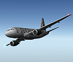
After my initial work on the Project airbus A318 (V1.2) and on the project Airbus A319 (A319 Special Version V2), I present my special version of the Project Airbus A318 Version 2, which includes many improvements and new features.
The instrument panel has been adapted of the Stefan Liebe work, on which I have added many changes. I created a vertical navigation gauge (VNAV gauge) which manages automatically the climb of the aircraft like a FMC (it can be work in several stage), with pre-programmed data according the weight of the aircraft and the altitude. The autopilot is constant MACH, with a transition altitude of 25000ft, thus avoiding the risk of overspeed. The ND will display information page in real time on the flight plan, an information page on the destination airport and display the radar map of the terrain, with AI traffic in real time.
All instruments are active in the VC and 2D panel. The instruments were completed by a multitude of small details. I have improved the autolanding function, with a soft landing (rounded). There is a complete operating manual in PDF format, in English and in French. Of course, TOGA mode and Autobrake mode works. Only compatible with FSX SP2 or Acceleration. See the readme file and the user manual for information and copyright. This version is also a big upgrade on the A318 special version 1.0 and 1.2. This is not an update, but a new aircraft. Francois Dore.
| Filename: | Airbus_A318_FD_Special_Version_V2.zip |
| License: | Freeware, limited distribution |
| Added: | 6th April 2012, 19:59:27 |
| Downloads: | 11,991 |
| Author: | Francois Dore, Project Airbus, Stefan Liebe |
| Size: | 134.71 MB |
| Category: Flight Simulator 2004 - Aircraft Repaints, Textures and Modifications | |
| P-51D G-SIJJ "Jumpin'Jacques" |
|
File Description:
"Jumpin Jacques" is a P-51D-20-NA model, built at North American’s Inglewood facility in California. Accepted by the USAAF on December 21 1944 as 44-72035, she was assigned to the 332nd fighter group in the Mediterranean Theatre of operations. The 332nd became very famous as the first all Afro American manned Group known as "The Tuskegee Airmen" although references to them at the time refer to them as "The Red Tails". She entered combat with the 15th Air force around March 1945 serving out the last few months of the war on escort and ground attack sweeps over Germany, Austria and Czechoslovakia. She still carries the battle scars to this day, with bullet repairs in several places on the fuselage. After the war, she was repatriated to the US and served with several ANG units. She was released from active duty in 1953 and in 1956 sold to Whitman Enterprises, CA, who registered her as N5411V.
She remained in the Us until 1981, when she was sold to Colombia. In 1989, she was bought by Jacques Bourret of Aero Retro, based in St.Rambert, France, with the registration F-AZMU. When looking for a colour scheme for the P-5, Jacques came upon the photo of a Mustang named "Jumpin’ Jacques" and could not resist adopting this as the new scheme. The original "Jumpin’ Jacques" was flown by Lt Jacques E Young of the 3rd Fighter Squadron, 3rd Air Commando Group, a unit that operated out of the Philippines.
At present, she is with the Hangar11 group of North Weald, UK, flying with the registration G-SIJJ. She has been repainted completely in early 2007, and it is this paintscheme that is depicted with this repaint.
Repaint for the Shockwave WWII Fighters P-51D Mustang by Jan Kees Blom, based on the paintkit by John Terrell.
| Filename: | P51D_GSIJJ_JumpinJacques.zip |
| License: | Freeware |
| Added: | 28th January 2008, 22:19:02 |
| Downloads: | 357 |
| Author: | Jan Kees Blom |
| Size: | 8.41 MB |
| Category: Flight Simulator X - Scenery | |
| YNUL Nullagine, Western Australia |
|
File Description:
YNUL Nullagine - Shire of East Pilbara with added ORBX textures. Nullagine is serviced by a gravel airstrip. This facility provides a vital air link. RFDS, Police, and local charter operators all rely on this airstrip for the provision of vital services to the communities. Nullagine is an old goldrush town in Western Australia's Pilbara region. It is located on the Nullagine River 296 km south-east of Port Hedland and 1,364 km north-north-east of Perth on the old Great Northern Highway. The town originated from gold being discovered in the area in 1886 by a prospector, N.W. Cooke. The population increased sharply as a result and by the mid 1890s the community wanted to have a town declared. Lots were surveyed and released in 1897 and the state government gazetted the town in 1899. Nullagine comes from the Aboriginal name of a nearby river, the Ngullagine river; the meaning of the word is unknown. Besides gold other minerals were mined in the area including diamonds and other gemstones. Between 1895 and 1914 the town boomed and contained a number of general stores, three hotels, eight stamp mills and a population of over 3,000. Its population was 1,500 prior to World War II. Now, with the decline of gold mining, only about 200 remain. However the town still attracts fossickers and prospectors who visit the surrounding area, which is particularly rich in minerals such as agate, asbestos, antimony, beryl, chalcedony, copper, jade, jasper, manganese, tiger eye and wolfram. The town is also the place of the Yirrangadji Aboriginal Community. The Martu people make up the bulk of this population. REQUIRES Blencowe_LibraryKit.zip
REQUIRES blencowe_librarykit_309494.zip (Available HERE)
| Filename: | YNUL_Nullagine_Western_Australia.zip |
| License: | Freeware |
| Added: | 28th February 2013, 14:00:15 |
| Downloads: | 292 |
| Author: | Alan Blencowe |
| Size: | 5.72 MB |


© 2001-2026 AVSIM Online
All Rights Reserved
Privacy Policy |