
Where Flight Simulation Enthusiasts Gather from Around the World!
AVSIM Library - Search Results

| Category: Flight Simulator X - Aircraft Repaints, Textures and Modifications | |
| Modification of the power table for the Continental IO-520-F Cessna CU206G Stationair 6 II de CARENADO. |

|
Images related to this file:
File Description:

New update of flight dynamics settings.
Corrected the indicated speed error (KIAS) vs the true speed (KTAS) according to the data suggested in the pilot's operating manual (POH).
In some cases the position of the center of gravity unladen weight is corrected for a better weight and balance of the airplane.
Actual direct references from Pilot Operations Manual (POH) for specific details, Power,
Nose or pitch position and weight and balance settings, airplane geometry, piston or turbine engine data,
propeller and everything that refers to references, also the real references of the manufacturers of sea engines whatever the specific case.
This model in particular, I am sure that the gauges have a difference error between what the indicator of
manifold pressure and actual airplane reading, similar case to the PA34 Seneca II, the RPM tachometer needle marked 2500 and the
Maus cursor on the tachometer said there were 2200 rpm.
In this modification of the Cessna CU206G Stationair 6 II there is still an error that could not be adjusted to what it says in manual
pilot operation (POH) because it is a gauge error and not an adjustment error in the .air file.
When the error is corrected it will be published together with a new and improved VC.
| Filename: | Modification_of_the_power_table_for_the_Continenta.zip |
| License: | Freeware |
| Added: | 15th April 2020, 18:48:28 |
| Downloads: | 147 |
| Author: | Rafael Ledezma |
| Size: | 642.83 KB |
| Category: Flight Simulator X - Aircraft Repaints, Textures and Modifications | |
| Modification of the power table for the Pratt & Whitney Canada – PT6A-140 Cessna C208B Grand Caravan EX. |
|
Images related to this file:
File Description:

New update of flight dynamics settings.
Corrected the indicated speed error (KIAS) vs the true speed (KTAS) according to the data suggested in the pilot's operating manual (POH).
In some cases the position of the center of gravity unladen weight is corrected for a better weight and balance of the airplane.
Actual direct references from Pilot Operations Manual (POH) for specific details, Power,
Nose or pitch position and weight and balance settings, airplane geometry, piston or turbine engine data,
propeller and everything that refers to references, also the real references of the manufacturers of sea engines whatever the specific case.
| Filename: | Modification_of_the_power_table_for_the_Pratt__Whi.zip |
| License: | Freeware |
| Added: | 22nd April 2020, 17:34:28 |
| Downloads: | 187 |
| Author: | Rafael Ledezma |
| Size: | 230.52 KB |
| Category: Flight Simulator 2004 - Scenery | |
| CYKF - Kitchener, Regional Muni of Waterloo - Ontario Canada |
|
Images related to this file:
File Description:
The town of Kitchener is in southern Ontario, 40 miles southwest of Toronto. The population is just over half a million, including the adjoining Cambridge and Waterloo which are known locally as the Tri Cities. The Kitchener name was adopted in 1916, replacing the former "City of Berlin".
The airport is on the northeastern side of the town, with the main runway aligned 08-26 and just over 7,000 feet of asphalt 150 feet wide, lit, with PAPI at both ends and approach lighting and ILS on 26. The second runway is aligned 14-32 and is 4,100 feet long, lit and with PAPI at both ends; right hand circuits for 32. The airport is being steadily enlarged and improved, with new hangars for rental, operators, and maintenance companies. The largest and most visible presence is the training operation located just off the southwest end of taxiway A, where there are 14 Cessna 172, 2 Cessna 152, 2 Piper Seminole, and others. These are represented in the AI. There are morning and evening scheduled flights by Westjet to Calgary and American Eagle to Chicago, also in the AI. To the southwest, past taxiway C, there is GA parking; request taxi to what is named here "southwest parking" where there are spaces on both grass and asphalt. To the southeast, along a taxiway off the southeast corner of the main apron, are mainly operators and maintenance facilities. This version of CYKF includes the new(ish) terminal, the first of the new central rental hangars alongside the new taxiway and access road, and the very new large hangar off taxiway C, but not the new airport services building (fire and snow clearance) that is off to the southeast of taxiway A, and not the new car park to the south of the airport access road. So an uncertain and possibly historically innacurate date, but with the correct taxiway lighting and signage, and building textures from photographs.
| Filename: | CYKF__Kitchener_Regional_Muni_of_Waterloo__Ontario.zip |
| License: | Freeware, limited distribution |
| Added: | 7th May 2016, 21:13:28 |
| Downloads: | 549 |
| Author: | Roger Wensley |
| Size: | 28.69 MB |
| Category: Flight Simulator X - AFCAD Files | |
| Camden County Airport (19N), NJ |
|
File Description:
Located 01 miles SW of Berlin, New Jersey on 75 acres of land, Camden County Airport is a small general aviation airport privately owned by Albion Airport, Inc. The airport can handle small commuter planes (like the Cessna 208B) as well as small GA craft. Tiedowns are available on both the grass turf at the west end of the airport and the tarmac on the east end. Fuel is only available on the tarmac - park next to the fuel trucks. Trees are summer time ONLY.
Scenery constructed with use of Google Maps images/streetview, the author has not been there in person.
This scenery is meant to be used in conjunction with MegaScenery Earth New Jersey/Delaware 004. It is not required, but apron use is minimized to allow satellite scenery to show through as much as possible, and objects are placed based on the MSE textures - lack of it may make scenery look out of place.
| Filename: | Camden_County_Airport_19N_NJ.zip |
| License: | Freeware |
| Added: | 8th October 2010, 14:04:03 |
| Downloads: | 243 |
| Author: | Drew Sikora |
| Size: | 944.87 KB |
| Category: Flight Simulator X - AFCAD Files | |
| Seiser Alm STOL and Gliding Area |
|
Images related to this file:
File Description:
Seiser Alm, is the largest high altitude Alpine meadow in Europe. Located in Italy's South Tyrol province in the Dolomites mountain range, it is a major tourist attraction, known for skiing and hiking.
This is a simple fun creation of a real world R/C sailplane and Para gliding site in the Italian Dolomites. There is no airport, no flatten so you must exercise caution when landing a STOL aircraft or sailplane. I have landed many types here including sailplanes and the FSDS Porter as well as a Cessna 185. The nearest real world airport is LIPD Bolzano. There are two landing areas represented one high is the actual site where R/C sailplanes with wingspans of up to 10 meters are launched into the air, as well as paragliders. .The lower field is a bonus area with a nice flat area for easier landings and take offs. It is the real world site of a famous ski lodge and resort.(look for the Chalet!)
| Filename: | Seiser_Alm_STOL_and_Gliding_Area.zip |
| License: | Freeware |
| Added: | 4th July 2014, 05:19:40 |
| Downloads: | 161 |
| Author: | Jon Davidson |
| Size: | 75.1 KB |
| Category: Flight Simulator 2004 - Scenery | |
| Misty Moorings DynaScene Scenario - 08/18/2005 |
|
File Description:
DynaScene scenario based scenery file for Misty Moorings members and other interested parties. (Misty Fjords Scenery from www.fsaddon.com required). Provides background text, photos, and scenery for a temporary scenario. Story as follows: NEWS FLASH! 08/18/2005 - BUSH PILOT GROUNDED PENDING INVESTIGATION - KETCHIKAN (APX) - The alaska wilderness is no stranger to strange tales. At least that's how it appears in the case of a local bush pilot, Randy Morgan, who had quite a large one to tell.
At 6 PM on the evening of the 16th, Randy and one passenger took off in a Cessna 182RG from Maloney's Tavern on his way back to Ketchikan. "The weather was good and I had no idea what was about to happen" said Randy Morgan. "We had planned our flight to pass over Raptor's Roost and Punchbowl Lake before heading into Ketchikan when I saw it." (full text in download) - Makes use of Rwy12 libraries by Seev Kahn and Glen Gordon (included in download).
| Filename: | Misty_Moorings_DynaScene_Scenario__08182005.zip |
| License: | Freeware |
| Added: | 22nd August 2005, 01:04:19 |
| Downloads: | 968 |
| Author: | Glen Gordon (Professor Khaos) |
| Size: | 4.76 MB |
| Category: Flight Simulator 2004 - Scenery | |
| Calcinate del Pesce, Italy |
|
Images related to this file:
File Description:
Calcinate del Pesce is a small gliders airport placed on Varese lake, approx 25 miles north-west Milan Italy, closed to the Prealpi hills. North of the hills around you can find towers and observer of Campo dei Fiori meteo station. The airport is also base of Elilombarda, helicopter-rescue. Contents: Grass runway placed approx on the real coordinates, with ILS and taxi ways; five different hangars and fast food on the entrance; 10 gliders parked on the ground, several glider boxes all around the airport; a lot of trees around the scenery and lights on parking, gliders and road areas; wind sign, static Cessna, fuel station, people and cars; bird storm floating in the air; complete fences on all the airport perimeter with opening gate; two helicopters on ground and a Coca Cola balloon; small pier in the lake with dinghy; Varese open footbal stadium, close sport building and cathedral (fiction); Campo dei Fiori fantasy scenery with observe and comunication towers
| Filename: | Calcinate_del_Pesce_Italy.zip |
| License: | Freeware |
| Added: | 16th February 2011, 15:34:22 |
| Downloads: | 769 |
| Author: | Aldo Della Vedova |
| Size: | 12.28 MB |
| Category: Flight Simulator X - Scenery | |
| Amsterdam Schiphol - EHAM Netherlands Package |
|
File Description:
This Airport package is being released in conjunction with the release of the new ADE Design Utility (Airport Design Editor) to illustrate the power and design capabilities of both the current Home Version and the future Pro Version. The main airport in my ADE BGL is the Amsterdam Schiphol EHAM Airport. I also included into the single Airport Facility data bgl 5 additional airports which are Eindhoven AB (EHEH), Groningen Eelde (EHGG), Lelystad (EHLE), Maastricht-Aache (EHBK) and Rotterdam (EHRD) for you to explore. Major key changes are all 3 parallel runways are open with restrictions and are ATC controlled Arrival runways for both the User and AI Plane Traffic. Additional runways are also working simultaneously but some runways are closed for Arrival and/or Departure as per the ATC Preferential Runway System. All Gates and Parking Spots have been updated so AI Airline Planes, Maintenance, Cargo, Commuter, and Corporate GA park in the correct places. New Approach code including the 3 STAR's, Night RNAV's and all current Transitions have been rewitten and coded properly as seen in the GPS receiver per current Jeppesen Charts. Many Scenery features have also been added at each of the Airports which also includes the new H Terminal at EHAM. AI Planes fly the true RWY 24 VORDME curved approach from the PAM VOR and RWY 04/22 is a restricted runway that FSX ATC will only vector AI/User Planes that weigh less then 74000lbs EW to this active runway. Read the included Whats New Readme txt file for all the added enhancements.
| Filename: | Amsterdam_Schiphol__EHAM_Netherlands_Package.zip |
| License: | Freeware, limited distribution |
| Added: | 4th December 2007, 12:15:13 |
| Downloads: | 45,413 |
| Author: | Jim Vile |
| Size: | 4.27 MB |
| Category: Flight Simulator X - Scenery | |
| RAF North Creake |
|
File Description:
RAF North Creake is a former Royal Air Force station located 3.3 miles (5.3 km) southwest of Wells-next-the-Sea, Norfolk and 5.7 miles (9.2 km) northwest of Fakenham, Norfolk, England.
Originally used in 1941 as a decoy site for RAF Docking, construction of this Class A airfield began in October 1942, with the station being provided with accommodation for 2,951 male and 411 female staff. The airfield had 36 loop type hardstandings, two T2 hangars and one B1 hangar.
By December 1943 the airfield had passed to 100 Group, although it did not immediately become operational as consideration was given to upgrading the airfield to Very Heavy Bomber Standard. In the event, this did not take place, with RAF Sculthorpe being selected for upgrade.
Short Stirling III's from 199 Squadron arrived in May 1944 to complete Window and Mandrel operations against enemy radar tracking of Bomber Command raids, however, in March 1945 these were changed to Handley Page Halifax III's. In September 1944, No. 199's 'C' Flight was used to re-form 171 Squadron, who contributed to 100 Group's radio counter-measures activities with Halifaxes.
The RAF relinquished the station in 1947, and the area is now used for agriculture, though some evidence of runways, buildings and facilities remains. Seventeen aircraft were lost from the airfield, eight Stirling's and nine Halifax's.
The control tower survives, and has been converted into a house, offering bed and breakfast.
Source: Wikipedia
| Filename: | RAF_North_Creake.zip |
| License: | Freeware |
| Added: | 13th February 2016, 12:50:51 |
| Downloads: | 237 |
| Author: | Terry Boissel |
| Size: | 1.73 MB |
| Category: Flight Simulator X - Panels | |
| Project Black Panels v6.3 |
|
Images related to this file:
File Description:
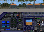
Looking for a functional all-in-one panel? This package might be worth a look then. With a consistent layout for all instrumentation except aircraft type specific gauges (like engine displays and controls), this package offers panels for nearly all possible aircraft types. These IFR compatible 2D panels use the proper autopilot system for the aircraft type and have all the bells and whistles in easy reach; including an upgraded PFD, backup gauges, full IFR gauges (including ADF), fuel request, jetway toggle, engine startup and shutdown ability, a speed reduction system with auto spoilers, auto reverse thrust and auto taxi after landing, automatic gear, a true auto-smoke gauge that works with any aircraft having an engine smoke system, ground handling and popups like a custom exits control gauge, flight information computer and a TCAS radar plus much more. No attempt was made to replicate an actual aircraft panel, these were designed to allow flight of any aircraft in any location or situation without having to figure out how to use a different panel for each plane, and to assure all the necessary controls are present.
v6.3 is a Major Upgrade with a cleaner, more uniform look and tons of updated graphics, along with a load of new and improved features, including a functional TOGA system and, for piston engine aircraft, an Auto-Takeoff system. Complete package, no previous version required.
Support & Updates for this package can be found here:
http://www.thecurrentpage.com/?page_id=2686
| Filename: | Project_Black_Panels_v63.zip |
| License: | Freeware, limited distribution |
| Added: | 18th June 2010, 01:50:04 |
| Downloads: | 1,865 |
| Author: | Don Janusz |
| Size: | 28.84 MB |


© 2001-2026 AVSIM Online
All Rights Reserved
Privacy Policy |