
Where Flight Simulation Enthusiasts Gather from Around the World!
AVSIM Library - Search Results

| Category: Flight Simulator 2004 - Scenery | |
| PASY - Shemya (Eareckson Air Station) - Alaska, USA |

|
Images related to this file:
File Description:
Shemya is pretty well AT the western end of the Aleutian chain of islands in Alaska, around 240 miles west of Amchitka. There is no town on Shemya and the whole island is occupied (and owned) by the Air Force. There are three runways, two of which are from the 1940's and are now unused; in fact one of them has been partly ploughed up and also used for outdoor storage. The single in-use runway is aligned 10-28 and is 10,000 feet of 150 feet wide asphalt with an ils on 28, the runway that is used 99% of the time. The base is now not active but is maintained as a refuelling facility, so for landing and takeoff purposes it is open. The older and now unused areas are those where the hangers are slowly rusting away and the asphalt is turning green with encroaching and well-watered wildlife plants. The tower is now closed, so there is no atc and you just announce your intentions. Read the history of Shemya, a lot happened there.
| Filename: | PASY__Shemya_Eareckson_Air_Station__Alaska_USA.zip |
| License: | Freeware, limited distribution |
| Added: | 18th February 2015, 19:52:36 |
| Downloads: | 453 |
| Author: | Roger Wensley |
| Size: | 8.81 MB |
| Category: Flight Simulator X - Scenery | |
| RAF Shepherds Grove - Suffolk, England |
|
File Description:
RAF Shepherds Grove is a former Royal Air Force station located 9.9 miles (15.9 km) north-east of Bury St Edmunds, Suffolk, England.
The Station was originally built for the United States Army Air Forces (USAAF) Eighth Air Force during the Second World War. However the facility was not used by the USAAF and was opened by No. 3 Group RAF on 3 April 1944. The name came from a small copse nearby and the airfield is close to Walsham le Willows in Suffolk.
It was occupied by No. 196 Squadron RAF in January 1945 as a base for Operation Varsity, supporting the Rhine crossing.
Various American units occupied the station after WW2 but ended their use of the unit in December 1958.
On 22 July 1956, No. 82 Squadron RAF was activated at Shepherds Grove as a Thor missile unit. Thor launching sites were built on the main airfield and became operational in 1959.
The base was closed in 1966. Third party files are required - see the readme.txt for details.
| Filename: | RAF_Shepherds_Grove__Suffolk_England.zip |
| License: | Freeware |
| Added: | 4th December 2015, 09:34:13 |
| Downloads: | 159 |
| Author: | Terry Boissel |
| Size: | 13.26 KB |
| Category: Flight Simulator X - Scenery | |
| RAF Skipton On Swale |
|
File Description:
RAF Skipton On Swale is a former Royal Air Force station operated by RAF Bomber Command during the Second World War.
The village of Sandhutton is located just to the east. RAF Skipton-on-Swale was a sub-station of RAF Leeming.
The airfield opened in autumn 1942, becoming operational in May 1943, originally a 4 Group facility and first hosted
420 Squadron, Royal Canadian Air Force (RCAF), which moved to RAF Middleton St. George in October 1942. Skipton was
assigned to No. 6 Group, Royal Canadian Air Force (RCAF) in January 1943. RCAF squadrons stationed here included 424
Squadron, No. 432 Squadron (which moved to RAF East Moor in September 1943), and 433 Squadron. Both squadrons flew the
Halifax bomber until replaced by the Lancaster in January 1945. 424 Squadron lost 52 aircraft and 433 Squadron lost 38
aircraft.
When Nos. 424 and 433 Squadrons were disbanded in October 1945 the airfield was closed. The station was not used again
and has since reverted largely to farmland. The site is home to turkey and pig farms.
Source:Wikipedia
| Filename: | RAF_Skipton_On_Swale.zip |
| License: | Freeware |
| Added: | 11th March 2017, 18:03:07 |
| Downloads: | 122 |
| Author: | Terry Boissel |
| Size: | 157.85 KB |
| Category: Flight Simulator 2002 - Scenery | |
| Alaska Bush Scenery: Stony River Bend & Old Stony |
|
File Description:
Here's your big chance to take-off and land using a curved airstrip. Stony River Bend is located just west of Merrill Pass, very close to Tom Fica's cabin at Two Lakes (part of his 'Merrill Pass' scenery add-on). The bumpy dirt runway - becoming slightly overgrown and prone to waterlogging - is marked out with wooden posts (lit at night) and presents a unique challenge: one that I haven't really sorted out just yet! There's a small settlement just up a log-lined trail from the airfield with a gravel service track connecting with a basic NDB/DME facility to help out with night or low visibility approaches. Although Stony River Bend is fictional, it has been based loosely on a real life runway at Elk City in Idaho. Three miles downstream is another simple backwoods strip called Old Stony - the narrow gravel runway here is conventional, but it's probably in an even worse state of repair. Designed for use with Eddie Denney's FS2002 mesh of Alaska, but the scenery is usable without it.
| Filename: | Alaska_Bush_Scenery_Stony_River_Bend__Old_Stony.zip |
| License: | Freeware, limited distribution |
| Added: | 31st March 2003, 13:09:28 |
| Downloads: | 1,873 |
| Author: | James Belk |
| Size: | 2.04 MB |
| Category: Flight Simulator 2002 - AFCAD Files | |
| China Lake NAWS, CA. AFCAD JANET |
|
File Description:
This is the AFCAD to a top secret facility known as China Lake Naval Air weapons station in California. The stories are wide and far ranging about this secret place in the desert.
There is a supposed underground tram system running 180 MPH under the Death Valley mountains to Area 51. (some reports of the tram running up to 275 MPH) Lockheed has a targeting and ranging station on base used to develop aircraft that are invisible. (the craft blend with the sky) Orbs can be seen here, UFO's reported daily, and on and on.
Folklore,? maybe. I dont know anything. Speculation only. Gates are approximated. My work is free to the simming community. Please do not sell any of ol' Bucks work.
Please do not include my work any any pay packages. Free is good. God bless the USA. If this is subversive to the USA, please feel free to pull my AFCADS.
P.S.: SDK is included with Lee Swordys installer. I had trouble getting this AFCAD to install so good luck. That is why I have included the SDK.
| Filename: | China_Lake_NAWS_CA_AFCAD_JANET.zip |
| License: | Freeware, limited distribution |
| Added: | 6th September 2003, 17:06:33 |
| Downloads: | 471 |
| Author: | Buck Martin |
| Size: | 49.75 KB |
| Category: X-Plane - Scenery | |
| BR RJ SBBZ - Buzios Airport v1.0.0 |
|
Images related to this file:
File Description:
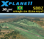
This is an X-Plane 11 and X-Plane 10 scenery package for Umberto Modiano Airport (IATA: BZC, ICAO: SBBZ), which is the airport serving Armacao dos Buzios, Brazil. It is named after Umberto Modiano, a local businessman who financially supported the emancipation movement of Armação dos Búzios as an independent municipality, which was completed in 1995.
It includes corrected aprons, ramps, gates, taxiways, lighting system, city buildings, ortho-photoscenery for the airfield area, and (XP11 only) airport ground services (like push back).
The airport was inaugurated in 2003 and it is dedicated to general aviation. On July 11, 2012 the facility was temporarily closed to conduct renovation works demanded by the National Civil Aviation Agency of Brazil. However, on May 28, 2016, after completing the renovations and legal procedures, the airport was again opened for general aviation.
This scenery was tested and is operational (as of January 16, 2018) in "X-Plane 11.11 64 bit", Windows 10 Home. It was also tested and is also operational (as of January 16, 2018) in "X-Plane 10.51 64 bit", Windows 10 Home.
| Filename: | BR_RJ_SBBZ__Buzios_Airport_v100.zip |
| License: | Freeware |
| Added: | 2nd February 2018, 00:12:38 |
| Downloads: | 62 |
| Author: | Rui Mesquita |
| Size: | 8.35 MB |
| Category: Flight Simulator X - Scenery | |
| PABE - Bethel Airport - Alaska, USA |
|
Images related to this file:
File Description:
Bethel Airport is a state owned, public use airport located three nautical miles (6 km) southwest of the central business district of Bethel.
Construction began September 21, 1941, and the airfield was activated July 4, 1942; it is also known as Bethel Air Base. It was used by Air Transport Command as auxiliary airfield for Lend-Lease aircraft being flown to Siberia. The facility was transferred to Eleventh Air Force, then to Alaskan Air Command in 1945; it became the joint-use Bethel Airport. It was used for construction of AC&W Bethel Air Force Station in mid 1950s. Full jurisdiction was turned over to Alaska Government in 1958.
Added and adjusted aprons and buildings. Also added additional parking. Added runway 1R/19L.Re-numbered runways to conform with AirNav data.
Created with Airport Design Editor 9x by ScruffyDuck Software using current FAA documentation and Google Earth measurements, this package offers a replacement for FSX's stock airport. All these enhancements are as close to the real airport as I can get with stock library objects and custom buildings.
| Filename: | PABE__Bethel_Airport__Alaska_USA.zip |
| License: | Freeware |
| Added: | 5th December 2014, 13:35:35 |
| Downloads: | 994 |
| Author: | Wayne Roberts |
| Size: | 94.58 KB |
| Category: Flight Simulator 2004 - Scenery | |
| Salmon River Safari |
|
File Description:
The Salmon River is known as the "River of No Return." Elevations in this wilderness vary from 610 to 3050 meters. Flying into and out of these high altitude short grass and dirt strips will give you a real challange, as well as an opportunity to enjoy the scenery.
No other files are required. Contains full maps, sectional chart, and instructions.
You can do this with the stock Cessna 182RG, but you may want to download John L. Woodward's BEAVER_WHEELS_2005.zip available here on Avsim.com. You'll probably appreciate a little more power and climbing ability to get out of some of these strips!
| Filename: | Salmon_River_Safari.zip |
| License: | Freeware |
| Added: | 3rd July 2006, 01:04:35 |
| Downloads: | 994 |
| Author: | Bill Baldwin |
| Size: | 1.87 MB |
| Category: Flight Simulator 2004 - Flight Plans | |
| Imperial Airways - Cairo to Cape Town - South Africa Service, 1932 |
|
File Description:
Our journey commences in May 1932 at Embaba airport (Cairo) and the Flight Simulator flight-plan shows the route all the way to Cape Town. You will, of course, pause for refuelling and overnight stops during this 7-day epic from the top of Africa to the very southern tip of the continent. Imperial Airways operated the Handley Page HP42 between Cairo and Nairobi and the Armstrong Whitworth AW15 "Atalanta" for the second half of the journey. The flight has been saved with the Flight Simulator 2004 default Cessna 172 to enable a trouble-free commencement.
| Filename: | Imperial_Airways__Cairo_to_Cape_Town__South_Africa.zip |
| License: | Freeware |
| Added: | 19th August 2006, 20:12:07 |
| Downloads: | 644 |
| Author: | Bruce Kennewell |
| Size: | 171.45 KB |
| Category: Flight Simulator 2004 - Flight Plans | |
| World Challenge Suriana |
|
File Description:
Suriana a beautiful country to do the next challenge in. Here you find yourself flying over rivers to make a landing and flying though the mountain region. Most flight can be done with a Extra 300s but to enjoy the beauty of this country take a Cessna,Baron,or piper. I have added maps and some very useful information about some of the airfields you will be flying into. There are only 8 airfields that you will be flying into, but only five of them are dirt landing strips. This is part of the eastern challenge three country swing going into Brazil.
| Filename: | World_Challenge_Suriana.zip |
| License: | Freeware |
| Added: | 1st July 2007, 00:00:41 |
| Downloads: | 172 |
| Author: | Hosea Robertson |
| Size: | 222.17 KB |


© 2001-2026 AVSIM Online
All Rights Reserved
Privacy Policy |