
Where Flight Simulation Enthusiasts Gather from Around the World!
AVSIM Library - Search Results

| Category: Flight Simulator 2004 - Aircraft Repaints, Textures and Modifications | |
| New Instrument Panel and Flight Dynamics for Default Cessna 172 SP |

|
File Description:
This package includes new instrument panel and Photoreal gauges which replaced the default fsx Cessna 172 panel:
1. Six new basic instruments which move very smoothly (especially the attitude indicator) make real IFR flight possible
1. KLN98B GPS
2. KMA24 AUDIO PANEL
3. new set of Bendix Kind Radio-Nav and adf (credits to Pierre FASSEAUX)
4. kap 140 autopilot (credits to Pierre FASSEAUX)
5. Fully working c172S clock (credits to Pierre FASSEAUX)
6. DME that emulate real UHF receive range
7. New VORs gauge with motion to/from flag
also new real aircraft flight dynamics.
| Filename: | New_Instrument_Panel_and_Flight_Dynamics_for_Defau.zip |
| License: | Freeware |
| Added: | 14th April 2011, 02:05:34 |
| Downloads: | 882 |
| Author: | Tomer Haim |
| Size: | 3.42 MB |
| Category: Flight Simulator X - Aircraft Repaints, Textures and Modifications | |
| Carenado Cessna U206G Stationair 6 II patch for FSX Aircraft Browser |
|
File Description:
This patch adds correct thumbnails for FSX Aircraft Browser and
changes search criterias to ones in FSX.
| Filename: | Carenado_Cessna_U206G_Stationair_6_II_patch_for_FS.zip |
| License: | Freeware |
| Added: | 8th January 2007, 12:07:11 |
| Downloads: | 1,048 |
| Author: | Marek Slotwinski |
| Size: | 238.83 KB |
| Category: Flight Simulator 2004 - Aircraft Repaints, Textures and Modifications | |
| Cessna C337 / O-2A Skymaster, 3 times c/n 67-21318 |
|
Images related to this file:
File Description:

This packet contains 3 repaints of the same aircraft c/n 67-21318. After the
Vietnam war it flew with the California ANG. There after it was one of six
O-2A's transfer to the Navy for range (clearing) duties and FAC. Started with
the VA-122 at NAS Fallon to end it's career with the VFA-125 at NAS Lemoore.
This aircraft is currently under restoration at the Connecticut Air And Space
Center.
These are complete repaints the pilot is repainted as-well.
To be used with the payware Cessna 337 from Carenado.
These texture were designed and tested with the FS2004 version, however should
also with work with the FSX version of this plane.
| Filename: | Cessna_C337__O2A_Skymaster_3_times_cn_6721318.zip |
| License: | Freeware, limited distribution |
| Added: | 22nd October 2012, 15:58:09 |
| Downloads: | 1,034 |
| Author: | Marcel Ritzema |
| Size: | 25.9 MB |
| Category: Flight Simulator X - Scenery | |
| RAF Shepherds Grove - Suffolk, England |
|
File Description:
RAF Shepherds Grove is a former Royal Air Force station located 9.9 miles (15.9 km) north-east of Bury St Edmunds, Suffolk, England.
The Station was originally built for the United States Army Air Forces (USAAF) Eighth Air Force during the Second World War. However the facility was not used by the USAAF and was opened by No. 3 Group RAF on 3 April 1944. The name came from a small copse nearby and the airfield is close to Walsham le Willows in Suffolk.
It was occupied by No. 196 Squadron RAF in January 1945 as a base for Operation Varsity, supporting the Rhine crossing.
Various American units occupied the station after WW2 but ended their use of the unit in December 1958.
On 22 July 1956, No. 82 Squadron RAF was activated at Shepherds Grove as a Thor missile unit. Thor launching sites were built on the main airfield and became operational in 1959.
The base was closed in 1966. Third party files are required - see the readme.txt for details.
| Filename: | RAF_Shepherds_Grove__Suffolk_England.zip |
| License: | Freeware |
| Added: | 4th December 2015, 09:34:13 |
| Downloads: | 159 |
| Author: | Terry Boissel |
| Size: | 13.26 KB |
| Category: Flight Simulator X - Scenery | |
| RAF Skipton On Swale |
|
File Description:
RAF Skipton On Swale is a former Royal Air Force station operated by RAF Bomber Command during the Second World War.
The village of Sandhutton is located just to the east. RAF Skipton-on-Swale was a sub-station of RAF Leeming.
The airfield opened in autumn 1942, becoming operational in May 1943, originally a 4 Group facility and first hosted
420 Squadron, Royal Canadian Air Force (RCAF), which moved to RAF Middleton St. George in October 1942. Skipton was
assigned to No. 6 Group, Royal Canadian Air Force (RCAF) in January 1943. RCAF squadrons stationed here included 424
Squadron, No. 432 Squadron (which moved to RAF East Moor in September 1943), and 433 Squadron. Both squadrons flew the
Halifax bomber until replaced by the Lancaster in January 1945. 424 Squadron lost 52 aircraft and 433 Squadron lost 38
aircraft.
When Nos. 424 and 433 Squadrons were disbanded in October 1945 the airfield was closed. The station was not used again
and has since reverted largely to farmland. The site is home to turkey and pig farms.
Source:Wikipedia
| Filename: | RAF_Skipton_On_Swale.zip |
| License: | Freeware |
| Added: | 11th March 2017, 18:03:07 |
| Downloads: | 122 |
| Author: | Terry Boissel |
| Size: | 157.85 KB |
| Category: X-Plane - Scenery | |
| BR RJ SBBZ - Buzios Airport v1.0.0 |
|
Images related to this file:
File Description:

This is an X-Plane 11 and X-Plane 10 scenery package for Umberto Modiano Airport (IATA: BZC, ICAO: SBBZ), which is the airport serving Armacao dos Buzios, Brazil. It is named after Umberto Modiano, a local businessman who financially supported the emancipation movement of Armação dos Búzios as an independent municipality, which was completed in 1995.
It includes corrected aprons, ramps, gates, taxiways, lighting system, city buildings, ortho-photoscenery for the airfield area, and (XP11 only) airport ground services (like push back).
The airport was inaugurated in 2003 and it is dedicated to general aviation. On July 11, 2012 the facility was temporarily closed to conduct renovation works demanded by the National Civil Aviation Agency of Brazil. However, on May 28, 2016, after completing the renovations and legal procedures, the airport was again opened for general aviation.
This scenery was tested and is operational (as of January 16, 2018) in "X-Plane 11.11 64 bit", Windows 10 Home. It was also tested and is also operational (as of January 16, 2018) in "X-Plane 10.51 64 bit", Windows 10 Home.
| Filename: | BR_RJ_SBBZ__Buzios_Airport_v100.zip |
| License: | Freeware |
| Added: | 2nd February 2018, 00:12:38 |
| Downloads: | 61 |
| Author: | Rui Mesquita |
| Size: | 8.35 MB |
| Category: Flight Simulator X - Scenery | |
| YBLT - Ballarat Aerodrome - Victoria, Australia |
|
Images related to this file:
File Description:
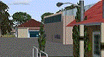
YBLT (Ballarat Aerodrome) is a regional 'airport' in the central west of the State of Victoria, Australia and utilises infrastructure from the days of RAAF operations which lasted till the early 1960's. Thus the buildings are now a bit outdated but this file does not reflect that as I have not done any custom texturing so everything in this package tends to look a bit new and crispy.
Note the name of this 'airport'. The locals are adamant it is an aerodrome, not an airport. I have not found any freeware or commercial offerings for an alternative to the default and so I have put one together.
This is a reasonable approximation of the airport /aerodrome but is not entirely accurate as the hangars/buildings I have modelled myself are generic ones I have done and do not look exactly like the ones at that facility. The connecting road is not in true alignment as I have created it so as it blends into the surrounding default scenery.
| Filename: | YBLT__Ballarat_Aerodrome__Victoria_Australia.zip |
| License: | Freeware |
| Added: | 21st October 2014, 01:51:16 |
| Downloads: | 838 |
| Author: | Robert Budd |
| Size: | 4.43 MB |
| Category: Flight Simulator 2002 - Scenery | |
| Alaska Bush Scenery: Stony River Bend & Old Stony |
|
File Description:
Here's your big chance to take-off and land using a curved airstrip. Stony River Bend is located just west of Merrill Pass, very close to Tom Fica's cabin at Two Lakes (part of his 'Merrill Pass' scenery add-on). The bumpy dirt runway - becoming slightly overgrown and prone to waterlogging - is marked out with wooden posts (lit at night) and presents a unique challenge: one that I haven't really sorted out just yet! There's a small settlement just up a log-lined trail from the airfield with a gravel service track connecting with a basic NDB/DME facility to help out with night or low visibility approaches. Although Stony River Bend is fictional, it has been based loosely on a real life runway at Elk City in Idaho. Three miles downstream is another simple backwoods strip called Old Stony - the narrow gravel runway here is conventional, but it's probably in an even worse state of repair. Designed for use with Eddie Denney's FS2002 mesh of Alaska, but the scenery is usable without it.
| Filename: | Alaska_Bush_Scenery_Stony_River_Bend__Old_Stony.zip |
| License: | Freeware, limited distribution |
| Added: | 31st March 2003, 13:09:28 |
| Downloads: | 1,873 |
| Author: | James Belk |
| Size: | 2.04 MB |
| Category: Flight Simulator X - AFCAD Files | |
| Warren Grove Range Airport (NJ24), New Jersey |
|
File Description:
Located 03 miles SW of Burlington County, New Jersey, Warren Grove Range is a private concrete airfield 1800' in length. It is owned by the Department of Defense and exists in a restricted flight area. The bare sand of this area has washed out the satellite images tremendously from over-exposure thanks to reflected sunlight - you can't even make out the runway (which FSX places incorrectly over a mile away). Due to lack of ground definition and primary use as a military facility, this airport has not been developed by MSEAirports and the concrete runway has been removed.
Scenery constructed with use of satellite images/streetview/aerial photos - the author has not been there in person.
This scenery is meant to be used in conjunction with MegaScenery Earth New Jersey/Delaware 003. It is not required, but apron use is minimized to allow satellite scenery to show through as much as possible, and objects are placed based on the MSE textures - lack of it may make scenery look out of place.
| Filename: | Warren_Grove_Range_Airport_NJ24_New_Jersey.zip |
| License: | Freeware |
| Added: | 20th August 2011, 19:58:05 |
| Downloads: | 174 |
| Author: | Drew Sikora |
| Size: | 153.47 KB |
| Category: Flight Simulator 2004 - Scenery | |
| Colorado Springs South (KCOS), Colorado, Photo-Scenery |
|
Images related to this file:
File Description:
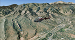
Colorado Springs South (KCOS), Colorado, Photo-Scenery (FS9 & FSX)
This region covers the area of Colorado Springs. Just west of the city you can fly around Pikes Peak. At 14.115ft it is the easternmost of Colorado's 54 fourteeners. Northwest of the city lies the Garden Of Gods with its many vertical rock formations. They are made of sedimentary beds red and white sandstones, conclomerates and limestone that were deposited horizontally but have been tilted vertically and faulted by the immense mountain building forces caused by the uplift of the Pikes Peak massiv. Deep within Chayenne Mountain is the North American Aerospace Defense Command's (NORAD) main technical facility which collects and evaluates data from a worldwide system of satellites, radars and other sensors.
High resolution versions of this scenery for FS9 and FSX (much sharper, but larger and multiple downloads) are available at www.blueskyscenery.com/GNB_South3East.html . The screenies are taken from the high-res versions, so expect this version to be slightly more blurry. YourDonation@Work: Dedicated to Veit and Hector.
| Filename: | Colorado_Springs_South_KCOS_Colorado_PhotoScenery.zip |
| License: | Freeware, limited distribution |
| Added: | 5th February 2010, 16:30:42 |
| Downloads: | 1,979 |
| Author: | Gottfried Razek, blueskyscenery.com |
| Size: | 95.63 MB |


© 2001-2026 AVSIM Online
All Rights Reserved
Privacy Policy |