
Where Flight Simulation Enthusiasts Gather from Around the World!
AVSIM Library - Search Results

| Category: Flight Simulator X - Scenery | |
| hythevillage_pier.zip |

|
File Description:
Hythe Village and Pier
Hythe Village [Town] nestles between the edge of Southampton Water and the New Forest, some 500 yards west of the ‘American Base – RAF Hythe’; the surrounding area is known as ‘The Waterside’. Hythe, with its waterfront, boasts incredible views across Southampton Water, while the village [town] centre, with its Georgian High Street, offers a range of shops, services, traffic-free precincts and parking facilities. Nearby is ‘Hythe Marina’, to be found on Southampton Water's southern shore; it’s a unique development of a 206 berth marina, together with waterside homes, shops, restaurants, bars and a boutique hotel.There is also a passenger ferry which sails back-and-forth from Hythe Pier to the City of Southampton every 30 minutes. Before Hythe Pier was built, ferry and other boats arriving at Hythe had to use a gravel hard ramp which ran from the land out to the low tide point in Southampton Water. Walking along the hard gravel was not easy and travellers often got very wet. Various ideas to improve the situation were suggested at the time and construction of Hythe Pier was eventually started in October 1879 and officially opened on the 1st January 1881. Many World War II heroes departed from this pier on D-Day in June 1944.The pier itself stretches some 640 meters into Southampton Water and is one of the ten longest piers in the British Isles. In 1922, a narrow gauge electric railway opened in order to take passengers the full length of the Pier. This railway, with its original engine and rolling stock, is the oldest operating electric pier train in the world and is still operational to this day – playing an important part in the local transportation system between Hythe and Southampton.
Scenery Features
* Bus Shelter
* Ferry Ticket Collectors (On pier landing platform)
* Ferry Ticket Office
* High Street Shops
* Hotspur House
* Hythe Library & Car Park
* Hythe Pier
* Hythe Pier Landing Platform
* Hythe Promenade
* Library Road & Shops
* Lidl Superstore & Car Park
* People (Static & animated)
* Pier Railway & Safety Railings
* Pier Train (Parked at village end of pier)
* Lord Nelson Public House
* Prospect Place Park
* Public Toilets
* Seashells Lounge Bar & Restaurant
* St. John's Church & Cemetery
* Street Lighting
* Streets & Roadways
* ‘The Marsh’ & New Road
* Vegetation (Trees, bushes)
* Vehicles (Buses & cars)
* Waitrose Supermarket & Car Park
* WWII Remembrance Plaque (Prospect Place)
Special Effects
* Animated Birds (seagulls-close to village & pier)
* Chimney Smoke
* Night, Dusk & Dawn Lighting Effects
* Seagull Cry Sounds
| Filename: | hythevillage_pierzip.zip |
| License: | Freeware |
| Added: | 21st November 2025, 12:42:28 |
| Downloads: | 68 |
| Author: | Barrie Semmens |
| Size: | 16.37 MB |
| Category: Flight Simulator X - Aircraft Repaints, Textures and Modifications | |
| Northern Pacific Airways Boeing 757-2B7(WL) (N627NP) |
|
Images related to this file:
File Description:

Northern Pacific Airways 757-200 with winglets (for the Rolls-Royce model). This livery was made before Northern Pacific Airways began operations and painted their first 757-200. The renders published by the company of the aircraft were used. The registrations, American flag and other markings were also added to the textures (which were not shown on the renders) using references from other US Airlines. Northern Pacific Airways is due to start operations by 2022 and will fly between East Asia and North America via Anchorage in Alaska with an initial fleet of 757s (of which N627NP will be the first). Model developed by Tenkuu Developers Studio (TDS). Features high-resolution textures, dynamic flexing wings, nose gear steering, rudder lock, ground spoilers, low-speed aileron locks at high speed, fully animated control surfaces, fully independent suspension, trim animation, opening passenger doors, rolling wheels, animated thrust reverse with reverser block doors, detailed textures, full night lighting, ground service vehicles and more. Model design by Hiroshi Igami. Flight dynamics design by Nate Rosenstrauch and Chesley Hann. Paint kit and master textures by Carlos Eduardo Salas. TDS members: Hiroshi Igami, Nick Wilkinson, Carlos Eduardo Salas, Yosuke Ube, Stian Svensen, David Biggar, Luiz Antonio Perina, Nate Rosenstrauch and Chesley Hann. For support visit Tenkuu Developers Studio's Facebook page: https://www.facebook.com/groups/214187952530554/. Works with FSX but might work in P3D or FS2004. Enjoy your flights!
| Filename: | Northern_Pacific_Airways_Boeing_7572B7WL_N627NP.zip |
| License: | Freeware, limited distribution |
| Added: | 7th November 2021, 19:16:57 |
| Downloads: | 455 |
| Author: | Neel Pillai |
| Size: | 31.14 MB |
| Category: X-Plane - Scenery | |
| BR AM SWMK - Maturaca Airfield v1.0.0 |
|
Images related to this file:
File Description:
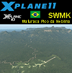
This is an X-Plane 11 and X-Plane 10 scenery package for Maturaca Airport (ICAO: SWMK, no IATA code) which is an airport serving Maturaca village, in São Gabriel da Cachoeira, Amazonas, Brazil, located in the vicinity of "Pico da Neblina" (Peak of the Haze, in English), the highest mountain in Brazil, 2,995.3 metres (9,827 ft) above sea level, in the Serra da Neblina, part of the Serra do Imeri, a section of the Guiana Highlands on the Brazil–Venezuela border, in the middle of the Amazon rainforest. It includes corrected aprons, ramps, gates, taxiways, lighting system, village buildings, ortho-photoscenery for the airfield area, and (XP11 only) airport ground services (like push back). This scenery was tested and is operational (as of April 14, 2017) in "X-Plane 11.00 RC #1 64 bit", Windows 10 Home. It was also tested and is also operational (as of April 14, 2017) in "X-Plane 10.51 64 bit", Windows 10 Home. Only the default X-Plane 11 libraries, by Laminar Research, are needed. No third party libraries are used.
A few extra objects are used and included in the package, thanks to artist Paulmort (Hangar 24, Hangar House, Ranch House, Deluxe Log Cabin, Hangar Barn) and to artist Capnsully (Grow Grass for Xplane). They are included in the package, no need to download them.
| Filename: | BR_AM_SWMK__Maturaca_Airfield_v100.zip |
| License: | Freeware |
| Added: | 15th April 2017, 06:23:29 |
| Downloads: | 132 |
| Author: | Rui Mesquita |
| Size: | 35.57 MB |
| Category: Flight Simulator X - Scenery | |
| Quebec CYQB |
|
File Description:
All pilots have used or heard the word "Quebec" during their radio communication but not many pilots actually landed at Quebec International airport (CYQB). A great number of Head of States, VIPs, tourists came to Quebec City for summits, special occasions or to visit the city declared a World Heritage Site by UNESCO in 1985. Quebec airport is also hosting a great airshow and this year in June, to celebrate the 400th anniversary of Quebec City, five of the world best aerobatic squadrons will perform simultaneously over Quebec: the British "Red Arrows", the French "La Patrouille de France", the US Navy "Blue Angels", the USAF "Thunderbirds" and the Canadian "Snowbirds". It will be quite a sight.
This very accurate scenery will give you the opportunity to visit CYQB with your simulator. Months of effort were devoted to make this scenery as real as possible. This package includes more that 25 highly detailed hangars and buildings all having night textures, some of them have windows with specular effect. Light poles provide aprons lighting. The adjacent mount Belair have communication towers with strobe lights visible for over 12nm which provides a good visual reference coming into the airport. Exceltech, a maintenance facility has static aircrafts parked in front. A second publication will include the new terminal which is presently under construction.
| Filename: | Quebec_CYQB.zip |
| License: | Freeware |
| Added: | 20th February 2008, 22:13:36 |
| Downloads: | 8,240 |
| Author: | Gilles Boily |
| Size: | 6.21 MB |
| Category: Flight Simulator X - AFCAD Files | |
| Vliet Airport (6NJ1), NJ |
|
File Description:
Located 02 miles SE of Washington, New Jersey, Vliet Airport is a private turf field. Trees border the runway on three sides, and a dirt mound and semi-truck are also obstacles to watch out for at the end of Runway 06 if you land long. At 1300' feet, it is a very short runway so make sure you check the capabilities of your aircraft before attempting to either land or take off here! Don't forget that in order to clear trees, usable runway space is closer to only 1000'. This airport has no lighting so daytime VFR operations only are recommended. Take note that there is also no wind sock, so be sure you are aware of the weather conditions prior to arriving/departing. There is also no hard-surfaced runway and you will be landing on terrain so it's suggested you have your mesh resolution slider as high as possible.
Scenery constructed with use of satellite images/streetview/aerial photos - the author has not been there in person.
This scenery is meant to be used in conjunction with MegaScenery Earth New York 007. It is not required, but apron use is minimized to allow satellite scenery to show through as much as possible, and objects are placed based on the MSE textures - lack of it may make scenery look out of place.
| Filename: | Vliet_Airport_6NJ1_NJ.zip |
| License: | Freeware |
| Added: | 8th February 2011, 23:20:47 |
| Downloads: | 182 |
| Author: | Drew Sikora |
| Size: | 375.28 KB |
| Category: Flight Simulator X - Scenery | |
| NZGA- Galatea Aerodrome (VectorLandClass, New Zealand) |
|
Images related to this file:
File Description:
Welcome to Galatea (ICAO: NZGA), a gateway to exploring the Urewera ranges and the east coast of New Zealand. Galatea is a small and basic airstrip with only one old hanger, a public toilet and a small clubhouse on a wide plain surrounded by native bush and pine plantation near Murupara in the Bay of Plenty of New Zealand. It is a grass strip of 1025m length and 60m width and aligned 01/19 with a group rating of 8. No night lighting or fuel is available.
The FSX model includes custom textures and models placed on an aerial image. It makes extensive use of items from the free VLC object libraries which are required to be installed (download from www.vectorlandclass.co.nz downloads menu). This scenery and the VLC libraries have been funded
by sales of VectorLandClass and although you do not need VLC to use it, your purchase helps further development.
To the south west of Murupara township and sawmill is the LakeLand Helicopters base which just fits onto the photo-real coverage. Library objects have been placed here although they may not be accurate as the site was not visited when taking reference photos. This airfield makes a great stop over when flying between Rotorua, Mount Tarawera, Whakatane or Gisborne.
We hope you enjoy exploring the area!
| Filename: | NZGA_Galatea_Aerodrome_VectorLandClass_New_Zealand.zip |
| License: | Freeware, limited distribution |
| Added: | 15th November 2012, 23:35:42 |
| Downloads: | 1,127 |
| Author: | Tim Barnes / VectorLandClass |
| Size: | 45.7 MB |
| Category: Flight Simulator 2004 - Scenery | |
| Union Island TVSU in the Grenadines, eastern Caribbean Version 1.1 |
|
Images related to this file:
File Description:
This is a self-contained version 1.1 that modifies the terrain flattens around the airport. I found that suddenly, and for no apparent reason, the Lesser Antilles mesh and my flattens were at war and creating hills within the airport boundary. If you are not having problems then you do not need this.
Union Island is in the southern tail of the chain of islands known as St Vincent and the Grenadines, between Canouan and Carriacou. Union is another small island, 3.5 miles long and at its widest 1.5 miles wide; the resident population is around 3,000, mostly in the two towns Clifton and Ashton. The airport is at the eastern end of the island, and has been extended into the sea on landfill. The runway is now around 2,480 feet long, aligned 08 (and with the southeast trade winds it is unlikely that you will find yourself using 26) and with a displaced threshold of 530 feet due to the hill to the west. The terminal is adjacent to a rather small apron; there is parking on the grass north of the taxiway. There are connecting flights by SVG to Barbados and the other islands and these are reflected in the AI. The airport has no lighting, and flights are obliged to land and depart in daylight hours only, outside of which the airport is closed.
| Filename: | Union_Island_TVSU_in_the_Grenadines_eastern_Caribb.zip |
| License: | Freeware, limited distribution |
| Added: | 16th June 2013, 18:46:33 |
| Downloads: | 526 |
| Author: | Roger Wensley |
| Size: | 2.02 MB |
| Category: Flight Simulator 2004 - Scenery | |
| Jerusalem |
|
File Description:
FS2004 Scenery - Jerusalem. The third part of Israel
scenery covering the mountain range of Samaria, Judea
and the cities of Jerusalem and Bethlehem. The scenery
is made in the highest detail with new terrain textures
and it shows all main roads, secondary roads, junctions,
rail roads, vegetation and residential areas with a
population of 1,000 and above. The scenery is enhanced
with over 300 structures and buildings made in Gmax.
Among them the Old City of Jerusalem with its walls and
gates, Mount Temple, the Wailling Wall, the city Citadel,
the Holy Sepulchre and all other major churches and
monasteries of Jerusalem, including the Church of
Nativity in Bethlehem and the churches on Mount Olive
and Mount Zion. The scenery also covers in high detail
the New City of Jerusalem, with all landmark structures
and buildings such as the Knesset (Israel's parliament),
museums, the Supreme Court, Yad-Vashem (the holocaust
memorial), Hadasa hospital, Teddi soccer stadium, all
hotels and highrise buildings and much more. There are
also landmarks outside Jerusalem such as the Latrun
Trappist monastery and the nearby Armor Corps Memorial.
All major structures are based on real measurements and
photos taken from the ground. The textures are all
specially made for this scenery. The scenery is enhanced
with night lighting to enable easy VFR navigation by
night.
| Filename: | Jerusalem.zip |
| License: | Freeware |
| Added: | 15th April 2004, 15:39:12 |
| Downloads: | 20,043 |
| Author: | Seev Kahn |
| Size: | 4.49 MB |
| Category: Flight Simulator X - Scenery | |
| Columbia SC (KCAE) |
|
Images related to this file:
File Description:
The Columbia Metropolitan Airport Authority has provided substantial information about KCAE online, making it possible to pretty accurately model this airport. The taxiway signs have been placed according to exhibits in the airport's certification manual, and taxiway designations have been revised in accordance with upgrades to be effective mid-Novemer 2012. Most buildings have been custom modeled in accordance with information available on the internet, including Microsoft Bing birdseye views. The airport layout and landclass changes are in accordance with Google Earth imagery.
If you have Jim Dhaenens' lightobj.bgl installed, apron lighting will be included, and if you have
KB_static_aircraft_FSX installed (available at www.kb-sim.com/screens_static_aircraft.html),
additional parked aircraft will be visible. The layout of scenery is optimized for use with
Ultimate Terrain X-USA. FSX runs smoothly with this scenery on my computer, but it has not been
tested on a low-end system. Sometime after starting this project, it came to my attention that a
good scenery for KCAE was already available (but not listed at www.freewarescenery.com) from Jim
Hill that is another option as well as adjusting scenery complexity.
The new taxiway designations are not yet shown in the latest observed FAA airport diagram. An airfield sketch provided to pilots by the Columbia Metropolitan Airport is included in the package to show the taxiway designation changes.
| Filename: | Columbia_SC_KCAE.zip |
| License: | Freeware |
| Added: | 14th December 2012, 01:28:23 |
| Downloads: | 1,694 |
| Author: | Art Poole |
| Size: | 3.43 MB |
| Category: Flight Simulator 2004 - Aircraft Repaints, Textures and Modifications | |
| Air New Zealand "The Hobbit: An Unexpected Journey" Boeing 777-319/ER (ZK-OKP) |
|
Images related to this file:
File Description:

Air New Zealand is the national airline and flag carrier of New Zealand. Based in Auckland, New Zealand, the airline operates scheduled passenger flights to 27 domestic and 29 international destinations in 15 countries across Asia, Europe, North America and Oceania. It was the last airline to circumnavigate the world because of its flagship NZ1/2 (Heathrow - Los Angeles - Auckland) and NZ35/38 (Auckland - Hong Kong - Heathrow) flights, which ended on March 2013 when Air New Zealand stopped Hong Kong - London flights, in favour of a code sharing deal with Cathay Pacific. Air New Zealand is a member of the Star Alliance global airline alliance, having joined in 1999.
Air New Zealand Boeing 777-319/ER. Air new Zealand livery painted on SkySpirit2012 Boeing 777-300/ER aircraft (model included). The textures are saved in 32bit format for quality graphics. Its features are Opening doors & Cargo doors, detailed textures, accurate paint, dynamic shine & effects, dynamic flexing wings that respond to turbulence, fully independent suspension, trim animation, gear steering, accurate flight dynamics, spoiler animation, reflective cockpit windows, crash effects, animated tilting bogies, full night lighting, ground service vehicles when cargo door open, transparent navigation light lenses and many more.
Visit our Facebook page "Sky Level Textures" for news, updates and previews on my future repaint projects. Thanks for downloading & Happy flying.
| Filename: | Air_New_Zealand_The_Hobbit_An_Unexpected_Journey_B.zip |
| License: | Freeware |
| Added: | 17th December 2013, 15:58:17 |
| Downloads: | 1,334 |
| Author: | Giacomo Tomasini | Sky Level Textures |
| Size: | 28.94 MB |


© 2001-2026 AVSIM Online
All Rights Reserved
Privacy Policy |