
Where Flight Simulation Enthusiasts Gather from Around the World!
AVSIM Library - Search Results

| Category: Flight Simulator 2004 - AI Flight Plans | |
| British Airways Winter 2009/2010 (including BA Cityflyer) - Version 2.0 UPDATE |

|
File Description:
A comprehensive collation of schedules for the Winter 2009/2010 season. 100% of flights, with BA Cityflyer fully inclusive. Full attention to detail has been taken to ensure that every flight is accounted for, and even greater attention to detail has been made to allocate the correct registrations for specific routes (predominantly the Boeing 777-200's, with some being Gatwick based, and also the different engine variants and seating configurations for specific routes). I have included EVERY single aircraft in the fleet, but with doing this, Heathrow gets very crowded at times and therefore, I have had to include a number of "maintenance" flights to free up space at Heathrow. Majority of these flights are to Cardiff (as per real life), but some aircraft will go to Chateauroux, Zurich, Amsterdam and Brize Norton. There are a few maintenance flights aswell for the BA Cityflyer planes, to free up parking at London City, going to Manchester and Edinburgh respectively. New destinations are included in these schedules, namely Sharm El Sheikh, Male (Maldives), Punta Cana, St Kitts, Las Vegas and more, aswell as the A318 service from London City to New York. ** NOTE THIS IS AN UPDATE TO MY PREVIOUS UPLOAD, AND FIXES THE INCORRECT A318 SCHEDULES **
| Filename: | British_Airways_Winter_20092010_including_BA_Cityf.zip |
| License: | Freeware |
| Added: | 27th November 2009, 16:34:25 |
| Downloads: | 1,293 |
| Author: | Chris Horsfield |
| Size: | 40.42 KB |
| Category: Combat Flight Simulator 1 and 2 - Missions | |
| Falklands-Malvinas Missions of the 21th May 1982 |
|
File Description:
This is a set of missions for CFS addon HArrier Jump Jet of Just Flight.
You have 12 missions for the 800th, 801th RN FRS.1 Harrier, RAF No.1 Squadron
Harrier GR.3, Fuerza Aerea Argentina A-4C Brigada IV, A-4B Brigada V, IAI
Dagger Brigada VI, Brigada III IA-58 Pucara, and CAN(Comando Aviación Naval)3th
Escuadrilla de Ataque.
All this missions were historical acomplished the 21-05-82 and in the missions
you have:
-Right time and geographical situation
-Right Aircrafts registrations
-Right Squadrons
-Right Indicatives Squadrons
-Right Pilots names
-Right aircraft number for each historical mission
-Relative strategical situation with the limitations CFS( some
problems for the height flight ,specially for the low altitude
of the attacks of the FAA planes)
-Right ships names and positions this day hour per hour
-Right Meteo and visibility
That was a big work of investigation to find all this informations and all corrections are welcome.There are not fantasie or fiction in this missions.
In memoriam to Lt Daniel Manzotti,Lt Néstor López,Lt Pedro Bean,TN Marcelo Marquez,
Sgt Andy Evans,LT Ken France,Lance Corporal Pat Giffin and all others were lost our life on duty in this day and tragic war.
| Filename: | FalklandsMalvinas_Missions_of_the_21th_May_1982.zip |
| License: | Freeware |
| Added: | 20th December 2003, 03:31:58 |
| Downloads: | 723 |
| Author: | Daniel Nole |
| Size: | 205.14 KB |
| Category: Flight Simulator 2004 - Utilities | |
| Active Camera 2004 Version 1.1 |
|
File Description:
(Shareware, non time limited and fully functional - limited to the Seattle area). FS2004 Active Camera 2004. This version replaces Active Camera 2004 1.0 (ac2004.zip). With this module you can enable additional views in Microsoft Flight Simulator 2004 - A Century of Flight. Several new camera views are selectable from the FS2004 - Options menu. When activated this module replaces the original tower and virtual cockpit views of FS2004. Features: Fly by, approach and spotter view, mouse driven spot plane view, allows mouse panning, zooming and clicking, discover spectacular effects like head latency, pre-stall buffeting, ground turbulence, thanks to FS2004 interactive virtual cockpits it is easy to move the mouse, pan and click, so allowing a more realistic way of flying, the virtual pilot can walk in the cabin (ability to create passenger and wing views) and outside of the aircraft, ability to save and call up to 10 views presets per aircraft, either in the VC or in external view, and this for an unlimited number of aircraft, ambient sounds like steps, wind and aircraft stress sounds, main features can be called through keyboard shortcuts, built-in TCAS that allows AI traffic tracking view (dynamic padlock like in combat simulators).
| Filename: | Active_Camera_2004_Version_11.zip |
| License: | Commercial demo |
| Added: | 1st October 2003, 15:22:54 |
| Downloads: | 40,036 |
| Author: | Serge Baye, Guillaume Darier |
| Size: | 3.17 MB |
| Category: Flight Simulator X - Scenery | |
| Airport update for Pudong Intl with New Satellite Terminal (ZSPD) |
|
Images related to this file:
File Description:
This is a reasonably accurate and up-to-date version of Pudong Intl airport and made only for FSX users, not suitable for use in P3D: I have given this airport a complete makeover which now includes the new Satellite terminal S1 and S2, assigned parking as per their website with extra overflow parking, all gates/parking numbered correctly where possible with gates included for the A380 (Gates are 24 at T1, 71,75 at T2, 504 remote stand near S1 on taxiway L2, between taxiway P2 and south of P3 and 170 at S2), taxiways and taxi signs updated to the latest charts, extra fuel trucks, drainage channels, support vehicle roads rebuilt, and many other scenery improvements and objects added, airport views are from inside the control tower (when in tower view)
I have also added the new runway 15/33 and its taxiways, although not officially in operation yet, i have opened it so AI traffic will use it and be able to get to the terminals, because there are no charts available to me there are no approaches or taxiway designators for this runway,
I will try to update the approaches and taxiways for runway 15/33 when the updated charts become available to me, please view the readme before installation.
| Filename: | Airport_update_for_Pudong_Intl_with_New_Satellite_.zip |
| License: | Freeware, limited distribution |
| Added: | 15th December 2020, 03:51:37 |
| Downloads: | 44,896 |
| Author: | Ray Smith |
| Size: | 4.07 MB |
| Category: Prepar3D V5 - Scenery | |
| VOMM_P3Dv5 |
|
File Description:
Chennai International Airport (IATA: MAA, ICAO: VOMM) is an international airport serving the city of Chennai, Tamil Nadu, India, and its metropolitan area. It is located in Tirusulam, 21 km (13 mi) from the city centre. Chennai International Airport is the third busiest in international traffic and cargo capacity in the country behind New Delhi and Mumbai.[4][5] It is also 49th busiest airport in Asia making it one of the four major airports in India under the top 50 list.[6] The airport is served by the airport metro station of the Chennai Metro and the Tirusulam railway station of the Chennai Suburban Railway system. To cope with the passenger traffic, two new terminals, namely, T2 and one satellite terminal, are under construction to handle 40 million passengers per year.[7] Once completed, it will be India's first airport to have a satellite terminal. The new satellite terminal will be connected through a four way underground walkalator for passenger movement across different terminals.[8] Still, the Tirusulam airport complex is expected to reach saturation by 2035, with a peak capacity of 40 million passengers, and a proposal for a new greenfield airport in Chennai is underway for decades. Once the new airport is commissioned, both the airports will be functional.
| Filename: | VOMM_P3Dv5.zip |
| License: | Freeware |
| Added: | 20th October 2020, 23:18:27 |
| Downloads: | 1,388 |
| Author: | Abhishek Banerjee |
| Size: | 14.68 MB |
| Category: Flight Simulator X - Scenery | |
| EDCB - Ballenstedt Airport - Sachsen-Anhalt, Germany *Version 1* |
|
Images related to this file:
File Description:
The airfield Ballenstedt is located in the eastern foothills of the €œHarz (North German low mountain range) and with twenty thousand aircraft movements per year a relatively highly frequented airport.
The scenery is designed very much in detail. All important objects have been created by me using photos of the original field. Also some clearly visible landmarks are integrated like the large photovoltaic arrangement north of the asphalt runway and the quite large pig farm “Asmusstedt†situated east of the field. An additional important point of reference for glider pilots is the so-called "Gegenstein", a narrow rock on top of the small hill south of the Gliderfield. A retouched photo background, covering all four seasons, completes the scenery.
However, many smaller Objects, like people, cars or static airplanes in this scenery were
taken from three popular freeware libraries for whose use I got the friendly permission of the
authors. If these libraries are not installed , many objects are not visible!
The following libraries are used:
--------------------------------
1. FS-Piloten_Objektlibrary: http://www.fs-piloten.de/thread.php?threadid=1063
2. FSX_FlightPortLib: http://www.flightport.de/libraries/flightport-library/
3. 3d People Library: http://library.avsim.net/download.php?DLID=192454
| Filename: | EDCB__Ballenstedt_Airport__SachsenAnhalt_Germany_V.zip |
| License: | Freeware |
| Added: | 1st May 2016, 21:00:27 |
| Downloads: | 1,367 |
| Author: | Wolfgang Allers |
| Size: | 272.19 MB |
| Category: Flight Simulator 2004 - Scenery | |
| Sulphur Creek Ranch ID74 private airfield in Idaho USA |
|
Images related to this file:
File Description:
This airfield is in the mountains of Idaho, around 30 miles south of Johnson Creek 3U2 which was the third in the series to be posted. Sulphur Creek Ranch is a privately owned airfield, serving the "Ranch", which translates into "restaurant-bar-lodge-and-holiday-cabins". The field is at 5,744 feet ASL, and the runway is 2,920 feet long and aligned 10-28. It is a single-ended runway, with 28 used for landing and 10 for take offs; this is down to a large chunk of mountain occupying the sky at the western end of the runway. The AI planes comply with this single runway concept and the only snag is that you cannot announce a landing as there is no runway offered for you to select for landing in the AI procedure. When taking off runway 10 is offered and you can announce take off. The land used by the ranch is mostly flat, and with a slant approach on finals and a late turn it is fairly straightforward. The largest landark is the man-made lake. Morgan Ranch 02ID is nearby and the grass area has been modified down in size as per reality. The buildings have been omitted as they are not adjacent to the runway and not visible, and I have no information on them.
| Filename: | Sulphur_Creek_Ranch_ID74_private_airfield_in_Idaho.zip |
| License: | Freeware, limited distribution |
| Added: | 25th May 2017, 17:54:33 |
| Downloads: | 164 |
| Author: | Roger Wensley |
| Size: | 6.21 MB |
| Category: Flight Simulator 2004 - Scenery Design | |
| WBGT/WBTM Long Banga, Tanjung Manis, Malaysia |
|
Images related to this file:
File Description:
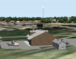
Googly scenery for WBGT Long Banga, Tanjung Manis (sometimes also referred to
under the ICAO code WBTM) - a small domestic airport in Malaysia that it seems
Microsoft forgot to provide in in Flight Simulator 2004. These scenery
files create the airport and add taxiways, aprons, buildings and other airport
features, so that you and your "AI" traffic can land, taxi, park and take off in
a realistic manner. Also added is the missing TMS non-directional beacon at
this airport (on frequency 264.0).
The airport serves the township of Sarikei, capital of the Sarekei district in
the Sarekei Division (are you following this?) of Sarawak in Eastern Malaysia.
Flights are provided by MASwings, a subsidiary of Malaysian Airlines, with De
Havilland Twin Otter aircraft calling here a few times per week.
The scenery does not purport to be ultra-accurate. Based on high-detail satellite
imagery from Google Earth, the layout is proportionally correct but the added
airport features, such as buildings, are built from default Microsoft objects
and add-on libraries so will not look exactly like the real thing.
You are not obliged to download and install any additional scenery libraries,
but to enjoy this scenery in its entirety, you may wish to. It will work fine,
with or without.
[File re-uploaded at request of AVSIM]
| Filename: | WBGTWBTM_Long_Banga_Tanjung_Manis_Malaysia.zip |
| License: | Freeware |
| Added: | 23rd May 2010, 01:23:38 |
| Downloads: | 964 |
| Author: | John Hinson |
| Size: | 51.04 KB |
| Category: Flight Simulator X - Scenery | |
| YEEB Eneabba, Western Australia strip and townsite |
|
File Description:
YEEB Eneabba strip and townsite
Sand mining town in heart of wildflower area Located 278 km north from Perth via the Brand Highway, Eneabba is basically a sand mining town surrounded by some of the most extensive and spectacular wild flower displays anywhere in Western Australia. The town itself is, to be fair, a real non-event with dreary modern housing (with more than a hint of construction town design), a small shopping centre and a service station all of which look as though they have sprung up in the last 20-30 years. The wealth of the area is based on the rutile sands which lie to the south of the town as well as farming, particularly cattle grazing. With an estimated 80 per cent of the world's known rutile supplies the town can boast that it has the biggest deposits of rutile in both Australia and the world. The major mining company in the area is Iluka Resources Ltd. Eneabba is basically a service town for the mines but some of the miners, realising that Eneabba is hardly a paradise, have opted for commuting and live on the coast at Leeman and drive to work preferring the beach to the dry inland.
REQUIRES blencowe_librarykit_309494.zip (Available HERE)
| Filename: | YEEB_Eneabba_Western_Australia_strip_and_townsite.zip |
| License: | Freeware |
| Added: | 25th February 2013, 23:48:24 |
| Downloads: | 255 |
| Author: | Alan Blencowe |
| Size: | 3.59 MB |
| Category: Flight Simulator X - Scenery | |
| Pichlingersee - LOW1 |
|
Images related to this file:
File Description:
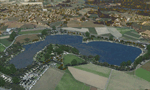
The Pichlingersee (LOW1) is a quarry pond near Linz (LOWL) in Austria (Upperaustria). The ILS approach to the runway 27 cross this lake. The helipad is in possession of Water Rescue Department and was not build on land. It was build "in water".
For the implementation of this area about 500 objects were set by hand from myself. Including not only trees and shrubs, but also signs, park benches, emergency call boxes (gernerated in gmax) etc at there right place. At night it was dark in real, so I does not create night texture. The scenery has 1.5 km ground imagery at 20cm per pixel and vary (hope) with the seasons.
Der Pichlingersee ist ein Baggersee in der Nhe von Linz (LOWL) in sterreich (Obersterreich). Der ILS Anflug auf die Landebahn 27 fhrt genau ber diesen See. Die Hubschrauberplattform gehrt der dortigen Wasserrettung und wurde nicht auf dem Land, sondern in den See hinein gebaut.
Fr die Umsetzung des Areals wurden von mir ber 500 Objekte von Hand gesetzt. Darunter nicht nur Bume und Strucher, sondern ebenso Schilder, Parkbnke, Notrufsulen (in gmax generiert) usw. an ihrem richtigen Platz. Da es dort in der Realitt nachts stockdunkel ist, habe ich auf Nachttexturen verzichtet. Die Szenerie hat eine 1.5 km Bodentextur mit 20cm/px und wechselt (hoffentlich) mit den Jahreszeiten.
| Filename: | Pichlingersee__LOW1.zip |
| License: | Freeware |
| Added: | 9th January 2013, 00:44:19 |
| Downloads: | 1,999 |
| Author: | Oliver Brandl |
| Size: | 54.71 MB |


© 2001-2026 AVSIM Online
All Rights Reserved
Privacy Policy |