
Where Flight Simulation Enthusiasts Gather from Around the World!
AVSIM Library - Search Results

| Category: Flight Simulator X - Scenery | |
| Frankfurt Main Airport (EDDF) v8 - Manual installation |

|
Images related to this file:
File Description:
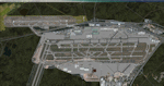
This major update represents EDDF in the July 2015 timeframe.
This version includes further expansion of the Terminal 3 area now in use as extended apron parking, with new J and K ramps for airline, general aviation and cargo aircraft, new apron night lighting, vehicular traffic/roadways as well as support for 70+ airlines coded for AI traffic.
In addition, this update features some brand new taxiways and updated airport navaids including use of the secondary 3.2 degree ILS approach paths for the Northwest runway.
For visual improvements, a new sound wall for the northern perimeter is included along with improvements in landclass to match Orbx FTX Global and inclusion of an optional 200Mb ground photo scenery layer providing even more realism.
Extended compatibility is also provided for P3D and GSX v1.9 (Ground Services for FSX) with the latter providing customized service vehicle parking for each parking position across the whole airport and in some cases, custom GSX pushback operations have been introduced at selected gates. The associated GSX airport .ini file is supplied in this package.
Last of all, more flexibility is delivered. This new scenery now comes supplied with 3 separate .BGL files - the standard .BGL AFCAD file together with the exclusions file ( _CVX) and the separate airport objects file ( _OBJ) so that the airport AFCAD can continue to be updated independently from the airport objects and exclusion files by users wishing to modify the airport layout to their own needs.
Default FSX scenery is required.
Please consult the readme and the comprehensive help manual prior to installation and for more information.
| Filename: | Frankfurt_Main_Airport_EDDF_v8__Manual_installatio.zip |
| License: | Freeware |
| Added: | 5th August 2015, 18:49:53 |
| Downloads: | 7,200 |
| Author: | Mark Aldridge |
| Size: | 230.24 MB |
| Category: Flight Simulator X - Scenery | |
| Frankfurt Main Airport (EDDF) v8 - Auto installer |
|
Images related to this file:
File Description:
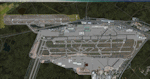
This major update represents EDDF in the July 2015 timeframe.
This version includes further expansion of the Terminal 3 area now in use as extended apron parking, with new J and K ramps for airline, general aviation and cargo aircraft, new apron night lighting, vehicular traffic/roadways as well as support for 70+ airlines coded for AI traffic.
In addition, this update features some brand new taxiways and updated airport navaids including use of the secondary 3.2 degree ILS approach paths for the Northwest runway.
For visual improvements, a new sound wall for the northern perimeter is included along with improvements in landclass to match Orbx FTX Global and inclusion of an optional 200Mb ground photo scenery layer providing even more realism.
Extended compatibility is also provided for P3D and GSX v1.9 (Ground Services for FSX) with the latter providing customized service vehicle parking for each parking position across the whole airport and in some cases, custom GSX pushback operations have been introduced at selected gates. The associated GSX airport .ini file is supplied in this package.
Last of all, more flexibility is delivered. This new scenery now comes supplied with 3 separate .BGL files - the standard .BGL AFCAD file together with the exclusions file ( _CVX) and the separate airport objects file ( _OBJ) so that the airport AFCAD can continue to be updated independently from the airport objects and exclusion files by users wishing to modify the airport layout to their own needs.
Default FSX scenery is required.
Please consult the readme and the comprehensive help manual prior to installation and for more information.
| Filename: | Frankfurt_Main_Airport_EDDF_v8__Auto_installer.zip |
| License: | Freeware |
| Added: | 5th August 2015, 18:50:05 |
| Downloads: | 15,651 |
| Author: | Mark Aldridge |
| Size: | 232.05 MB |
| Category: Flight Simulator 2004 - Scenery | |
| Gjoa Haven CYHK, on King William Island, Nunavut, Canada, |
|
Images related to this file:
File Description:
Gjoa Haven is a village of 1,200 or so inhabitants at N 68 38 W 95 51 on the southeast corner of King William Island, around 155 miles north of the Arctic Circle. It's Inuit name is Uqsuqtuuq; the Gjoa Haven name was given by the Norwegian explorer Roald Amundsen when he spent two years there from 1903 to 1905 during his exploration of the northwest passage from east to west. His boat was called Gjoa and the cove was named Gjoa Harbour, in Norwegian. The village has been added in this scenery with approximately the right shape; though the coastline with Ultimate Terrain does have the small cove that serves as a harbor the coast shape is wrong. The airfield runway is 4,400 feet of gravel 100 feet wide at 154 feet above sea level. There is no LL100 available, only JetA1, delivered once a year by ship along with all the other requirements of the town. There is also a nearby CAM-B remotely operated defence radar station with its three protective domes. The old terminal building is still there, albeit repainted and spruced up, along with the far larger and newer one alongside it.
One of the screen shots shows Gjoa Haven as it appears for at least 8 months of the year, with snow on the ground and sea ice all around. If you want the ice then download my recent post of All Canada frozen lakes, rivers, and the northern seas, reversible with an untick in the FS scenery library.
| Filename: | Gjoa_Haven_CYHK_on_King_William_Island_Nunavut_Can.zip |
| License: | Freeware, limited distribution |
| Added: | 19th February 2011, 15:42:51 |
| Downloads: | 550 |
| Author: | Roger Wensley |
| Size: | 2.68 MB |
| Category: Miscellaneous Files - General Utilities | |
| Flight plan management table |
|
File Description:
THe Flight management table is an excel file which will help you to monitor weights and time of your flight plan.
You can insert the following info:
-Departure
-Arrival
-Callsign
-Flight number
-Route distance
-Number of pax
-Cost index
-Cruise altitude
-Block fuel, taxi fuel, trip fuel, extra fuel, reserve fuel
You can also manage time by inserting simulation date, start time, cockpit preparation time and many more.
The file also gives you an advice if you make a mistake and will calculate the fuel you have to burn if you have to perform an emergency landing but you are above the max landing weight.
The excel file will then calculate zero fuel weight, gross weight, takeoff and landing weights based on the "active aircraft management table".
It will also calculate off and on block time as well as takeoff and landing time.
You can use this file with any aircraft by adding tamplates to it or using one that is already in the file. At present the tamplates available are:
X plane
-Flight Factor A320 Ultimate
-Zibo mod B738
-IXEG B733
-Aerobask Eclipse 550NG
Prepar3d/Flight sim X
-PMDG B738 NGX
-Majestic Dash 8 Q400
Creating a new tamplate is easy. All you need to do is having weights info about the aircraft you wish to add in hand.
The file is under development which means that I am going to add new feature to it.
A good breefing is the first step for a good flight.
| Filename: | Flight_plan_management_table.zip |
| License: | Freeware |
| Added: | 9th August 2018, 14:21:41 |
| Downloads: | 336 |
| Author: | Luca Tessieri |
| Size: | 17.92 KB |
| Category: Flight Simulator 2004 - Scenery | |
| Big Creek U60 public use airfield in Idaho USA |
|
File Description:
This airfield is in the mountains of Idaho, 30 miles south of Dixie A05, which was the first in the series to be posted. Big Creek is now regularly used for picnic fly-ins and overnight camping, or for just a day of fishing in the creek; the creek does not appear in FS9 as it is not exactly huge, and within the Ultimate Terrain USA settings I have in fact turned streams off as in some cases they cross the grass or (in conjunction with the roads) left insufficient runway space. The U60 runway is at 5,743 feet ASl, 3,550 feet long, aligned 01-19, and in good condition. At the southern end there is the new replica of the old original Big Creek Lodge which was built in 1935. This burned down in 2008, and is now being rebuilt by a group of pilots, pilots having formed a large part of the early clientel courtesy of the grass strip. It is shown here as still under construction. There are also Forest Service buildings on the west side of the runway. All of this is located in the Frank Church Wilderness area and the Payette National Forest. The AI is increased at the weekends, reflecting reality, and also revised to use Boise as one of the starting places. Dixie is also reissued here with a revised positioning to fit with the roads. I had concluded that the roads were wrong, while in fact the position of the airstrip was at fault.
| Filename: | Big_Creek_U60_public_use_airfield_in_Idaho_USA.zip |
| License: | Freeware, limited distribution |
| Added: | 25th May 2017, 17:53:58 |
| Downloads: | 132 |
| Author: | Roger Wensley |
| Size: | 11.06 MB |
| Category: Flight Simulator 2004 - Scenery | |
| Lake Hood LHD and Z41 in Anchorage Alaska UPDATED |
|
Images related to this file:
File Description:
This is an updated version that is complete in itself and which greatly upgrades Lake Hood Airstrip Z41 and also makes minor modifications to LHD. Lake Hood is right next door and to the north of Ted Stevens Anchorage International Airport, and there is a second airfield on the north side of the lake called Lake Hood Airstrip. The airstrip is coded Z41, the International is PANC, and Lake Hood itself is LHD. You will need Ultimate Terrain Alaska Canada for this to work, and you should also download and install Anchorage International (verson 4?) by William Morgan of FRFStudio. LHD/Z41 includes a fair proportion of the 780 float planes that are based there and which make Lake Hood the largest and busiest float plane base in the world, averaging 190 flights per day during the year and a lot more than that per day during the summer months. There is fuel at two places on the lake, and a lot of maintenance help available. The documentation showing the VFR routes to Lake Hood is also included in the Lake Hood VFR procedures folder, and basically, if you listen to the ATC chatter, planes either route via the Ball Park or the Gravel Pit, which gets abbreviated to something like "You want the park or the gravel?" which wouldn't mean a whole lot to an unrehearsed stranger. Unfortunately FS doesn't reach that level of sophistication, but you can still take the right route. There is a google marked map showing the locations of the checkpoints.
| Filename: | Lake_Hood_LHD_and_Z41_in_Anchorage_Alaska_UPDATED.zip |
| License: | Freeware, limited distribution |
| Added: | 18th July 2010, 08:16:48 |
| Downloads: | 983 |
| Author: | Roger Wensley |
| Size: | 9.25 MB |
| Category: Flight Simulator X - Scenery | |
| Toulouse Blagnac (LFBO) v1 |
|
File Description:
This is an addon scenery for FSX of the Toulouse Blagnac Airport LFBO. It has been made using the excellent freeware tool Airport Design Editor for the layout. I have used Sketchup from Google and Model Converter X to design the buildings of the airport.
You will find all the terminals of LFBO and the control tower, as well as the Airbus facilities of the A380 Lagardere plant North East of LFBO, the A380 delivery center Henry Ziegler North West of LFBO, and some buildings of the Airbus facilities in Blagnac, West of LFBO. All buildings have photo textures, most of them taking with my camera, as I am working in the area. All buildings include night textures. You have two landing pads for helicopters like in reality South East of LFBO.
I used google earth for some items position, but the current view not being up to date, I used my knowledge of the area to correctly position the taxiways, parkings, gates and building position.
I used the FSX generic buildings for the other missing buildings, however they have the size and position which corresponds as far as possible to the position of the real buildings. The surroundings of the airport not being too realistic with Ultimate Terrain X or with FSX, I have modified the landclass of the surroundings to make them look more in accordance with reality. I have changed the parking assignment to make sure that the usual traffic will park on the parkings E, F D AB, V and U.
| Filename: | Toulouse_Blagnac_LFBO_v1.zip |
| License: | Freeware |
| Added: | 21st December 2011, 13:09:29 |
| Downloads: | 23,248 |
| Author: | Jose Mauriz |
| Size: | 34.72 MB |
| Category: Flight Simulator 2004 - Scenery | |
| Homer PaHO in Alaska US |
|
Images related to this file:
File Description:
Homer is a mainly GA airfield with rows of open air parking, but it also has scheduled flights, a terminal building, a long (for GA) runway of just under 6,700 feet that is 150 feet wide and aligned 03-21 with VASI on both ends and ILS on 03. So I think we can refer to it as an airport. Plus, at the time of this scenery (around 2010) there were three newly completed hangars on the north apron that I was told were for three companies, Bald Mountain Air service, Maritime Helicopters, and Pathfinder Aviation. I do not know which was for whom, but all three companies are in the helicopter and/or plane charter business. The south apron has a number of hangars and other buildings along it's length, starting at the western end with Smokey Bay Air that has an old control tower on the roof, then the Fire Station, and then Homer Air. I am not aware of who owns what after those first three, except that at the far eastern end there are several garages etc for the airport maintenance equipment. Next to the airport at that end there are a number of boat maintenance companies with boats pulled out of the water; this could not be well replicated due to the airport elevation above the sea level and a misplaced road. The nearby Beluga Lake 5BL float base is also included here, with some AI. The lake height above sea level has been adjusted to cope with too many cliffs intruding into the water; this is an annoying FS9 habit. The Homer scenery is as close to the actual airport as I could make it, while coping with inaccurate coast lines and roads, and grassed areas that could not all be modified for reasons that I will not bore you with. The Spit is a major scenery feature next to the airport, and I have added to this to provide some boats, docks, and nearby buildings etc. Small planes use the adjacent gravel taxi path instead of the runway when back-tracking to take off on runway 21. They only go as far as the path takes them and then u-turn onto the runway and take off. By the way, this airport's AI will function at its best if the prevailing wind makes 03 the runway in use. And I will eventually stop writing 03 and just call it 3, as the US, alone in the world, does not put a zero in front of 01, 02, 03, 04 etc. Just one other thing to note is that all access to the runway is from taxiways A and B; there was (in 2010) no access to the extreme western end of the runway as the taxiway there is marked as out of service pending a needed resurfacing.
If you find an error email me please, and note that my email address has been changed to rogwens at Gmail dot com.
| Filename: | Homer_PaHO_in_Alaska_US.zip |
| License: | Freeware, limited distribution |
| Added: | 28th July 2021, 03:31:04 |
| Downloads: | 129 |
| Author: | Roger Wensley |
| Size: | 11.86 MB |
| Category: Flight Simulator 2004 - Scenery | |
| CYKF – Kitchener / Waterloo, Ontario, Canada Version 3.0 |
|
File Description: I have now overhauled the CYKF Airport and made it the lively place it is today. I used the Canada Flight Supplement and my real life knowledge of the airport as this is where I do my flight training.
After seeing the traffic in my Southwestern Ontario addon, CYKF 2.1 looked a little bare in comparison, so added more parking and traffic. There are now 35 parking spots and 2 gates. All parking spots and gates have been assigned codes, which like the airline codes for the larger airports will tell the GA aircraft where to park. I organized the different aprons into parking areas. The Waterloo Wellington flight centre is referred to as “North” parking. There are 3 other parking areas as well as the gates. Traffic includes weekly scheduled aircraft that will fly up to the cottage or down south on the weekend etc.
• 35 parking spots, 2 gates
• Extended runway 25/07 and added the new taxiway and renamed the others
• Changed the landclass for the runway 25/07 extension
• Updated the airport in AFCAD for AI to use the runway 25/07 extension
• Added 22 AI flightplans to the 3 already there. AI will model real life training and commercial operations of the airport
• AI use proper Canadian registration codes
• Tested the files to make sure it operates correctly including AI
| Filename: | CYKF__Kitchener__Waterloo_Ontario_Canada_Version_3.zip |
| License: | Freeware, limited distribution |
| Added: | 14th November 2003, 19:39:31 |
| Downloads: | 2,750 |
| Author: | David Voogd |
| Size: | 1.06 MB |
| Category: Flight Simulator X - AFCAD Files | |
| DAOO - Oran Ahmed Ben Bella International Airport (Es Senia), Algeria |
|
Images related to this file:
File Description:
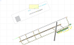
The main airport of Oran was recently renamed Oran Ahmed Ben Bella International in honor of the nation's founding president. The airport recently underwent EUR 20 million renovations which added the new 07R/25L runway and extended and renamed the existing 07L/25R runway as well as taxiway construction. Renovations were also done to the main parking apron and terminal building. This airport serves as a hub for Air Algeria and Aigle Azur with service to points in Africa, the Middle East and Europe. Several other airlines serve the airport with Air France beginning service from Paris in the Summer of 2013. The city of Oran (population approx. 759,645) is the second largest city in Algeria and an important industrial, educational and cultural center in Alegria.
Features:
*Expanded parking apron
*Parking ramp for cargo (v1.2)
*Taxiways properly desginated (v1.2)
*New runway 07R/25L
*Extension and renaming of runway 07/25 to 07L/25R
*Parking spots for commercial traffic
*Seperate parking areaa for GA traffic
*Misc airport buildings added
*Airport vehicles and objects throughout the airport
*Fuel service vehicles
*Date palms added
*Military area on the north side of the field with a helipad
*Version 1.1 corrects an issue with a misplaced taxi sign as well as a few minor oversights
*Version 1.2 adds correctly labeled taxiway designators (was able to get a hold of recent accurate charts) as well as correct ILS allignment for 25L
| Filename: | DAOO__Oran_Ahmed_Ben_Bella_International_Airport_E.zip |
| License: | Freeware |
| Added: | 13th April 2013, 23:43:00 |
| Downloads: | 1,140 |
| Author: | Jaison Diaz / Endeavour ai |
| Size: | 138.08 KB |


© 2001-2026 AVSIM Online
All Rights Reserved
Privacy Policy |