
Where Flight Simulation Enthusiasts Gather from Around the World!
AVSIM Library - Search Results

| Category: Flight Simulator 2004 - Scenery | |
| Alaska South Slope 11; Brevig Mission KTS |

|
Images related to this file:
File Description:
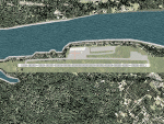
There are four main northwestern Alaska towns which are serviced by Alaska Airlines, and from which local flights spread out. The northernmost is Barrow. Southwest of Barrow is Kotzebue, then Nome, and the furthest south is Bethel (not yet made). This is the fourth in a series for local flights from Nome, and it is on the coast around 50 miles east of Wales, and 60 miles northwest of Nome. There are two other airfields around a large lagoon that is almost totally enclosed from the sea, and Brevig Mission is on the northern shore, just 12 miles northeast of the already-posted Port Clarence. Brevig Mission has a populaton that has risen to 390 in recent years. Tollef Brevik was a Lutheran missionary who was both a pastor and teacher for the Inuit in the area from 1894 onward, travelling from community to community but based in Teller, 6 miles southeast. the village now called Brevig Mission was founded at a later date (unknown to me) and took his name. The airstrip is just east of the village, with two gravel runways; 11-29 which is 3,600 feet of gravel and 04-22 which is 2,600 feet and with PAPI on 22. The AI is the usual for this area, Bering and ERA with some GA and cargo by Everts.
| Filename: | Alaska_South_Slope_11_Brevig_Mission_KTS.zip |
| License: | Freeware, limited distribution |
| Added: | 25th October 2016, 20:52:56 |
| Downloads: | 199 |
| Author: | Roger Wensley |
| Size: | 2.55 MB |
| Category: Flight Simulator 2004 - Scenery | |
| CYOC - Old Crow - Yukon Territory, Canada |
|
Images related to this file:
File Description:
Old Crow is in the far north of the Yukon Territory, Canada, 115 miles south of the nearest coastline and 30 miles east of the border with Alaska. The town has a population of less than 300 and the population are reliant on the caribou migration for an annual food supply replenishment. The fact that it is the only Yukon town that cannot be reached by car makes the airport important, and there are regular flights by Air North, the Yukon airline. They are included in the AI along with GA aircraft. I had several tries at matching up the Hawker Siddeley 748 with the right set of textures and I have included both here so that you do not have to go through the same torture. Thanks go to Hernan for sorting all that out, and for his textures. The airport is beside the town that is built along a bank of the Porcupine River. I have replicated the current shore line of the river that has cut a new channel at one end of the town, and I flattened the river as it was somewhat mountainous. The runway is gravel and just over 5,000 feet long, aligned 03-21. The terminal building is specific to Old Crow as I had photos, but the hangars are approximations and the village houses are only representational.
| Filename: | CYOC__Old_Crow__Yukon_Territory_Canada.zip |
| License: | Freeware, limited distribution |
| Added: | 5th December 2014, 13:31:46 |
| Downloads: | 373 |
| Author: | Roger Wensley |
| Size: | 7.58 MB |
| Category: Flight Simulator 2004 - Scenery | |
| Fort Simpson CYFS in the Northwest Territories, Canada |
|
Images related to this file:
File Description:
Fort Simpson is the sixth in a series of airfields that follow (approximately) in a southward direction the Mackenzie River. At the far northern end of the river is Tuktoyaktuk, then Inuvik, Fort McPherson, Fort Good Hope, Deline, Wrigley, and Fort Simpson Island, all posted. Fort Simpson is at 555 feet asl and on the west bank of the the Liard River, close to Fort Simpson Island and where the Liard and the Mackenzie join up. The town of Fort Simpson is on an island, and has a population of 1,250 or so folks. The Hudson Bay trading post was established here in 1822. The new(er) Fort Simpson airport is just over seven miles south of the town, and has 6,000 feet of asphalt runway. It may be from the WW2 time, as it seems there was originally a second runway which has now totally disappeared, There are scheduled flights by First Air and Air Tindi, plus I have added a Buffalo DC3 and GA. There is a mandatory radio frequency which is for both CYFS and CET4 and in this case I have set the "tower" to "manned" so you will report position and obey instructions. There is fuel available. I have added the ferry at the crossing of the Liard River just south of the field.
| Filename: | Fort_Simpson_CYFS_in_the_Northwest_Territories_Can.zip |
| License: | Freeware, limited distribution |
| Added: | 7th July 2014, 22:46:00 |
| Downloads: | 308 |
| Author: | Roger Wensley |
| Size: | 14.18 MB |
| Category: Flight Simulator 2004 - Scenery | |
| Rae Lakes CYRA at Gameti in the Northwest Territories, Canada |
|
Images related to this file:
File Description:
Gameti is a village in the Northwest Territories, around 65 miles north of Whati which was recently posted. Until 2005 the village, which has a population of around 280, was known as Rae Lakes and the airfield is now renamed Gameti/Rae Lakes as shown in the 2010 version of the Nav Canada Flight Supplement, my standard reference year. Permanent settlement was established there in 1965. There is no all-weather road access and the village is reliant upon the airfield for supplies, along with an ice road in the winter months. The airfield is a mile or so east of the village, with a lit gravel runway of just over 3,000 feet aligned 14-32 and with PAPI at both ends. The airfield is served by Air Tindi from Yellowknife on an almost daily basis, included in the AI here along with some GA and a Friday delivery by a Buffalo DC3 that uses all of the runway. The runway has lake water at each end, ready for the unwary. A note here about my scenery making. There will not be many more to follow this as I am almost at the end of the photos I either took or found for scenery purposes, plus I expect to move on from FS9 at some point during next year.
| Filename: | Rae_Lakes_CYRA_at_Gameti_in_the_Northwest_Territor.zip |
| License: | Freeware, limited distribution |
| Added: | 26th December 2019, 19:32:09 |
| Downloads: | 124 |
| Author: | Roger Wensley |
| Size: | 4.81 MB |
| Category: Flight Simulator 2004 - Helicopters | |
| Sikorsky CH-3 'Jolly Green Giant'. Three detailed Sikorsky CH-3 liveries of original helicopters, used by the USAF in the early sixties. |
|
File Description:
This download, based on the original Giovanni Quai's Agusta HH-3F, contains three detailed Sikorsky CH-3 liveries of original helicopters, used by the USAF in the early sixties.
-Sikorsky CH-3E USAF/21stHeliSqdr. No.703 'DUSTY'.Vietnam War Livery.
CH-3E Jolly Green Giant heavy-lift helicopter, introduced in 1962. It was developed for aircrew rescue missions deep into enemy-held territory during the Vietnam War where the helicopters were best known as the "Jolly Green Giants". This version contains an improved and more detailed livery.
-Sikorsky CH-3 USAF 1370th Photographic Mapping Wing, MATS, APCS, Turner AFB, Albany, GA 1959-1966. Bare metal liveries around 1966, No's. 39686 and 39687.
These helicopters were used by the 1370th Photo-Mapping Wing for supply and support of geodetic ground stations in conjunction with aerial surveys. They were assigned to the wing in 1964 and replaced the H-21 "Workhorse". Both "Jollys" joined the Ethiopia-U.S. Mapping Mission (Project AF58-3), aka Project "King's Ransom " in 1964-1966. This unique mission was created in order to photograph and map the entire Empire of Ethiopia.
If you want to know more about the 1370th Photographic Mapping Wing or photomapping helicopters in general, please visit the very interesting page of Jim Kinter sr.
You can find it under: http://www.1370th.org/Helicopters_files/ch-3b,c/ch3bc.htm
| Filename: | Sikorsky_CH3_Jolly_Green_Giant__Three_detailed_Sik.zip |
| License: | Freeware |
| Added: | 6th October 2010, 08:44:11 |
| Downloads: | 1,919 |
| Author: | Andreas Becker |
| Size: | 18.55 MB |
| Category: Flight Simulator 2004 - Utilities | |
| FlightSim Manager v2.6.1 |
|
File Description:
Compatible with both FS2002 and FS2004
FlightSim Manager is a great tool for managing add-ons to Microsoft Flight Simulator. Using easy to Wizard - FSM can install aircraft, panels, textures and scenery directly from distribution ZIP files you may have downloaded, with proper uninstallation of add-ons. From an easy to use Aircraft editor to add or remove aircraft variants, to an comprehensive Hangar management allows you to manage and configure your add-ons off your live FS installation.
You can now create Virtual Fleets, and enable/disable the complete fleet with ease. For serious pilots, FSM also offers a complete Logbook.
Lan View feature allows you to create virtual cockpits with multiple monitor support, using networked PCs.
With FSM, you can create Texture Sets - i.e.. different Tree Sets, and you can install any set with a single click, capture screenshots from Flight Simulator, Benchmark with log, launch it with Random Splash Screens, and fly from anywhere in the world using an map view.
You can also control Flight Simulator with speech commands using FSM. It also supports auto-saving flight, warning sytem, and custom event sounds.
Finally with a comprehensive Diagnostic Tools and Repository feature, FSM keeps your FS installation clean. Apart from the usual Missing and unused gauges, FSM can also locate Aircraft problems, Missing and unused effects, Scenery Problems with a LandClass File relocate feature - say bye-bye to all the memory leaks.
You can find the latest version from: http://www.ranainside.com/
To provide you - the user with the best Freeware FS-Addon, I need your help... if you have any suggestions, recommendations or problem using this software, please contact me through our Forum at: http://softwares.ranainside.com/forum/
You may not distribute the original archive/setup utility of the program(s) to anyone else, any Bulletin Board System, Portable Media or any web-site unless EXPRESS PERMISSION FROM THE AUTHOR is granted. You may not sell, lease, rent, or include this program or its original archive by any media without EXPRESS PERMISSION FROM THE AUTHOR. You are not required to pay for this program in any way, shape or form, but you are not licensed to distribute this program or its original archive for any financial gain.
| Filename: | FlightSim_Manager_v261.zip |
| License: | Freeware, limited distribution |
| Added: | 15th September 2004, 12:51:52 |
| Downloads: | 5,440 |
| Author: | Rana Hossain |
| Size: | 4.43 MB |
| Category: Flight Simulator 2004 - AFCAD Files | |
| PAKT Ketchikan International, Alaska, USA |
|
Images related to this file:
File Description:
Googlyafcad A&F Data file for Ketchikan International based on Google Earth satellite
data - a small but relatively busy airport located in one of the wettest parts of
Alaska, USA. Ketchikan is Alaska's fifth largest city, with its economy based on
salmon fishing.
For some curious reason the facilities provided in Flight Simulator 2004 omit a crucial
taxiway at the west end of the airport, causing all traffic to taxi from the opposite
end. These files redress this issue, and also provide realistic levels of parking for
commercial and general aviation traffic, allowing you and your "AI" traffic to land,
taxi, park and take off in a realistic manner. The layout has been cunningly designed
to fit both with the Flight Simulator default scenery and version 2 of Alan Wright's
enhanced scenery (paktv2.zip on AVSIM) and is compatible with both in every respect.
Apart from conventional and water-based general aviation aircraft Ketchikan International
is regularly served by commercial flights of Alaska Airlines and by smaller operators
such as Alaska Central Express, Everts Air Alaska and LAB Flying Service. [File re-uploaded at request of AVSIM]
| Filename: | PAKT_Ketchikan_International_Alaska_USA.zip |
| License: | Freeware |
| Added: | 29th May 2010, 09:28:41 |
| Downloads: | 1,266 |
| Author: | John Hinson |
| Size: | 206.01 KB |
| Category: Flight Simulator 2004 - Scenery | |
| Los Angeles VTerminal (KLAX) 2009 V2 |
|
File Description:
UPDATE: After reports of people not getting the complete file, I have re-uploaded it. The problem was my program that I was using to zip the file. I have since changed programs and fixed the problem. Sorry for the inconvenience.
The LAX Vterminal was originally released to a select few virtual airlines and can now be yours. These were West Express, Atlantic Sun, Empora Virtual, City Bird, Arizona Pacific, and Family Virtual Airlines. The terminal contains three concourses, forty-three (43) gates, and eight overflow parking spots. Parking assignments have not been assigned to any of the gates, so you will need to go through and do so. The terminal was created by Michael Wood and Nick O'Dell. It was designed to fit the needs of virtual airlines, in order to return parking spots in the main terminal to their real world owners. This scenery is frame rate friendly, and will not take up a lot of space on your hard drive. Included in this file are AFCAD's for the default and OceanFlight scenery. Enjoy our scenery, and look for more scenery projects coming in the near future.
| Filename: | Los_Angeles_VTerminal_KLAX_2009_V2.zip |
| License: | Freeware, limited distribution |
| Added: | 16th March 2009, 11:13:46 |
| Downloads: | 1,805 |
| Author: | Nick O'Dell, Michael Wood |
| Size: | 231.75 KB |
| Category: Flight Simulator 2004 - Scenery | |
| HEMM Mersa Matruh, Egypt |
|
File Description:
Googly scenery for HEMM Mersa Matruh - a large Air Base near the north coast of
Egypt. Marsa Matruh, as the town should be spelt, is a seaport 150 miles west of
Alexandria but its main function today is that of a holiday resort for the
residents of Cairo. It does not have an airport of its own, but uses a small
corner of the Air Base for civilian flights. Microsoft Flight Simulator has
made no provision for any traffic at this airport and this scenery seeks to
redress the situation.
Scheduled flights are operated by Egyptair Express using Embraer 170 jets,
but other airlines call here from time to time, such as Air Sinai and Midwest
Airlines.
The scenery does not purport to be ultra-accurate. Based on high quality
satellite imagery from Google Earth, the layout is proportionally correct but the
added airport features, such as buildings, are built from default Microsoft objects
and add-on libraries so will not look exactly like the real thing.
You are not obliged to download and install any additional scenery libraries,
but to enjoy this scenery in its entirety, you may wish to. It will work fine,
with or without.
| Filename: | HEMM_Mersa_Matruh_Egypt.zip |
| License: | Freeware |
| Added: | 18th February 2008, 17:32:10 |
| Downloads: | 1,988 |
| Author: | John Hinson |
| Size: | 114.6 KB |
| Category: Prepar3D V1-4 - Scenery | |
| EPBK - Bialystok-Krywlany 2020 |
|
File Description:
EPBK - Białystok-Krywlany 2020 - P3D V4.5 Scenery
PL:
Prosta sceneria lotniska Białystok-Krywlany i landclass miasta oraz okolic.
EPBK:
- zaktualizowane wymiary pasa trawiastego 9L/27R i odpowiednie położenie
- dodany nowy asfaltowy pas 9R/27L - uzyska certyfikat z dniem 23 maja 2020 - do tej daty wyłączony z użytku
- dodana płyta postojowa przed hangarem
- dodane 2 helipady
- dodane obiekty i ogrodzenie lotniska z domyślnej biblioteki obiektów
MIASTO I OKOLICE:
- dodany domyślny obiekt stadionu w miejscu Stadionu Miejskiego
- dodane najważniejsze ulice i drogi w okolicy lotniska - min. Ciołkowskiego, Mickiewicza, nowa obwodnica miasta - Trasa Niepodległości
- zaktualizowany landclass terenów wokół lotniska
- zaktualizowany kształt lasów na terenie całego miasta oraz w jego okolicach - min. Las Turczyński, Las Solnicki, Las Bacieczkowski
Najlepsze wrażenia wizualne z ORBX Global + Vector i openLC Europe.
ENG:
Simple scenery of the Bialystok-Krywlany airport and the landclass of the city and the surrounding area.
EPBK:
- updated grass runway 9L / 27R
- new asphalt 9R / 27L runway added - will be certified on May 23, 2020 - out of service until this date
- parking apron added
- 2 helipads added
- added objects and airport fence from the default object library
CITY AND VICINITY:
- default stadium object added in place of the City Stadium
- the most important streets and roads around the airport have been added - min. Ciołkowskiego, Mickiewicza, the new city beltway - Independence Route
- updated landclass of areas around the airport
- updated shape of forests throughout the city and in its vicinity - Turczyński Forest, Solnicki Forest, Bacieczkowski Forest and others
| Filename: | EPBK__BialystokKrywlany_2020.zip |
| License: | Freeware |
| Added: | 26th April 2020, 19:05:34 |
| Downloads: | 177 |
| Author: | Åukasz Tyszkiewicz |
| Size: | 8.34 KB |


© 2001-2026 AVSIM Online
All Rights Reserved
Privacy Policy |