
Where Flight Simulation Enthusiasts Gather from Around the World!
AVSIM Library - Search Results

| Category: Flight Simulator 2004 - Scenery | |
| Carp CYRP in Ontario Canada (updated October 2011) |

|
Images related to this file:
File Description:
This version further updates the post of 2006 and the 2009 update with more bespoke buildings for the west GA apron plus the revised fuelling area, and corrected surroundings with large forested areas and a modified airfield grass shape. This is a stand-alone version and does not require you to have downloaded and installed the previous posts; this REPLACES those versions. Carp airfield is fifteen miles west of Ottawa and two miles south of the town of Carp. There are two runways, 10/28 which is asphalt and almost 4,000 feet long and 100 feet wide, and 04/22 which is gravel and 2,000 feet long. The airfield has a fairly large population of general aviation residents and is slowly expanding under new ownership. This version models the large hangar beside the terminal, the "Touch'n Go" aviation warehouse that has opened more recently, and the ramshackle collection of hangars and sheds that make up Westair, the maintenance facility. The nearby pagoda-roof flight school building has in fact now been demolished, but I like it too much to do that, at least until something else has been built on that space.
| Filename: | Carp_CYRP_in_Ontario_Canada__updated_October_2011.zip |
| License: | Freeware, limited distribution |
| Added: | 25th November 2011, 09:25:34 |
| Downloads: | 587 |
| Author: | Roger Wensley |
| Size: | 7.59 MB |
| Category: Flight Simulator 2004 - Scenery | |
| KGFL - Glens Falls, Floyd Bennett Memorial (v2.2) |
|
Images related to this file:
File Description:
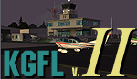
KGFL - Glens Falls, Floyd Bennett Memorial v2.2, located in the foothills of the Adirondack Mountains in upstate NY USA, this facility is owned by Warren County and run by RichAir. Although it has a 5000 ft main rwy, KGFL is a Non-controlled airfield catering to small engine a/c up to a few private jet daily traffic serving 'The Northcountry' New York. KGFL recently received several upgrades including 4 new GA hangars large enough to accommodate the needs of business jets.
All Objects fully designed and completely redone in GMAX using high resolution custom photo-real 32bit textures. Optional DXT textures included. Also includes new AFCAD file, more accurate airport grounds perimeter, satellite photo-real grounds, custom taxiways, taxi-signs and taxi lights, area roads, animated hangar doors, and near area landclass. No AI traffic tracks included with this release, but afcad designed to support several AI. Rwy12 objects required for a few static a/c and parking lot cars. v2.2 Includes mipmapped textures, reduced trees for better performance, and increased, more accurate taxiway light density. This v2.2 package is a full-install.
| Filename: | KGFL__Glens_Falls_Floyd_Bennett_Memorial_v22.zip |
| License: | Freeware, limited distribution |
| Added: | 5th February 2010, 16:52:44 |
| Downloads: | 2,348 |
| Author: | Ed 'Geneer' Cox |
| Size: | 74.81 MB |
| Category: Flight Simulator 2004 - AFCAD Files | |
| Belfast Aldergrove (EGAA) |
|
File Description:
Belfast Aldergrove is a joint civil and military aerodrome 18 miles NW of Belfast. The civil airport (now known as Belfast International) is the main passenger airport in the Province and handles practically all air cargo. RAF Aldergrove is the only remaining military airfield in Ulster. Details at http://www.raf.mod.uk/rafaldergrove.
This AFCAD file corrects many of the inaccuracies of the FS2004 default airport. The corrections are based on information from the aerodrome chart, Google Earth, and personal observations. None of the changes are strictly accurate to scale. An apron area for helicopters and the occasional RAF transport aircraft has been provided for the military base. The cargo area has also been enlarged and parking provided for up to eight aircraft. Additional parking places have also been provided on the main passenger apron and on the GA apron off taxiway A. A holding area adjacent to taxiway C near the threshold of Rwy 17 has been removed. Various other improvements have been made to taxiways and holding areas on the military side of the airfield. Much of the original base is now disused hence the large number of closed taxiways.
| Filename: | Belfast_Aldergrove_EGAA.zip |
| License: | Freeware |
| Added: | 3rd April 2009, 18:54:38 |
| Downloads: | 513 |
| Author: | John Hubbard |
| Size: | 9.25 KB |
| Category: Flight Simulator X - AFCAD Files | |
| CYLW - Kelowna International Airport / Kelowna, British Columbia, Canada |
|
Images related to this file:
File Description:
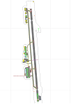
CYLW - Kelowna International Airport / Kelowna, British Columbia, Canada
This airport update was made with the latest version of ADE (Airport Design Editor) and made for FSX as a replacement for the stock (default) airport. I found that most stock airports in FSX lack a decent amount of character and realism and I've done my best to correct that wherever possible. I've made several additions to the airport which are listed below. All these enchancements are as close to the real airport as I can get with stock library objects. I've used satellite images, terminal photos and maps throughout the whole process so building locations are as accurate as possible. Happy landings in the beautiful Canada!
Features:
*Expanded parking apron
*Main terminal building with it's 8 gates some with jetways
*Seperate parking aprons for GA traffic
*Runway accurately expanded to 8,900ft to reflect 2008 runway project
*Hangar and other airport buildings added
*Airport vehicles and objects throughout the airport
*Main road in front of airport added with static vehicles
*Parking lots with static vehicles
*Airport fire station with fire trucks
*Static de-icing vehicles & runway plow
*2 Helipads
(Next up: CYWG Winnipeg Intl Airport)
| Filename: | CYLW__Kelowna_International_Airport__Kelowna_Briti.zip |
| License: | Freeware |
| Added: | 22nd July 2012, 15:13:45 |
| Downloads: | 1,128 |
| Author: | Jaison Diaz |
| Size: | 10.38 KB |
| Category: Flight Simulator 2004 - AI Flight Plans | |
| AI Flightplans - Airlines of Hong Kong and Macau 1998 |
|
Images related to this file:
File Description:
Looking to fill up FlyTampa's Kai Tak? Look no further! This package contains 1998 flightplans for Air Macau, Air Hong Kong, Cathay Pacific, and Cathay Cargo. Passenger plans are based off the summer 1998 Offical Airline Guide(OAG), while cargo plans are representative based off of early 2000s flightplans and backdated to represent the airlines in 1998. Air Macau did maintenance in Hong Kong and Air Hong Kong did training flights to Macau, this is represented in the flightplans with Air Macau spending a few days in HKG and Air Hong Kong doing 2 training flights on Sunday to MFM. If you are a P3D user, please download our package with repaints for FAIB and FSPX models. Each airline has up to 3 versions; standard, lite(with minimal variations), and bonus(with extra aircraft from the era but not active in 1998). These flightplans are part of a much larger 1998 Flight Simulator Project which will complete all scheduled, cargo, and charter flights to project countries as well as select military and GA plans as well as backdated scenery and ADEX. Please follow our project at: www.facebook.com/flightsim98. By Ranmori Scythe and Chasen Richardson.
| Filename: | AI_Flightplans__Airlines_of_Hong_Kong_and_Macau_19.zip |
| License: | Freeware |
| Added: | 11th March 2018, 00:22:38 |
| Downloads: | 406 |
| Author: | Ranmori Scythe, Chasen Richardson, 1998 Flight Simulator Project |
| Size: | 58.74 KB |
| Category: Flight Simulator 2004 - Aircraft Repaints, Textures and Modifications | |
| T-6A Texan II USAF/USN Repaints |
|
File Description:
USAF/USN Repaints of the T-6A TEXAN II by Tom "Tomcattwo" Stevenson
Based on Original Repaint and Panel mods by Nick Karatzides/Original Model by David Friswell
This set of repaints is designed to be used with the Hellenic Air Forces package by Nick Karatzides "t-6a_haf_v2.zip" (which can be used with either FS2002 or FS2004 - has not been tested in FSX). It contains modified files which represent the following USAF and USN T-6A Training Squadrons and represents the paint schemes for the T-6As that student pilots fly at Joint Specialized Undergraduate Pilot Training (JSUPTS) or Euro-NATO Joint Jet Pilot Training (ENJJPT):
84th Flying Training Squadron - Laughlin AFB TX,
85th Flying Training Squadron - Laughlin AFB TX,
3rd Flying Training Squadron - Moody AFB GA,
8th Flying Training Squadron - Vance AFB OK,
558th Flying Training Squadron - Randolph AFB TX,
TRARON FOUR - U S Navy - Pensacola FL.
Follow the installation instructions in the included readme file to install and use.
Make sure that the Hellenic Air Forces T-6A Texan II v2 has been installed first!
You can get Nick's excellent package at AVSIM.com (search for "Karatzides" or search for file name:
"t-6a_haf_v2.zip").
| Filename: | T6A_Texan_II_USAFUSN_Repaints.zip |
| License: | Freeware |
| Added: | 15th October 2006, 16:56:38 |
| Downloads: | 1,338 |
| Author: | Tom Stevenson |
| Size: | 7.06 MB |
| Category: Flight Simulator 2004 - Scenery | |
| Boundary Bay CZBB in British Columbia, Canada |
|
Images related to this file:
File Description:
Boundary Bay is south of Vancouver in British Columbia, close to the US/Canada border. It is the 5th busiest airfield in Canada measured in terms of take offs and landings as there are several training companies based there. The airfield was purchased by Alpha Aviation in 2009 and and modernised for the 2010 Winter Olympics, the main addition being a new terminal. This is an ex-military training base which was built in 1941, and one of the original hangars still survives. The two runways in use now (07/25 5,600' and 12/30 2,750', both of them 100' wide) are reduced asphalted areas of the original runways; the third runway is now an apron for GA parking and has had hangars built along it. There is JetA and 100LL available. The large building at the east end of the north apron is a HQ and maintenance facility for a helicopter company, Heli-one. All of the north apron buildings on the field have been modelled specifically for this scenery, plus the nearby huge greenhouse farm structures which are visible from further away than the airfield is. AI for Boundary Bay will be posted later this week.
| Filename: | Boundary_Bay_CZBB_in_British_Columbia_Canada.zip |
| License: | Freeware, limited distribution |
| Added: | 12th May 2011, 13:30:18 |
| Downloads: | 855 |
| Author: | Roger Wensley |
| Size: | 4.4 MB |
| Category: Flight Simulator 2004 - Scenery | |
| FS2004 Scenery World War II Naval Air Stations. |
|
Images related to this file:
File Description:

FS2004 Scenery--World War II Naval Air Stations. Leading up to the Second World War, the United States pursued a rush building program for airship bases. These bases were designed to support fleets of blimps that would patrol its coasts and help protect its vulnurable shipping lanes. Together these bases boasted fourteen airdocks which are widely believed to be the largest free-standing wooden buildings ever constructed. Although time and misfortune have destroyed most of them, this scenery will bring them back in their heyday of the early 1940's. This scenery package contains all eight of these wartime Naval Air Stations; Weeksville, North Carolina (NC), Hitchcock, Texas (TX), Glynco, Georgia (GA), Santa Ana, California (CA), Richmond, Florida (FL), Houma, Louisiana (LA), South Weymouth, Massachusetts (MA), and Tillamook, Oregon (OR). As a bonus for your patience you will also find the seaplane base at Tongue Point OR and a custom scenery addon package of ground crews and vintage vehicles. This is a stand alone scenery package and requires the removal of any and all previous versions. Re-upload of previous file due to library hack. By John Stinstrom.
| Filename: | FS2004_Scenery_World_War_II_Naval_Air_Stations.zip |
| License: | Freeware, limited distribution |
| Added: | 27th May 2010, 09:37:53 |
| Downloads: | 903 |
| Author: | John Stinstrom |
| Size: | 11.09 MB |
| Category: Flight Simulator 2004 - Scenery | |
| Airstrips of South-West France |
|
File Description:
Part two of my "Airstrips of Western Europe" project, these 90+ sceneries are mostly default basic airstrips from FS2004, enhanced with taxiways, parking spaces and aprons as appropriate, to facilitate the activation of lightweight GA AI traffic, primarily over the south-west of France. Hopefully these will allow a degree of continuity between my previous upload (Airstrips of North-West Europe) and the existing freeware releases for Spain and Portugal.
Again, there's no photo-realism here, just a selection of basic 'generic' buildings, more or less accurately sized and placed to reflect the airfield layout as seen on on-line satellite imagery and aerial photography. These buildings have minimal effect on frame-rates, so are ideal for this kind of job. The airfields are aligned as well as possible with the roads etc. in UT Europe and the Genesis Europe mesh, but should mostly be fine in a default installation or other configuration.
A good number of airfields in this area have been neatly implemented in the "Occitania_VFR" package, so I've not duplicated their work.
Also included are some "bonus" sceneries from further north that weren't included in my previous upload. Just copy them over as appropriate if required.
| Filename: | Airstrips_of_SouthWest_France.zip |
| License: | Freeware |
| Added: | 16th July 2024, 18:20:44 |
| Downloads: | 112 |
| Author: | Chris Eve |
| Size: | 274.73 KB |
| Category: Flight Simulator 2004 - Scenery | |
| CZFN - Tulita - Northwest Territories, Canada |
|
Images related to this file:
File Description:
Tulita (Fort Norman until 1996) is another in the series of airfields that follow (approximately) the Mackenzie River. At the far northern end of the river and on the eastern side of the delta there is Tuktoyaktuk, then Inuvik, Fort McPherson, Fort Good Hope, Deline, Wrigley, Fort Simpson Island and Fort Simpson, and then Fort Liard at the southern end of the list of those in the Northwest Territories. South of Fort Liard there are Peace River and Dawson Creek, both of which are already posted. Tulita is at the junction of the Mackenzie and Great Bear Rivers, on the east bank of the Mackenzie and the south bank of the Great Bear, around 40 miles southeast of Norman Wells. The town has a population of about 480 folks. The airport is above and to the east of the town, and has 3,000 feet of gravel runway. The scheduled flights are by North Wright and I have also added a Buffalo DC3 and GA. There is a mandatory radio frequency but in this case I have set the "tower" to "unmanned" so you will report position and intentions. There is no fuel available.
| Filename: | CZFN__Tulita__Northwest_Territories_Canada.zip |
| License: | Freeware, limited distribution |
| Added: | 12th July 2014, 08:05:54 |
| Downloads: | 272 |
| Author: | Roger Wensley |
| Size: | 2.66 MB |


© 2001-2026 AVSIM Online
All Rights Reserved
Privacy Policy |