
Where Flight Simulation Enthusiasts Gather from Around the World!
AVSIM Library - Search Results

| Category: Miscellaneous Files - General Utilities | |
| U.S. DOF 2 Plan-G V1 |

|
Images related to this file:
File Description:
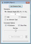
DOF 2 Plan-G converts the publicly available FAA US Digital Obstacle File so it can be used for database import in Plan-G V2 and V3. The Daily Digital Obstacle File describes all known obstacles of interest to aviation users in the United States, with limited coverage of the Pacific, the Caribbean, Canada, and Mexico. NOTE - This re-upload includes a fix for international users. Namely the comma/decimal usage differences between different countries.
| Filename: | US_DOF_2_PlanG_V1.zip |
| License: | Freeware, limited distribution |
| Added: | 22nd January 2013, 01:53:28 |
| Downloads: | 138 |
| Author: | Roman Stoviak |
| Size: | 298.81 KB |
| Category: Flight Simulator X - Gauges | |
| AP - Alt - VS MultiFuel Flaps v1 |
|
Images related to this file:
File Description:
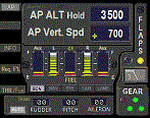
This gauge is for use in the Saitek FIP and is an extension to my recent Baron 58 (FSX default) gauge . That gauge was designed for a specific aircraft whilst this package of three gauges has the same functionality of the BB58 gauge but will work on all aircraft. Each of the three gauges displays fuel level for different tanks but are identical in all other respects. As part of your pre-flight checklist you will need to make sure the right gauge for the aircraft is being displayed.
The set of 3 gauges have been designed to complement the saitek AP / Multi panel. The gauges primarily show the selected AP Altitude and Vert Spd whilst the AP / multi panel is displaying HDG. Five indicators for "lights on" are included as well as lights for landing gear (in transition and down) . The flaps indicator shows a blue light for intermediate positions and a yellow light when at full down position. A separate flaps position indicator (numerical and needle) is included. The 5 fuel indicators in each gauge are vertical analogue 'meters'. Rudder and aileron trim is displayed and controlled by the two FIP rotary knobs. Pitch trim readout and other functions is included.
NOTE. This package includes a pitch trim image file that was inadvertently left out of my original BB58_AP_Alt_VS_and_Fuel_v1.zip folder.
| Filename: | AP__Alt__VS_MultiFuel_Flaps_v1.zip |
| License: | Freeware |
| Added: | 12th July 2014, 07:40:09 |
| Downloads: | 400 |
| Author: | Robert Budd |
| Size: | 183.72 KB |
| Category: Flight Simulator 2004 - Scenery | |
| PAKN - King Salmon - Alaska, US V1 |
|
Images related to this file:
File Description:
This is the final version, complete in itself and incorporating the two modifications posted separately. King Salmon is a town with a population of just under 400, on the north bank of the Naknek River and 15 miles from the sea. The airport is adjacent to the town and was originally an airforce base; the military hangars on the airport are still usable. The airport, with its long runway (11-29 and 8,500 feet with an ILS, and a second runway 18-36 and 4,000 feet) is a transportation hub for the area in general and in particular for the salmon industry. Along the Naknek River there are numerous canneries and there are also fishing lodges on the river and nearby lakes; to speed up transportation to the lodges there are float bases on the river to the south of the airport. King Salmon has three tiers of scheduled flights: Alaska Air direct from Anchorage in a 737 (passengers and cargo), PenAir (Saab turboprop) as part of their flights up and down the peninsula, and Grant Air serving nearby small towns. There are also PenAir flights, both scheduled and unscheduled, in smaller aircraft (Piper Navajo for instance) to smaller airports for the fishing season, plus cargo flights in larger aircraft by the lowest bidder (Everts and Northern). To complete the mix the AI includes a pair of F15s. The runways cross (see the airport diagram) so read the notes re long taxi routes. There is AI for PAKN, plus revised AI made for Dutch Harbor which includes flights by PenAir to King Salmon, plus revised parking for Dutch Harbor with new replacement bgls to cater for more flights. There is also AI for the float bases on the river; I have made two runways separated into two float bases for river AI, called King Salmon Floats and King Salmon River; more AI for these will be added when other scenery along the river is made. Just land according to the wind and taxi to whatever dock takes your fancy.
| Filename: | PAKN__King_Salmon__Alaska_US_V1.zip |
| License: | Freeware, limited distribution |
| Added: | 11th April 2015, 06:20:40 |
| Downloads: | 506 |
| Author: | Roger Wensley |
| Size: | 23.67 MB |
| Category: Flight Simulator 2004 - Scenery | |
| CNZ3 - Chatham-Kent - Ontario, Canada V1 |
|
Images related to this file:
File Description:
This is partly part of the Small Ontario Fields series. The airport ICAO was changed from CNZ3 to CYCK in November 2012; I have left it as it was. The runway too remains as it was a few years ago. Chatham is located 50 miles east of Detroit and 150 miles southwest of Toronto, between Lake St. Clair and Lake Erie, and the airfield is southeast of the town. There is a single asphalt runway 5,000 feet long and 75 feet wide, aligned 05/23 in FS9 but in fact in real life now 06/24 due to the wandering magnetic north. The apron is on the northern side of the runway at the eastern end, with added taxiways to cater for newer hangars wearing identical colour schemes. There is fuel, runway lighting, some taxiway lights, visitor parking on the grass, and plane maintenance in the large hangar beside the small terminal building on the north side of the apron. There is a train station in the middle of the town, and no scheduled flights to the airport that is 8 miles away; these two facts may be connected. Ditches along the road and around much of the airfield provide separation, which is why the fences are not continuous. If you are on the runway and find your path to the apron blocked by another plane that is stationary at the hold short, continue past the first turnoff to the threshold markers and turn off the runway and wait. The AI plane will then taxi out and you will have a clear path.
| Filename: | CNZ3__ChathamKent__Ontario_Canada_V1.zip |
| License: | Freeware, limited distribution |
| Added: | 27th August 2015, 21:02:59 |
| Downloads: | 341 |
| Author: | Roger Wensley |
| Size: | 9.89 MB |
| Category: Flight Simulator 2004 - Scenery | |
| CYQS - St Thomas - Ontario, Canada *V1* |
|
Images related to this file:
File Description:
St Thomas is a town in Ontario around 12 miles south of London and less than 10 miles from the north shore of Lake Erie, with a population of just under 40,000. The airport (actually more of an airfield, as there are no scheduled flights) has three runways typical of an ex-military field, with one remaining hangar from RCAF flight training times in the 1940's, and the east-west runway now extended to just over 5,000 feet. The main presence at CYQS is a company in the crop seeding and spraying business over a wide area of Ontario; as a result there are several AT-802 planes based there which are included here as AI planes and also as parked scenery objects. To the west of the original apron area there are added taxiways to cater for a herd of new individual hangars wearing orange and white uniforms. There is fuel, runway lighting on 09-27, taxiway lights, visitor parking on the edge of the apron, and maintenance companies in the large hangars, plus a flight training group. A small terminal building sits quietly between hangars, waiting. Ditches along the road and around much of the airfield provide separation, which is why the fences are not continuous. I presume that the warning balls on the electricity cables were found to be necessary to persuade pilots not to land there; probably ski planes in winter, they tend to land anywhere so long as it has snow on it. This V1 version includes previous updates.
| Filename: | CYQS__St_Thomas__Ontario_Canada_V1.zip |
| License: | Freeware, limited distribution |
| Added: | 30th August 2015, 02:35:28 |
| Downloads: | 265 |
| Author: | Roger Wensley |
| Size: | 11.13 MB |
| Category: Flight Simulator X - AFCAD Files | |
| ESGJ - Jonkoping Airport - Jonkoping, Sweden V1 |
|
File Description:
It's a nice little edit of the airport. The buildings are not the same as in real but the ground and almost every taxiway is updated and correct. Some fixes for the terminal and tower too.
| Filename: | ESGJ__Jonkoping_Airport__Jonkoping_Sweden_V1.zip |
| License: | Freeware |
| Added: | 12th September 2015, 18:13:40 |
| Downloads: | 228 |
| Author: | Erik Wismen |
| Size: | 5.48 KB |
| Category: Prepar3D V1-4 - Aircraft Repaints, Textures and Modifications | |
| Embraer Phenom 100 GTN750 mod v1 |
|
File Description:
This is native Flight1 GTN750 implementation for Carenado Phenom 100 based on Bert Pieke's Phenom 300 GTN update. With Bert Pieke's permission to modify his Phenom 300 version.
| Filename: | Embraer_Phenom_100_GTN750_mod_v1.zip |
| License: | Freeware |
| Added: | 17th December 2015, 17:14:59 |
| Downloads: | 494 |
| Author: | Jiri Kocman |
| Size: | 759.55 KB |
| Category: Flight Simulator X - AI Aircraft | |
| South African Airbus A340-600 v1 |
|
Images related to this file:
File Description:
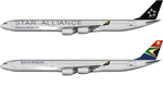
This package contains repaints for the South African A340-600s Both ZS-SNB, a standard livery, and ZS-SNC, the Star Alliance livery, are included. These are textures only. The FSPainter A340-600 base model is required. It can be bought from http://secure.simmarket.com/fspxai-airbus-a340-fsxp3d-ai-traffic.phtml
V1 changes include resizing of 'Star Alliance' to match real life as well as additional warnings added to nose gear doors and static ports
| Filename: | South_African_Airbus_A340600_v1.zip |
| License: | Freeware |
| Added: | 2nd August 2017, 16:59:04 |
| Downloads: | 205 |
| Author: | Brian Swintal |
| Size: | 7.58 MB |
| Category: Flight Simulator X - Scenery | |
| VEBS Biju Patnaik International Airport V1 |
|
File Description:
Biju Patnaik International Airport (IATA: BBI, ICAO: VEBS), also known as the Bhubaneswar Airport. Compatibility - FSX & P3D
| Filename: | VEBS_Biju_Patnaik_International_Airport_V1.zip |
| License: | Freeware |
| Added: | 24th November 2017, 17:22:36 |
| Downloads: | 955 |
| Author: | Sachin Gnath |
| Size: | 153.06 KB |
| Category: Prepar3D V1-4 - Scenery | |
| EDJA Allgäu Memmingen (DE) - V1 |
|
Images related to this file:
File Description:
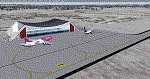
Airport: Allgäu (DE) EDJA V1
Release: January 2018
Simulation: P3D v4.1
This scenery is an update of the stock Airport (ICAO code: EDJA).
"Memmingen Airport (IATA: FMM, ICAO: EDJA), also known as Allgäu-Airport Memmingen, is an international airport in the town of Memmingerberg near Memmingen, in the Swabia region of Germany. It is the smallest of the three commercial airports in Bavaria after Munich Airport and Nuremberg Airport and has the highest altitude of any commercial airport in Germany. It is operated by Allgäu Airport GmbH & Co. KG, a limited partnership of 71 mostly local, medium-sized companies with only minor public shares.
Located about 3.8 km (2.4 mi) from the centre of Memmingen and 110 km (68 mi) from the city centre of Munich, it serves Memmingen and the Allgäu area and also provides a low-cost alternative to Munich Airport and therefore is sometimes referred to as Memmingen/Munich-West Airport or similar by some low-cost airlines, despite the fact that it is 110 kilometres from the centre of Munich. It mostly features flights to European leisure and some metropolitan destinations and handled nearly 1,18 million passengers in 2017."
Source: Wikipedia, the free encyclopedia
Link: https://en.wikipedia.org/wiki/Memmingen_Airport
What to expect?
The entire airport has been updated with correct RWY, Taxiways, APRON's, COMM's (ATIS, GND, TWR), markings and some objects. RWY 24 got it's ILS and go arround information acc. to the charts. The main Terminal is a custom building with custom day and night textures. Also all ground textures are custom made. Other objects INCLUDING the tower are from stock ADE!
In time I will add more custom buildings to further releases of this airport. Currently I have already started to work on the Tower building.
Ground textures will not receive shadows unless you turn "Buildings" receieve shadows to ON!
General:
I'm not a proffessional scenery builder or texture artist but I did try to do my best to update the stock Airport and offer it as freeware to the simming community. I have tested the scenery and did not find any issues with it. GSX services work, AI traffic with Ultimate Traffic Live works, COMM's work, APPR on ILS24 does work, and so on.
Entire work and object placing has been done using a photo overlay image from Google Earth, yet don't expect a photoreal scenery. The used background image has been removed due to Google's copyright policy.
Big thanks to the guys from FS Developer (Don, Arno) who I have kept busy during the birth of the scenery and those who offered the tools to build it (ADE, MCX, Sketchup, Gimp,...).
| Filename: | EDJA_Allgu_Memmingen_DE__V1.zip |
| License: | Freeware |
| Added: | 21st January 2018, 17:07:14 |
| Downloads: | 1,628 |
| Author: | Gerald Krutsch |
| Size: | 19.08 MB |


© 2001-2026 AVSIM Online
All Rights Reserved
Privacy Policy |