
Where Flight Simulation Enthusiasts Gather from Around the World!
AVSIM Library - Search Results

| Category: Flight Simulator 2004 - Aircraft Repaints, Textures and Modifications | |
| New York Mets Beechcraft Twin Bonanza |

|
File Description:
Simmers,and Baseball fans. This is my 5th repaint of my in progress MLB collection. All repaints are of "Eric Dantes" Beachcraft Twin Bonanza. All MLB teams will be represented. These repaints are not layered so each one has to be redrawn in its offical colors. All repaints will have two liveries, one with team logos and one without logos. All MLB team names were put in two hats, American League and National League they are drawn one from each hat at random. The next repaint will be the Chicago White Sox. Look for it soon. I hope you have as much fun collecting all 30 liveries as I will have painting them! This file also includes a new folder DXT3 Format. For those of you that require friendlier frame rates just replace the 32 bit 888-8 extended bitmap textures with the DXT3 textures in the DXT3 Format folder.Backup the 32 bit 888-8 extended bitmap textures, then just let the DXT3 files overwrite. This file includes the Texture.Mets"(New York Mets Edition)",Texture.MLB New York,"(The MLB New York Edition)NO..LOGOS,Panel.Mets and Panel.MLB New York folders. The following additional file is required.-------twinstar__twin__bonanza_v2.zip---------- This file can be downloaded @ http://www.avsim.com/ Again I thank each of you for your downloads.
| Filename: | New_York_Mets_Beechcraft_Twin_Bonanza.zip |
| License: | Freeware |
| Added: | 6th August 2008, 13:32:38 |
| Downloads: | 213 |
| Author: | Chris Tuinstra |
| Size: | 8.3 MB |
| Category: Flight Simulator X - Miscellaneous Files | |
| FeelThere Map screens megapack |
|
File Description:
This package looks to be my final release of its' kind. Here are over 250 different screens for use with FeelThere Map; an amalgamation of my prior work into one package. You must have the payware add-on, FeelThere Map installed. These screens will work in FS9 and FSX, but were not tested in other sims. They should work in any sim that works with FeelThere Map (i.e. compatible versions of P3D). Many more complete airline sets are found here, along with a few sensible national groupings, a new bizjet operator grouping, and the addition of luxury brand advertisements for our high-end GA cockpit interiors, or to perhaps complete a set for an airline that might only have 2 or 3 screens of its' own. Lots of retro carriers, and some of the complete sets draw from historic timetable art, and/or bring type specificity. There are other packages from different authors available on the internet that would enable the construction of several more complete airline sets, for the dedicated VA pilot. Speaking of VAs, there's a few VA-specific groupings herein, as well. There's literally something here for every Map-enabled aircraft and flight context in your hangar. Enjoy your flights.
| Filename: | FeelThere_Map_screens_megapack.zip |
| License: | Freeware |
| Added: | 25th April 2026, 17:13:15 |
| Downloads: | 27 |
| Author: | Henry Douglas |
| Size: | 18.38 MB |
| Category: Flight Simulator X - Scenery | |
| KMSN - Madison Wisconsin Dane County Airport - Wisconsin, USA |
|
Images related to this file:
File Description:
Madison Wisconsin Dane County Regional Airport for FSX. Several improvements have been made to the default airport. The default terminal buildings have been replaced with buildings created in FSDS; aircraft gates have been correctly coded using Airport Design Editor 1.67.5684; a new airport vehicle network has been built; extra fuel trucks have been added throughout the airport; the tower view has been changed to display from the roof of the control tower; a static FedEX truck in two different color schemes has been placed in the cargo area; a missing taxiway has been added, and all taxiway designators are correctly placed and named; there is the option to open all three runways to AI traffic; the 115th Fighter Wing of the Wisconsin Air National Guard is represented, and the parking spaces for the military AI aircraft there are coded to work with the MAIW GLANG1 flight plans; optionally, a set of GA flight plans made using AI flight Planner using all FSX default aircraft is included to liven up the GA area; another option included is to display moving road traffic outside the airport; and Jim Dhaenen's excellent ramp lights are also included. Please read the README FIRST.txt and installation.txt files to insure proper installation of all files.
| Filename: | KMSN__Madison_Wisconsin_Dane_County_Airport__Wisco.zip |
| License: | Freeware, limited distribution |
| Added: | 10th April 2016, 19:55:42 |
| Downloads: | 1,286 |
| Author: | Patrick Finch |
| Size: | 2.1 MB |
| Category: Flight Simulator X - AFCAD Files | |
| Greenwood Lake Airport (4N1), NJ |
|
File Description:
Located 01 miles E of West Milford, New Jersey on 150 acres of land, Greenwood Lake Airport is a public asphalt strip that services small to medium GA air traffic. The second runway that used to be there has been re-paved and now serves as extra aircraft parking. You can park anywhere on the closed runway, along the edge of the main tarmac where the terminal building is, or between any two white cones (50 foot max wingspan) that mark tie-down locations in the middle of the main tarmac. A helicopter start is provided as well. For parking, Small GA spaces are for craft with wingspans of less than 50 feet; Medium GA spaces are for craft with wingspans from 50-60 feet. The glide slope for Runway 24 has been adjusted up from 3.5 degrees to 4 degrees as in real life the runway sits higher than the ground the trees grow from so this will give you proper clearance on approach. Fuel is available by stopping near the tank on the main tarmac. Scenery constructed with use of satellite images/streetview/aerial photos - the author has not been there in person. This scenery is meant to be used in conjunction with MegaScenery Earth New York 005. It is not required, but apron use is minimized to allow satellite scenery to show through as much as possible, and objects are placed based on the MSE textures - lack of it may make scenery look out of place.
| Filename: | Greenwood_Lake_Airport_4N1_NJ.zip |
| License: | Freeware |
| Added: | 22nd July 2011, 03:59:26 |
| Downloads: | 479 |
| Author: | Drew Sikora |
| Size: | 1.98 MB |
| Category: Flight Simulator 2004 - Scenery | |
| PAIW Wales, Alaska, USA |
|
Images related to this file:
File Description:
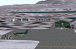
Googly scenery for Wales - a small domestic airport on the western coast of Alaska that is poorly provided for in Flight Simulator 2004. These scenery files add taxiways, aprons, buildings and other airport features, so that you and your "AI" traffic can land, taxi, park and take off in a realistic manner.
Wales is a small village with a population of just over 150 people, so the facilities at this 4000 foot gravel airstrip are fairly limited. The airport is allocated the ICAO code PAIW, although Microsoft has ignored this in Flight Simulator and uses the IATA ticket code IWK. Wales is served by light aircraft from airlines such as Bering Air, Cape Smythe Air, Frontier Flying Service, and Hageland Aviation Services. You might find it a convenient stopping-off point for a quick trip across to Russia - this is about as close as you can get and a nip across the Bering Strait will find you there in no time.
The scenery does not purport to be ultra-accurate. Based on high-detail satellite imagery from Google Earth, the layout is proportionally correct but the added airport features, such as buildings, are built from default Microsoft objects and add-on libraries so will not look like the real thing.
You are not obliged to download and install any additional scenery libraries, but to enjoy this scenery in its entirety, you may wish to. It will work fine, with or without.
[File re-uploaded at request of AVSIM]
| Filename: | PAIW_Wales_Alaska_USA.zip |
| License: | Freeware |
| Added: | 26th June 2010, 13:51:45 |
| Downloads: | 1,268 |
| Author: | John Hinson |
| Size: | 76.81 KB |
| Category: Flight Simulator X - Scenery | |
| Toulouse Blagnac (LFBO) v1 |
|
File Description:
This is an addon scenery for FSX of the Toulouse Blagnac Airport LFBO. It has been made using the excellent freeware tool Airport Design Editor for the layout. I have used Sketchup from Google and Model Converter X to design the buildings of the airport.
You will find all the terminals of LFBO and the control tower, as well as the Airbus facilities of the A380 Lagardere plant North East of LFBO, the A380 delivery center Henry Ziegler North West of LFBO, and some buildings of the Airbus facilities in Blagnac, West of LFBO. All buildings have photo textures, most of them taking with my camera, as I am working in the area. All buildings include night textures. You have two landing pads for helicopters like in reality South East of LFBO.
I used google earth for some items position, but the current view not being up to date, I used my knowledge of the area to correctly position the taxiways, parkings, gates and building position.
I used the FSX generic buildings for the other missing buildings, however they have the size and position which corresponds as far as possible to the position of the real buildings. The surroundings of the airport not being too realistic with Ultimate Terrain X or with FSX, I have modified the landclass of the surroundings to make them look more in accordance with reality. I have changed the parking assignment to make sure that the usual traffic will park on the parkings E, F D AB, V and U.
| Filename: | Toulouse_Blagnac_LFBO_v1.zip |
| License: | Freeware |
| Added: | 21st December 2011, 13:09:29 |
| Downloads: | 23,268 |
| Author: | Jose Mauriz |
| Size: | 34.72 MB |
| Category: Flight Simulator 2004 - Scenery | |
| VFR of Lario, Area E2 - Como Lake, Italy (Update) |
|
Images related to this file:
File Description:
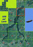
This 8th scenery covers approximately an area of 7.5x6 km, from S.Gregorio/Dongo (NW) to Colico (NE), and S.Siro (SW) to Tremenico/Aveno (SE) and includes six NLC piers: Dervio, Piona, Colico, Dongo, Musso, Pianello del Lario, in addition to the disused Cremia's one; a lot of dedicated buildings are included, as S.Tommaso of Canterbury church and fortification (Corenno), Cistercian abbey (Piona), pier and dock (Colico), S.Stefano church, factory buildings and airpollution control machinery (Dongo), Rezzonico's castle (S.Siro).
This VFR on Lario scenery includes several Dervio's details, and fully revises the previous Dervio scenery; Are included: Boldona's park office and stand, railway station, NLC shiphard, Pontile piers with Concordia steamer, dock bay with small floating pier and compass of the lake, S. Peter and Paul church and houses front of lake, hydro power station, Municipality and some other buildings, Castello's tower, windsurf school, windsurfers and kitesurfers on the lake, cross and Madonna on top of Legnoncino mountain. There are also included two viaducts between the tunnels of the freeway 36, with moted traffic. Catamarans Citta di Como and Tivano at Colico/Dongo piers together with other minor boats and docks alongside the lake coast; a moted regata with catamarans is placed in the lake between Pianello and Dervio.
This scenery SUPERSEDES AND CANCELS the previous "dervio_v2a" one, removed from the library. This is the eighth scenery of the "VFR of Lario" project, made with photorealistic terrain (multiseason & night) and with some 3D GMax realistic objects.
| Filename: | VFR_of_Lario_Area_E2__Como_Lake_Italy_Update.zip |
| License: | Freeware |
| Added: | 25th November 2012, 20:54:39 |
| Downloads: | 1,667 |
| Author: | Aldo Della Vedova, Daniele Lanfranchi, Gian Mario Verga |
| Size: | 39.39 MB |
| Category: Flight Simulator X - Scenery | |
| Amsterdam Schiphol - EHAM Netherlands Package |
|
File Description:
This Airport package is being released in conjunction with the release of the new ADE Design Utility (Airport Design Editor) to illustrate the power and design capabilities of both the current Home Version and the future Pro Version. The main airport in my ADE BGL is the Amsterdam Schiphol EHAM Airport. I also included into the single Airport Facility data bgl 5 additional airports which are Eindhoven AB (EHEH), Groningen Eelde (EHGG), Lelystad (EHLE), Maastricht-Aache (EHBK) and Rotterdam (EHRD) for you to explore. Major key changes are all 3 parallel runways are open with restrictions and are ATC controlled Arrival runways for both the User and AI Plane Traffic. Additional runways are also working simultaneously but some runways are closed for Arrival and/or Departure as per the ATC Preferential Runway System. All Gates and Parking Spots have been updated so AI Airline Planes, Maintenance, Cargo, Commuter, and Corporate GA park in the correct places. New Approach code including the 3 STAR's, Night RNAV's and all current Transitions have been rewitten and coded properly as seen in the GPS receiver per current Jeppesen Charts. Many Scenery features have also been added at each of the Airports which also includes the new H Terminal at EHAM. AI Planes fly the true RWY 24 VORDME curved approach from the PAM VOR and RWY 04/22 is a restricted runway that FSX ATC will only vector AI/User Planes that weigh less then 74000lbs EW to this active runway. Read the included Whats New Readme txt file for all the added enhancements.
| Filename: | Amsterdam_Schiphol__EHAM_Netherlands_Package.zip |
| License: | Freeware, limited distribution |
| Added: | 4th December 2007, 12:15:13 |
| Downloads: | 45,410 |
| Author: | Jim Vile |
| Size: | 4.27 MB |
| Category: Flight Simulator 2004 - Scenery | |
| CYFD Brantford Municipal Airport, Ontario, Canada Version 1.0 |
|
File Description:
I decided to make Brantford a little more like the real thing. I also changed the landclass in the area to make it more realistic as this is where I live. Here are the changes I have made.
--
Modified the airport in AFCAD2 to have the aircraft park on either side of the large apron as they do in real life
, Corrected the runway lengths and added the connector between the runway ends at the north side of the airport
, Added AI Flightplans (see details below)
, Added a landclass update so that the area appears as it does in real life. There are now more farms around the airport as well as in the Burford area. The towns of Burford (my hometown) and Scotland are added, the Long Point Conservation Authority Forest is added to the west of Burford, and the Burford Golf Links appear beside the 403 (divided highway) to the north west of town.
--AI Flightplans
I tried to make the AI traffic as realistic as possible. I have training aircraft doing touch and goes 7 days a week. A few DC-3's have been restored at the airport so I have a DC-3 that flies for testflights on Monday, Wednesday, and Friday from 7am to 12:30pm. A learjet flies to Chicago on business days. It departs at 8am and arrives at 1:59pm. Also, a 182 flies up to Timmins on the weekends. It departs on Saturday at 9am and arrives home on Sunday at 11:36am.
| Filename: | CYFD_Brantford_Municipal_Airport_Ontario_Canada_Ve.zip |
| License: | Freeware, limited distribution |
| Added: | 9th November 2003, 02:46:05 |
| Downloads: | 2,575 |
| Author: | David Voogd |
| Size: | 425.3 KB |
| Category: Prepar3D V1-4 - AI Aircraft | |
| AI Eurus Aviation AIM Embraer ERJ-145LR XA-JNR |
|
Images related to this file:
File Description:
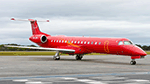
This is the newest mexican air taxi airliner called Eurus Aviation, the aircraft for now of this new airline is a Embraer ERJ-145LR with the registration XA-JNR, the files contain normal paint and No Tail Titles paint. You can choose any type of texture that you want to add to your air traffic, it does not affect anything in the chronology of the aircraft as it is a charter aircraft, it is not necessary to add all the textures that I am including in this package, I simply choose to that there is variety, the logos on the aircraft are real and have been on the aircraft since it recently began operations. Eurus Aviation is a Mexican luxury airline company dedicated to providing personalized VIP charter services. With extensive experience in air operations and in managing clients with the highest demands, we design personalized flights and charter trips for our clients. Since 2017 we offer private flight service Our clients include leading national and multinational companies, entertainment businesses, sports teams, and individual users who are looking for a totally personalized transportation alternative tailored to their particular needs with an unmatched service. This is my website: https://el-mundo-de-los-aviones-ai-traffic.jimdosite.com The model is Ai Malcontent (AIM) Embraer ERJ-145 Basepack. I hope enjoy it!.Â
| Filename: | AI_Eurus_Aviation_AIM_Embraer_ERJ145LR_XAJNR.zip |
| License: | Freeware |
| Added: | 24th July 2023, 20:03:20 |
| Downloads: | 35 |
| Author: | Jesús Gibran Soriano Solleiro |
| Size: | 13.36 MB |


© 2001-2026 AVSIM Online
All Rights Reserved
Privacy Policy |