
Where Flight Simulation Enthusiasts Gather from Around the World!
AVSIM Library - Search Results

| Category: Flight Simulator 2004 - AI Aircraft | |
| Convair F-102A Delta Dagger |

|
Images related to this file:
File Description:

Convair F-102A Delta Dagger. I present a comprehensive AI traffic model package for the second of the Century Series fighter aircraft, one of the backbones of Air Defense Command and Air National Guard squadrons from the mid-1950s to mid-1970s. The "Deuce" first flew in 1953, and 1,000 of these aircraft served as strategic interceptors during the height of the Cold War. Late examples served until 1979, over twenty years after its introduction; and many were expended as target drones on live fire ranges. An original 7-LOD model brings this historic aircraft to the flightsim world.
This package is a complete representation of the F-102 through its entire career, in the service of the USAF as well as NASA, and the Hellenic and Turkish Air Forces. Models included are F-102A/TF-102A with both Case X and Case XX wings, and the PQM-102 manned and un-manned drones, with a total of 10 models and 164 repaints, to include over 70 individual squadron schemes. Original aircraft model, master textures, and all release repaints by Michael Pearson, flight dynamics by Michael MacIntyre. PLEASE READ THE DOCUMENTATION FOR RESEARCH DISCLAIMERS.
| Filename: | Convair_F102A_Delta_Dagger.zip |
| License: | Freeware |
| Added: | 1st December 2013, 21:20:28 |
| Downloads: | 810 |
| Author: | Michael Pearson |
| Size: | 38.19 MB |
| Category: Flight Simulator 2004 - Original Aircraft | |
| Lockheed WP-3D NOAA's Hurricane hunter (N42RF) |
|
Images related to this file:
File Description:
About the Aircraft.-----
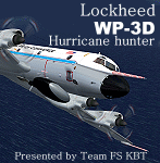
Two of the world's premier research aircraft, the renowned NOAA WP-3D Orions, participate in a wide variety of national and international meteorological, oceanographic and environmental research programs in addition to their widely known use in hurricane research and reconnaissance. These versatile turboprop aircraft are equipped with an unprecedented variety of scientific instrumentation, radars and recording systems for both in-situ and remote sensing measurements of the atmosphere, the earth and its environment. Obtained as new aircraft from the Lockheed production line in the mid-70's, these robust and well maintained aircraft have led NOAA's continuing effort to monitor and study hurricanes and other severe storms, the quality of the atmosphere, the state of the ocean and its fish population, and climate trends.
About the Model.----
The sixth P3 series of Team FS KBT produced WP-3D.
This model was made with GMAX. It is FS2004 exclusive use, and it is not possible to use it with FS2002.
The sound file is not bundled. It is described that the data of p-3c_zip is used. By Team FS KBT.
| Filename: | Lockheed__WP3D_NOAAs_Hurricane_hunter_N42RF.zip |
| License: | Freeware |
| Added: | 23rd May 2010, 01:51:25 |
| Downloads: | 22,214 |
| Author: | Daisuke Yamamoto and Hiroaki kubota with Friends |
| Size: | 28.83 MB |
| Category: Flight Simulator X - Scenery | |
| Sioux Falls South Dakota Regional Airport - Joe Foss Field for FSX |
|
Images related to this file:
File Description:
Sioux Falls South Dakota Regional Airport - Joe Foss Field for FSX. Several improvements have been made to the default airport. The default terminal buildings have been replaced with buildings created in FSDS; aircraft gates have been correctly coded using Airport Design Editor 1.70.6042; a new airport vehicle network has been built; extra fuel trucks have been added throughout the airport; the tower view has been changed to display from the roof of the control tower; a static FedEX truck in two different color schemes has been placed in the cargo area; all taxiway signs are correctly placed and all taxiway designators are correctly named; there is the option to open all three runways to AI traffic; the 114th Fighter Wing of the South Dakota Air National Guard is represented; optionally, a set of GA flight plans is included using all default FSX aircraft to liven up the GA area; also included is a set of military flight plans for the 114th Fighter Wing; and Jim Dhaenen's excellent ramp lights are also included. Please read the README FIRST.txt and Installation.txt files to insure proper installation of all files.
| Filename: | Sioux_Falls_South_Dakota_Regional_Airport__Joe_Fos.zip |
| License: | Freeware, limited distribution |
| Added: | 14th April 2017, 07:16:53 |
| Downloads: | 972 |
| Author: | Patrick Finch |
| Size: | 3.56 MB |
| Category: Flight Simulator X - Scenery | |
| EETN TALLINN X DEMO |
|
Images related to this file:
File Description:
EETN TALLINN X DEMO features an extremely detailed scenery of EETN Lennart Meri Tallinn Airport in Tallinn, Estonia, fully compatible with FSX, FSX:SE, P3Dv1, P3Dv2, P3Dv3, P3Dv4 and FSW.
It's a fully functional DEMO version of the commercial payware product. It features same airport layout as in the full version but with limited 3D objects and low resolution textures. Using this free demo ensures no problems with online (VATSIM, IVAO, multiplayer etc.) flying in case some users use the payware scenery and some don't.
Lennart Meri Tallinn Airport (TLL / EETN) is the largest airport in Estonia and home base of the national airline Estonian Air. The airport has a single asphalt-concrete runway that is 3070 metres long and 45 metres wide (large enough to handle wide-bodied aircraft such as the Boeing 747).
It's equipped with an automatic installer, which means that the scenery will be automatically added to the Flight Simulator Scenery Library.
Please uninstall all previous versions of this airport you may have installed before. Please make also sure that no duplicated AFCAD files are installed.
Enjoy your virtual flying with Drzewiecki Design!
| Filename: | EETN_TALLINN_X_DEMO.zip |
| License: | Freeware, limited distribution |
| Added: | 4th February 2018, 05:51:28 |
| Downloads: | 2,504 |
| Author: | Drzewiecki Design |
| Size: | 10.36 MB |
| Category: Flight Simulator 2004 - Scenery | |
| EETN - Tallinn 2014 DEMO |
|
Images related to this file:
File Description:

EETN TALLINN 2014 DEMO features an extremely detailed scenery of EETN Lennart Meri Tallinn Airport in Tallinn, Estonia, fully compatible with FS2004.
It's a fully functional DEMO version of the commercial payware product. It features same airport layout as in the full version but with limited 3D objects and low resolution textures. Using this free demo ensures no problems with online (VATSIM, IVAO, multiplayer etc.) flying in case some users use the payware scenery and some don't.
Lennart Meri Tallinn Airport (TLL / EETN) is the largest airport in Estonia and home base of the national airline Estonian Air. The airport has a single asphalt-concrete runway that is 3070 metres long and 45 metres wide (large enough to handle wide-bodied aircraft such as the Boeing 747).
It's equipped with an automatic installer, which means that the scenery will be automatically added to the Flight Simulator Scenery Library.
Please uninstall all previous versions of this airport you may have installed before. Please make also sure that no duplicated AFCAD files are installed. Enjoy your virtual flying with Drzewiecki Design!
| Filename: | EETN__Tallinn_2014_DEMO.zip |
| License: | Commercial demo |
| Added: | 2nd September 2015, 21:46:19 |
| Downloads: | 1,216 |
| Author: | Drzewiecki Design |
| Size: | 15.16 MB |
| Category: Flight Simulator 2004 - AI Aircraft | |
| MAIW Offutt AFB |
|
Images related to this file:
File Description:

This freeware AI package, produced by Military AI Works, contains everything needed to activate Offutt Air Force Base in FS2004.
Offutt AFB is the home of the USAF Strategic Command (STRATCOM) and hosts the 55th Wing flying the famous "White Tops", a collection of intelligence,
surveillance and reconnaissance aircraft all derived from the Boeing C-135 airframe. The 55th Wing's mission is to provide dominant intelligence,
surveillance, reconnaissance; electronic attack; command and control; and precision awareness to national leadership and warfighters across the spectrum
of conflict any time, any place. This package contains seven different aircraft models along with custom made scenery for Offutt AFB,
customized flight plans for each aircraft, aircraft textures, a comprehensive airfield file, aircraft call signs and much more.
This package also includes the E-4B Nightwatch aircraft of the 1st Airborne Command and Control Squadron.
Credits: AFD's: MAIW Development Team & Giacomo Gramazio, Models: MAIW Development Team & Jan Martin, Flight Dynamics Design: Michael MacIntyre &
AI Aardvark, Effects: John Stinstrom & Michael MacIntyre, Repaints: Mark Walsh & Graham King, Voicepacks: Stewart Pearson, Flightplans: Giacomo Gramazio
& Desmond Burrell, Custom Scenery: MAIW Development Team, John Stinstrom & Paul Mitchell, Special thanks to Barry Taylor for extensive aircraft
research for this project.
| Filename: | MAIW_Offutt_AFB.zip |
| License: | Freeware |
| Added: | 22nd January 2014, 03:08:31 |
| Downloads: | 837 |
| Author: | MAIW Development Team |
| Size: | 24.42 MB |
| Category: Flight Simulator X - AFCAD Files | |
| Peaslees Airstrip Airport (NJ25), New Jersey |
|
File Description:
Located 01 miles SW of Clarksboro, New Jersey on 8 acres of land, Peaslees Airstrip is a private turf field 2207' in length. The hard surface runway has been removed to allow for landings on terrain, so have your terrain mesh set as high as possible. The surrounding area of rural farmland and houses has been filled in to provide an encompassing ground environment with as few breaks to the horizon as possible. There are no services at this airport - if you arrive there is room past the hangar to park and tie down although no tie downs are available in real life, thus you can only start from this airport on the runway. The windsock is located approximately midfield of the runway, as in real life. A second hangar has been constructed nearby the current one, but MSE textures do not reflect this and it was not included. This airport is not lit and daytime VFR operations only are recommended.
Scenery constructed with use of satellite images/streetview/aerial photos - the author has not been there in person.
This scenery is meant to be used in conjunction with MegaScenery Earth New Jersey/Delaware 004. It is not required, but apron use is minimized to allow satellite scenery to show through as much as possible, and objects are placed based on the MSE textures - lack of it may make scenery look out of place.
| Filename: | Peaslees_Airstrip_Airport_NJ25_New_Jersey.zip |
| License: | Freeware |
| Added: | 20th August 2011, 19:56:22 |
| Downloads: | 160 |
| Author: | Drew Sikora |
| Size: | 1 MB |
| Category: Flight Simulator 2004 - Scenery | |
| HCMM - Mogadishu International Airport, Mogadishu/Petrella, Somalia |
|
Images related to this file:
File Description:
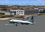
Googly scenery for HCMM Mogadishu/Petrella, the capital airport of Somalia.
Astonishingly, in Flight Simulator 2004 this international airport is depicted as little
more than a runway! Whilst in the real world the airport can hardly be
described as busy, it is served by the country's sole airline - Jubba
Airways, with their wonderful Ilyushin IL-18, and many African and Eastern
European operators call by with cargo flights. In fact, the vast proportion of
the aircraft seen here are Russian-built.
These scenery files add aprons, taxiways, buildings and other airport features to Flight Simulator's limited representation and allow "AI" traffic to land, taxi, park and take off in a realistic manner. But do watch out for cars on the runway and taxiways as they
appear to be regularly used as a by-pass to the perils of driving through the city!
The scenery does not purport to be ultra-accurate. Based on high-detail satellite
imagery from Google Earth, the layout is proportionally correct but the added
airport features, such as buildings, are built from default Microsoft objects
and add-on libraries so will not look exactly like the real thing.
You are not obliged to download and install any additional scenery libraries,
but to enjoy this scenery in its entirety, you may wish to. It will work fine,
with or without. [File re-uploaded at request of AVSIM]
| Filename: | HCMM__Mogadishu_International_Airport_MogadishuPet.zip |
| License: | Freeware |
| Added: | 28th May 2010, 20:46:31 |
| Downloads: | 2,790 |
| Author: | John Hinson |
| Size: | 61.51 KB |
| Category: Flight Simulator X - AFCAD Files | |
| Cross Keys Airport (17N), NJ |
|
File Description:
Located 01 miles S of Cross Keys, New Jersey on 280 acres of land, Cross Keys Airport is a small General Aviation field privately owned by Cross Keys Airport Inc. In addition to servicing GA flights, the airport also hosts a paintball field and a sky diving operation to the north of the field. For this reason, all aircraft must remain south of the runway at all times. Any aircraft with a wingspan larger than 40 feet will need to park in the turf area west of the main apron - smaller GA aircraft can pick a spot from any of the open tiedown areas. 100LL (Blue) Fuel is available by stopping next to the fuel tank on the main apron. Although it doesn't exist in real life, a patch of concrete to the west of the main apron made for a good helipad, so I included one. It is not lit at night. Trees in the surrounding forest are summer trees ONLY.
Scenery constructed with use of Google Maps images, and vague recollection by the author who went sky diving there once.
This scenery is meant to be used in conjunction with MegaScenery Earth New Jersey/Delaware 004. It is not required, but apron use is minimized to allow satellite scenery to show through as much as possible, and objects are placed based on the MSE textures - lack of it may make scenery look out of place.
| Filename: | Cross_Keys_Airport_17N_NJ.zip |
| License: | Freeware |
| Added: | 7th October 2010, 03:27:53 |
| Downloads: | 246 |
| Author: | Drew Sikora |
| Size: | 719.13 KB |
| Category: Flight Simulator X - AFCAD Files | |
| RPLC - Diosdado Macapagal International Clark International, Philippines |
|
File Description:
This Afcad/AFD for RPLC - Diosdad Macapagal International Airport (previously Clark International Airport and Clark AFB) in Angeles City, Pampanga, Philippines was made with ADE V1.37 and is for the default RPLC airport in FSX.
Diosdado Macapagal International Airport is currently a significant low cost carrier and UPS hub for the Philippines and is under development - ultimately intended to replace Ninoy Aquino Airport, Manila (RPLL) as the Premier Gateway to the Philippines. Domestic traffic is currently limited to Cebu Pacific and South East Asian Airlines. The airport handles international traffic - AirAsia, Asiana, Tiger Airways, Hong Kong Express, Hong Kong Airlines and Transglobal - including their recently launched flights to Dhaka and Fujairah - as well as international flights for Asian Spirit to and from Seoul. Cargo use includes a very significant UPS hub, Yangtze River Express, Transglobal and Pacific East Asia Cargo Airlines. Philippine Air Force C-130's are also frequent visitors.
Aprons and taxiways have been changed as needed, additional cargo and airline specific maintenance aprons added, taxiways surfaced correctly, gates and parking spaces coded for airlines and aircraft types using the airport. Many buildings have been changed to be more representative of the real thing. The default airport lacks coding and sees little of the actual traffic coming to RPLC. Use of this file increases traffic and places them where they should park. Tested with WOAI, MAIW's Exotic Alberts Package Philippines Part 1 and custom AI.
| Filename: | RPLC__Diosdado_Macapagal_International_Clark_Inter.zip |
| License: | Freeware |
| Added: | 24th August 2008, 01:18:46 |
| Downloads: | 1,944 |
| Author: | Matthew Brooks |
| Size: | 15.34 KB |


© 2001-2026 AVSIM Online
All Rights Reserved
Privacy Policy |