
Where Flight Simulation Enthusiasts Gather from Around the World!
AVSIM Library - Search Results

| Category: Flight Simulator X - AFCAD Files | |
| Woodbine Municipal Airport (1N4), NJ |

|
File Description:
Located 02 miles SE of Woodbine, New Jersey on 700 acres of land, Woodbine Municipal Airport serves small to large GA craft as well as gliders and ultralights. Tie downs are the only option for transient aircraft. The main parking area of the airport is located in the center tarmac area near the fuel station. The parking spots can accomodate aircraft with wingspans up to 50 feet. Anything larger should park off the side of the taxiway. Fuel is available by stopping near the fuel tank. It should be noted that this airport's real ICAO is KOBI.
Scenery constructed with use of satellite images/streetview, the author has not been there in person.
This scenery is meant to be used in conjunction with MegaScenery Earth New Jersey/Delaware 005. It is not required, but apron use is minimized to allow satellite scenery to show through as much as possible, and objects are placed based on the MSE textures - lack of it may make scenery look out of place.
| Filename: | Woodbine_Municipal_Airport_1N4_NJ.zip |
| License: | Freeware |
| Added: | 22nd October 2010, 06:03:35 |
| Downloads: | 202 |
| Author: | Drew Sikora |
| Size: | 352.7 KB |
| Category: Flight Simulator X - Scenery | |
| TTCPx Patch Ver. 1.2 ( Rev. 8 ) |
|
Images related to this file:
File Description:
Unofficial LatinVFR Tobago TTCP for FSX Expansion Pack. This freeware patch contents: New photoreal scenery with seasons to airport area ( day and night for winter/fall and summer/spring seasons ); New ADE with correction of the NDB TAB 323 and park positions, activation of the RWY's 11 and 29, and other minor fixes; Addition of fuel-repair trigger points to the airport ( JetA to Gates 1-4 area, JetA1 to Gates 5-6 area, and AV100 to Gate 7 area ); New land and water classiffication in the entire island of Tobago; Correction of the entire island terrain including a better flatten around the airport area; More buildings, objects, vegetation and life around on the island of Tobago ( FSX default fictitious objects ); More road traffic over the photoreal area; Full set of the TTCP airport charts ( Use for Virtual Flight Only ); Other fixes. It's not a cumulative patch, so remove any previous version to install. System Requirements: LatinVFR Tobago TTCP v1.1 for FSX and Microsoft Flight Simulator X SP2 or Acceleration.
| Filename: | TTCPx_Patch_Ver_12__Rev_8_.zip |
| License: | Freeware |
| Added: | 22nd August 2010, 08:59:46 |
| Downloads: | 2,429 |
| Author: | Gladson Moreira |
| Size: | 32.76 MB |
| Category: Flight Simulator 2004 - AFCAD Files | |
| Newark Liberty Int'l Airport (KEWR) with active Crosswind Runway |
|
Images related to this file:
File Description:
A high spec AFCAD2 for the FS2004 Newark Liberty Int'l Airport (KEWR) scenery by Steve Whalin. This afcad has been built using FAA Charts and information from the Airport Website. All taxiways are named and all aprons are reworked to be as real as possible according to photos. All gates are named as per real life and have airlines assigned to them. The Fedex and UPS aprons are represented and can accomodate many cargo aircraft. The final addition is random GA parking and the CO maintenance area to the north of the airport. Overflow parking is also available for rush hour periods (Ball Park). This airport features a tower view and also night and approach lighting. Finally, by using the crosswind runway technique, runways 04L/22R, 04R/22L and 11/29 can all be used simultaniously for take-off and landing. Runway 11/29 will be mainly used by CO Express flights. Enjoy!!
This afcad works with the Steve Whalin scenery only (Requires: kewr.zip).
| Filename: | Newark_Liberty_Intl_Airport_KEWR_with_active_Cross.zip |
| License: | Freeware |
| Added: | 2nd March 2010, 19:26:13 |
| Downloads: | 1,355 |
| Author: | Lee Brompton |
| Size: | 259.8 KB |
| Category: Flight Simulator 2004 - Scenery | |
| St. Kitts International Airport (Bradshaw), Caribbean |
|
File Description:
This scenery depicts the Robert L. Bradshaw International airport on the Island of St. Kitts in the Caribbean. It contains the modern new terminal, along with the distinctive green glass tower, and outer buildings. It is a small airport which is located in a valley between two mountain ranges near the southern end of the Island. The scenery has been updated to work in FS2004 by changing the location slightly, removing the hills which are no longer necessary, since FS has now done a great job with the new terrain. The tarmac area is now more representational of the airport, since the scenery tarmacs now override the default FS tarmacs, taxiways, and lines. The airport now has a cleaner layout, and the taxiway extending to the runway end now fits in perfectly. More trees have been added to prevent the stark look of the old scenery. This airport needs an afcad, since there are some A1 aircraft which park in the middle of the taxiway. This scenery will not work in FS2002.
| Filename: | St_Kitts_International_Airport_Bradshaw_Caribbean.zip |
| License: | Freeware |
| Added: | 23rd August 2003, 15:27:31 |
| Downloads: | 4,299 |
| Author: | Bill Melichar |
| Size: | 3.57 MB |
| Category: Flight Simulator 2004 - Scenery | |
| Milano Malpensa Area (ISD) 2013 |
|
Images related to this file:
File Description:
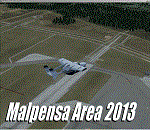
Dear Friends simmer, as always taking advantage of the beautiful objects bgl Gianluca Giovannini, I tried to improve with a symmetric pairing of autogen trees / towns / industrial buildings, the urban area near the international airport of Milano Malpensa, in the best ever scenery by the ISD project.
With the current integration I have created the village of Casenuove, Cardano al Campo, Cascina Costa, Femo, part of the small towns near the attached industrial buildings and new parking in 3D for both terminals. I paid particular attention to the impact of the approach in view of the Ticino Park with a significant density of trees near the runway. Inside you will also find the file on the grass in 3D previously published by me, so if you have already installed, you can deactivate maintaining this.
Warning Very Important: the scenery "is not complete" and to get the best result, you must install ISD LIMC 2009 (limc2009v1.1.zip) - available HERE.
| Filename: | Milano_Malpensa_Area_ISD_2013.zip |
| License: | Freeware |
| Added: | 22nd February 2013, 17:15:22 |
| Downloads: | 4,756 |
| Author: | Fabio Ferrari "fafo air" |
| Size: | 4.51 MB |
| Category: Flight Simulator 2004 - Scenery | |
| VAAH Ahmedabad International, India |
|
Images related to this file:
File Description:

Googly scenery for VAAH Ahmedabad International, India - an enhancement to the airport provided in Flight Simulator 2004 which is incorrect in many respects. These scenery files correct and improve the terminal location, apron, taxiways, buildings and other airport features so that you and your "AI" traffic can land, taxi, park and take off in a realistic manner.
The airport is served by aircraft as large as Jumbo Jets from a range of domestic and international Indian airline operators, together with flights from other countries' airlines such as Kuwait Airways and Singapore Airlines.
The scenery does not purport to be ultra-accurate. Based on high-detail satellite imagery from Google Earth, the layout is proportionally correct but the added airport features, such as buildings, are built from default Microsoft objects and add-on libraries so will not look like the real thing.
You are not obliged to download and install any additional scenery libraries, but to enjoy this scenery in its entirety, you may wish to. It will work fine, with or without.
[File re-uploaded at request of AVSIM]
| Filename: | VAAH_Ahmedabad_International_India.zip |
| License: | Freeware |
| Added: | 26th June 2010, 06:06:36 |
| Downloads: | 2,922 |
| Author: | John Hinson |
| Size: | 82.47 KB |
| Category: Flight Simulator 2004 - Scenery | |
| WIOO Pontianak/Supadio, Kalimantan, Indonesia |
|
Images related to this file:
File Description:
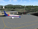
Googly scenery for WIOO Pontianak/Supadio, Kalimantan, Indonesia. In Flight Simulator
2004 only a general aviation parking is provided at this important Indonesian domestic
airport, but in the real world it is served over fifteen times
a day by jets and smaller aircraft of Adam Air, Airfast Service, Batavia Air, Deraya
Air Taxi, Indonesia Air Transport, Sriwijaya Air and Tri-MG Intra Asia Airlines. These
scenery files add aprons, taxiways, buildings and other airport features to Flight
Simulator's limited representation and allow "AI" traffic to land, taxi, park and
take off in a realistic manner.
The scenery does not purport to be ultra-accurate. Based on high-detail satellite
imagery from Google Earth, the layout is proportionally correct but the added
airport features, such as buildings, are built from default Microsoft objects
and add-on libraries so will not look like the real thing.
You are not obliged to download and install any additional scenery libraries,
but to enjoy this scenery in its entirety, you may wish to. It will work fine,
with or without.
[File re-uploaded at request of AVSIM]
| Filename: | WIOO_PontianakSupadio_Kalimantan_Indonesia.zip |
| License: | Freeware |
| Added: | 15th May 2010, 01:10:01 |
| Downloads: | 1,963 |
| Author: | John Hinson |
| Size: | 64.96 KB |
| Category: Flight Simulator 2004 - Scenery | |
| WAML Palu/Mutiara, Indonesia |
|
Images related to this file:
File Description:
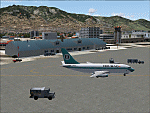
Googly scenery for WAML Palu/Mutiara, Indonesia. In Flight Simulator 2004 little
is provided other than a runway at this small domestic airport, although in the
real world it sees regular jet flights from airlines such as Batavia Air, Bouraq
Indonesia Airlines, Garuda Citylink, Lion Airlines and Merpati Nusentara and
smaller aircraft from operators like Airfast Service and Indonesia Air Transport.
These scenery files add aprons, taxiways, buildings and other airport features
to Flight Simulator's limited representation and allow "AI" traffic to land,
taxi, park and take off in a realistic manner.
The scenery does not purport to be ultra-accurate. Based on high-detail satellite
imagery from Google Earth, the layout is proportionally correct but the added
airport features, such as buildings, are built from default Microsoft objects
and add-on libraries so will not look exactly like the real thing.
You are not obliged to download and install any additional scenery libraries,
but to enjoy this scenery in its entirety, you may wish to. It will work fine,
with or without.
| Filename: | WAML_PaluMutiara_Indonesia.zip |
| License: | Freeware |
| Added: | 15th May 2010, 01:11:30 |
| Downloads: | 1,771 |
| Author: | John Hinson |
| Size: | 140.88 KB |
| Category: Flight Simulator 2004 - Scenery | |
| VEPT Patna, India |
|
Images related to this file:
File Description:
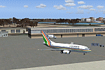
Googly scenery for VEPT Patna, India. In Flight Simulator 2004, the airport is
depicted at a pretty waterside location but only a small ramp for general aviation
aircraft is provided. In the real world it is served around six times a day by
Boeing jets on domestic flights by Alliance Air, Indian Airlines, Jet Airways, and
Sahara Airlines. These scenery files add aprons, taxiways, buildings and other
airport features to Flight Simulator's bland representation and allow "AI" traffic,
to land, taxi, park and take off in a realistic manner.
The scenery does not purport to be ultra-accurate. Based on high-detail satellite
imagery from Google Earth, the layout is proportionally correct but the added
airport features, such as buildings, are built from default Microsoft objects
and add-on libraries so will not look like the real thing.
You are not obliged to download and install any additional scenery libraries,
but to enjoy this scenery in its entirety, you may wish to. It will work fine,
with or without.
[File re-uploaded at request of AVSIM]
| Filename: | VEPT_Patna_India.zip |
| License: | Freeware |
| Added: | 7th May 2010, 11:02:44 |
| Downloads: | 1,705 |
| Author: | John Hinson |
| Size: | 65.91 KB |
| Category: Flight Simulator X - Aircraft Repaints, Textures and Modifications | |
| Tunisair TS-IOP retro livery for PMDG B737-600NGX |
|
Images related to this file:
File Description:
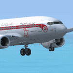
This is a livery For the PMDG B737-600NGX of the Tunisian national airline 'Tunisair'
At this time, Tunisair operate one of its four Boeing 737-600. Its registration is TS-IOP.
This 21-year old aircraft have the special retro livery for the 70 years of Tunisair.
To install this livery, you can use the PMDG Operation Center or you can do it manually by followings the steps located in the Readme file
This livery was tested only on FSX, I hope that it will work on P3D too.
Please don't share this file on other websites or forums
I hope that you will enjoy my work
If you have any remark about this file or one of my other liveries, please tell me below in the comments
Have a good flight
From Tunisia, DM
| Filename: | Tunisair_TSIOP_retro_livery_for_PMDG_B737600NGX.zip |
| License: | Freeware, limited distribution |
| Added: | 13th May 2021, 23:55:04 |
| Downloads: | 132 |
| Author: | Denguir Mehdi |
| Size: | 33.71 MB |


© 2001-2026 AVSIM Online
All Rights Reserved
Privacy Policy |