
Where Flight Simulation Enthusiasts Gather from Around the World!
AVSIM Library - Search Results

| Category: Prepar3D V1-4 - Aircraft Repaints, Textures and Modifications | |
| Douglas C-47 (ZK-APK) NZNAC |

|
Images related to this file:
File Description:
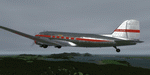
This folder contains a repaint for P3Dv4.5 PBR version of the Douglas C-47 by Manfred Jahn and colleagues in the colors of ZK-APK of the New Zealand National Airways Corporation (NZNAC). Originally C-47B-45-DK 45-964, it was ferried to New Zealand and flew as NZ3556 with the RNZAF until 1947. She then went to NZNAC as ZK-APK 'Poaka' (white headed gull). In 1964 it was converted to DC-3D and leased to Fiji Airways until 1967, when it was sold to Airland (NZ) Ltd. It was cancelled from the NZ register in 1984, and is currently in use as a cafe at Mangaweka, NZ. Repaint by Jan Kees Blom for Manfred Jahn's C-47 for P3Dv4.5, with PBR, Rivet and bump detail by Ted (Tufun) Wolfgang."
| Filename: | Douglas_C47_ZKAPK_NZNAC.zip |
| License: | Freeware |
| Added: | 26th January 2020, 17:56:04 |
| Downloads: | 211 |
| Author: | Jan Kees Blom |
| Size: | 27.58 MB |
| Category: Flight Simulator 2004 - Scenery | |
| FA2004 Scenery - Des Moines Intl KDSM |
|
Images related to this file:
File Description:
Re-upload. FS2004 Scenery-The Des Moines International Airport (KDSM) is owned and operated by the City of Des Moines . The Airport (IATA: DSM, ICAO: KDSM) is a commercial airport located in the southern part of the city of Des Moines, Iowa USA. The airport serves residents of the Des Moines metropolitan area and is the closest airport with connections to major airline hubs for people who live throughout much of east-central, north-central, and southern Iowa. The 132d Fighter Wing of the Iowa Air National Guard is located at the Des Moines International Airport. This scenery was created solely with Rwy12 and Lago's FSE. The AFCAD2 file has been modified and is included in the download. Readme file important, please read. By John B. Loney, Jr.
| Filename: | FA2004_Scenery__Des_Moines_Intl_KDSM.zip |
| License: | Freeware, limited distribution |
| Added: | 6th June 2010, 09:41:45 |
| Downloads: | 4,061 |
| Author: | John B. Loney, Jr. |
| Size: | 464.22 KB |
| Category: Flight Simulator X - Aircraft Repaints, Textures and Modifications | |
| NATO HAW Boeing C-17A |
|
Images related to this file:
File Description:
Virtavia C-17A in an Eindhoven based NATO Heavy Airlift Wing livery. This livery represents a fictional still fictional fifth NATO C-17A, belonging to the "Heavy Airlift Wing" based at Eindhoven AB. Currently NATO owns three C-17A's purchased as a joint venture by Bulgaria, Estonia, Lithuania, the Netherlands, Poland, Romania, Slovenia and the United States. This livery is of a possible future 5th C-17A for the same command, based at the home of another Joint Venture called EATC: Eindhoven AB. The first 3 C-17's have the Hungarian national colors. This particular livery has the colors of the possible future host-nation for number 4, 5 and 6: The Netherlands. You need a legal copy of the payware Virtavia C-17A for FSX in order to use these repaint.
| Filename: | NATO_HAW_Boeing_C17A.zip |
| License: | Freeware |
| Added: | 13th June 2011, 03:29:30 |
| Downloads: | 198 |
| Author: | Rene Spaan |
| Size: | 5.91 MB |
| Category: Flight Simulator 2004 - Scenery | |
| Dumaguete Scenery Landclass and Coastline Modification ver.2.0 |
|
File Description:
This is the version 2.0 of my Dumaguete Scenery modification.This file complements Manny Tecson's Dumaguete Scenery for FS2002 and adapted for FS2004.This will improve the following:
1.Landclass from sparsely populated houses to densely populated coconut trees at runway 09 approach.
2.Modifies the present coastline of Dumaguete City to make the runway 27 end of the airport extend out to the sea.
3.Modifies the city landclass of Dumaguete City to promote realism.
4.Modifies rocky reclamation at runway 27 tip of Dumaguete Airport.
5.Modifies the national highway from perpendicular to runway 09 to diagonal.
6.Excludes the crash detection activated electric post at runway 09 tip.
To download Manny Tecson's Dumaguete scenery,go to www.philskies.net then click the Scenery section and click the Visayas sub-menu.
| Filename: | Dumaguete_Scenery_Landclass_and_Coastline_Modifica.zip |
| License: | Freeware |
| Added: | 12th January 2004, 18:44:14 |
| Downloads: | 2,371 |
| Author: | Ver Walter L. Gulfan |
| Size: | 635.96 KB |
| Category: Flight Simulator X - AFCAD Files | |
| S77 Magee Airstrip |
|
File Description:
This airstrip lies in the Coeur D'Alene national forest region right in the mountains, but FSX has it badly misplaced, right in the middle of a mountain, so you have the horrible looking cliffs on each side and front and back too, whereas the real airstrip is in a valley alongside and actually looks like a very nice spot to make a landing. I redid the airfield with ADE and also did the landclass for the valley to improve the overall appearance, using google earth as a reference.
I also added a small taxiway and parking, with hold short nodes, these are not part of the real world strip, but if you want AI planes to fly in and out of these strips then you need those features, otherwise the AI will just vanish.
| Filename: | S77_Magee_Airstrip.zip |
| License: | Freeware |
| Added: | 25th September 2010, 02:20:46 |
| Downloads: | 222 |
| Author: | Kim Gowney |
| Size: | 78.63 KB |
| Category: Flight Simulator 2004 - Sounds | |
| ATC Voices - Airport names set 13 |
|
File Description:
A collection of 67 additional, improved or corrected airport names, for
use with Flight Simulator 2004 and FS2002. Installation requires the
EditVoicepack software (see
http://bevelstone.xs4all.nl/FlightSimulator/EditVoicepack) by Lars
Møllebjerg which is also available as a free download from the usual
Flight Simulator download sites such as Avsim.
The airports represented here are:
1X1 Higgins (United States of America),
2E3 Cluck Ranch (United States of America),
CYCC Cornwall Regl (Canada),
EDSK Kehl-Sundheim (Germany),
EFKJ Kauhajoki (Finland),
EG74 Jurby (United Kingdom),
EKOD Odense (Denmark),
ENOP Oppdal (Norway),
ENZ6 Frya (Norway),
EPZP Przylep (Poland),
ES0G Mantorp Park (Sweden),
ESGS Stromstad/Nasinge (Sweden),
ESGV Varberg (Sweden),
ESSK Gavle-Sandviken (Sweden),
ESSW Vastervik (Sweden),
FD98 Ferguson (United States of America),
FZRA Manono (Congo DRC),
KBJJ Wayne Co (United States of America),
KDYR Dyersburg Mun (United States of America),
KELD El Dorado/South Arkansas Regional (United States of America),
KIDL Indianola (United States of America),
KLLQ Monticello Mun/Ellis (United States of America),
KPBF Grider (United States of America),
KPKD Park Rapids (United States of America),
KUOX University-Oxford (United States of America),
KVPC Cartersville (United States of America),
KWWR West Woodward (United States of America),
LFIM St Gaudens/Montrejeau (France),
LFRI Les Ajoncs (France),
LIRQ Florence/Peretola - fixed (Italy) - fixed,
LKCT Chotebor (Czech Republic),
LKPO Prerov (Czech Republic),
NFNK Lakeba (Fiji),
O07 Westheimer (United States of America),
OICS Sanandaj (Iran),
OIMN Bojnord (Iran),
ORSU Sulaymaniyah International (Iraq),
RJSC Yamagata (Japan),
RJSY Shonai (Japan),
RPUW Gasan/Marinduque (Philippines),
RPVT Tagbilaran (Philippines),
SBNF Navegantes (Brazil),
SPAS Andoas (Peru),
SPMS Yurimaguas (Peru),
SSGB Guaratuba (Brazil),
TFFS Les Saintes (Guadeloupe),
TN83 Cedar Glade (United States of America),
ULL9 Gostitilsy (Russian Federation),
ULLD Gromovo (Rusian Federation),
ULLG Gorelovo (Ruissian Federation),
ULPW Sortavala (Russian Federation),
W11 Menomonie (United States of America),
WARR Surabaya/Juanda (Indonesia),
WARS Semarang/Achmad Yani (Indonesia),
WIOD Tanjung Pandan/Buluh Tumbang/H.A.S. Hanandjoeddin (Indonesia),
XCN Coron/Busuanga (Philippines),
Y95 Hillman (United States of America),
YADD Arubiddy Station( (Australia),
YBAL Balladonia (Australia),
YECL Eucla (Australia),
YNRB Narembeen (Australia),
Z19X Aozou (Libya), plus
BOJNORD INFORMATION Beajnord (Iran),
BUDEJOVICE PRECISION Budejovice (Czech Republic),
KARSHI Karshi South (Uzbekistan), and
PRYZLEP AERO Przylep Aero (Poland),
| Filename: | ATC_Voices__Airport_names_set_13.zip |
| License: | Freeware |
| Added: | 22nd February 2008, 09:20:06 |
| Downloads: | 3,084 |
| Author: | John Hinson |
| Size: | 44.06 KB |
| Category: Flight Simulator 2004 - Scenery | |
| OPDB Dalbandin, Pakistan |
|
Images related to this file:
File Description:

Googly scenery for OPDB Dalbandin, Pakistan - a quiet domestic airport for
which no operational facilities are provided in Flight Simulator 2004. These
scenery files add/correct the runways, apron, taxiways, buildings and other
airport features so that you and your "AI" traffic can land, taxi, park
and take off in a realistic manner.
The airport appears to be served all of once per week by ATRs of Pakistan
International Airways so will hardly buzz with activity, but you will be
assured of a friendly welcome when you arrive.
The scenery does not purport to be ultra-accurate. Based on high-detail satellite
imagery from Google Earth, the layout is proportionally correct but the added
airport features, such as buildings, are built from default Microsoft objects
and add-on libraries so will not look like the real thing.
You are not obliged to download and install any additional scenery libraries,
but to enjoy this scenery in its entirety, you may wish to. It will work fine,
with or without.
[File re-uploaded at the request of AVSIM]
| Filename: | OPDB_Dalbandin_Pakistan.zip |
| License: | Freeware |
| Added: | 5th May 2010, 22:32:37 |
| Downloads: | 1,017 |
| Author: | John Hinson |
| Size: | 65.99 KB |
| Category: Flight Simulator 2004 - Scenery | |
| VEAT Argatala, India |
|
Images related to this file:
File Description:
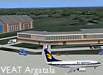
Googly scenery for VEAT Argatala, India - one of the airports that Microsoft seem to have, um, "forgotten" in FS2004. In the real world it is regularly served by Boeings and Airbii of Alliance Air, Indian Airlines, Jet Airways and Kingfisher Airlines (and smaller aircraft), using the 6000 foot runway with little room for manoevre. These scenery files add aprons, taxiways, buildings and other airport features to Flight Simulator's bland representation and allow you, and "AI" traffic, to land, taxi, park and take off realistically. The scenery does not purport to be ultra-accurate. Based on high-detail satellite imagery from Google Earth, the layout is proportianally correct but the added airport features, such as buildings, are built from default Microsoft objects and add-on libraries so will not look like the real thing. You are not obliged to download and install any additional scenery libraries, but to enjoy this scenery in its entirety, you may wish to. It will work fine, with or without. Details of optional additional scenery library downloads are provided within.
[File re-uploaded at request of AVSIM]
| Filename: | VEAT_Argatala_India.zip |
| License: | Freeware |
| Added: | 14th May 2010, 04:49:05 |
| Downloads: | 1,658 |
| Author: | John Hinson |
| Size: | 65.16 KB |
| Category: Flight Simulator 2004 - Scenery | |
| SPHZ Anta/Comandante German Arias Grazz, Peru |
|
Images related to this file:
File Description:
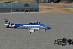
Googly scenery for SPHZ Anta/Comandante German Arias Grazz, Peru - a small
domestic airport for which nothing more than a runway is provided in Flight
Simulator 2004. These scenery files add the apron, taxiways, buildings and
other airport features so that you and your "AI" traffic can land, taxi, park
and take off in a realistic manner.
The airport is served daily by domestic operator L C Busre and perhaps also
others using small aircraft, but little information has been found on activity
in this area.
The scenery does not purport to be ultra-accurate. Based on high-detail satellite
imagery from Google Earth, the layout is proportionally correct but the added
airport features, such as buildings, are built from default Microsoft objects
and add-on libraries so will not look like the real thing.
You are not obliged to download and install any additional scenery libraries,
but to enjoy this scenery in its entirety, you may wish to. It will work fine,
with or without.
[File re-uploaded at request of AVSIM]
| Filename: | SPHZ_AntaComandante_German_Arias_Grazz_Peru.zip |
| License: | Freeware |
| Added: | 23rd May 2010, 01:24:24 |
| Downloads: | 1,224 |
| Author: | John Hinson |
| Size: | 65.15 KB |
| Category: Flight Simulator 2004 - AFCAD Files | |
| WIKK/WIKP/WIDK Depati Amir, Pangkal Pinang, Indonesia |
|
Images related to this file:
File Description:
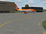
Googlyafcad A&F Data file for Depati Amir, based on Google Earth satellite data. It is a domestic airport located on the east coast of the island on Bangka serving the serving the largest town on the island, Pangkal Pinang, which is also the capital of the province
Bangka-Belitung.
The facilities in Flight Simulator 2004 only allow for general aviation traffic, but the
airport is regularly served by Boeing jets of Adam Air, Batavia Air and Sriwijaya Air as
well as smaller prop-driven craft of airlines like Merpati Nusentara. These files will
allow you and your "AI" traffic to land, taxi, park and take off in a realistic manner.
Like many airports in Indonesia, the ICAO code has changed in recent years. Microsoft
Flight Simulator 2004 uses the old code (WIKK) but this changed first to WIPK (in error)
and now WIDK. These files allow you to continue using the old code or change to the new
one. [File re-uploaded at request of AVSIM]
| Filename: | WIKKWIKPWIDK_Depati_Amir_Pangkal_Pinang_Indonesia.zip |
| License: | Freeware |
| Added: | 29th May 2010, 09:30:30 |
| Downloads: | 755 |
| Author: | John Hinson |
| Size: | 69.96 KB |


© 2001-2026 AVSIM Online
All Rights Reserved
Privacy Policy |