
Where Flight Simulation Enthusiasts Gather from Around the World!
AVSIM Library - Search Results

| Category: Flight Simulator X - Original Aircraft | |
| Project Airbus A318 FD-FMC 2.0 |

|
Images related to this file:
File Description:

Project Airbus A318 FD-FMC 2.0 is the new version of the FD-FMC project for FSX / P3D. It comes with a new ehanced virtual cockpit (3 set of HD textures), new FMC gauge fully fonctionnal in virtual cockpit (and 2D window). A 550 airport database is provided in the pack with all SID, STAR and approaches procedures (updated monthly) and Waypoints update for FSX. Vertical navigation management with all real Airbus flight mode. TCAS and TAWS on ND. Cold and dark status. Holding pattern, DME-ARC and teardrop turns management. original sound set provided. This FMC is not only a GPS like, It controls engines and aircraft to a real vertical navigation to a realistic flight experience. New folder organisation to optimize file space, with other aircraft of the family (A319 - A320 and A321).
Aircraft 3D model edited to a right flightdeck position. CFM and IAE engine version. New airports added and navaids updated monthly on the freenavdbgroup website. User and install manuals provided in French and English. Have a good flight.
| Filename: | Project_Airbus_A318_FDFMC_20.zip |
| License: | Freeware |
| Added: | 2nd November 2019, 18:59:14 |
| Downloads: | 2,270 |
| Author: | Project Airbus / Francois Dore / Bjoern Kesten |
| Size: | 169.5 MB |
| Category: Flight Simulator X - Original Aircraft | |
| Project Airbus A32x Family FD-FMC 2.0 |
|
Images related to this file:
File Description:

Project Airbus A32x family FD-FMC 2.0 (include A318 - A319 - A320 - A321) is the new version of the FD-FMC project for FSX / P3D. It comes with a new ehanced virtual cockpit (3 set of HD textures), new FMC gauge fully fonctionnal in virtual cockpit (and 2D window). A 550 airport database is provided in the pack with all SID, STAR and approaches procedures (updated monthly) and Waypoints update for FSX. Vertical navigation management with all real Airbus flight mode. TCAS and TAWS on ND. Cold and dark status. Holding pattern, DME-ARC and teardrop turns management. original sound set provided. This FMC is not only a GPS like, It controls engines and aircraft to a real vertical navigation to a realistic flight experience. New folder organisation to optimize file space, with other aircraft of the family.
Aircraft 3D model edited to a right flightdeck position. CFM and IAE engine version. New airports added and navaids updated monthly on the freenavdbgroup website. User and install manuals provided in French and English. Have a good flight.
| Filename: | Project_Airbus_A32x_Family_FDFMC_20.zip |
| License: | Freeware, limited distribution |
| Added: | 4th November 2019, 18:33:03 |
| Downloads: | 10,264 |
| Author: | Project Airbus / Francois Dore / Bjoern Kesten |
| Size: | 478.17 MB |
| Category: Flight Simulator 2004 - Miscellaneous Files | |
| Active ILS - KMCO (Orlando International Airport) |
|
File Description:
This is the 3rd Airport in a series of new ILS runways. As most know initiating the ILS at certain airports for AI Traffic is not a function at this time when using AFCAD2. If you add a new ILS runway to an airport such as KMCO (Orlando International Airport 17L/35R) only the user aircraft can use this runway when visibility falls below 3 miles. ATC will no longer use this runway for AI Traffic because FS9 sees it as a visual runway. This will cause ATC to vector your AI Traffic back to 17/35 (old numbers) 17R/35L (new numbers) which is also a Terminal departure runway. This file adds all NAVAIDS for making 17L/35R a Precision Instrument Runway. I have added all the radar fixes for both the ILS approach portion and the proper missed approach procedures, altitudes and intersections as per current published plates. All AI Aircraft will now continue to use 17L/35R when Airport visual conditions are less than 3 miles.
| Filename: | Active_ILS__KMCO_Orlando_International_Airport.zip |
| License: | Freeware, limited distribution |
| Added: | 25th June 2004, 01:50:15 |
| Downloads: | 3,846 |
| Author: | Jim Vile |
| Size: | 45.38 KB |
| Category: Prepar3D V1-4 - Scenery | |
| Piarco International Airport - TTPP V1.2 |
|
File Description:
TTPP v1.2 - In this version, problems with markings in tax lanes have been fixed. The textures of the taxi stands have also been redone. More vehicles and vegetation were included.
Piarco International Airport (IATA: POS, ICAO: TTPP) is an international airport serving the island of Trinidad and is one of two international airports in Trinidad and Tobago. The airport is located 30 km (19 mi) east of Downtown Port of Spain, located in the adjacent town of Piarco. It is the seventh busiest airport in the Caribbean in terms of passengers served[6] and third busiest in the English-speaking Caribbean, after Sangster International Airport and Lynden Pindling International Airport. The airport is also the primary hub and operating base for the country's national airline, as well as the Caribbean's largest airline, Caribbean Airlines.
Piarco International Airport has direct scheduled service to destinations in the United States, Canada, Central America, South America and Europe. It is also a significant transit hub for the Southern Caribbean and serves as the primary connection point for many passengers travelling from Guyana.
| Filename: | Piarco_International_Airport__TTPP_V12.zip |
| License: | Freeware |
| Added: | 4th February 2022, 03:49:10 |
| Downloads: | 559 |
| Author: | Eduardo Puelker |
| Size: | 53.65 MB |
| Category: Flight Simulator X - Original Aircraft | |
| Project Airbus A320 FD-FMC 2.0 |
|
Images related to this file:
File Description:

Project Airbus A320 FD-FMC 2.0 is the new version of the FD-FMC project for FSX / P3D. It comes with a new ehanced virtual cockpit (3 set of HD textures), new FMC gauge fully fonctionnal in virtual cockpit (and 2D window). A 550 airport database is provided in the pack with all SID, STAR and approaches procedures (updated monthly) and Waypoints update for FSX. Vertical navigation management with all real Airbus flight mode. TCAS and TAWS on ND. Cold and dark status. Holding pattern, DME-ARC and teardrop turns management. original sound set provided. This FMC is not only a GPS like, It controls engines and aircraft to a real vertical navigation to a realistic flight experience. New folder organisation to optimize file space, with other aircraft of the family (A319 - A320 and A321).
Aircraft 3D model edited to a right flightdeck position. CFM and IAE engine version. New airports added and navaids updated monthly on the freenavdbgroup website. User and install manuals provided in French and English. Have a good flight.
| Filename: | Project_Airbus_A320_FDFMC_20.zip |
| License: | Freeware, limited distribution |
| Added: | 2nd November 2019, 19:05:39 |
| Downloads: | 6,235 |
| Author: | Project Airbus / Francois Dore / Bjoern Kesten |
| Size: | 386.01 MB |
| Category: Flight Simulator X - Flight Plans | |
| When The Land Trembles |
|
File Description:
At 8:46 A.M. a 6.2 in the Richter Scale Earthquake hit the western mountains of Guatemala, Central America.
Two Flight Routes have been set up by the Civil Defence and SAR authorities. They use
two airports to reconnoiter their respective areas. It has been reported that two mines
in the western Pine Mountains have been heavely hit and in Mine 1( Socrates Fer Coal Ltd ) there are some
wounded miners which must be picked up. Mine 2 (Ductil Ltd.Mine No.33) has been totally abandoned and
must be looked at for important documentation pertaining to security (?)
You can choose RED FLIGHT, where you will use a good transport aircraft, since you must pick up
the wounded and others---- or BLUE FLIGHT which is a " reconnaissance" flight out to a lake area and access
the damage as well as land and bring radio communications equipment to the communities.
Either way, this is dangerous stuff-----are your wits ready for such flying tasks?????----By the way, Dr. Lalita
Mazsis is counting on you to fly her safely....OH Boy!!!!!!!!------
| Filename: | When_The_Land_Trembles.zip |
| License: | Freeware, limited distribution |
| Added: | 19th October 2007, 21:11:11 |
| Downloads: | 675 |
| Author: | Gera Godoy C |
| Size: | 449.4 KB |
| Category: Flight Simulator 2004 - Scenery | |
| FHSH - St. Helena Island & Airport - St. Helena, South Atlantic |
|
Images related to this file:
File Description:
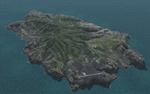
This project is a port of my FSX release of the the new airport (FHSH) on St. Helena Island. This scenery provides more accurate coastlines and roads, as well as corrected landclass based on the latest available satellite imagery. Flight plans are provided for the proposed commercial service to St. Helena, and some additional GA and military flights to the island are added as well.
The FS2004 St. Helena (FHSH) airport was created by aligning master plans for the airport with current satellite data and by studying many of the pictures that have been posted as the airport has taken shape. The official opening of the real airport on May 21, 2016, has been pushed back for more field tests due to challenging crosswinds. Updates were created or rebuilt in a manner which carefully aligns airport data with current satellite imagery. Scenery was created using Airport Design Editor 9 v1.67.5684 and SBuilder. Scenery objects were added and modified from stock FS9 scenery to resemble as closely as possible the actual airports.
| Filename: | FHSH__St_Helena_Island__Airport__St_Helena_South_A.zip |
| License: | Freeware |
| Added: | 5th May 2016, 07:44:38 |
| Downloads: | 2,230 |
| Author: | Carlyle Sharpe |
| Size: | 1.62 MB |
| Category: Flight Simulator X - Miscellaneous Files | |
| 737NG Normal Procedures Non-APU version |
|
Images related to this file:
File Description:
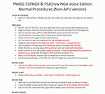
After some input and ideas from a fellow FS2Crew pilot here is a non-APU version of my flow and checklist to even closer mimic real world OPs the way many big airlines operate in real life every day at big airports around the world where the use of APU is limited to only a short period of time a couple of minutes before engine start. I also (don't I always ;-)) did some other changes and what I think improvements since my last version so give it a try and see what you think! About fitting the list on 2 A4 pages when printing it from WordPad please set all your margins to 25 mm in WordPad and uncheck the option to print the page numbers. This time I will not ask the AVSIM Library Managers to replace my old version with this one since some of you might still want the version where the APU is used depending on what kind of flights you do and to what kind of airports. Instead this will be uploaded as a new and separate version.
A flow/checklist for flying PMDG's 737NGX with FS2Crew Voice Edition. Did this mainly for my own use meaning the flow/checklist is adjusted for how I do my flying and with the addons I use like Aerosoft AES for example. Please also be aware this is not the kind of flow/checklist that includes all things you need to perform during a normal flight but instead you are expected to already have a general knowledge of both the NGX and FS2Crew. However I thought others might be helped by this too both newbies to get you going with the "flow" using FS2Crew but also for the more experienced users as a simple to print out and use memory note. It's also easy for you to change whatever you like to suit your own needs better since I created it in common rtf format using the standard Wordpad Windows application. I deliberately made it as compressed as possible leaving out stuff like all the answers to the checklists etc so it would fit on a single A4 sheet being easy to print and maybe also laminate if you like. Hope you'll enjoy it!
| Filename: | 737NG_Normal_Procedures_NonAPU_version.zip |
| License: | Freeware |
| Added: | 22nd June 2012, 03:34:37 |
| Downloads: | 1,085 |
| Author: | Richard Asberg (with input from Peter Wolf) |
| Size: | 6.36 KB |
| Category: Flight Simulator 2004 - Scenery | |
| Nome PAOM on the northwestern coast of Alaska |
|
Images related to this file:
File Description:
There are four main northwestern Alaska towns which have good airports and are serviced by Alaska Airlines. From these airports local flights connect to nearby villages, "nearby" in Alaska meaning up to 200 miles away. The northernmost is Barrow. Southwest of Barrow is Kotzebue, then Nome, and the furthest south is Bethel. The town of Nome is south of the Bering Strait on the southern coast of the Seward Peninsula, around 185 miles south of Kotzebue, with a population of about 3,800. It is the town that led to the creation of the most famous dogsledge race in the world, the Iditarod, which is based on the delivery to Nome of diphtheria serum during the blizzard conditions of the winter of 1925. The Nome airport (it currently has no other name) was originally built as the last of the refuelling airfields for planes being ferried to Russia during WW2. It has two runways, aligned 09-27 and 02-20 in FS9 (the wandering magnetic north has recently renamed the magnetic headings) and both of them around 6,000 feet with an ILS on 27. There is a modern airport layout diagram included showing taxiway names etc. Alaska Airlines, ERA, and Bering Air (which is headquartered in Nome), along with the shared cargo terminal for Northern Air Cargo and Everts Air, are all on the southern apron. The northern apron is mainly for GA, along with maintenance facilities, a garage building that also houses a weather bureau, and at the far northern end of runway 02-20 an apron and hanger for the Alaska Air National Guard. All AI aircraft in FS9 much prefer to use a runway that has an ILS and so will continue to use 09-27 even if the wind is from the north or south, right up until it reaches 30+ knots, so for AI realism in FS9 a permanent wind from the west would be the most realistic on a daily basis. There is also a small gravel strip just north of the town and this is included (94Z), as are some old line-of-sight radio communication reflectors on the hills above the town. There is a note about making adjustments to Ultimate Terrain Alaska-Canada regarding both realistic road lighting and also auto-generation.
| Filename: | Nome_PAOM_on_the_northwestern_coast_of_Alaska.zip |
| License: | Freeware, limited distribution |
| Added: | 18th October 2016, 02:38:42 |
| Downloads: | 487 |
| Author: | Roger Wensley |
| Size: | 22.65 MB |
| Category: Flight Simulator 2004 - Scenery | |
| Kotzebue PAOT on the northwestern coast of Alaska |
|
Images related to this file:
File Description:
There are four main northwestern Alaska towns which have good airports and are serviced by Alaska Airlines. From these airports local flights connect to nearby villages, "nearby" in Alaska meaning up to 150 miles away. The northernmost is Barrow. Southwest of Barrow is Kotzebue, then Nome, and the furthest south is Bethel. The town of Kotzbue is north of the Bering Strait on the northwestern coast, 320 miles southwest of Barrow. The population is just over 3,000 people. The location was for a long time a base for trading in furs, with three rivers emptying into the sea and providing routes into the interior land and villages; a meeting place between hunters and traders from Russia and elsewhere. The Kotzebue airport is called the Ralph Wien Memorial and has two runways. The modern one is aligned 08-26 and is 5,880 feet of 150 feet wide asphalt built across a shallow lagoon, with an ILS on 08 and PAPI on both ends. The second and older runway is originally military and gravel, aligned 17-35 and 3,786 feet long and used (wind allowing) by the GA planes that park alongside the runway. The prevalent wind is from the west; when the wind is from the east it is generally relatively feeble and with a much lower cloud base, possibly to the ground, hence the need for an ILS. All AI aircraft in FS9 much prefer to use a runway that has an ILS and so will continue to use 08-26 even if the wind is from the south until it reaches 30+ knots, even if they are a Cessna 150 flying VFR. So for AI realism in FS9 a northern or southern wind needs to be a strong one so that the runway is actually used. However, as Alaska Airlines, Northern Air Cargo, and Everts Air also fly to Kotzebue and can only use the east-west runway (as less than 4,000 feet of asphalt would be seriously inconvenient for a Boing 737 or DC6) it is necessary to have the northern or southern wind UNDER 30 knots at the times when they are landing or taking off. Your choice. I suppose a permanent strong wind from the west would be the most realistic on a daily basis, deterring all planes from ever using 17-35. The AI will develop along with further scenery additions in the neighbourhood.
| Filename: | Kotzebue_PAOT_on_the_northwestern_coast_of_Alaska.zip |
| License: | Freeware, limited distribution |
| Added: | 2nd August 2016, 16:47:52 |
| Downloads: | 461 |
| Author: | Roger Wensley |
| Size: | 19.32 MB |


© 2001-2026 AVSIM Online
All Rights Reserved
Privacy Policy |