
Where Flight Simulation Enthusiasts Gather from Around the World!
AVSIM Library - Search Results

| Category: Flight Simulator X - AFCAD Files | |
| UKOO - Odesa Intl. Odesa, Ukraine |

|
File Description:
Odesa International Airport(IATA: ODS, ICAO: UKOO) is an airport located 7 km (4.3 mi) southwest from the centre of Odesa, Ukraine.
It serves both domestic and international flights. Airport's runways either were or are co-used by the Ukrainian Air Force.
The airport was built in 1961. In 2009, the airport served 651,000 passengers.
The area of Odessa International airport is 570 hectares. The airport concerns to group of the largest airports of Ukraine and connects Odesa by airlines with many cities of Ukraine and CIS, Western Europe, Asia and Africa.
Technical service of airport is based on 2800 square meters area and represented by 4 parking places to provide technical service to 4 planes simultaneously. European standards classify the airport as "class 1".
In May 2007, the airport started construction work that includes extending the main runway. The airport has ILS CAT I status.
The airport charts can be found here.
This file has the right coordenates, with the apron and characteristics of the airport and buildings.
| Filename: | UKOO__Odesa_Intl_Odesa_Ukraine.zip |
| License: | Freeware |
| Added: | 19th October 2012, 23:37:31 |
| Downloads: | 3,035 |
| Author: | Anwar Gonzalez |
| Size: | 484.36 KB |
| Category: Flight Simulator 2004 - AFCAD Files | |
| LPPT by PPP, and EDDH |
|
File Description:
AFCAD2 File for :
Lisbon, Portela Intl Airport, Portugal ( LPPT )
for PPP Scenery of Portugals's LPPT, LPPR and LPFR airports.
Although Runway 17/35 is rarely used, I have decided to open it for Take-off and landing .
Primarily 21 and secundary 35 ( Can't make 3 and 17 work, though I haven't tested it with wind.
Can be found on Avsim as ppp30.zip ( PPP version 3.0 )
All credits to the PPP team for LPPT/LPPR/LPFR sceneries, many many thanks .
( Not to bo used with the default scenery )
You may have to delete Airport.bgl in the scenery file of PPP, otherwise this Afcad file will not work .
For that reason also back-up Afcad files for PPP's LPPR and LPFR included.
Also included Hamburg, Fuhlsbuttel airport, Germany ( EDDH ) for Jan Martin's
jtacof_4.zip ( Jetways & Terminals For ACOF Package Four ) ( can also be used with default scenery )
Primarily Runway 15 and secundary 05 ( again I am not sure if 33 and 23 work , haven't tested
it with wind .
Tested them in my own FS2004, and it works well .
Have fun!
| Filename: | LPPT_by_PPP_and_EDDH.zip |
| License: | Freeware |
| Added: | 10th October 2004, 03:42:57 |
| Downloads: | 1,639 |
| Author: | Silvester van Wijk |
| Size: | 26.7 KB |
| Category: Flight Simulator 2004 - Scenery | |
| The Greater Toronto Area Part 1 |
|
File Description:
Part 1 of Flight Ontario's scenery for the Greater Toronto Area and Southern Ontario.
Over a year in the making, this scenery for Fs 2002 and Fs 2004 is bounded by Detroit in the west, Kingston in the east, Huntsville in the north and Buffalo in the south and features:
* all-season scenery
* custom water textures
* completely modelled Toronto Airports...CYTZ (Toronto Island) and CYZD
(Downsview-home to Bombardier Aerospace and the Canadair Regional Jet
and Dash-8, and the Toronto Aerospace Museum)
* custom autogen for the GTA
* Custom landclass for southern Ontario
* custom shorelines (western Lake Ontario, Kingston area, Lake
Couchiching...Severn River...Sparrow Lake area, and the Muskoka Lake
area)
* prominent features around Hamilton include the Burlington Skyway and
Lift Bridge and steel mills
* the Welland Canal is featured with lift bridges, bascule bridge and
fixed link bridge from Pt Weller to Pt Colborne
* the Niagara area includes the Minolta Tower, and 3 hydro generating
plants with reservoirs
* compatibility with SimFlyers CYYZ
This scenery is downloadable in two parts and both parts are essential
| Filename: | The_Greater_Toronto_Area__Part_1.zip |
| License: | Freeware |
| Added: | 9th April 2004, 12:40:02 |
| Downloads: | 37,177 |
| Author: | Flight Ontario |
| Size: | 62.09 MB |
| Category: Flight Simulator X - Original Aircraft | |
| Project Airbus A319 FD-FMC 2.0 |
|
Images related to this file:
File Description:

Project Airbus A319 FD-FMC 2.0 is the new version of the FD-FMC project for FSX / P3D. It comes with a new ehanced virtual cockpit (3 set of HD textures), new FMC gauge fully fonctionnal in virtual cockpit (and 2D window). A 550 airport database is provided in the pack with all SID, STAR and approaches procedures (updated monthly) and Waypoints update for FSX. Vertical navigation management with all real Airbus flight mode. TCAS and TAWS on ND. Cold and dark status. Holding pattern, DME-ARC and teardrop turns management. original sound set provided. This FMC is not only a GPS like, It controls engines and aircraft to a real vertical navigation to a realistic flight experience. New folder organisation to optimize file space, with other aircraft of the family (A318 - A320 and A321). It comes with CFM and IAE engine version.
Aircraft 3D model edited to a right flightdeck position. CFM and IAE engine version. New airports added and navaids updated monthly on the freenavdbgroup website. User and install manuals provided in French and English. Have a good flight.
| Filename: | Project_Airbus_A319_FDFMC_20.zip |
| License: | Freeware, limited distribution |
| Added: | 2nd November 2019, 19:04:10 |
| Downloads: | 2,785 |
| Author: | Project Airbus / Francois Dore / Bjoern Kesten |
| Size: | 385.84 MB |
| Category: Prepar3D V1-4 - Scenery | |
| LRTR Traian Vuia P3D v4 |
|
Images related to this file:
File Description:
Timisoara RO LRTR V-4 (Released October 2017) for P3D v4- This scenery is an update of the stock Airport (ICAO code: LRTR).
What to expect? The entire airport has been updated with correct RWY, taxiways, aprons, COMM's (ATIS, GND, TWR), markings, parkings, roads, some buildings, lights and vegetation. All objects are from stock ADE! Entire work and object placing has been done using a photo overlay image from Google Earth, yet don't expect a photoreal scenery. The used background image has been removed due to Google's copyright policy. Due to using stock objects from library, don't expect perfect shape and colors of objects. I tried to customize the objects so that they look like the real ones. Basic shape and colors should match the real word buildings. NOTE: Some 3rd party addon's might change ground textures or building textures. I have also generated some own ground textures to match those of the airports. Unfortunately there is a problem with those textures not casting shadows. If you still want to see the shadows, you will have to turn on "Buildings" receieve shadows.
| Filename: | LRTR_Traian_Vuia_P3D_v4.zip |
| License: | Freeware |
| Added: | 8th October 2017, 01:15:58 |
| Downloads: | 902 |
| Author: | Gerald Krutsch |
| Size: | 1.07 MB |
| Category: Flight Simulator 2004 - Scenery | |
| Sioux Lookout CYXL in northwest Ontario Canada |
|
File Description:
Sioux Lookout is a small town of some 5,000 folks in northwest Ontario, towards the Manitoba border, and a regional centre for surrounding villages. The airfield is some two miles east of the town. It originally had two runways but the smaller was abandoned recently as part of a planned long term improvement of the field, leaving just 34/16 with its 5,300 feeet of asphalt. Both Wasaya and Bearskin fly to Sioux Lookout; on the field there are two maintenance companies, Eagle and Allen, and hangers for the Ministry of Health, Bearskin Airlines, Wasaya, and the Nishnawbe Aski Police Service (NAPS). I think there is now another company too, but I have no information on them so I pretended this was two years ago. As well as the airfield scenery there is also a landclass file an "AFCAD" file for your AI aircraft. You should also download and install Northwest Ontario Airports by Eric O'Link, and preferably also have Ultimate Terrain; I have not tested this without UT and there is a small lake nearby.
| Filename: | Sioux_Lookout_CYXL_in_northwest_Ontario_Canada.zip |
| License: | Freeware |
| Added: | 26th November 2008, 13:08:04 |
| Downloads: | 853 |
| Author: | Roger Wensley |
| Size: | 2.66 MB |
| Category: Prepar3D V1-4 - Aircraft Repaints, Textures and Modifications | |
| VASP 1998 AI Package |
|
File Description:
VASP was the 2nd largest airline in Brazil, but was scaling down by 1998. VASP still had a great international network stretching to ATH/KIX/ICN/LAX/YYZ/JFK/BCN/ZRH ect. A fleet of 10 MD-11s did all the long haul flying, as well as plenty of domestic flights. 3 A300s and a large 737-200/300 fleet served the domestic routes. While VARIG was based in GIG, VASP was based in GRU and the planes tend to hang out there. There was only 1 special livery, which was a named MD-11, so not much variation unlike VARIG. VASP did serve SDU and CGH with mainline equipment, however, so these plans will help populate those airports. Included are repaints by Raphael Rodrigues for the FAIB 737-200, 737-300, FSPX MD-11, and TFS A300B4. Flightplans by Chasen Richardson. Part of the 1998 Flight Simulator Project. Follow us on Facebook at facebook.com/flightsim98 and on instagram as @bayviationsim. For more Retro AI, check out the forums at: http://retroai.proboards.com/
| Filename: | VASP_1998_AI_Package.zip |
| License: | Freeware, limited distribution |
| Added: | 29th October 2019, 07:18:35 |
| Downloads: | 304 |
| Author: | Raphael Rodrigues, Chasen Richardson/Bayviation |
| Size: | 4.51 MB |
| Category: Flight Simulator X - Original Aircraft | |
| Project Airbus A321 FD-FMC 2.0 |
|
Images related to this file:
File Description:
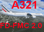
Project Airbus A321 FD-FMC 2.0 is the new version of the FD-FMC project for FSX / P3D. It comes with a new ehanced virtual cockpit (3 set of HD textures), new FMC gauge fully fonctionnal in virtual cockpit (and 2D window). A 550 airport database is provided in the pack with all SID, STAR and approaches procedures (updated monthly) and Waypoints update for FSX. Vertical navigation management with all real Airbus flight mode. TCAS and TAWS on ND. Cold and dark status. Holding pattern, DME-ARC and teardrop turns management. original sound set provided. This FMC is not only a GPS like, It controls engines and aircraft to a real vertical navigation to a realistic flight experience. New folder organisation to optimize file space, with other aircraft of the family (A318 - A319 and A320).
Aircraft 3D model edited to a right flightdeck position. CFM and IAE engine version. New airports added and navaids updated monthly on the freenavdbgroup website. User and install manuals provided in French and English. Have a good flight.
| Filename: | Project_Airbus_A321_FDFMC_20.zip |
| License: | Freeware, limited distribution |
| Added: | 2nd November 2019, 19:06:41 |
| Downloads: | 4,102 |
| Author: | Project Airbus / Francois Dore / Bjoern Kesten |
| Size: | 384.23 MB |
| Category: Miscellaneous Files - Demos from Commercial Vendors | |
| Punta Cana 2006 |
|
File Description:
Punta Cana, one of the world's favorite airport its unique design make this airport one of the few, as some say, one of the most "beautiful" airports in the world. Arriving at Punta Cana Airport is arriving in paradise, and the airport is a great example of what Punta Cana is.
Punta Cana for many years has consolidated its place for one of the caribbean´s top destination from Europe and North America, receiving hundreds of flights a week, making it one of the most busiest touristsm airport in the Caribbean Basin.
This scenery package contains:
Punta Cana International Airport, with all of its buildings, carefully detailed as accurate as possible made with photo realistic pictures.
All passenger Stairs and Catering trucks fully animated by NAV frequency setting -Marshaller in every parking position.
Numerous static objects, service trucks, cars, airport staff, etc.
Static aircraft
Ready for use with ProjectAI©, MyTraffic© or UltimateTraffic©.
Users Manual
All major resorts, Bavaro and Punta Cana, including 2 helipads.
Landclass of the entire Higuey (Punta Cana) Area.
And much more!!
| Filename: | Punta_Cana_2006.zip |
| License: | Freeware |
| Added: | 12th February 2006, 23:57:31 |
| Downloads: | 11,095 |
| Author: | Dominican Aerodromes |
| Size: | 6.34 MB |
| Category: Flight Simulator 2004 - Scenery | |
| Tel Aviv Lod Airport Scenery 1961 |
|
File Description:
Lod Airport, now called Ben Gurion International Airport started out in 1936 as Lydda Airport, an airstrip of four concrete runways on the outskirts of the Arab town of Lydda. By the mid-1960s, 14 international airlines were landing at Lod Airport.
I have backdated Lod airport back to 1961, when it was much smaller than today. Lod was and is Tel Aviv's major airport, used for all airline flights in 1961, and most international flights today. I have used GMAX to create the terminal and many of the hangars and other buildings at the airport, and have also used many library objects to increase the detail around the airport. Landclass files are included to reduce the city area back to their sizes in the 1960's. I have also backdated 4 other airports: Eilath (LLET), Sde Dov (LLSD), Mahanaim (LLIB), and Beer Sheeba (Teyman LLBS). These use library objects to increase the airport detail as well. These cities constituted the entire route network of Arkia, the local airline of Israel, in 1961.
| Filename: | Tel_Aviv_Lod_Airport_Scenery_1961.zip |
| License: | Freeware, limited distribution |
| Added: | 30th October 2008, 20:30:22 |
| Downloads: | 2,847 |
| Author: | Mike Stevens |
| Size: | 699.82 KB |


© 2001-2026 AVSIM Online
All Rights Reserved
Privacy Policy |