
Where Flight Simulation Enthusiasts Gather from Around the World!
AVSIM Library - Search Results

| Category: Flight Simulator 2004 - AI Aircraft | |
| Executive Airbus A320 Package - Flightplans Included Version 2 |

|
File Description:
***This is an update to my original upload (evolveai_executive_a320s.zip). It was brought to my attention that the aircraft.cfg entry for the IAE model was incorrect. This upload contains the correct entry so if you installed the original you'll want to replace your IAE entry with the on in this packge. If you've not downloaded the original package this one will function as a stand-alone version. Installation insructions are provided in the readme. Thanks to Andrew Langille for pointing this out.***
This package contains repaints and flight plans for the two known Airbus A320 aircraft in executive service. The flight plans are based on photo locations as well as a great deal of internet research. These aircraft visit 16 airports in Europe and the Middle East as well as North America and Asia. This package contains textures only so you’ll need both the Evolve AI A320 CFM and IAE base packages installed on your system.
| Filename: | Executive_Airbus_A320_Package__Flightplans_Included_Version_2.zip |
| License: | Freeware, limited distribution |
| Added: | 1st July 2006, 13:44:03 |
| Downloads: | 1,429 |
| Author: | Kelly Freeman / Evolve AI |
| Size: | 502.98 KB |
| Category: Flight Simulator X - Scenery | |
| YPTN RAAF Tindal, Australia |
|
File Description:
Ants Aussie Airports Vol 5 : RAAF Tindal is a military base about 290kms south east of Darwin near the town of Katherine in Australia's Northern Territory. Tindal is a major front-line operational air base and home to No. 75 Squadron Air Combat Group (F/A-18). There is also a civilian apron in the north west corner of the airfield. This scenery contains photoreal ground textures and these are designed to blend in with the payware FTX textures (available from www.fullterrain.com). It is therefore recommended that you have the FTX textures installed if you wish to see this airfield at its best. I have tried to make this airfield as accurate as possible although as Tindal is a military base there aren't a lot of photos available so a lot of the hangars are "educated guesses". Almost all of the models have been custom made with the use of library objects kept to the minimum.
| Filename: | YPTN_RAAF_Tindal_Australia.zip |
| License: | Freeware, limited distribution |
| Added: | 6th January 2009, 13:49:54 |
| Downloads: | 3,636 |
| Author: | Anthony Lynch |
| Size: | 30.62 MB |
| Category: Flight Simulator X - Scenery | |
| Lost River ASU Observatories |
|
Images related to this file:
File Description:
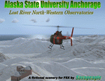
This is a fictitous scenery of the Alaska State University operated North-Western observatories.
It is located near LSR_Lost River and AK45_Lost River_2 on the Western coast of Alaska.
LSR, AK45 and KPC_Port Clarence have been upgraded with hangers and various objects.
LSR, AK45 and the (2) mountain top observatories have been upgraded with helipads along with various ground vehicles including snocats, aircraft, misc buildings and hangers. The main observatory complex has a main rooftop pad and a heli-tower. These helipads were designed for heli practice. some are on the ground and others are a bit more challenging.
There is a map included which shows the locations of the observatory complexes in relation to the airports. There is also a small research facility located to the east which is indicated on the map. This fictional scenery was design with default FSX 3D objects and (1) addon library, fa_ez-arctic_set by Finney Air, Robert Finnegan.
| Filename: | Lost_River_ASU_Observatories.zip |
| License: | Freeware |
| Added: | 11th November 2009, 19:11:39 |
| Downloads: | 557 |
| Author: | Tim Durham |
| Size: | 3.41 MB |
| Category: Flight Simulator 2004 - Scenery | |
| Denali Park Research Base |
|
Images related to this file:
File Description:
A fictitious research base located 16 nautical miles west of Denali airport (AK06). It is owned and operated by NWS and used by several agencies including park service, various concessionaires, Fish and Game, Law enforcement and Medical/search and rescue agencies.
It has a runway only marked by barrels emitting heavy smoke along with crew barracks, main base building w/comm center, covered parking for snowcats and cargo/supplies. there are other buildings and a very large communications tower on the south side of the runway which parallels the river. It has an NDB of 351.2 (ADF).
Get hired to bring in cargo from Denali and other nearby airports. Made with Instant Scenery and various object libraries.
Best approach is from the north and the smoking barrels only mark a short section of the available landing area. Read the txt file for more info and have a great fly to the research base. By savageagle.
| Filename: | Denali_Park_Research_Base.zip |
| License: | Freeware |
| Added: | 1st February 2010, 09:35:25 |
| Downloads: | 279 |
| Author: | Tim Durham |
| Size: | 3.46 MB |
| Category: Flight Simulator 2004 - Scenery | |
| Skysoft Simulation - ZUJZ_2011 |
|
Images related to this file:
File Description:
Jiuzhai Huanglong Airport (ICAO: ZUJZ, IATA: JZH) situated at the famous tourist
spot Jiuzhaigou in Sichuan Province, China, where is the home of pandas. With an
elevation of 3448m, it is one of the highest airports in China as well as in the world.
While enjoying the breathtaking landscape around you, you should always be cautious
about the severe turbulence and intense crosswind whenever departure or arriving the
airport. The airport was constructed in the year 2003 with a runway length 3400 meters
(11 056 ft.) and width 60 meters (147 ft.).
In the year 2007, the airport has been expanded. The runway was extended by 200
meters (650 ft.) and 7 parking gates were added. Now the airport is capable for
medium jets to takeoff and landing. Certification needed in both airplanes as well as the
crews before executing takeoff or landing on the airport. It is expected that in the year
2015, the average number of flights everyday could increased to about 100.
| Filename: | Skysoft_Simulation__ZUJZ_2011.zip |
| License: | Freeware, limited distribution |
| Added: | 1st April 2011, 15:36:44 |
| Downloads: | 2,909 |
| Author: | Skysoft Simulation DevelopTeam |
| Size: | 24.48 MB |
| Category: Flight Simulator 2004 - Aircraft Repaints, Textures and Modifications | |
| US Airways NC Airbus A321-231 (N508AY) |
|
Images related to this file:
File Description:
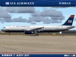
I am very proud to present this Project Airbus (pa321) Airbus A321-231 in the US Airways NC livery. This was the 2nd A321-231 acquired by US Airways and is 1 of 20 A321-231's in US Airways A321 fleet. It was delivered new to the airline in December of 2008 and bears registration N508AY. The A321 is the medium-haul workhorse for US Airways and flies into most major US airports serviced by US Airways including; KCLT, KPHX, KLAX, KSFO, KORD, KMCO, KSAN among others. The A321's service Caribbean destinations for US Airways as well. This is a detailed repaint with custom textures. The repainted textures in this package are 32-bit with no mipmaps for best clarity and quality. This is a complete install. The Project Airbus A321-231 model and air files are included. Uses default 737-400 panel and sounds. Please see Readme.txt for more details.
| Filename: | US_Airways_NC_Airbus_A321231_N508AY.zip |
| License: | Freeware, limited distribution |
| Added: | 27th May 2011, 03:55:28 |
| Downloads: | 1,078 |
| Author: | Jeffrey S. Bryner, Project Airbus |
| Size: | 9.38 MB |
| Category: Flight Simulator 2004 - Gauges | |
| RwyInfo 2 Data Update Version 2 |
|
File Description:
The purpose of this download is to allow you to update the data used by Ernie Alston's Runway Info gauge (RwyInfo version 2.0, available from http://www.fsbuild.com/rwyinfo/). This is an excellent little gauge that allows you to retrieve, through a gauge on your panel, information for all the runways at an airport (selected by ICAO code), and optionally automatically load frequency and course for an ILS into your NAV1 radio and MCP. However the usefulness of the gauge is somewhat restricted by the fact that it comes with a text database of 'info' to be displayed, and does not include any method for updating this info. This is Version 2 of this utility - the first version was uploaded a couple of weeks ago. The first version is not required to use this version. This version fixes some problems with the display of new airports and runs much faster than the original version.
| Filename: | RwyInfo_2_Data_Update_Version_2.zip |
| License: | Freeware |
| Added: | 17th November 2011, 07:55:54 |
| Downloads: | 728 |
| Author: | Ken Leedham |
| Size: | 5.73 KB |
| Category: Flight Simulator X - AFCAD Files | |
| MHLM - Ramon Villeda Morales International Airport (La Mesa) / San Pedro Sula, Honduras |
|
Images related to this file:
File Description:
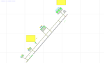
This airport update was made with the latest version of ADE (Airport Design Editor) and made for FSX as a replacement for the stock (default) airport. I found that most stock airports in FSX lack a decent amount of character and realism and I've tried to fix that a little bit. This airport in particular had no commercial aircraft parking at all. I've added plenty of parking for GA aircraft as well as some hangars around the GA aprons. I've redone the main terminal to match the shape of the current terminal complete with the 3 jetways the airport terminal has. There's parking for regional aircraft and GA on the main apron as well. Small touches like vehicles in the parking lot and service vehicles and crates on the apron and birds in the vicinity of the airport add a little bit more depth to what was a rather bland stock airport. Happy landings in Honduras!
| Filename: | MHLM__Ramon_Villeda_Morales_International_Airport_.zip |
| License: | Freeware |
| Added: | 11th July 2012, 06:15:18 |
| Downloads: | 489 |
| Author: | Jaison Diaz |
| Size: | 7.82 KB |
| Category: Navigation and ATC - Navigation | |
| ChartMap 5.0 |
|
File Description:
ChartMap 5.0 is a small stand-alone Windows utility for Flight Simulators allowing a number of airport charts to be stored and available on screen whilst still flying.
The use of the program is very simple and intuitive. You insert only the Airport ICAO Code and the program will show all the data stored.
The ChartMap 5.0 is a program completely rebuilding with a new graphics power and a new database.
Now is possible to use the PDF format for every kind of charts. You can everywhere download it.
The important thing is to use the conventional letter below in this tutorial (vds IMPORTANT NOTE).
Differences with the previous version:
- Corrected some bugs.
IMPORTANT NOTE:
TO USE THIS PROGRAM YOU NEED DOWNLOAD the charts from Flight Simulator website FOR Italian airport download "Italian Airports Charts and Procedures Series 1, 2 and 3" and unzip in ICAO CODE FOLDER.
| Filename: | ChartMap_50.zip |
| License: | Freeware |
| Added: | 24th November 2013, 16:07:51 |
| Downloads: | 331 |
| Author: | Carlo Chiappisi |
| Size: | 1.51 MB |
| Category: Flight Simulator X - Aircraft Repaints, Textures and Modifications | |
| Ryanair Boeing 737 MEGA Pack (EI-EXE / EI-DCL) |
|
Images related to this file:
File Description:

Ryanair is an Irish low cost airline. Its headquarters is located in Swords, County Dublin, Ireland, with its primary operational bases at Dublin Airport and London Stansted Airports.
Ryanair livery painted on PMDG Boeing 737 NGX WL model. The textures are saved in DDS format for quality graphics. Textures are also characterized by HD (High Definition). Its features are idle-reverser animation, animated pack vents and pressurisation outflow valve, detailed textures, accurate paint, dynamic shine & effects, dynamic flexing wings that respond to turbulence, fully independent suspension, trim animation, gear steering, accurate flight dynamics, spoiler animation, reflective cockpit windows, improved wingflex code with input from several new parameters including ground spoilers, fuel load, and angle of attack, transparent navigation light lenses and many more. "HD EXPERIENCE" INSIDE. Credits to PMDG Simulations.
Visit our Facebook page "Sky Level Textures" for news, updates and previews on my future repaint projects. Thanks for downloading & Happy flying.
| Filename: | Ryanair_Boeing_737_MEGA_Pack_EIEXE__EIDCL.zip |
| License: | Freeware |
| Added: | 20th May 2014, 22:50:56 |
| Downloads: | 6,862 |
| Author: | Giacomo Tomasini | Sky Level Textures | PMDG Simulations |
| Size: | 75 MB |


© 2001-2026 AVSIM Online
All Rights Reserved
Privacy Policy |