
Where Flight Simulation Enthusiasts Gather from Around the World!
AVSIM Library - Search Results

| Category: Flight Simulator 2002 - AFCAD Files | |
| Canadian Airfields Around CYWG (Winnipeg Intl) |

|
File Description:
AFCAD files for Canadian airfields around CYWG (Winnipeg Intl)
Nice to populate your AI traffic with Beavers and Otters.
Requires AFCAD by Lee Swordy. If you have AFCAD's newer versions you can just drop in the AFCAD installer screen and you are done. Enjoy!
CYWG (Winnipeg Intl)
CJV7 (Summer Beaver)
CNE4 (Iroquois Falls)
CPV7 (Poplar Hill)
CYBR (Brandon Muni)
CYER (Ft Severn)
CYPG (Southport)
CYPM (Pikangikum)
CYPO (Peawanuck)
CYRL (Red Lake).
| Filename: | Canadian_Airfields_Around_CYWG_Winnipeg_Intl.zip |
| License: | Freeware |
| Added: | 24th December 2002, 21:26:46 |
| Downloads: | 879 |
| Author: | Alex Feldstein |
| Size: | 14.43 KB |
| Category: Flight Simulator 2002 - Panels | |
| Boeing 737-400 |
|
File Description:
Photorealistic panel of a Boeing 737.400, using default gauges and some others from different smart authors. All gauges on the same screen, to use with default fs2002 B737, so that virtual cockpit works. When used with a FS 2000 aircraft, no view available. Request Concorde Gauges available at AVSIM.COM or to be pasted from your past century old fs2000. Tested with fs2002 pro, 1024 res., should be framerate friendly. New throttle, flaps, spoilers and trim handles.Included tutorial for radio-nav management on this panel (FAQ).
| Filename: | Boeing_737400.zip |
| License: | Freeware |
| Added: | 26th June 2002, 05:26:06 |
| Downloads: | 2,571 |
| Author: | Christophe Jeanne |
| Size: | 1.11 MB |
| Category: Flight Simulator 2004 - Gauges | |
| Kill Drift Gauge |
|
File Description:
FS2004 KillDrift Gauge v1. The video screen on this gauge graphically displays the effect of wind on the track of an aircraft. This allows the pilot to eliminate drift error. Wind speed and wind direction are also shown. Two separate course headings can be stored into this gauge. Included is an icon gauge for installing KillDrift into separate window. It can also be installed on a panel. The gauge can be helpful for hovering/landing helicopters because of its 360-degree display capability. By Glenn Copeland
| Filename: | Kill_Drift_Gauge.zip |
| License: | Freeware |
| Added: | 2nd November 2005, 14:07:34 |
| Downloads: | 1,594 |
| Author: | Glenn Copeland |
| Size: | 826.54 KB |
| Category: Flight Simulator 2004 - Scenery | |
| Aurangabad Domestic Airport [VAAU] |
|
Images related to this file:
File Description:
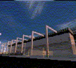
Aurangabad Airport is about 135nm East of Mumbai. Recently a New Apron has been added to the airport which has also been amended in the scenery. One of the runways i.e. Rwy 27 has ILS CAT II, Vor, Ndb - every basic requirement is available.Quick Short Flights to Mumbai is what one might enjoy . The other reason to fly in-out of this airport. ...well ... these screen shots might ....just...help you decide. 2 tiny mini terminal buildings and landscape gives a good frame rate.
| Filename: | Aurangabad_Domestic_Airport_VAAU.zip |
| License: | Freeware |
| Added: | 12th August 2010, 00:38:05 |
| Downloads: | 1,052 |
| Author: | Ashish Singh |
| Size: | 19.88 MB |
| Category: Civil Flight Simulators - Looking Glass Flight Unlimited 3 | |
| Outer Terrain GTL Grid Structure Map v2.0 |
|
Images related to this file:
File Description:
This version of my GTL grid structure map includes Andre's new outer terrain area north of Seattle and adds a search facility, which enables you to search for a tile using FU3 world co-ordinates. To find out the world co-ordinates of any OT area simply open Fled, set the top-down view to the latitude/longitude of the area you're interested in and click the latitude/longitude figures that appear in the bottom left hand corner of the screen. The latitude/longitude figures will disappear and be replaced by FU3 world co-ordinates as easting and northing values. Enter these values into my FU3 GTL Map, click the button and the spreadsheet will map these co-ordinates to the correct tile and return the tile name. If you don't know the latitude/longitude of the area you're interested in then you can always obtain this from within the game itself. Just start a flight in the area you're interested in and press Ctrl-z at any time to enter Zoar mode. This will pause the game and display the current latitude/longitude in the top left hand corner of the screen.
| Filename: | Outer_Terrain_GTL_Grid_Structure_Map_v20.zip |
| License: | Freeware |
| Added: | 29th December 2009, 23:16:52 |
| Downloads: | 35 |
| Author: | Jonathan Stonehouse |
| Size: | 198.97 KB |
| Category: Flight Simulator X - Gauges | |
| Advanced Radar System 4 (ARS4) |
|
Images related to this file:
File Description:
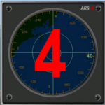
This gauge has been developed for FSX Flight Simulator SP1 or SP2. It
has also been tested with Microsoft Acceleration also, but compatibility is not guaranteed by the author.
This new Advanced Radar System (ARS 4) includes significant new features,
functions and displays for FSX AI traffic. The new key features are:
1)AI traffic display for air targets and boat/ship targets.
2)Auto landing on carrier if the carrier is part of the scenery MECOPS.
3)Allows switching between air target display and boat target display.
4) Provides for air and boat display to optionally insert airport and/or basic terrain display on the screen.
5)Different screen presentations for air and boat targets.
6)Simplified installation procedure.
7)The A2A re-fuel function remains the same as in the ARS2 version.
8)The auto tracking function remains the same as well as in the ARS2 version.
All displays for air, or boat/ship traffic, can be selected in a range of 5, 10, 20, and 40 miles.
For installation and additional information look at the ARS4 documentation inside the zip file. For copyrights and credits please look at the documentation for this gauge.
| Filename: | Advanced_Radar_System_4__ARS4.zip |
| License: | Freeware |
| Added: | 5th March 2013, 15:53:52 |
| Downloads: | 3,818 |
| Author: | Dietmar Loleit |
| Size: | 1.18 MB |
| Category: Flight Simulator X - Aircraft Repaints, Textures and Modifications | |
| TNTAIR Piper PA-23 Aztec F (VH-COO) |
|
Images related to this file:
File Description:

This repaint is for our friends down under and anyone that like to fly down under aircraft. I was asked to build a repaint based on a real world Red and White Aztec that was operating in AU once upon a time. We only have one photo and I guessed the rest of the story. I started with the outstanding red livery that comes with the Alabeo Aztec F model and made a few additions and changes. This involved making a logo for TNTAIR, a white Piper logo in script for the cowling and a little white AZTEC near the tail along with changing the registration to VH-COO. Let's see how it flies with the community. You must have the payware Alabeo PA23-250 Aztec F model for FSX/FSX:SE/P3Dv2-v3 to use this repaint.
| Filename: | TNTAIR_Piper_PA23_Aztec_F_VHCOO.zip |
| License: | Freeware |
| Added: | 26th February 2016, 10:14:56 |
| Downloads: | 477 |
| Author: | Ray Marshall |
| Size: | 22.55 MB |
| Category: Flight Simulator 2004 - Aircraft Repaints, Textures and Modifications | |
| Stena Line Boeing 717-200 |
|
File Description:
A Repaint of JCA's Boeing 717-200. Full aircraft Included in an easy installation package. Please visit us at www.geocities.com/stenavirtual.
| Filename: | Stena_Line_Boeing_717200.zip |
| License: | Freeware |
| Added: | 30th August 2005, 14:59:15 |
| Downloads: | 314 |
| Author: | Robbie Nelson |
| Size: | 6.49 MB |
| Category: Flight Simulator 2004 - Aircraft Repaints, Textures and Modifications | |
| TexAir Boeing 767-300 |
|
File Description:
The TexAir Virtual Airlines Boeing 767-300 by POSKY. Includes the full working North American model and the beautiful TexAir textures.
| Filename: | TexAir_Boeing_767300.zip |
| License: | Freeware |
| Added: | 10th January 2007, 05:45:06 |
| Downloads: | 298 |
| Author: | POSKY, Jeff Stewart |
| Size: | 19.18 MB |
| Category: Flight Simulator 2004 - AI Aircraft | |
| Manx2 Metroliner III |
|
File Description:
Textures only for the DJC AI (Craig Ritchie) Metroliner III. Manx2 in full colours. Reg: D-CSAL.
Base model required (djc_met.zip)
| Filename: | Manx2_Metroliner_III.zip |
| License: | Freeware |
| Added: | 22nd April 2007, 15:50:39 |
| Downloads: | 1,253 |
| Author: | Symon Long |
| Size: | 315.14 KB |


© 2001-2026 AVSIM Online
All Rights Reserved
Privacy Policy |