
Where Flight Simulation Enthusiasts Gather from Around the World!
AVSIM Library - Search Results

| Category: Prepar3D V1-4 - Aircraft Repaints, Textures and Modifications | |
| USAAF 3X-W "That's all, Brother!" Douglas C-47 (292847) |

|
Images related to this file:
File Description:
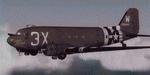
This folder contains a repaint for version 3.14 of the Douglas C-47 by Manfred Jahn and colleagues in the colors of C-47A 42-92847 3X-W "That's All, Brother!"of the 438th TCG, based in Greenham Common, England. It was the aircraft that was the lead plane with the parachute droppings on the night of D-Day, dropping men of 502nd PIR of the 101st Airborne Division arond 00:48. It then returned to Greenham Common and later that day pulled a glider to Normandy to reinforce the 82nd Airborne Division. Later it evacuated wounded from France, took part in Operation Market Garden, flew supplies to Bastogne, took part in Operation Varsity, before returning to the US in 1945. It passed through the hands of several private owners, is rumoured to have flwon for the CIA, and was restored as an AC-47 gunship by the Aero heritage Museum in 2004.. In 2008 it went to Basler for conversion to a turboprop BT-67, when somebody recognised the significance of this aircraft. A kickstarter campaign secured the purchase by the Commemorative Air Force, who are planning to restore her to her D-Day configuration. More details on this, including D-Day footage, can be seen here: http://ww2live.com/en/content/world-war-2-forgotten-d-day-bird-s-all-brother-will-be-restored-and-itll-fly-thanks. Repaint by Jan Kees Blom for Manfred Jahn's C-47 version 3, based on the paintkit by Gman5250.
| Filename: | USAAF_3XW_Thats_all_Brother_Douglas_C47_292847.zip |
| License: | Freeware |
| Added: | 9th September 2018, 03:44:19 |
| Downloads: | 620 |
| Author: | Jan Kees Blom |
| Size: | 9.85 MB |
| Category: Flight Simulator 2004 - Aircraft Repaints, Textures and Modifications | |
| VARIG Boeing 737-341 (PP-VOD) |
|
File Description:
VARIG B.737-341 PP-VOD C/N 24275-1637.
The model B.737-341 is the original series 300 builded by Boeing for VARIG(17 exemplaires builded).VARIG fleet had differents variant of the Boeing 737'(B.737-2C3Adv,B.737-241,B.737-2K9,B.737-2Q8,B.737-219,B.737-33A,B.737-36N,B.737-3K9,B.737-341,B.737-3Q8,B.737-4YO,etc)and the planes are the workhorse of the route systeme of the airline.The main technical center is located a Rio de Janeiro Antonio
Carlos Jobim(Galeao)with the most big hangar maintenance in South America.
I have included a serie of 90 Flights to the main national and international destinations,all served with 737 and the timetable and numbers flights are the rights one of this year 2004.
Destinations are revised and actualised like in the reality(Curitiba,Porto Alegre, Ponte aereo=Rio Santos Dumont-Sao Paulo Congonhas,Recife,Salvador,La Paz,Cordoba,etc.
Many flights are corrected to be acomplished with the 737 and not the Douglas DC-10(out of service by VARIG long time ago and remplaced with the MD-11,this last also to be tasked in the future to fly only cargo).
Today only two DC-10 fly cargo services with VARIG Logistica.
Also included a new complete revised AirFile for the 737-300 type(17-04-04).
| Filename: | VARIG_Boeing_737341_PPVOD.zip |
| License: | Freeware |
| Added: | 17th April 2004, 23:36:08 |
| Downloads: | 384 |
| Author: | Daniel Nole |
| Size: | 456.4 KB |
| Category: Flight Simulator 2004 - Aircraft Repaints, Textures and Modifications | |
| Tarom ATR-42-500 'YR-ATG' |
|
File Description:
For Traffic 2004. TAROM ATR42-500 YR-ATG(C/N 605)ex F-WWLG. TAROM((Transporturile Aeriene Romane) is the official airline of Romania. His fleet after the restructuration in the early 90´s is today composed with
6 ATR-42-300 and 9 B.737-300 and 700 series(models B.737-38J,B.737-78J and one B.737-36Q).All 707´s and soviet types are now stored and out of service.The two A310 are in reserve and also out of service or saled the fleet of ROMBAC 1-11(BAC 1-11 build under licence by Romaero.The ATR´s are the subtitute for the olds BAC 1-11 and medium soviet types.TAROM ATR42 served national destinations(Cluj,Constanta,Tirgu Mures,Timisoara,Satu Mare,Oradea,Iasi,etc)and some others Internationals like Athens,Thessaloniki and Chisinau.TAROM main hub is located at Bucarest Otopeni Intl airport.The plane is very practical for landings in short and few prepared runways and his consum of only 204 gal/hour play a important factor in the economical explotation of the type by TAROM. I have included a serie of 64 TAROM flights, all served with the B.737-300´s and ATR42-500´s.
Also included a new complete revised AirFile for the ATR42-500 type(23-04-04)with the right engine power, consum,weight parameters,fuel,aerodynamics,etc for a right ATR42-500 model.
| Filename: | Tarom__ATR42500_YRATG.zip |
| License: | Freeware |
| Added: | 25th April 2004, 02:07:35 |
| Downloads: | 425 |
| Author: | Daniel Nole |
| Size: | 287.15 KB |
| Category: Civil Flight Simulators - Micro Flight | |
| Micro Flight 5 |
|
File Description:
Micro Flight is a state of the art flight simulator specializing in simulating ultralight flying vehicles and micro meteorological conditions.
Unlike other flight simulators, Micro Flight simulates the intricate flow of air over the ground and the effects of thermals created by the sun, making it ideal for simulating gliders of all types.
Micro Flight also simulates types of vehicles not simulated by other general aviation programs, such as: Hanggliders, Paragliders, Gyroplanes, Helicopters, Trikes, Balloons and more.
Flight instrumentation and navigational aids were made to resemble real ones, this includes the hand held GPS, standard flight instruments, head up display and more.
The whole enviroment which the user interacts with is three dimentional, even operating the instruments in the cockpit is made by manipulating them with the mouse and not just by pressing keys.
The terrain model used is detailed and optimized, giving the terrain a photorealistic look while still maintaing a high frame rate during run.
The program supports a wide variety of scenery formats, and can import aerial photography and USGS digital elevation data directly.
The program includes flight recording and anaylis, giving the user the ability to study the flight in detail and export it's path in digital form for any purpose.
The program has netplay mode which enables users to fly and communicate with each other.
All this and more make the program a unique and valueable tool for flight simulation.
Copyright Ilan Papini 1999 - 2004 ©
| Filename: | Micro_Flight_5.zip |
| License: | Commercial demo |
| Added: | 16th December 2004, 04:03:44 |
| Downloads: | 544 |
| Author: | Ilan Papini |
| Size: | 6.46 MB |
| Category: Flight Simulator 2004 - Scenery | |
| HCMM - Mogadishu International Airport, Mogadishu/Petrella, Somalia |
|
Images related to this file:
File Description:
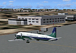
Googly scenery for HCMM Mogadishu/Petrella, the capital airport of Somalia.
Astonishingly, in Flight Simulator 2004 this international airport is depicted as little
more than a runway! Whilst in the real world the airport can hardly be
described as busy, it is served by the country's sole airline - Jubba
Airways, with their wonderful Ilyushin IL-18, and many African and Eastern
European operators call by with cargo flights. In fact, the vast proportion of
the aircraft seen here are Russian-built.
These scenery files add aprons, taxiways, buildings and other airport features to Flight Simulator's limited representation and allow "AI" traffic to land, taxi, park and take off in a realistic manner. But do watch out for cars on the runway and taxiways as they
appear to be regularly used as a by-pass to the perils of driving through the city!
The scenery does not purport to be ultra-accurate. Based on high-detail satellite
imagery from Google Earth, the layout is proportionally correct but the added
airport features, such as buildings, are built from default Microsoft objects
and add-on libraries so will not look exactly like the real thing.
You are not obliged to download and install any additional scenery libraries,
but to enjoy this scenery in its entirety, you may wish to. It will work fine,
with or without. [File re-uploaded at request of AVSIM]
| Filename: | HCMM__Mogadishu_International_Airport_MogadishuPet.zip |
| License: | Freeware |
| Added: | 28th May 2010, 20:46:31 |
| Downloads: | 2,792 |
| Author: | John Hinson |
| Size: | 61.51 KB |
| Category: Flight Simulator 2004 - Sounds | |
| Bombardier/Canadiar Regional Jet GE CF34-series Soundpack |
|
File Description:
This sound is intended for use on Project Opensky's models, but they'll work pretty good I am sure on Wilco/Feelthere models and other freeware and payware planes. After month's of hard precision work, I present to you my new realistic and accurate CRJ General Electric CF34-3B and CF34-8C soundpack for Microsoft Flight Simulator 2004 and x. This sound more specifically replicates the sound of the CF34-3C1 which powers CRJ-100 and CRJ-200s, however the CF34-8C sounds extremely similar to the -3B1 with a few minor differences. Also the interior sounds are mainly from a passenger perspective. Once you load your aircraft with these sounds, you'll hear the APU System and Fans in the cabin. You hear the humming sound of the CF34 at idle after you have started the engines. You spool up the engines at takeoff then hear the buzzsaw-like sound of the CF34 engine's fans. Once you lift off and put up the landing gear you will hear a chime from the cabin. It features realistic cockpit sounds like the autopilot deactivation sound, stall buzzer, overspeed beeper, gear up warning sound buzzer, flaps, rolling, and touch-down. I am sure that if you are a frequent Canadier/Bombardier Regional jet aircraft flyer, or if you're a pilot or flight crew onboard a CRJ aircraft, that you'll pretty impressed by these sounds. Give this soundpack a try, I am sure you won't be disappointed!
| Filename: | BombardierCanadiar_Regional_Jet_GE_CF34series_Soun.zip |
| License: | Freeware |
| Added: | 17th May 2010, 00:02:01 |
| Downloads: | 8,868 |
| Author: | Adam Murphy - Skyhigh Sound Systems |
| Size: | 86.12 MB |
| Category: Flight Simulator 2004 - Scenery | |
| Astrakhan City topology and autogen |
|
Images related to this file:
File Description:
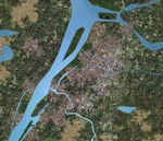
I'm pleased to introduce you the project of topology and autogen of Astrakhan city, Russia, version 1.0b. The project is for MS Flight Simulator 2004.
This projects changes the default autogen of the city and its neighborhood, that doesn't correspond to the real city. Also it adds missing rivers, islands, roads, railroads, and bridges in the vicinity of the city and Astrakhan aerodrome (URWA) and removes non-existent bridges across the Volga river.
This scenery is not professional since I designed it to my own cheek in Ground2K4 to replace the default terrible scenery and make my flights to homeland more comfortable. That's why it is probable, that you can face some challenges (although, I didn't see any problems yet). The project has several disadvantages: all bridges are autogen, so they don't look very similar to real ones (but they are better, that their absence and presence of several non-existent :) ); no autogen on added islands (although the autogen option for them is set on in Ground2K4), I will continue to work on it; rivers that fall into the Volga river have the default shoreline visible at theirs mouths (it's possible to remove it, but only on the square of big area, in that case the river-land transition doesn't look real).
Overall, this project is more for IFR flights, than VFR. But, again, even for VFR flights it's much better than the default crap (imho!).
| Filename: | Astrakhan_City_topology_and_autogen.zip |
| License: | Freeware |
| Added: | 2nd July 2010, 15:18:39 |
| Downloads: | 435 |
| Author: | Valery 'Oracle' Smirnov |
| Size: | 11.23 KB |
| Category: Flight Simulator X - Scenery | |
| GABS Bamako Senou International Airport |
|
File Description:
Bamako Senou International Airport (IATA: BKO, ICAO: GABS) is Malis main airport approximately 15 km south of downtown Bamako, the capital of Mali in West Africa. It is managed by Aeroports du Mali (ADM). Its operations are overseen
by the Malian Ministry of Equipment and Transports. Senou Airport was opened to traffic in 1974. The airport was upgraded between 2007 and 2012 in a 181 million US dollar project funded by the Millennium Challenge Corporation, a United
States foreign aid agency. Passenger traffic steadily increased in the early 2000s. Government figures show 403,380 passengers in 1999, 423,506 in 2003, 486,526 in 2004, and 516,000 in 2005. It is predicted to reach over 900,000 by 2015
under a low (4%) yearly growth rate scenario.
To date this growth rate has been surpassed. Total air traffic at BKO increased by 12.4% in 2007 and 14% in 2008. Most of this increase came in passenger transport, with the number of passengers served increasing by 20% in 2007 and 17%
in 2008. Twenty-seven airline carriers operated weekly or better at BKO in the 2007-2008 period. This continued growth was offset by cargo flights decline of 16.75% in 2007, and 3.93% in 2008.
The highest frequency route is on the Bamako-Dakar sector with 29 weekly non-stop connections. Domestic flights also serve Mali's regional capitals Kayes, Mopti, Timbuktu, Sikasso, Gao, and Kidal.
This work is dedicated to West Wind Airlines.
| Filename: | GABS_Bamako_Senou_International_Airport.zip |
| License: | Freeware |
| Added: | 27th March 2013, 01:12:43 |
| Downloads: | 3,407 |
| Author: | Anwar Gonzalez |
| Size: | 915.65 KB |
| Category: Flight Simulator X - Scenery | |
| Mesolonghi Airport - Rio-Antirio Bridge - Greece ** UPDATED VERSION ** |
|
Images related to this file:
File Description:
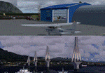
These are actually two sceneries offered in one pack. I started building the small airport of Mesolonghi in Western Greece. When nearing completion, I thought that FS was really missing the big suspension Bridge that connects mainland Greece with Peloponese that was finished in 2004, being the biggest in the world of the fully suspended type. The bridge project turned out bigger than the airport as I ended up doing the typical, Greek-style double ended ferries that served the straights for decades before the bridge and still offer a cheaper and, to some, more relaxing alternative.
Mesolonghi airport is situated 5 kilometers east of the historic city of Mesolonghi and is close to the technical school of fisheries. There is no ICAO code (ZZZZ) so I had to give it the fictional LGME in the sim. A purely day field, it houses the local Aeroclub and ultralight school. due to its small size and hospitable atmoshpere, it is a popular GA pilots destination, receiving also often international arrivals. The runway is asphalt and 800m (2635') in length. No PAPI or VASI are provided. There is no tower service and unicom frequency of 119.7MHz is used by the traffic. Closest controlled airport is Araxos (LGRX), a civil and military field, quite common in Greece, 12.5 nautical miles S-SE. The nearby city of Mesolonghi is famous for its heroic resistance and fall in 1826 during the Greek war of indepence. It is also famous for its fishery production, due to the natural lagoon, formed by the shallow waters.
Features of the Mesolonghi airport scenery include:
- Photoreal area with seasonal variations and watermask.
- Custom hangars and containerised buidings.
- AI default trike performing TnGs (in P3D it will work only if you copy over the FSX trike).
- The technical shool of fisheries on the north side.
- Customized shorelines, to fit with ORBX Global Vector.
- Optional shoreline fix for default scenery.
The Rio-Antirio bridge is located 14.5 nautical miles to the east of the airport. It connects the towns of Rio on the south side and Antirio on the north side. More data on the bridge can be found on Wikipedia.
Features of the Rio-Antirio bridge scenery include:
- Custom bridge model, bump mapped textures with hard platform surface and vehicle traffic.
- Night lighting textures and custom roadlights.
- Photoreal scenery for north and south shores, including hand placed autogen and night textures.
- Custom castle models on north and south sides, with bump mapped textures and night lighting.
- Custom model of the toll post on the north side.
- Custom AI ferry boats with constant shuttle service between Rio and Antirion piers.
- Customized shorelines, to fit with ORBX Global Vector.
- Optional shoreline fix for default scenery.
- Optional HDR optimized photoreal textures.
| Filename: | Mesolonghi_Airport__RioAntirio_Bridge__Greece___UP.zip |
| License: | Freeware |
| Added: | 16th March 2016, 09:15:21 |
| Downloads: | 2,629 |
| Author: | Vassilios Dimoulas |
| Size: | 300.05 MB |
| Category: Flight Simulator 2004 - Gauges | |
| VTOL/Hover gauge for Adam Preece' GR7 Harrier, V1.1 |
|
File Description:
If you use the previous version (RCBhcb10.zip): this version corrects a problem where the gauge gave problems when transitioning from hover to normal flight if you had loaded the aircraft in SpotPlane view. Plus some minor improvements.
See README for upgrade instructions.
This freeware gauge adds a whole new flightmodel and new VTOL & Hover featuresto Adam Preece' freeware Harrier.
Besides true vertical takeoff&landing, it allows you to fly forward, backward, sideways and turn, while in a hover.
This solution is based on overriding the normal FS flightdynamics while in a
hover, simular to the implementation of catapult launch / cable arrest in my
Carrier Operation Package; in short, it's a VTOL&Hover FDE coded in a gauge.
Special thanks to Doug Dawson, who created a gauge that provides for overriding FS2004 variables from an XML gauge.
Besides a VTOL controller, it also contains an effects controller plus visual
effects, for things like wingtip vortex, directional engine smoke and a cannon.
Requires FSUIPC (registered or unregistered).
The README includes extensive installation and flying instructions.
By Rob Barendregt.
| Filename: | VTOLHover_gauge_for_Adam_Preece_GR7_Harrier__V11.zip |
| License: | Freeware, limited distribution |
| Added: | 9th December 2005, 12:49:31 |
| Downloads: | 2,084 |
| Author: | Rob Barendregt |
| Size: | 88.49 KB |


© 2001-2026 AVSIM Online
All Rights Reserved
Privacy Policy |