
Where Flight Simulation Enthusiasts Gather from Around the World!
AVSIM Library - Search Results

| Category: Flight Simulator 2002 - Aircraft Repaints, Textures and Modifications | |
| Hellenic Air Force F-4E Phantom II |

|
File Description:
Full compatible with both FS2K2 & FS9 versions, this "VietNam camouflage" repaint, is representing an F-4E Phantom II in service of 338th Squadron of Hellenic Air Force. The model is made by Kazunori Ito, the textures and the panel by Nick Karatzides. The package contains realistic sounds made by Angelos Hatzikatakos. A new panel was made by Nick Karatzides according pictures of the real Phantom cockpit. The panel uses the fine radar and HUD gauges, compatible with both FS2K2 & FS9 versions, made by Paolo Dessani and Eric Marciano. Nick Karatzides also made an accurate checlist for FS purposes and the VERY completed flight manual (38 pages) which can be read with Adobe Acrobat. This "F-4E_HAF_v1.zip" package is for EXPERIENCED FlightSimers and virtual pilots who have a "good feeling" on the controls and do not "kick" the contol stick while flying...(no mistakes allowed especialy during landing phase!) It is for people who want to know how it looks to fly with a modern fighter. The package contains visual effects, night lighting, fine looking mechanical parts movement, smoke contrails, realistic gears extracting / retracting etc.
| Filename: | Hellenic_Air_Force_F4E_Phantom_II.zip |
| License: | Freeware |
| Added: | 31st October 2003, 16:53:45 |
| Downloads: | 4,408 |
| Author: | Nick Karatzides |
| Size: | 10.49 MB |
| Category: Flight Simulator 2004 - AI Flight Plans | |
| World GA Traffic |
|
File Description:
These AI flight plan files have been created as a replacement to (NOT an addition to) the default Microsoft FS2004 GA flight plans. If you already use proper AI flight plans for commercial traffic, this is ideal for you.
The default flight plans, as many know, are far from realistic as traffic just flies back and forth between two airports at regular intervals throughout each 24-hour day.These replacement plans are far more realistic in that:
a) Aircraft keep flying to different airports throughout the day, returning home in the evening.
b) Each aircraft flies to different destinations on different days of the week,
c) Evening flights are substantially reduced,
d) Night flights are minimal, and
e) Appropriate country-based tail numbers are used.
The flights comprise a total of 25389 aircraft, flying to 5520 different airfields. There are no circuits or touch and go flights to hamper your landing.
They use only the MS default aircraft and fly to and from the default GA airports in FS2004. The only vintage aircraft included in these plans are DC-3s and Piper Cubs.
(File re-uploaded at the request of AVSIM)
| Filename: | World_GA_Traffic.zip |
| License: | Freeware |
| Added: | 16th February 2010, 11:32:58 |
| Downloads: | 7,535 |
| Author: | John Hinson |
| Size: | 48.04 MB |
| Category: Flight Simulator X - Gauges | |
| Advanced Radar System 4 (ARS4) |
|
Images related to this file:
File Description:
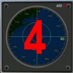
This gauge has been developed for FSX Flight Simulator SP1 or SP2. It
has also been tested with Microsoft Acceleration also, but compatibility is not guaranteed by the author.
This new Advanced Radar System (ARS 4) includes significant new features,
functions and displays for FSX AI traffic. The new key features are:
1)AI traffic display for air targets and boat/ship targets.
2)Auto landing on carrier if the carrier is part of the scenery MECOPS.
3)Allows switching between air target display and boat target display.
4) Provides for air and boat display to optionally insert airport and/or basic terrain display on the screen.
5)Different screen presentations for air and boat targets.
6)Simplified installation procedure.
7)The A2A re-fuel function remains the same as in the ARS2 version.
8)The auto tracking function remains the same as well as in the ARS2 version.
All displays for air, or boat/ship traffic, can be selected in a range of 5, 10, 20, and 40 miles.
For installation and additional information look at the ARS4 documentation inside the zip file. For copyrights and credits please look at the documentation for this gauge.
| Filename: | Advanced_Radar_System_4__ARS4.zip |
| License: | Freeware |
| Added: | 5th March 2013, 15:53:52 |
| Downloads: | 3,809 |
| Author: | Dietmar Loleit |
| Size: | 1.18 MB |
| Category: Flight Simulator 2004 - Aircraft Repaints, Textures and Modifications | |
| FS2004/FSX Delta Boeing 727-200 1972 Widget Livery. |
|
Images related to this file:
File Description:

FS2004/FSX Delta Boeing 727-200 1972 Widget Livery.
This is a repaint on the TDS (Tenkuu Developers Studio) Boeing 727-200 model, in Delta's 1972 Widget livery, registration N494DA. Texture only. The textures are saved in 32 bit format for quality graphics. Includes custom Delta Cabin and Ground Support Equipment and personnel, photo real taxi & landing light lenses, photo real refueling station under the wing and custom new wing textures. Model developed by Tenkuu Developers Studio, features high resolution textures, dynamic flexing wings, nose gear steering, rudder lock, ground spoilers, low speed aileron locks at high speed, fully animated control surfaces, fully independent suspension, trim animation, opening passenger doors, rolling wheels, animated thrust reverse with reverser block doors, detailed textures, full night lighting, ground service vehicles and more. Model design by Hiroshi Igami. Flight dynamics design by Nate Rosenstrauch, Joe DeGregorio and Chesley Hann. Paint kit and master textures by Carlos Eduardo Salas. TDS members: Hiroshi Igami,Nick Wilkinson,Carlos Eduardo Salas,Yosuke Ube,Stian Svensen,David Biggar, Luiz Antonio Perina,Nate Rosenstrauch, Joe DeGregorio and Chesley Hann. Delta textures By Joe DeGregorio.
| Filename: | FS2004FSX_Delta_Boeing_727200_1972_Widget_Livery.zip |
| License: | Freeware |
| Added: | 30th September 2021, 18:53:44 |
| Downloads: | 142 |
| Author: | Joe DeGregorio |
| Size: | 17.26 MB |
| Category: Flight Simulator 2004 - Scenery | |
| Port McNeill CAM8 float base in British Columbia, Canada |
|
Images related to this file:
File Description:
This is the seventh in a series of new and renovated float bases in BC. Port McNeill is a float base in a sheltered inlet on the northeast coast of Vancouver Island, close to the town and just under 20 miles east of the Port Hardy float base. There is no fuel available as the Port Hardy floatbase (already posted) acts as a refuelling centre for this and other float bases in the neighbourhood. The dock is to the west of the marina and east of the log raft area. The AI is a further adaptation of the CF36 AI and involves Beavers as listed in the AI folder. At Port McNeill all the AI works for both landing and takeoff for all of the planes, no matter what the wind direction is. All of these float bases can be installed together in the same folders, with a saving in duplicate textures. So a series called BC Floats (or whatever you want to call it) or individually installed float bases; your choice. The next in the series was suposed to be Sullivan Bay, another floating marina, but I digressed to Port Hardy and Port McNeill.
| Filename: | Port_McNeill_CAM8_float_base_in_British_Columbia_C.zip |
| License: | Freeware, limited distribution |
| Added: | 21st January 2017, 19:11:03 |
| Downloads: | 170 |
| Author: | Roger Wensley |
| Size: | 5.07 MB |
| Category: Flight Simulator X - Scenery | |
| LGSK - Skiathos Airport, Greece |
|
Images related to this file:
File Description:
LGSK Skiathos Airport Greece.
Skiathos Island lies off the east coast of mainland Greece and is often referred to as 'Europe's St. Maarten' with landing aircraft skimming the beach and the nearby harbour. At 5341feet the runway is short and narrow and usually only captains are allowed to perform landings. Seasonal taffic includes Munich, Gatwick, Rome, Oslo and Stockholm, with scheduled flights to Athens.
This scenery has been designed to sit on the excellent photoreal scenery by Angelo Tassoglou, available here on Avsim, just search for 'Skiathos.zip'. Please note, it will not work with the default terrain. It also uses many objects from my LGKF Kefallinia scenery, also available here at Avsim.
The scenery features added vegetation, detailed airport buildings based on real photographs, animated windsocks, flags, road traffic, people, trees, waves, birds and air traffic. All the scenery files have been divided so they can be switched on or off according to user preference. It has been designed for and tested in DX9 and FSXA only.
Please enjoy and I hope you like my scenery as much as I enjoyed building it.
Required files:
skiathos.zip by Angelo Tassoglou
LGKF Kefallinia by George Keogh
| Filename: | LGSK__Skiathos_Airport_Greece.zip |
| License: | Freeware, limited distribution |
| Added: | 28th January 2013, 00:13:54 |
| Downloads: | 15,992 |
| Author: | George Keogh |
| Size: | 20.47 MB |
| Category: Flight Simulator 2004 - Scenery | |
| CYCQ - Chetwynd - British Columbia, Canada |
|
Images related to this file:
File Description:
The town of Chetwynd (population around 2,600) is on the east side of the Rocky Mountains, the first town to be encountered when descending from the Rockies on highway 97. Previously known as Little Prairie, the town name was changed in 1962. The main occupations of the town are linked to forestry, fossil fuels, and transportation; there are railway lines north to Fort St John, east to Dawson Creek, and south to Prince George. The airport is on the southern side of the town, with one runway aligned 05-23, asphalted in 1975 and just under 4,500 feet long. There are no scheduled services, although a new terminal building was constructed in 2008, and the helicopter operations by at least two companies (oil and gas and medical evacuation flights) are the primary operations from the field. These are included in the AI, incorporating helicopter modifications made by Holger Sandmann so that they function properly as AI at an airfield. As an aside, landing like a plane and using the runway and taxiways is in fact exactly what a helicopter does at a normal airfield in real life; everyone does the same thing so that guessing is unneccesary.
| Filename: | CYCQ__Chetwynd__British_Columbia_Canada.zip |
| License: | Freeware, limited distribution |
| Added: | 28th March 2016, 21:36:33 |
| Downloads: | 299 |
| Author: | Roger Wensley |
| Size: | 18.84 MB |
| Category: Flight Simulator X - AFCAD Files | |
| Somerset Airport (KSMQ), NJ |
|
File Description:
Located 03 miles N of Somerville, New Jersey on 210 acres of land, Somerset is a public airport with one asphalt and two grass runways, the longest of which is 2733' in length. The turf runways have no hard surfaces and you will be landing on terrain so have your mesh set as high as possible - both runways are still selectable in the ATC window for landing/takeoff announcements. AI aircraft will not use them. The helipad is a start location in front of the main terminal if a parking location is not wanted to begin helicopter flights. Parking is divvied up into three categories - GA_SMALL spots will accommodate aircraft with wingspans no greater than 40 feet. GA_MEDIUM spots will accommodate aircraft with wingspans no greater than 60 feet. GA_LARGE spots are named to identify locations suitable for starting in a glider if you wish to do so. They can also accommodate aircraft with wingspans no greater than 60 feet. In addition to tie downs, there are 13 hangars open for parking in various locations - they can be identified by GA_DOCK. Only the N Parking hangar can accommodate aircraft with wingspans no greater than 60 feet - all other hangers are suitable only for aircraft with wingspans no greater than 40 feet. Several of the hangars have attendants - look beside the doors for the NAV2 frequency to set for opening them. AI aircraft will only spawn on the north tarmac/hangars (largely to prevent AI traffic crossing the runway on taxi). All objects and static aircraft in the immediate vicinity of parking and taxiways have collision disabled. If your aircraft has a wingspan greater than 40 feet it is NOT recommended that you taxi down the middle taxiway leading to the main tarmac from N Parking as you will not clear the hangars - go either via the NW taxiway past the grass tie downs (NW Parking) or around East to the next taxi way on the other side of the east hangars (E Parking) which has more wing clearance. Fuel is available on both tarmacs north and south of the runway by stopping on the asphalt in front of the tanks/pump.
Scenery constructed with use of satellite images/streetview/aerial photos - the author has not been there in person.
This scenery is meant to be used in conjunction with MegaScenery Earth New York 005. It is not required, but apron use is minimized to allow satellite scenery to show through as much as possible, and objects are placed based on the MSE textures - lack of it may make scenery look out of place.
| Filename: | Somerset_Airport_KSMQ_NJ.zip |
| License: | Freeware |
| Added: | 27th September 2011, 01:15:53 |
| Downloads: | 306 |
| Author: | Drew Sikora |
| Size: | 1.47 MB |
| Category: Miscellaneous Files - Demos from Commercial Vendors | |
| QuickPlan for Windows |
|
Images related to this file:
File Description:

QuickPlan for Windows is a visual point and click flight planner that makes it easy to generate flight plans in native FSX, FS2004 or X-Plane formats.
The entire route is generated visually, by tapping the map to add the departure airport, intermediate waypoints and arrival airport in the same order that you intend flying the plan.
During plan creation and after adding the final arrival waypoint you also have the opportunity to remove any of the intermediate waypoints before saving the plan in your preferred format.
QuickPlan utilises a new mapping engine and includes 12 world-wide map styles and has support for FSWidgets Cloud Based Aero Charts (free Cuba/Puerto Rico WAC Cloud Based Chart included) and FSWidgets Cloud Based World Nav Data (Free KSFO - San Francisco Bay area Nav Data included).
QuickPlan can be used in Freeform Mode, Advanced Mode, or a combination of both.
FREEFORM MODE: Simply click anywhere on the map and QuickPlan will allow you to add it as a generic waypoint. VFR pilots often use towns, lakes and other unique geographic features and with QuickPlan you can add any geographical location shown on the base map. Plans created this way label the waypoints automatically with generic names (e.g. DEP, WP1, WP2, ARR).
If desired, the entire route from departure to arrival can be created without reference to any navigational aids or official airports. This is handy for bush pilots who often use unlicensed airfields and small landing strips (or seaplane landing areas). Helicopter pilots can also quickly create plans that depart from off-airport locations like building rooftops or land on a road.
ADVANCED MODE: If you own the FSWidgets Cloud Based World Nav Data product you can create more advanced flight plans by clicking on any of the icons displayed on the map to add them as waypoints - airports, VOR's, NDB's and intersections (data for the KSFO area is included free). Plans created this way label the waypoints automatically with airport and navigational aid identifiers taken from the Nav Data (e.g. KSFO, OSI, LV, FABLA). FEATURE LIST:
- Generates native FSX (.pln), FS2004 (.pln) and X-Plane (.fms) format flight plans
- Saves flight plans to any folder (preferred folder set in Preferences)
- Search for airport by ICAO identifier
- Map powered by CloudMade Leaflet API (using OpenStreetMap data)
- Includes 12 world-wide maps styles
- Supports FSWidgets Cloud Based AERO CHARTS
- Free Cuba/Puerto Rico WAC Cloud Based Chart included
- Supports FSWidgets Cloud Based WORLD NAV DATA
- Free KSFO (San Francisco Bay) area Nav Data included
- World-wide Metar and TAF Data icons
- US Nexrad (Next-Gen Radar) Data
| Filename: | QuickPlan_for_Windows.zip |
| License: | Commercial demo |
| Added: | 27th October 2012, 09:22:33 |
| Downloads: | 523 |
| Author: | Fermin Fernandez - FSWidgets |
| Size: | 1.95 MB |
| Category: Flight Simulator X - Aircraft Repaints, Textures and Modifications | |
| North American P-51D Mustang "Boo-Man Choo" (N51MV) |
|
Images related to this file:
File Description:
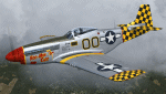
A repaint only for the payware Warbirdsim product 'Mustang Tales'. This repaint depicts the restored P-51D-25-NT 45-11391, "Boo-Man Choo", registered N51MV. This aircraft has a long civilian history, having been first registered with the FAA in 1963. In the 1990's, this aircraft became a popular sight when owned by Wally Sanders and painted as "Nervous Energy IV", and could sometimes be seen flown by the late, great Jeff Ethell. In the years since, the aircraft has passed through several owners, though the same over-all paint scheme has remained. In 2005, the aircraft's name was changed to "Luscious Lisa". In 2008, not long after having switched hands, the aircraft was damaged in a hard landing. For the next four years the aircraft was repaired and rebuilt, flying again in May 2012. The aircraft's most recent owner is Col. Ray Hofman, who now bases the aircraft in Midland, TX. The aircraft is now named "Boo-Man Choo", which is derived from the nickname of Col. Hofman's son, "Boo-Man". The nose art was inspired by the nurse character from the animated cartoon Animaniacs. This repaint features new bump maps, wheel well, gun bay, and cockpit textures.
| Filename: | North_American_P51D_Mustang_BooMan_Choo_N51MV.zip |
| License: | Freeware |
| Added: | 17th April 2013, 06:21:24 |
| Downloads: | 190 |
| Author: | John Terrell |
| Size: | 27.52 MB |
© 2001-2026 AVSIM Online
All Rights Reserved
Privacy Policy |