
Where Flight Simulation Enthusiasts Gather from Around the World!
AVSIM Library - Search Results

| Category: Flight Simulator 2002 - Miscellaneous Files | |
| Los Angeles Terminal Area Chart |

|
File Description:
The rendition of Los Angeles´ KLAX airport is one of the most detailed in FS2002 and a great starting point to explore the West Coast. The library hosts a few awesome landclass and mesh files for this area that offer an "as real as it gets" VFR experience if used with this chart. The 1:250.000 scaled chart is scanned in high resolution (8400*4700 pixel). It covers a much smaller area, but offers considerably more detail than the LA sectional. You may use this chart "as is" without any other software, but it will develop its full potential if used as moving map with SimSystem´s FSFlightMax or FSGarmin. It wouldn´t have been possible to offer this chart without Richard Harvey and his love to flightsimming, so please consider this file to be "donationware" and make a however small contribution to the Richard Harvey Endowed Scholarship.
| Filename: | Los_Angeles_Terminal_Area_Chart.zip |
| License: | Check within download |
| Added: | 30th March 2003, 15:27:19 |
| Downloads: | 1,472 |
| Author: | Uwe Rademacher |
| Size: | 28.03 MB |
| Category: Flight Simulator 2002 - Scenery | |
| British Farm Strips: Eastbach, Milson, & Nayland |
|
File Description:
Three interesting small English farm strips. Nayland is in Suffolk, near Colchester - the main 600m grass strip has a gradient of 8% in its first half:
probably the closest you'll get in Britain to one of the French alpine runways like Courchevel or Megève. Milson is in rural Shropshire on the side of a shallow valley; it has both a helipad & a 450m grass strip - most of which is on a fairly gentle 3.5% slope apart from the last 70 feet which rises up more steeply. The two runways at Gloucestershire's Eastbach Farm, on the edge of the Forest of Dean, are also on a slight slope but most of the excitement comes from their short length (250m & 350m respectively) - ideal for microlights and STOL planes. All three airfields are compatible ONLY with LAGO's TerraMesh Part 13 of England & Wales - no other mesh will work.
| Filename: | British_Farm_Strips_Eastbach_Milson__Nayland.zip |
| License: | Freeware, limited distribution |
| Added: | 31st March 2003, 13:05:02 |
| Downloads: | 1,298 |
| Author: | James Belk |
| Size: | 2.73 MB |
| Category: Flight Simulator 2002 - Scenery | |
| British Columbia Bush Scenery: Grant Narrows & Rambo's Hideout |
|
File Description:
The larger runway at Grant Narrows has a 15 degree bend, and the shorter runway is on a slope that involves an unconventional downhill landing & an uphill take-off (STOL planes only!). Both strips are bumpy, and require Holger Sandmann's mesh of the Lower Mainland of Southern British Columbia (bcmesh9c.zip) for the required effect. A dock is provided down on the lake shore for visitors on floats. The landing strips are fictional, set in an area of wilderness on the shores of Pitt Lake - but only 20 miles from downtown Vancouver. The first Rambo movie was filmed in the hills just to the east in the Golden Ears Provincial Park: if you fly north from Grant Narrows you'll find Rambo's airstrip hideout just a couple of miles past the end of the lake - the real life location of a popular fishing lodge. Also requires Gerrish Gray's trees (trees_v3.zip).
| Filename: | British_Columbia_Bush_Scenery_Grant_Narrows__Rambo.zip |
| License: | Freeware, limited distribution |
| Added: | 13th March 2003, 21:26:06 |
| Downloads: | 946 |
| Author: | James Belk |
| Size: | 1.74 MB |
| Category: Flight Simulator 2004 - Scenery Design | |
| ResampleTools V.095Beta |
|
File Description:
ResampleTools is a great little utility that helps you automate the import of Mesh or Photo Real scenery into
Flight Simulator 200x. The interface is a simple 4 or 6 step wizard depending
on what you are importing and the information you have about your source files.
FS Resample Tools can help you determine the extents of your bitmap source if
you don't already know them (all four corners in degrees) and will also
determine the CellX and CellY sample or pixel width from those corner extents among others.
This is a beta version and there will be no more updates as work on this tool stoped a while ago but the author has been kind enough to allow distribution to all who might enjoy using it,(note: this may have been replaced by Elronds "imagetool" also available soon in this library).
Works with FS2000/FS2002 and FS2004.
| Filename: | ResampleTools_V095Beta.zip |
| License: | Freeware, limited distribution |
| Added: | 21st September 2003, 18:50:03 |
| Downloads: | 1,621 |
| Author: | Elrond Elvish |
| Size: | 728.39 KB |
| Category: Flight Simulator 2004 - Scenery | |
| Revised East Vancouver Islands - compatible with vicenh05 |
|
File Description:
These files are a revision of the default Vancouver Island shorelines and landclass textures from Chemainus to Campbell River, British Columbia. Included are the islands from the Southern Gulf Islands to Texada Island and inland to Cowichan Lake. Most of the smaller lakes within 20 km of the shoreline have been redrawn as well. In this version shorelines have been revised to match Jon Patch & Holger Sandman's vicenh05.zip. As well major corrections for the shorelines in LOD5 area 117-114, Comox, have been made so that the shorelines now conform to the 38.2m mesh and to Vern Opperman's CFB - Comox version 042. Shoreline types are changed to look more like the Pacific Northwest courtesy of Holger Sandman's who made his shoreline textures for vicenh05 available. Also in this version no roads are included since complete British Columbia roads in bcroadsys.zip are now available.
| Filename: | Revised_East_Vancouver_Islands__compatible_with_vi.zip |
| License: | Freeware, limited distribution |
| Added: | 8th October 2005, 20:17:46 |
| Downloads: | 3,927 |
| Author: | Harvey Janszen |
| Size: | 346.85 KB |
| Category: Flight Simulator 2004 - Scenery | |
| South West Islands, Japan and Taiwan Ver.3.0 |
|
Images related to this file:
File Description:
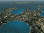
FS2004 Scenery SWIJT2004 Ver 3.0 (South West Islands, Japan and Taiwan)
These files improve specific scenerys (South West Islands of Japan and Taiwan, Asia) of FS2004. Included islands: Ohsumi Islands, Tokara Islands, Amami Islands, Okinawa lands, Kerama-Kume Islands, Miyako Islands, Yaeyama Islands and Taiwan Island.
In this scenery design, the coastline was reproduced as exactly as possible, following the specification of FS2004. Moreover, 90m mesh geographical data is reproduced by
using SRTM 3arc/sec. Correction of missing holes is perfect.
==NOTAM== I exhibited "SWIJ2k4.zip" on August 26, 2004.
However, it became clear that some of files of "SWIJ2k4" are infringing on the opyright of Microsoft. Then, I stopped public presentation of "SWIJ2k4". I apologize for having
made you trouble to those who already downloaded "SWIJ2k4.zip". New "SWIJT2k4.zip" is vast scenery which covered South West Islands, Japan and Taiwan Island. Please install new "SWIJT2k4".
By Kazuo Kawamura
| Filename: | South_West_Islands_Japan_and_Taiwan_Ver30.zip |
| License: | Freeware, limited distribution |
| Added: | 4th December 2011, 00:05:05 |
| Downloads: | 7,744 |
| Author: | Kazuo Kawamura |
| Size: | 20.5 MB |
| Category: Flight Simulator 2004 - Scenery | |
| Airstrips of Southern Germany |
|
Images related to this file:
File Description:
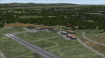
The next my Western Europe airstrips project, herewith about 170 small airfields, mostly in Baden-Wurttemberg and Bavaria, each enhanced with buildings, taxiways, parking spaces and aprons as appropriate, to further facilitate the generation of lightweight AI traffic in the area, without overloading the more major airfields.
Again, there's no photo-realism here, just a selection of basic 'generic' buildings, more or less accurately sized and placed to reflect the airfield layout as seen on on-line satellite imagery and aerial photography. These buildings have minimal effect on frame-rates, so are ideal for this kind of job. The airfields are aligned as well as possible with the roads etc. in UT Europe and the Genesis Europe mesh, but should mostly be fine in a default installation or other configuration.
Please read the rest of this "blurb" in the included text file. There may be some details of note or interest.
| Filename: | Airstrips_of_Southern_Germany.zip |
| License: | Freeware |
| Added: | 25th December 2024, 20:54:30 |
| Downloads: | 126 |
| Author: | Chris Eve |
| Size: | 2.84 MB |
| Category: Flight Simulator 2004 - Scenery | |
| The Victoria Falls of the Zambezi River, Zambia/Zimbabwe |
|
File Description:
One of the main landmarks of Africa, the spectacular Victoria Falls of the Zambezi River are missing in out-of-the-box FS. With a local SRTM LOD9 mesh as a base (included) and the help of satellite imagery, maps, Ground2K4, and GMax, we did our best to model a realistic representation of the falls, the river, and the gorge, complete with custom waterfall and spray effects. The portion of the Zambezi covered in this project extends from E25 to E26.5 (more than 100km), with the falls at its center. Also included is a replacement landclass file for an area of about 20km on either side of the Zambezi River and an optional AI boat (by Lynn and Bill Lyons) cruising on the Zambezi above the falls. Tested with FS2004 only but most scenery enhancements (not the AI boat) should work just as well in FS2002.
| Filename: | The_Victoria_Falls_of_the_Zambezi_River_ZambiaZimb.zip |
| License: | Freeware, limited distribution |
| Added: | 8th May 2004, 02:45:30 |
| Downloads: | 19,146 |
| Author: | Holger Sandmann and Johan van Wyk, Aeroworx |
| Size: | 3.5 MB |
| Category: Flight Simulator 2004 - Scenery | |
| BFU Brooks |
|
File Description:
With BFU Brooks, BFU enters the faraway bush country of northern Alaska. Located at Coldfoot in the southern foothills of the Brooks mountains, this base will cater to the needs of visitors to the area, and of sportsmen who indulge in hunting and fishing. This scenery package consists of three sceneries: our new northern base BFU Brooks, Moose Camp and Moose Lodge. The camp sits in the mountains on a small lake, whereas the lodge is situated on the shore of a large lake. Visitors are flown into Coldfoot from Fairbanks, then on to the camp or lodge as desired. Moose Camp and Moose Lodge will not show on the GPS, and of course do not have an NDB or similar to guide you. You'd better start in the camp/lodge, and fly toward Coldfoot to get to know the area. The sceneries have only been tested with the default mesh.
| Filename: | BFU_Brooks.zip |
| License: | Freeware |
| Added: | 30th September 2003, 15:17:31 |
| Downloads: | 5,316 |
| Author: | Naji Chehabeddine |
| Size: | 2.96 MB |
| Category: Flight Simulator 2004 - Scenery | |
| Kerkira Airport Enhancement |
|
File Description:
This is old scenery which has been updated for FS2004 and enhances the visual environment of Ionian sea island airport of Kerkira, also known as Corfu. Its part of my “Greek Airfields” package that currently is not fully compatible with FS2004 since MS decided to move the airports in Greece and elsewhere to adjacent positions and ASD, which I use for placing these objects, is not compatible with FS2004. Here you will find airport & terrain enhancements for Hellenic airport of Kerkira LGKR that make it look closer to the real one; hotels, runway turning bay, perimeter fences, windsocks, radio antennae, new approach radar antenna to the southwest and most importantly, an exclusion of autogen scenery that is wrongfully generated on each side of the runway. A big difference is attributed to Babis Peribolas’s Kerkira mesh terrain that is included in this scenery. Scenery includes the necessary ASD 2.1 textures.
| Filename: | Kerkira_Airport_Enhancement.zip |
| License: | Freeware, limited distribution |
| Added: | 4th September 2003, 02:23:06 |
| Downloads: | 12,180 |
| Author: | Kyprianos Biris |
| Size: | 1.94 MB |


© 2001-2026 AVSIM Online
All Rights Reserved
Privacy Policy |