
Where Flight Simulation Enthusiasts Gather from Around the World!
AVSIM Library - Search Results

| Category: Flight Simulator X - Scenery | |
| Airport Kassel EDVK |

|
Images related to this file:
File Description:
The 5th version of this Add-On for FSX approaches the reality with photo-realistic ground textures, accurate buildings, runways, taxiways and the official approaches with waypoints, localizers and glide paths. More than 1200 objects, 60 individual scenery-models, approx. 100 custom ground polygons and lines have been created. One big problem was to adopt the terrain mesh to fit the new airport. The actual state of January 2019 has been adapted to the scenery. Photorealistic ground textures have been reworked. High resolution textures you find at the aprons and the vehicle parking areas at the General Aviation and Business Terminals. Accurate Night Lighting and winter textures have been added. All buildings, Hangars and a lot of objects have been designed individually (no library objects). Even the taxiway and apron markings are hand-made. For P3D a different version can be downloaded. Works with VFR Germany and ORBX Northern Germany.
| Filename: | Airport_Kassel_EDVK.zip |
| License: | Freeware, limited distribution |
| Added: | 30th June 2019, 16:37:37 |
| Downloads: | 11,926 |
| Author: | Albert Claudi |
| Size: | 105.46 MB |
| Category: Prepar3D V1-4 - Scenery | |
| Square Kilometre Array (MeerKAT) – South Africa |
|
Images related to this file:
File Description:

This scenery is of the MeerKAT radio telescope site (originally the Karoo Array Telescope – KAT but was changed to MeerKAT, meer=more) when the project was expanded to 64 dishes. It forms part of an international Square Kilometre Array (SKA) project. It is situated in the Karoo near the town of Carnarvon. The scenery includes the landing strip just North East of the biggest concentration of dishes. I could not find a code for this strip and called it FAKA (MeerKAT SKA), or take off from Carnarvon (FACN) and fly a heading of 320 degrees for 73 km. The scenery was designed and tested for P3D V5 to work with the ORBX Africa LC and Pilots NG2020 mesh products. I am not sure what the actual site would look like at night, but I included some night lighting to make the array visible after dark.
| Filename: | Square_Kilometre_Array_MeerKAT__South_Africa.zip |
| License: | Freeware |
| Added: | 14th August 2020, 22:53:38 |
| Downloads: | 99 |
| Author: | Johan Pienaar |
| Size: | 20.33 MB |
| Category: Flight Simulator 2004 - Scenery | |
| Tokyo Bay 2005 |
|
Images related to this file:
File Description:
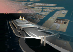
FS2004 Scenery Tokyo Bay Scenery 2005 Ver. 5.0
This add-on scenery improves specific scenerys (Tokyo Bay, Japan) of FS2004.
There are a lot of reclaimed land in Tokyo Bay.
They form an artificial peculiar coastline. This scenery reproduces these coastlines precisely.
And, this scenery reproduces the Keihin industrial area and the Keiyo industrial area in Tokyo Bay located west and east. In this scenery design, the coastline was reproduced as exactly as possible, following the specification of FS2004.
Moreover, 90m mesh geographical data is reproduced by using SRTM 3arc/sec.
The range of detailed coastline and 90m digital elevation data is as follows:
** [detailed coastline] N33:45 E138:45 to N36:55 E141:05 (included Izu Islands)
** [90m digital elevation data] N33:00 E138:00 to N37:00 E141:00 --
The Tokyo Wan AquaLine is arranged in the exact location. By Kazuo Kawamura
| Filename: | Tokyo_Bay_2005.zip |
| License: | Freeware, limited distribution |
| Added: | 3rd December 2011, 23:51:31 |
| Downloads: | 11,790 |
| Author: | Kazuo Kawamura |
| Size: | 9.74 MB |
| Category: Flight Simulator 2004 - Scenery | |
| Argyle International Airport, Saint Vincent |
|
Images related to this file:
File Description:
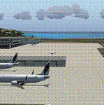
This is a scenery created by me of the soon to be completed Argyle International Airport on the island nation of Saint Vincent and the Grenadines. This scenery was created as a pet project of mine out of personal love for the project. The airport was created using only default scenery objects and the only thing that was changed was the type and direction of the turning point at the RWY04 end. I'm sharing this so FS2004 simmers can see what the airport will be like on completion. The scenery is 100% customizable to suit your preference. All I ask is that you don't change the actual airport design. I hope that this will bring you hours and hours of flying fun.
Important: This scenery requires the full RWY12 Scenery Library including the Gate Markings SS files. Also the Lesser Antilles Mesh is required.
| Filename: | Argyle_International_Airport_Saint_Vincent.zip |
| License: | Freeware |
| Added: | 22nd December 2013, 21:57:40 |
| Downloads: | 529 |
| Author: | Cilbert Campbell |
| Size: | 6.8 KB |
| Category: Flight Simulator X - AFCAD Files | |
| Woodcrest Farms Airstrip Airport (JY17), NJ |
|
File Description:
Located 02 miles NE of Shiloh, New Jersey, Woodcrest Farms Airstrip Airport is a private turf field 2303' in length. There are no services offered for transient aircraft and the field is not lit, so daytime VFR operations only are recommended. There is no hard-surfaced runway so make sure your terrain mesh is set as high as possible. You can start on the runway or parked next to the hangar east of the field
Scenery constructed with use of satellite images/streetview/aerial photos - the author has not been there in person.
This scenery is meant to be used in conjunction with MegaScenery Earth New Jersey/Delaware 004. It is not required, but apron use is minimized to allow satellite scenery to show through as much as possible, and objects are placed based on the MSE textures - lack of it may make scenery look out of place.
| Filename: | Woodcrest_Farms_Airstrip_Airport_JY17_NJ.zip |
| License: | Freeware |
| Added: | 11th May 2011, 03:29:54 |
| Downloads: | 170 |
| Author: | Drew Sikora |
| Size: | 443.09 KB |
| Category: Flight Simulator X - AFCAD Files | |
| Fly-N-D Landing Strip Airport (92NJ), NJ |
|
File Description:
Located 01 miles E of Kingwood Township, New Jersey on 121 acres of land, Fly-N-D Landing Strip Airport is a private turf field with a 2200' runway. There is no hard surface runway so setting your mesh as high as possible will lead to the best effects of landing on terrain. No transient storage or services are offered, and the airfield is not lit, so daytime VFR operations are recommended only.
Scenery constructed with use of satellite images/streetview/aerial photos - the author has not been there in person.
This scenery is meant to be used in conjunction with MegaScenery Earth New Jersey/Delaware 001. It is not required, but apron use is minimized to allow satellite scenery to show through as much as possible, and objects are placed based on the MSE textures - lack of it may make scenery look out of place.
| Filename: | FlyND_Landing_Strip_Airport_92NJ_NJ.zip |
| License: | Freeware |
| Added: | 23rd March 2011, 13:33:27 |
| Downloads: | 174 |
| Author: | Drew Sikora |
| Size: | 474.94 KB |
| Category: Flight Simulator X - Scenery | |
| France Vendee (86) - LF8523 Atlantic Airpark V2 |
|
Images related to this file:
File Description:
Version 2 because the version V1 didn't include chasnay.bgl file ...
A french scenery just for fun = Atlantic Aeropark near Chasnais and Lucon towns in Vendee country in France.
There are few aeropark in France. I created airport and some houses with planes for 4.75 precision mesh. There is a little problem with flat tile but it was too long to correct this. Never mind it's not very problematic.
It's just for fun to fly in Vendee ...
You can use library for your own scenery if you want. You can update this scenery but, please, make this free for FSX community. See http://www.atlanticairpark.com/ for map and details on real world.
For installation, you just unzip in addon scenery path
and you have to declare in parameters of fsx the scenery repertory (as usual). Vladimir Corre. Contact: [email protected]
| Filename: | France_Vendee_86__LF8523_Atlantic_Airpark_V2.zip |
| License: | Freeware |
| Added: | 3rd October 2015, 18:31:57 |
| Downloads: | 461 |
| Author: | Vladimir Corre |
| Size: | 1.29 MB |
| Category: X-Plane - Scenery | |
| WW32 Susi Air Nevere v1.0.0 |
|
Images related to this file:
File Description:
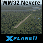
This is an X-Plane 11 scenery for Nevere Airstrip (WW32) in Nevere, Papua, Indonesia. This is one of the destinations for "PT ASI Pujiastuti Aviation", operating as Susi Air, an Indonesia airlines established in late 2004 by Mrs. Susi Pudjiastuti. This scenery was tested and is operational (as of January 08, 2017) in "X-Plane 11 Public Beta #5 64 bit", Windows 10 Home. It was also tested but is partially operational (as of January 08, 2017) in "X-Plane 10.51 64 bit", Windows 10 Home. The XP10.51 mesh presents no river, hence there is no water for the sealane water runway 11/29 to work properly. It will look weird because of the absence of teh river. Despite this issue with the rwy 11/29, the other two runways (10/28 dirty and 02/20 grass) both work nicely and are very much usable.
| Filename: | WW32_Susi_Air_Nevere_v100.zip |
| License: | Freeware |
| Added: | 9th January 2017, 15:02:07 |
| Downloads: | 60 |
| Author: | Rui Mesquita |
| Size: | 2.9 MB |
| Category: X-Plane - Scenery | |
| WXPN Susi Air Pulau Nurseen Airstrip v1.0.0 |
|
Images related to this file:
File Description:
This is an X-Plane 11 scenery for Pulau Nurseen Airstrip (WXPN) in the Island of Nurseen, Indonesia. This is a fictitious airfield, located in a tiny isolated island. This fictitious airfield may serve as a stopover for flights between Java and Papua, for the Susi Air scenery package. This is one of the destinations for "PT ASI Pujiastuti Aviation", operating as Susi Air, an Indonesia airlines established in late 2004 by Mrs. Susi Pudjiastuti. This scenery was tested and is operational (as of January 17, 2017) in "X-Plane 11 Public Beta #5 64 bit", Windows 10 Home. It was also tested and is not really operational (as of January 17, 2017) in "X-Plane 10.51 64 bit", Windows 10 Home. XP10's mesh is different, and presents problems in placing the runway over the water, instead of the land, plus some terrain elevations issues as well. Sorry, XP11 only.
| Filename: | WXPN_Susi_Air_Pulau_Nurseen_Airstrip_v100.zip |
| License: | Freeware |
| Added: | 18th January 2017, 05:00:53 |
| Downloads: | 45 |
| Author: | Rui Mesquita |
| Size: | 2.65 MB |
| Category: X-Plane - Scenery | |
| WIPB Susi Int'l Pangandaran Beach Airstrip v1.0.0 |
|
Images related to this file:
File Description:
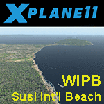
This is an X-Plane 11 scenery for the Susi Int'l Pangandaran Beach Airstrip (WIPB) in Pangandaran, West Java, Indonesia. This is a real private airfield, 9nm east of the Susi Air's headquarters at WICN/WI1A airport. This airfield is one of the destinations for "PT ASI Pujiastuti Aviation", operating as Susi Air, an Indonesia airlines established in late 2004 by Mrs. Susi Pudjiastuti. This scenery was tested and is operational (as of January 20, 2017) in "X-Plane 11 Public Beta #8 64 bit", Windows 10 Home. It was also tested and is partially operational (as of January 20, 2017) in "X-Plane 10.51 64 bit", Windows 10 Home. The issue with XP10 is the mesh again: there is a road crossing the airfield, by the end of rwy 28. If you can live with that, it's still operational in XP10, as a courtesy.
| Filename: | WIPB_Susi_Intl_Pangandaran_Beach_Airstrip_v100.zip |
| License: | Freeware |
| Added: | 21st January 2017, 18:45:03 |
| Downloads: | 40 |
| Author: | Rui Mesquita |
| Size: | 1.74 MB |


© 2001-2026 AVSIM Online
All Rights Reserved
Privacy Policy |