
Where Flight Simulation Enthusiasts Gather from Around the World!
AVSIM Library - Search Results

| Category: Flight Simulator 2004 - Scenery | |
| Project Mexico Real LOD10 File 2 of 11 |

|
Images related to this file:
File Description:
File 2nd of 11 of a Terrain Mesh that covers the entirety of Mexican Territory and related bordering U.S., Guatemala and Belice areas, part of the "Proyecto M�©xico Real" project, compiled at LOD10 (1.24 arcseconds in latitude and 1.65 arcseconds in longitude) resolution from INEGI data. Intended to enhance the virtual flying experience complementing the LOD8 and LOD9 versions compiled from the same data. Compatible backwards with Flight Simulator 2000, Flight Simulator 2002 and Combat Flight Simulator 2. Refer to the file contents about the cover area to this compressed file. (Re-upload due to AVSIM hack)
| Filename: | Project_Mexico_Real_LOD10_File_2_of_11.zip |
| License: | Check within download |
| Added: | 7th June 2010, 08:52:32 |
| Downloads: | 3,316 |
| Author: | Juan Jose Galvan Bautista |
| Size: | 76.38 MB |
| Category: Flight Simulator 2004 - Scenery | |
| Alternates for Durban Island CWFB FOX-E DEW line station in Nunavut, Canada |
|
File Description:
These are alternative bgls that include a flatten. They will change the shape of the hill that the FOX-E station sits on top of, but they will also make sure that there are no "floating" or "buried" scenery objects. If you are having that problem then just throw these into the scenery folder that you already created when you installed Durban Island, and say Yes! to over-write or whatever the question is. If you have a mesh that is compatible with what I use then you won't be having that problem, so don't do anything.
| Filename: | Alternates_for_Durban_Island_CWFB_FOXE_DEW_line_st.zip |
| License: | Freeware, limited distribution |
| Added: | 1st July 2011, 22:12:35 |
| Downloads: | 267 |
| Author: | Roger Wensley |
| Size: | 353.65 KB |
| Category: Flight Simulator 2004 - Scenery | |
| Project Mexico Real LOD10 File 7 of 11 |
|
Images related to this file:
File Description:
File 7th of 11 of a Terrain Mesh that covers the entirety of Mexican Territory and related bordering U.S., Guatemala and Belice areas, part of the "Proyecto Mexico Real" project, compiled at LOD10 (1.24 arcseconds in latitude and 1.65 arcseconds in longitude) resolution from INEGI data. Intended to enhance the virtual flying experience complementing the LOD8 and LOD9 versions compiled from the same data. Compatible backwards with Flight Simulator 2000, Flight Simulator 2002 and Combat Flight Simulator 2. Refer to the file contents about the cover area to this compressed file. (Re-upload due to AVSIM hack)
| Filename: | Project_Mexico_Real_LOD10_File_7_of_11.zip |
| License: | Check within download |
| Added: | 23rd August 2010, 00:40:35 |
| Downloads: | 2,865 |
| Author: | Juan Jose Galvan Bautista |
| Size: | 74.25 MB |
| Category: Flight Simulator 2004 - Scenery | |
| Project Mexico Real LOD10 File 8 of 11 |
|
Images related to this file:
File Description:
File 8th of 11 of a Terrain Mesh that covers the entirety of Mexican Territory and related bordering U.S., Guatemala and Belice areas, part of the "Proyecto M�©xico Real" project, compiled at LOD10 (1.24 arcseconds in latitude and 1.65 arcseconds in longitude) resolution from INEGI data. Intended to enhance the virtual flying experience complementing the LOD8 and LOD9 versions compiled from the same data. Compatible backwards with Flight Simulator 2000, Flight Simulator 2002 and Combat Flight Simulator 2. Refer to the file contents about the cover area to this compressed file. (Re-upload due to AVSIM hack)
| Filename: | Project_Mexico_Real_LOD10_File_8_of_11.zip |
| License: | Check within download |
| Added: | 29th August 2010, 04:15:59 |
| Downloads: | 1,173 |
| Author: | Juan Jose Galvan Bautista |
| Size: | 73.7 MB |
| Category: Flight Simulator 2004 - Scenery | |
| Project Mexico Real LOD10 File 9 of 11 |
|
Images related to this file:
File Description:
File 9th of 11 of a Terrain Mesh that covers the entirety of Mexican Territory and related bordering U.S., Guatemala and Belice areas, part of the "Proyecto Mexico Real" project, compiled at LOD10 (1.24 arcseconds in latitude and 1.65 arcseconds in longitude) resolution from INEGI data. Intended to enhance the virtual flying experience complementing the LOD8 and LOD9 versions compiled from the same data. Compatible backwards with Flight Simulator 2000, Flight Simulator 2002 and Combat Flight Simulator 2. Refer to the file contents about the cover area to this compressed file. (Re-upload due to AVSIM hack)
| Filename: | Project_Mexico_Real_LOD10_File_9_of_11.zip |
| License: | Check within download |
| Added: | 29th August 2010, 23:24:57 |
| Downloads: | 1,196 |
| Author: | Juan Jose Galvan Bautista |
| Size: | 76.35 MB |
| Category: Flight Simulator 2004 - Scenery | |
| Project Mexico Real LOD10 File 5 of 11 |
|
Images related to this file:
File Description:
Re-upload. File 5th of 11 of a Terrain Mesh that covers the entire Mexican Territory and related areas bordering the U.S., Guatemala and Belize areas. Part of the "Proyecto M�©xico Real" project, compiled at LOD10 (1.24 arcseconds in latitude and 1.65 arcseconds in longitude) resolution from INEGI data. Intended to enhance the virtual flying experience complementing the LOD8 and LOD9 versions compiled from the same data. Compatible backwards with Flight Simulator 2000, Flight Simulator 2002 and Combat Flight Simulator 2. Refer to the file contents about the cover area to this compressed file.
| Filename: | Project_Mexico_Real_LOD10_File_5_of_11.zip |
| License: | Check within download |
| Added: | 7th August 2010, 22:08:10 |
| Downloads: | 3,016 |
| Author: | Juan Jose Galvan Bautista |
| Size: | 73.08 MB |
| Category: Flight Simulator 2004 - Scenery | |
| Hauraki Gulf, v6 |
|
Images related to this file:
File Description:
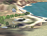
This replaces all my previous Pakatoa Island and Hauraki Gulf sceneries. You must have Christian Stock's NZ mesh in the form of "Mountains of New Zealand" and topo in the form of "Lakes and Rivers of New Zealand" (payware).
New additions...PAKIHI ISLAND: Small jetty and nearby buildings. TAKANGAROA ISLAND: House on Island. House & Jetty island north of Takangaroa Island. MOTUREKAREKA ISLAND: Wreck of the Rewa. PONUI ISLAND: Chamberlain's Bay Airstrip. Chamberlain's Donkey Farm. Third Bay Airstrip. Motunau Bay Jetty. KARAMURAMU ISLAND: Jetty and quarry. ROTOROA ISLAND: Rotoroa Jetty. MOTUIHE ISLAND: Motuihe Wharf.
| Filename: | Hauraki_Gulf_v6.zip |
| License: | Freeware |
| Added: | 17th April 2010, 16:10:12 |
| Downloads: | 218 |
| Author: | Godfrey Tier |
| Size: | 6.61 MB |
| Category: X-Plane - Scenery | |
| WA0B Susi Air Idedua Airstrip v1.0.0 |
|
Images related to this file:
File Description:

This is an X-Plane 11 scenery for Idedua Airstrip (WA0B) in Idedua, Papua, Indonesia. This is one of the destinations for "PT ASI Pujiastuti Aviation", operating as Susi Air, an Indonesia airlines established in late 2004 by Mrs. Susi Pudjiastuti. This scenery was tested and is operational (as of January 10, 2017) in "X-Plane 11 Public Beta #5 64 bit", Windows 10 Home. It was also tested and is partially operational (as of January 10, 2017) in "X-Plane 10.51 64 bit", Windows 10 Home. XP10's runway presents a much higher runway slope, given mesh issues.
| Filename: | WA0B_Susi_Air_Idedua_Airstrip_v100.zip |
| License: | Freeware |
| Added: | 13th January 2017, 20:10:39 |
| Downloads: | 97 |
| Author: | Rui Mesquita |
| Size: | 1.99 MB |
| Category: Flight Simulator 2002 - Scenery | |
| Patches for LOD7/LOD9 Terrain Meshes of British Columbia and Southeast Alaska |
|
File Description:
Patches (flatten files) for 108 lakes in British Columbia and Southeast Alaska that were either sunken below or raised above the terrain surface due to discrepancies between my add-on LOD7 and LOD9 mesh files and FS2002's default scenery. In some areas, such as the Prince George/Burns Lake region, the effect of the patches is obvious even from a great distance; in other areas, you'll have to be close to the lake to notice the difference. Also included are flatten files for nine airfields that had problems with sloping terrain or texture "bleed-through".
| Filename: | Patches_for_LOD7LOD9_Terrain_Meshes_of_British_Col.zip |
| License: | Freeware, limited distribution |
| Added: | 18th February 2003, 22:28:49 |
| Downloads: | 2,831 |
| Author: | Holger Sandmann |
| Size: | 613.45 KB |
| Category: Flight Simulator 2002 - Miscellaneous Files | |
| Anchorage South and Seaward Sectional Charts |
|
File Description:
The northern coast of the Gulf of Alaska is a paradise for Bush pilots. You´ll find many small interesting airstrips and exciting glacier formations up here, especially when you use some third party mesh and landclass files. While it can be used "as is" without any other software, it will develop its full potential if used as moving map with SimSystem´s FSFlightMax or FSGarmin. It wouldn´t have been possible without Richard Harvey and his love to flightsimming, so please consider this file to be "donationware" and make a however small contribution to the Richard Harvey Endowed Scholarship.
| Filename: | Anchorage_South_and_Seaward_Sectional_Charts.zip |
| License: | Check within download |
| Added: | 24th March 2003, 02:02:27 |
| Downloads: | 2,483 |
| Author: | Uwe Rademacher |
| Size: | 19.79 MB |


© 2001-2026 AVSIM Online
All Rights Reserved
Privacy Policy |