
Where Flight Simulation Enthusiasts Gather from Around the World!
AVSIM Library - Search Results

| Category: Flight Simulator X - Gauges | |
| TCAS and Traffic Display Gauge V2.0 |

|
Images related to this file:
File Description:
This TCAS and Traffic Display Gauge Version 2.0 includes significant improvements from V1.0. It has been developed for the FSX Flight Simulator SP1/2 also. It should also work with Acceleration.The functionality for the TCAS part is based on general specs for commercial aircrafts. It does not provide in detail the function for a specific aircraft model. It is a generic gauge, and can be simple added to any aircraft as a standalone popup window.
In addition the gauge provides a AI traffic display in the ranges of 10,20, and 40 miles.Within this display mode, no TCAS rules are valid, which means all AI aircraft are displayed independent of any altitude or distance.
Improvements in V2.0 are: 1: Full TCAS and traffic display capability is provided even though your aircraft is on the ground. Only the trigger of the alarm/warn sound and the blinking lamp display willbe blocked. 2: An AI HDG pointer will be displayed. It shows in which direction the AI is moving. 3: A bearing pointer has been introduced. It allows the pilot to point to a specific AI.4: The AI additional text info display follows the structure of an ATC text.5:The AI additional text can be selected individually per AI with a mouse click.
6: Each AI display contains a ID index number (0 � 20).7: The design of the TCAS and Traffic Display Box has been updated.8: Increased the number of AIs displayed on the screen in display mode.
For installation and functional description look at the doc inside the ZIp.
CREDIT goes to :
Stefan Schneider for his support on special XML issues and TCAS functionality.
Bob Familton for his review of the documentation and testing for SP1 FSX.
Doug Dawson for his dsd-XML-sound interface in order to generate the sounds.
| Filename: | TCAS_and_Traffic_Display_Gauge_V20.zip |
| License: | Freeware |
| Added: | 25th October 2010, 13:37:36 |
| Downloads: | 3,759 |
| Author: | Dietmar Loleit |
| Size: | 981.32 KB |
| Category: Flight Simulator X - Gauges | |
| TCAS and Traffic Display Gauge V1.0 |
|
Images related to this file:
File Description:
This TCAS and Traffic Display Gauge Version 1.0 has been developed for the FSX Flight Simulator SP1/2. It should also work with Acceleration. The functionality for the TCAS part is based on general specs for commercial aircrafts. It does not provide in detail the function for a specific aircraft model. It is a generic gauge, and can be simply added to any aircraft as a standalone pop-up window.
In addition the gauge provides a AI traffic display in the ranges of 10,20, and 40 miles.
Within this display mode, no TCAS rules are valid, which means all AI aircraft are displayed independent of any altitude or distance.
For installation and functional description look at the doc inside the Zip.
CREDIT goes to:
Stefan Schneider for his support on special XML issues and TCAS functionality.
Bob Familton for his review of the documentation and testing for SP1 FSX.
Doug Dawson for his dsd-XML-sound interface in order to generate the sounds.
| Filename: | TCAS_and_Traffic_Display_Gauge_V10.zip |
| License: | Freeware |
| Added: | 13th September 2010, 12:58:33 |
| Downloads: | 1,731 |
| Author: | Dietmar Loleit |
| Size: | 979.49 KB |
| Category: Flight Simulator 2004 - Aircraft Repaints, Textures and Modifications | |
| Corporate Maroon and Grey Dornier 328Jet |
|
File Description:
Fictional repaint of the Dornier 328Jet in a corporate maroon and grey livery. Original aircraft by Mike Stone required.
| Filename: | Corporate_Maroon_and_Grey_Dornier_328Jet.zip |
| License: | Freeware |
| Added: | 11th July 2006, 02:50:50 |
| Downloads: | 204 |
| Author: | Chris Coarse |
| Size: | 291.57 KB |
| Category: Flight Simulator 2002 - Scenery | |
| Pago Pago International Airport and City |
|
File Description:
This scenery redoes all the airport facilities at Pago Pago including its very interesting series of hut styled buildings at the main terminal. It also contains a rendition of the city of Pago Pago at the end of the next bay over from the airport. The airport itself has a very interesting layout with its two runways jutting out into the bay on coral reefs, with a small body of water between them, where I have placed a small docking area for sea planes. The city is able to be driven around in a car, and contains several interesting features such as a luxury hotel, specialty shops and restaurants, boat docks, and houses dotting the mountainsides behind it which all have night lighting.
| Filename: | Pago_Pago_International_Airport_and_City.zip |
| License: | Freeware |
| Added: | 24th November 2002, 16:26:54 |
| Downloads: | 4,864 |
| Author: | Bill Melichar |
| Size: | 2.93 MB |
| Category: Flight Simulator 2004 - Scenery | |
| New Caledonia (Landclass and Terrain Mesh) |
|
Images related to this file:
File Description:
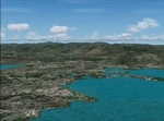
FS2004 Landclass and Terrain Mesh--New Caledonia. This is a complete Landclass and Terrain Mesh makeover for New Caledonia and its outlying islands. Andy Weir and Ian Thatcher have graciously allowed me to integrate their Terrain Mesh into this scenery. All known airports have now been added to New Caledonia and the local islands are designed for AI aircraft operation.
| Filename: | New_Caledonia_Landclass_and_Terrain_Mesh.zip |
| License: | Freeware |
| Added: | 18th April 2010, 09:59:48 |
| Downloads: | 1,110 |
| Author: | Charles Reid |
| Size: | 24.88 MB |
| Category: Flight Simulator 2004 - Scenery | |
| Kara sea polar stations and seaports |
|
Images related to this file:
File Description:
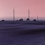
MSFS 2004 scenery: Kara sea polar stations and seaports (as it appears before 1940).
This scenery represents most important polar stations, seaports and objects on the Kara sea coasts. For object locations see Map_E.jpg.
NOTE: Installation of the sceneries Tiksi-1935.zip (Tiksi bay), gusmp_ships.zip (ships opn the Nothern Seaway) and soviet_polar_stations_1932.zip (Soviet Arctic Stations) is strongly recommended.
Freeware (c) 2013 Alexander Belov
| Filename: | Kara_sea_polar_stations_and_seaports.zip |
| License: | Freeware, limited distribution |
| Added: | 24th June 2013, 18:11:55 |
| Downloads: | 182 |
| Author: | Alexander Belov |
| Size: | 32.64 MB |
| Category: Flight Simulator X - Scenery | |
| New Runway and Taxiway Textures - FSX |
|
File Description:
The included textures will improve the look of your Runways to be much more like they are in REAL LIFE.
You are welcome to use these as freeware and include them with any other scenery package.
| Filename: | New_Runway_and_Taxiway_Textures__FSX.zip |
| License: | Freeware |
| Added: | 29th November 2009, 00:19:12 |
| Downloads: | 3,627 |
| Author: | Peter Alberts |
| Size: | 1.46 MB |
| Category: Flight Simulator X - Scenery | |
| Lord howe Island and Balls Pyramid |
|
File Description:
This is a complete replacement for the default Lord Howe Island in Flight Simulator X and provides the following: Accurate coastlines, beaches, roads etc. - Accurate placement of settlements, golf course, etc. - Terrain mesh based on SRTM 90m data - Updated Lord Howe Island airport (YLHI) - GMax model of the Balls Pyramid rock outcrop - Updated landclass and waterclass - Boat traffic in the waters around the island
| Filename: | Lord_howe_Island_and_Balls_Pyramid.zip |
| License: | Freeware, limited distribution |
| Added: | 10th June 2007, 23:57:49 |
| Downloads: | 3,341 |
| Author: | Don Bush |
| Size: | 603.88 KB |
| Category: Flight Simulator 2004 - Scenery | |
| Greenland Ports and Docks V.2 |
|
File Description:
Greenland Ports and Docks Version 2, by Halfdan Abrahamsen
Made for Microsoft Flight Simulator 2004 and 2002.
The scenery consists of:
The two airports of Narsarsuaq and Kangerlussuaq (Sondre Stromfjord), in detail.
The heliports and towns of Narsaq Kujalleq, Nanortalik, Alluitsup Paa, Qaqortoq, Narsaq, Gronnedal and Arsuk, in detail.
The settlements of the Egaliko Fjord in Southwestern Greenland, in detail.
Three fishing camps with floatplane and helicopter access.
Basic airport buildings at all other airports in Western Greenland.
Several flights with manually edited flight plans and diverse and changing
weather and day/night conditions. All flights have html briefings.
FSNav flightplans.
Please read HTML manual.
This scenery is released in connection with:
Greenland_AFCAD_and_AI_traffic
Greenland_Aircraft_Repaints
Greenland_Sikorsky_s61n_Repaint
| Filename: | Greenland_Ports_and_Docks_V2.zip |
| License: | Check within download |
| Added: | 3rd December 2003, 19:49:01 |
| Downloads: | 13,561 |
| Author: | Halfdan Abrahamsen |
| Size: | 4.62 MB |
| Category: Flight Simulator 2004 - Scenery Design | |
| Caribbean Islands of Antigua and Barbuda |
|
File Description:
This package DOES NOT contain finished FS scenery products! Instead, the two bitmaps (N16.9-17.8 W61.5-62.0) are meant to be used for FS landscape scenery design with Ground2K4 (by Christian Fumey) or similar utilities. Source data are public domain Landsat 7 ETM+ satellite images, at 15-m and 30-m ground resolution. I used professional GIS software for the geographic transformation to lat/long-WGS84 projection, and photo processing software for channel merging and image enhancements. Each image has been tested in Ground2K4 for accurate placement. Note: these images have been ECW-compressed and need special (free) software for decompressing (instructions included).
| Filename: | Caribbean_Islands_of_Antigua_and_Barbuda.zip |
| License: | Freeware, limited distribution |
| Added: | 28th February 2004, 00:15:03 |
| Downloads: | 597 |
| Author: | Holger Sandmann |
| Size: | 899.3 KB |


© 2001-2026 AVSIM Online
All Rights Reserved
Privacy Policy |