
Where Flight Simulation Enthusiasts Gather from Around the World!
AVSIM Library - Search Results

| Category: Orbiter - Spaceships | |
| Explorer 1 Add-on for Orbiter |

|
File Description:
Explorer 1 was the first satellite launched by the United States when it was sent into space on January 31, 1958. Following the launch of the Soviet Union's Sputnik 1 on October 4, 1957, the U.S. Army Ballistic Missile Agency was directed to launch a satellite using its Jupiter C rocket developed under the direction of Dr. Wernher von Braun. The Jet Propulsion Laboratory received the assignment to design, build and operate the artificial satellite that would serve as the rocket's payload. JPL completed this job in less than three months.
The primary science instrument on Explorer 1 was a cosmic ray detector designed to measure the radiation environment in Earth orbit. Once in space this experiment, provided by Dr. James Van Allen of the State University of Iowa, revealed a much lower cosmic ray count than expected. Van Allen theorized that the instrument may have been saturated by very strong radiation from a belt of charged particles trapped in space by Earth's magnetic field. The existence of these radiation belts was confirmed by another U.S. satellite launched two months later, and they became known as the Van Allen Belts in honor of their discoverer.
Explorer 1 revolved around Earth in a looping orbit that took it as close as 354 kilometers (220 miles) to Earth and as far as 2,515 kilometers (1,563 miles). It made one orbit every 114.8 minutes, or a total of 12.54 orbits per day. The satellite itself was 203 centimeters (80 inches) long and 15.9 centimeters (6.25 inches) in diameter. Explorer 1 made its final transmission on May 23, 1958. It entered Earth's atmosphere and burned up on March 31, 1970, after more than 58,000 orbits. The satellite weighed 14 kilograms (30.8 pounds).
| Filename: | Explorer_1_Addon_for_Orbiter.zip |
| License: | Freeware |
| Added: | 27th September 2004, 16:24:14 |
| Downloads: | 1,258 |
| Author: | Jim Williams |
| Size: | 565.57 KB |
| Category: Flight Simulator 2004 - Miscellaneous Files | |
| The VA Administrator v5.2 |
|
File Description:
The VA Administrator version 5.2
Plus the Operations Centre v5.2 (Pilot Based Pirep System)
The VA Administrator v5.2 is out now and ready to make your job at running the VA a little easier. The software is like a smaller version of Myob for Virtual Airlines. Its all software based very easy to use. No need for website with ASP or PHP, this baby does it all on your local machine, after you have finished you just upload the pages to your site. So free hosting sites are great for this software, it will look like a database driven website but not... If PHP or ASP is hard for you to work out then this is for you. It does so much in a small amount of time. Like the older version it has its virtual bank so you can take out loans for new equipment. But this time you will love the new personal files, keep data on your virtual pilots from meetings to bad raps they may get. Store it all on the personal files with Photo ID if you get your pilots to send you a passport photo. Its only going to get better, this new version had some fixes to the virtual bank and some small nip and tucks here and there.
The GOOD NEWS ITS FREEWARE ! everyone can have a copy of this software. You can issue one copy for each hub and have each hub run itself and then report back at the end of month the the CEO in a meeting. Hey its freeware so don't just think about it do it. Its software to manage virtual airlines, and its FREE. This software was payware but now its free !
| Filename: | The_VA_Administrator_v52.zip |
| License: | Freeware |
| Added: | 24th February 2005, 19:13:01 |
| Downloads: | 1,175 |
| Author: | Ray Porteous |
| Size: | 6.29 MB |
| Category: Flight Simulator X - Missions | |
| Discover FSX Flight (PAFA - PABR) (486 NM) (Heavy Cargo Run) |
|
File Description:
(PAFA - PABR) (486 NM) (Heavy Cargo Run)____Situation Orientation (Fictional) : Twice a year, (GREEN SOLUTIONS) a joint US-UN funded scientific research firm, based in Anchorage Alaska, charters a freighter jet to make a cargo run to (Barrow/Alaska (PABR)) located near the beaufort sea / Arctic ocean, where one of the firm's major research facilities is located. For the September run, it has been arranged that the flight will make a stop over at Fairbanks International Airport- Alaska (PAFA) to pick up additional cargo that a supplier working with the firm shipped to Fairbanks by train. As this run is a pre-winter run, the cargo is heavy and the cargo company have allocated a large freighter ship to handle the heavy cargo load. The aircraft arrived into Anchorage inbound from South America early this morning and departed Anchorage at 11:00 am. It arrived PAFA on time and is loading the additional cargo at a designated hanger. The flight was shedualedto depart to Barrow at 2:30 pm butfreighter paperwork and administrative complexities have caused a two and a half hour delay. Everyone, including you,is frustrated and anxious to get moving. Finaly, ground crews inform you that you will be ready to go in 10 ____Note : Although no significant malfunctions where logged during the first leg of the flight, the aircraft's maintenence logs indicate that during its Panama City departure,the crew logged an abnormalylow climb attitude after take off. However, due to compressed schedual timetables, maintenance operations in Anchorage decided that maintenance would be done after it returned from its charter flight and have given it a green light. As first officer, the captain has instructed you to watch that closley as he has given you control of this leg.
| Filename: | Discover_FSX_Flight_PAFA__PABR_486_NM_Heavy_Cargo_.zip |
| License: | Freeware |
| Added: | 30th September 2007, 15:11:13 |
| Downloads: | 5,090 |
| Author: | Ali Zied |
| Size: | 391.35 KB |
| Category: Flight Simulator X - Scenery | |
| Burke Lakefront Airport (KBKL), Clevland, Ohio |
|
Images related to this file:
File Description:

File Description:
This airport was made using Google sketch up 8, Airport Facilitator X and Instant Scenery 2. Burke Lakefront Airport is a general aviation airport located next to Lake Erie in Cleveland, Ohio. I have made custom 3D buildings using Google sketchup for the airport. This update makes it so that all the buildings will show because some people were having problems with the buildings. All the buildings have photo textures to make it closer to real life. The update also makes it so that the airport ICAO is not included in the airport name and an installer program is included. I put static aircraft on the ramp, airport vehicles and more fuel trucks. I added more parking and fuel spots. I also made a parking lot full of cars. If you choose to start off at a DOCK gate, you will start off inside one of the custom hangars. Starting off or taxiing inside of a hangar will cause a crash (unless you have crashes turned off). I added a helipad located near the FBO. I have also included the aviation high school, that is located at the northeast, and boats that are right next to it in the water. There will be more objects at the airport if your scenery complexity is set to normal (such as vehicles, aircraft, and fuel trucks). Tower view is from the roof of the control tower. This was all made based on Google Earth satellite imagery and Bing Maps. There are no night textures for the custom buildings. These will be added in a future version. Please read the readme for instructions on how to install. You do not need the original file for this update to work. This is for flight simulator X only. By Tyler Lawrence.
| Filename: | Burke_Lakefront_Airport_KBKL_Clevland_Ohio.zip |
| License: | Freeware |
| Added: | 7th April 2012, 11:42:42 |
| Downloads: | 1,347 |
| Author: | Tyler Lawrence |
| Size: | 6.82 MB |
| Category: Flight Simulator 2004 - AI Aircraft | |
| Chance-Vought F-8 Crusader (Part 1) |
|
Images related to this file:
File Description:

Chance-Vought F-8 Crusader (Part 1). I present a comprehensive AI traffic model package for this classic aircraft of modern military history.
This is an original 8-LOD model, with many animations and features thanks to a growing confidence in XML-coding and making FSDS work for me instead of the other way around.
Nicknamed "The Last Gunfighter", this aircraft was the last production aircraft for the US Navy and Marine Corps which used guns as primary armament, and was in service at the twilight of this age, as well as the dawn of the missile age. Like all combat-experience aircraft, it had a relatively short life during its operational use (only about twenty years or so as a fighter), but was used a little longer as a recce aircraft; and beyond that in export service to France and the Philippines. The Crusader was used extensively in combat operations in Vietnam, played a crucial role in the Cuban Missile Crisis, and gave the newer F-4 Phantoms a fair run for their money in terms of air combat capability during this time.
This is part one of this model series, covering the F-8A, F-8B, and F-8C base models; with a total of 16 model options and a staggering 65 individual squadron paints. I am fairly confident that if any operational squadron of the USN and USMC used this aircraft from the late 50s to the late 60s, it is covered here at some time frame. Subsequent releases will include the later USN/USMC models, as well as the French and Philippine exports. Extensive credits and instructions are in the documentation. Base model and paint by Michael Pearson, flight dynamics by Michael MacIntyre.
| Filename: | ChanceVought_F8_Crusader_Part_1.zip |
| License: | Freeware |
| Added: | 15th November 2012, 17:16:30 |
| Downloads: | 1,138 |
| Author: | Michael Pearson |
| Size: | 18.48 MB |
| Category: Prepar3D V1-4 - Original Aircraft | |
| UV-4 V/STOL UAV (Experimental) |
|
Images related to this file:
File Description:
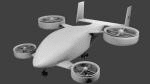
Created as a means to display the potential of a ducted fan rotorcraft powered by multiple electric motors. The system made its launch in 2015, since then advances and improvements have been completed to the airframe and power plant configurations. Delivering an efficient means of lift using smaller and therefore quieter propeller then traditional helicopters. The function of the ducted system serves as a mean of channeling pressure and vectoring thrust. Giving the UV-4 a unique control system and improved maneuverability. The design of a low speed "T-Tail" houses the function of yaw control with multiple rudders located on its vertical stabilizer, and elevators on its horizontal stabilizer. In addition the rear ducted systems may pivot up to less then sixty degrees forward and backwards to deliver the vector thrust where the aircraft needs it to be. The cargo bay may house up to four thousand pounds of deliverable payload. As its max gross take-off weight is designed to reach twelve thousand five hundred pounds. The electrical systems on the aircraft use a network of batteries, generators, and its two electrical motors. Proving five hundred horse power each, totaling an amount of one thousand horse power. An electrical charge then powers the mechanization used to spin the propeller to its desired rate per minute. Perhaps in the near future an additional system can be created to then generate electrical charges created by the spinning propeller of inside the duct back into the aircraft to then power systems or recharge the battery. We forward to providing this aircraft on Microsoft Flight Simulator X, Lockheed-Martin Prepar3d, and X-Plane 10 for download by the end of 2016. Aircraft by Rob Gomez & Kris Pyatt
| Filename: | UV4_VSTOL_UAV_Experimental.zip |
| License: | Commercial demo |
| Added: | 22nd January 2017, 04:10:41 |
| Downloads: | 185 |
| Author: | Rob Gomez & Kris Pyatt |
| Size: | 8.13 MB |
| Category: Flight Simulator 2004 - Scenery | |
| Alaska North Slope 9; Point Hope PAPO |
|
Images related to this file:
File Description:
The town of Barrow is in the far north of Alaska, and these are coastal villages or radar installations to the west, south, and east of Barrow on the North Slope. There will be further additions. Point Hope is a village on a spit of land that is one of the oldest and continuously inhabited places in all of North America, not just the polar regions. The "Point" is what brought this about, migrating whales passing close to land as they rounded the point, and the traditional way of life continues to this day. The population is now around 670. The airport surpassed all my expectations of FS9. Go look at the area before you install this. The first thing you will notice is that FS9 does not list Point Hope PAPO. The town is there (way too big and in totally the wrong place) and the airport background is there (wrong place of course) but there is no airport! Some buildings, but no runway, no apron, nothing that can be used by a plane?!? In real life the town is 3 miles east of the point, the runway is situated between town and point and, unusually in the north, is asphalt. This is presumably possible because of the gravel make-up of the point itself, with very little vegetable content and the warming sea restricting permafrost movements. 4,000 feet of 75 feet wide asphalt, lit, PAPI at both ends, and aligned 01-19. The building that appears to be wrongly situated away from the apron is like that intentionally; it is a helicopter hangar (not used in winter?) and they presumably did not want the apron traffic to get in their way. The AI has daily flights by ERA, plus Northern Air Cargo, and some GA.
| Filename: | Alaska_North_Slope_9_Point_Hope_PAPO.zip |
| License: | Freeware, limited distribution |
| Added: | 25th July 2016, 20:20:35 |
| Downloads: | 254 |
| Author: | Roger Wensley |
| Size: | 3.02 MB |
| Category: Flight Simulator 2004 - Scenery | |
| Brevoort CWOB and BAF-3 radar plus Cartwright LAB-6 radar Canada |
|
Images related to this file:
File Description:
Brevoort airstrip and the BAF-3 radar it serves is on Brevoort Island, off one of the southeastern tips of Baffin Island and 140 miles east of Iqaluit. This scenery includes the BAF-3 buildings on the hilltop and those on the airstrip below, plus the roads connecting them and down to the beach landing area on the rocky coast. This scenery is made for the FSGenesis 76m terrain mesh for northern Canada, and there will be a repost of all my northern Canada airfields to suit this; I cannot think now why I never installed this mesh before. The AI reflects the use of civil airlines for resupply and transportation of personnel. Given the terrain the wind should be from the north so that ai lands using the 02 runway. Landing from the north will involve a terrain clash while take off towards the north will not as the climb out clears the hilltop. The video shows the 600 foot cliff at the runway threshold and an Air Tindi plane on the apron. Cartwright CYCA is on the Labrador coast and has been posted by Flight Ontario as part of their Goose Bay and Labrador Regional Airports sceneries. The nearby LAB-6 radar site is included here, connected to CYCA by an extended road. The site uses the same buildings as Brevoort and Saglek (posted recently) and although I have included them here as separate sceneries the contents can be placed in the same folders as Saglek with a saving in duplicated textures. The textures here are more accurate than Saglek so say yes to over-write; a downloader with personal experience of Brevoort noted that in reality they are lighter.
| Filename: | Brevoort_CWOB_and_BAF3_radar_plus_Cartwright_LAB6_.zip |
| License: | Freeware, limited distribution |
| Added: | 20th August 2017, 15:46:36 |
| Downloads: | 176 |
| Author: | Roger Wensley |
| Size: | 4.37 MB |
| Category: Flight Simulator X - Original Aircraft | |
| "Janet Airways" Boeing 737-600 BBJ-ER |
|
Images related to this file:
File Description:
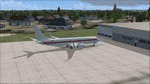
A highly classified small fleet of passenger aircraft known as "Janet" is operated for the United States Air Force to transport military and contractor employees. It mainly serves the Nevada National Security Site (most notably Area 51 (AR51) and Tonopah Test Range (TNX), from their terminal at Las Vegas' McCarran International Airport (KLAS). The planes are also used to fly to/from Air Force Plant 42 (KPMD), Naval Air Weapons Station China Lake (KNID), Hill Air Force Base (KHIF), and Edwards Air Force Base (KEDW). I encourage you to locate, download, and install the AFCAD files or scenery add-ons associated to these airports from any source you desire, but make sure they are designed for FSX. The fleet's "Janet" call sign, from which its de facto name comes, is said to stand for "Just Another Non-Existent Terminal", or more likely "Joint Air Network". Everything is realistic in this model, now, and most simmers know how inaccurate the original FSX 737-800 was. However, this aircraft simulates the accuracy of a 737-600 BBJ-ER, if there ever was one built. I modified everything to fit that aspect, except for the visual model. The engine characteristics are correct as well as all weight/balance and MOI. I even fixed the wheels to be accurate in base, track and pressure size. Everything I've done here is for educational purposes without any expectation of any monetary gain, and offered publicly for free. Read the Readme.txt file for installation and details. All persons involved with this and the original design are credited, unless they are unknown and have offered no credit details. Sounds by: Christoffer Petersen, Panel by: Pasquale Rinaldi, Redirected Texture by: Microsoft (Unknown Staff Member Names), Real World Engine/Aerodynamics by: Douglas E. Trapp, FS Flight Dynamics Engineer [email protected] July 2017
| Filename: | Janet_Airways_Boeing_737600_BBJER.zip |
| License: | Freeware |
| Added: | 8th July 2017, 20:04:30 |
| Downloads: | 1,920 |
| Author: | Douglas E. Trapp |
| Size: | 39.16 MB |
| Category: Prepar3D V1-4 - Scenery | |
| Madonna della Corona Verona Italy N45.39.64 E10.53.34 |
|
File Description:
Madonna della Corona Verona Italy N45.39.64 E10.53.34 A sanctuary set in the Rock of Monte Baldo at about 1350 Ft in the Adige valley.The Corona Sanctuary is a place of silence and meditation, suspended between heaven and earth, hidden in the heart of the Baldo rocks. Medieval documents attest that already around the year 1000 in the Baldo area lived hermits linked to the Abbey of San Zeno in Verona and that at least from the second half of 1200 there existed a monastery and a chapel dedicated to S. Maria di Montebaldo accessible through a narrow and dangerous path in the rock. During the sixteenth century the two access stairs still visible were made: the widest, of 556 steps, which from the source of Spiazzi, then called "Fonte dell'Indipendenza", descended to the bridge of the lime tree, and the narrower one, of 234 steps, carved into the rock along the original narrow path that led from the bridge to the church. In 1974 the architect Guido Tisato was entrusted with the task of drawing up a project for a global intervention that envisaged the demolition of the existing Church, the preservation of the most valid and significant parts and the construction of a broader structure. Demolition and reconstruction of the Sanctuary were carried out between 1975 and 1978 and on June 4, 1978 the Bishop Giuseppe Carraro was able to proceed with the dedication of the new Sanctuary and the new altar. In 1982 the sanctuary was given the title "minor basilica". On April 17, 1988, Pope John Paul II visited and prayed to Our Lady of the Crown. Important VFR point for approaching airport Verona Villafranca e Verona Bosco Mantico. Within the downloaded package you will find readme files for scenery installatio, photos of site an flight plan. Good fly VFR. Pasquale Marrulli.
| Filename: | Madonna_della_Corona_Verona_Italy_N453964_E105334.zip |
| License: | Freeware |
| Added: | 4th May 2018, 04:44:39 |
| Downloads: | 154 |
| Author: | Pasquale Marrulli |
| Size: | 38.05 KB |


© 2001-2026 AVSIM Online
All Rights Reserved
Privacy Policy |