
Where Flight Simulation Enthusiasts Gather from Around the World!
AVSIM Library - Search Results

| Category: Flight Simulator 2004 - Scenery | |
| Z19O - Hamat Airbase - Batroun, Lebanon |

|
Images related to this file:
File Description:
Hamat is a village near the coast of Lebanon, around 25 miles north of Beirut. The airport runway was built during the civil war to the west of Hamat in the late 1970's, between Hamat and another village called Wuajh Al Hajar. The intention was have an alternative to Beirut airport, which could be (and often was) closed by shell fire from any or all of the sides involved in the civil war, or by bombing by those who were not directly part of the civil war but occasionally joined in. It has been used for drag racing, occasional freefall parachuting (this may continue) and is now an army base with mostly helicopter use. The runway is around 5,600 feet of asphalt, 90 feet wide and aligned 02/20. There is no lighting. The apron is set well back from the runway and has hangars at each end; one set is four hangars long, and at the other end of the apron there are three hangars. There are also the remains of some radar to the west of the apron, bombed (in 1982?). The runway has been repositioned and the surrounding landclass modified to reduce one village to it's approximate actual size and to create a second village which was missing entirely. An intrusive road has been deleted, and the airfield grass area also modified.
| Filename: | Z19O__Hamat_Airbase__Batroun_Lebanon.zip |
| License: | Freeware, limited distribution |
| Added: | 23rd May 2015, 10:03:10 |
| Downloads: | 224 |
| Author: | Roger Wensley |
| Size: | 8.53 MB |
| Category: Flight Simulator 2004 - Scenery | |
| Dolbeau-St-Felicien CYDO in Quebec Canada |
|
Images related to this file:
File Description:
This is the fourth of five sceneries around Lac Saint-Jean in Quebec, Canada. Saint-Felicien is a village on a small river at the western end of Lac Saint-Jean, and the airfield is just under 10 miles to the northeast. At the same distance further to the northeast of the airfield and on a slightly larger river is the village called Dolbeau. The village of Sainte-Methode is closer than either of the other villages but presumably lacked influence. The airfield effectively has one runway aligned 11-29 and just under 5,000 feet long, with approach lights on 11. There is, or was, a second runway aligned north-south but this has badly deteriorated without maintenance and has loose stones that threaten propellor damage. The taxiway that runs east-west is in a similar condition and all planes operate as if there is no taxiway. There is a clubhouse and a maintenance facility along with a line of old hangars that remain in full use, plus planes parked in the open. The landclass has been modified along with the grassed area of the airfield, and in the AI (included with the post of CYRC) there are scheduled flights by Max Aviation, and GA flights etc. It is a really typical airfield in northern(ish) rural Canada with a lot more activity than one might expect.
| Filename: | DolbeauStFelicien_CYDO_in_Quebec_Canada.zip |
| License: | Freeware, limited distribution |
| Added: | 19th November 2017, 15:52:32 |
| Downloads: | 167 |
| Author: | Roger Wensley |
| Size: | 4.17 MB |
| Category: Flight Simulator 2004 - Scenery | |
| Hazyview Airfield, Hazyview, South Africa |
|
Images related to this file:
File Description:
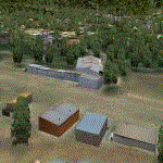
Hazyview is one of the gateway towns to the Kruger National Park and is located just to the West of Phabeni Gate, one of the main gates to use if you are travelling to Skukuza. The airfield in Hazyview is also called Numbi Airfield due to the location of the Numbi Hotel right next to the airfield.
Hazyview airfield is not included in the default scenery of FS2004. With this package, it has been faithfully produced in Gmax with photoreal textures on all the buildings and a photoreal ground as well. Even the Lowveld mall to the North of the airfield and right on the approach to Rwy 19 as well as the Building supplies store to the south and on approach to Rwy 01 is inlcuded with custom models and textures. Likewise, the buildings to the West of the runway (right at the edge of the runway) and the brickyard at the Northern end is modeled with custom models and textures. The two large cellphone antennas are also present in the airport scenery and custom made.
In real life, the runway is quite sloped and this was also recreated in the scenery under the limitations FS2004 presents with regards to non-flat airports.
The grass runway is aligned 01/19 and only 820m long. Take-off is on Rwy 01, with landings on Rwy 19.
| Filename: | Hazyview_Airfield_Hazyview_South_Africa.zip |
| License: | Freeware, limited distribution |
| Added: | 4th February 2022, 14:57:40 |
| Downloads: | 139 |
| Author: | Kobus van Wyk |
| Size: | 17.07 MB |
| Category: Flight Simulator 2004 - Scenery | |
| Mustique TVSM in the Grenadines |
|
Images related to this file:
File Description:
Mustique island is one of the northernmost of the group of islands known as the Grenadines, just south of Bequia. Mustique is a small island, less than 3 miles long and even at its widest less than a mile wide; as a result the resident population is less than 500. The island is unique in that it is owned by a company. The company is owned, in its turn, by the owners of the 100 or so private villas on the island. The Queen of England is one owner; her participation is balanced out by Jeremy Clarkson.
The airport is at the northern end of the island; the runway is around 3,240 feet long, aligned 09 (and with the southeast trade winds it is most unlikely that you will ever find yourself using 27) and with a steep and displaced threshold of over 900 feet. The displaced threshold is shown but unfortunately FS9 is not capable of coping with anything other than a prefectly flat airport. The terminal is a steel-framed shed with cladding, but is "quaintly" transformed with a palm frond roof etc. There are connecting flights by SVG to Barbados and the other islands and these are reflected in the AI. The airport has no lighting, and flights are obliged to land and depart in daylight hours only, outside of which the airport is closed.
| Filename: | Mustique_TVSM_in_the_Grenadines.zip |
| License: | Freeware, limited distribution |
| Added: | 11th June 2013, 22:57:37 |
| Downloads: | 512 |
| Author: | Roger Wensley |
| Size: | 2.07 MB |
| Category: Flight Simulator 2004 - Scenery | |
| Terrace CYXT Updated |
|
Images related to this file:
File Description:
This revises the previous versions by adding two missing buildings, corrects the apron markings and parking and adds a third gate, creates more GA parking, updates the AI to include, for instance, a Westjet flight, and most importantly of all adds the ILS to runway 33. It is complete in itself and can be installed as-is without first installing previous versions. Terrace is fifteen miles east and inland from Prince Rupert, which is 500 miles north of Vancouver up the BC coast. It is at the point in the mountains where two fjords meet, one coming from Prince Rupert and the other from Kitimat. The population of the town is around 12,500. The airport is called Terrace-Kitimat and is a couple of miles south of the town of Terrace, on the south side of the Skeena River. There are two runways, and the main one is a recently-extended 7,500 feet long and lit 33-15 with approach lighting to both ends and an ILS on 33. The second is 5,373 feet of unlit 03-21. The apron has been enlarged to be able to accommodate a Boeing 737, though there is at the moment no airline using a 737 for flights to Terrace. The pics and the video show the surrounding hilly terrain and the nearby river between the airport and the town.
| Filename: | Terrace_CYXT_Updated.zip |
| License: | Freeware, limited distribution |
| Added: | 13th January 2019, 18:38:12 |
| Downloads: | 177 |
| Author: | Roger Wensley |
| Size: | 15.64 MB |
| Category: Flight Simulator 2004 - Aircraft Repaints, Textures and Modifications | |
| Lockheed L-749A Constellation TWA 1958 |
|
File Description:
FS2004 Lockheed L-749A Constellation TWA 1958.
In June 1939 TWA (Transcontinental & Western Air) required a four-engined airliner capable of flying transcontinental US services non stop west to east or with one stop travelling in the opposite direction against the prevailing wind. The specification was drawn up by TWA's major shareholder Howard Hughes and TWA-director Jack Frye. The intial result was the L-49 Constellation, but before the first aircraft was built WWII broke out and the Connie was drafted by the militaries as C-69. After the war the C-69 was renamed L-049 Constellation and delivered to a.o. TWA (27). The L-649 and L-749 Constellations were the first true civil versions. TWA used 12 L-749's and 28 L-749A's from March 1948 till 1967. This particular L-749A, N6001C 'Star of New Jersey', flew with TWA from 24 March 1950 till September 1966. It was scrapped in 1968.
This repaint is a much improved version of the one issued in 2006. It has not been tested for the FSX version of Abacus' Constallation but probably will function there as well.
These are textures only. You will require Francisco Sánchez-Castañer's great payware Lockheed L-749 Constellation, which can be obtained from Abacus' Platinum Collection (see http://www.abacuspub.com/default.html). Repaint (based on Francisco Sánchez-Castañer's textures) by Maarten Brouwer.
| Filename: | Lockheed_L749A_Constellation_TWA_1958.zip |
| License: | Freeware, limited distribution |
| Added: | 14th September 2007, 18:25:40 |
| Downloads: | 522 |
| Author: | Maarten Brouwer |
| Size: | 3.31 MB |
| Category: Flight Simulator X - Scenery | |
| LJLJ - Jozef Puchnik International Airport - Ljubljana, Slovenia |
|
Images related to this file:
File Description:
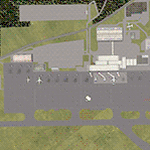
Decent representation of Slovenian airport named after Jozef Pucnik,
located near the village Spodnji Brnik, some 15 miles north of Slovenia's capital Ljubljana.
The scenery is packed with many features: custom landclass in the walley underlying the approach paths to both runways(12 and 30),
custom airport layout as found after last reconstruction of aprons and taxiways, corrected approaches (so IFR AI traffic in case of a missed approach to runway 30 is no longer turning right crashing into the 8000ft mountains just North of the airport). All airport buildings are placed into their correct
locations and shapes, even if only default generic buildings and library objects were used.
You will also notice airport has 3 runways(AFCAD on steroids),when there is actually
only one in reality and only one is also visible in the simulation.
This was done in order to enable different categories of AI aircraft using different intersections
for departure and the only way possible to recreate this was to use overlayed runways of different lenght.
There are also some surprises hidden in the scenery, but we will leave them for you to discover.
Music titles used in the scenery are published with kind permission of the author, Mr.Slavko Avsenik.
Released as freeware but with limited distribution.
LJLJ2012 by SST - Slovenia Scenery Team
| Filename: | LJLJ__Jozef_Puchnik_International_Airport__Ljublja.zip |
| License: | Freeware, limited distribution |
| Added: | 10th June 2012, 15:30:05 |
| Downloads: | 3,467 |
| Author: | SST - Slovenia Scenery Team |
| Size: | 11.35 MB |
| Category: Flight Simulator X - Scenery | |
| Airport update for Chicago O'Hare Intl Airport (KORD), Illinois, USA |
|
Images related to this file:
File Description:
This updated version reflects the changes taking place at the airport with two optional files and made only for FSX users, not made or suitable for use in P3D: There is one version with the Crosswind runways operating where all 8 runways will be used for takeoff/landing and one version as the default airport runway operation: Runway 9C/27C and its taxiways now added with ILS approaches included for it, runway 9R/27L now at its new extended length and the ILS approaches corrected for it, the runway reconfiguration is now complete, the new extension and gates added to terminal 5, all aprons, taxiways and taxi signs updated to the latest charts, assigned parking as per their website where possible with extra parking including 2 gates for the A380 (gates M9 and M19), extra fuel trucks, support vehicle roads rebuilt and many other scenery improvements and objects added, airport views are from inside the central control tower (when in tower view), there is also a file for the nearby airport Chicago Executive formally Palwaukee Municipal (KPWK) which uses the same frequency as the KORD ILS for rwy 9C/27C, this bgl file for KPWK has the ILS frequency for Rwy 16 corrected to 109.75, so as not to cause a conflict at KORD, please view the readme before installation.
| Filename: | Airport_update_for_Chicago_OHare_Intl_Airport_KORD.zip |
| License: | Freeware, limited distribution |
| Added: | 22nd January 2022, 01:59:01 |
| Downloads: | 52,751 |
| Author: | Ray Smith |
| Size: | 5.95 MB |
| Category: Flight Simulator X - Scenery | |
| "Your Own Sea Port"..Part II of "Your Own" |
|
File Description:
This scenery is Part II of "Your Own" Series. The first one is "Your own AirPort"....
slowly but surely a community is being born!!!!!!...what do you get with YOSP??
--
"YO Airport" has contracted the " Marching Band and Construction Ltd" to construct the " YO-Seaport" near the rich Oil Fields of the coast. MBC Ltd, has thus proceeded full blast on this major important Sea Port which will give traffic to YO Airport and sorroundings.....Now planes will fly on rigid schedules between these two airfields......
later YO-Hill Airfields(Part III) will come along in the mountains in small lakes and Sea Stops...or small seaplane destinations....for more Fun and activities!!!!
What does "Your Own Sea Port" has for you.....?and what can you do there??
1) Two Airfields, one grass for small private planes and one Concrete for Commercial traffic ( new technique so it won´t be "sunk" with whatever mesh you have!!!) ...........+ Floatplane Base!!!
2) Helicopter Pad at the Port Hospital...(lighted)
3) Rescue Sailors at burning ship!!!!---(ship sinking fast!!)...take them to the Port´s Hospital.
4) Check moving traffic with any chopper.( There is a red corvette which must be checked with some women driving too fast!!!)
5) Participate in:
Road Race ( Need a car!!)...Prices galore!!!
Boat Race around Red Bull Pylons (need a Boat!!)...RedBull guys left them here for good!!!
Fly a Race at the same Pylons...(Really Hard!!!!)
6) Fly Tourists to Fishing Lake where Bass Abounds..(Need Floatplane).
8) Fly with your Navy Patrol plane and check on some "Strange Submarine
taking pictures of the port"...if necessary blow it to smitherins!!!!!!!
9) Open a New Airline....YO Air Service Inc...
10) Fly around and take pictures.
11) Take executives to the Oil Facilities in the Interior (EpisodeIII)...
or just fly around with your gal, wife or hummmm, hummmm.............or go fly under its three bridges!!!!!
12) Take passenger from the "Float Plane" Airpark, near the hospital, to lakes and rivers. The Mayor of YOSP will be giving the "city Keys" to all Pilots
who makes four consecutive loops in a helicopter on Sunday at 11:42:45.
| Filename: | Your_Own_Sea_PortPart_II_of_Your_Own.zip |
| License: | Freeware, limited distribution |
| Added: | 28th November 2008, 15:48:14 |
| Downloads: | 1,513 |
| Author: | Gera Godoy Canova |
| Size: | 900.13 KB |
| Category: Flight Simulator X - Aircraft Repaints, Textures and Modifications | |
| RNLAF General Atomics MQ-9 Reaper |
|
Images related to this file:
File Description:
For a while now, the Royal Netherlands Air Force is looking for a Medium Altitude Long Endurance (MALE) UAV, to fill the ISR-gap between tactical requirement and avaliable manned recce assets. One of the candidates is the General Atomics MQ-9 Reaper (or Predator-B as it was formerly known). This repaint on the magnificent model by FFS gives you an impression what a Dutch Reaper can look like.The squadron logo is of the disbanded 306 Sqn, a unit with a long aerial reconnaissance history.
You need a legal, payware copy of the FFS General Atomics MQ-9 Reaper for FSX in order to use this repaint.
| Filename: | RNLAF_General_Atomics_MQ9_Reaper.zip |
| License: | Freeware |
| Added: | 15th September 2013, 19:57:07 |
| Downloads: | 104 |
| Author: | Rene Spaan |
| Size: | 5.01 MB |


© 2001-2026 AVSIM Online
All Rights Reserved
Privacy Policy |