
Where Flight Simulation Enthusiasts Gather from Around the World!
AVSIM Library - Search Results

| Category: Flight Simulator 2004 - Original Aircraft | |
| Lockheed L-749 Constellation Base Pack |

|
Images related to this file:
File Description:
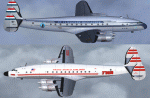
Dimensionally identical to the first-generation Constellation (L-049), the
post-war 749 had more powerful engines, additional fuel tanks, strengthened
landing gear, and much improved performance. Equally good for shuttle hops
and long-range flights, L-749 Connies entered service with major 1950s
carriers such as Eastern, TWA, B.O.A.C., Air France, KLM, Quantas, and many
others. Another customer was the Air Force, which placed an order for ten
aircraft (designated C-121A) in 1948.
Included in this sim package are seven
models and five textures, covering variants with and without "Speedpak"
cargo pannier, weather radar, and "jetstack" exhausts. KLM texture by Jaap
de Baare (representing "Flevoland", the last 749 in flying condition today).
TWA texture N6003C "Star of America" by Hans Herrmann. EAL, Air France, and
MATS textures by Manfred Jahn (including "8609", a frequent visitor to
airshows all over the world until 2005). Panel textures and additional
gauges by Diego S. Barreto, model and VC by Manfred Jahn, panels, gauges,
and animations by Hansjoerg Naegele, flight dynamics by Luis Pallas,
wingview angles, lights, and exhaust effects by Bill Tyne and Roland Berger,
checklist and documentation by Volker Boehme, flight test and handling
research by Stefan Werner. The 749 project has been hosted by Tom Gibson's
Calclassic forum at http://calclassic.proboards55.com.
| Filename: | Lockheed_L749_Constellation_Base_Pack.zip |
| License: | Freeware |
| Added: | 5th December 2009, 04:07:37 |
| Downloads: | 23,652 |
| Author: | Manfred Jahn and 749 Team |
| Size: | 36.17 MB |
| Category: Prepar3D V1-4 - Utilities | |
| Flightplan Visualizer 1.14 |
|
Images related to this file:
File Description:
Flightplan Visualizer (FV) version 1.14.0. Copyright 2018-2019 by Pelle F. S. Liljendal ([email protected]), all rights reserved.
FV comes with 629 pre-imported Commercial AI flightplans (+380 BizJet flightplans are available as a separate download). However you are able to import additional (AI) flightplans yourself. Once imported these (AI) flightplans can be visualized on a map-view, and the user will be able to search accross all these. Hence you can use the program as inspiration as to which routes to fly. E.g. you can search across all imported flightplans to find all flights in an A321 flying into/out from LDDU, or simply to look for all flights in a Boeing 747-8F.
Simply run the included installer to install the software. The program will be installed into "C:\Program Files (x86)\Flightplan Visualizer" and all datafiles will be installed into: "C:\Users\[UserName]\AppData\Roaming\FlightplanVisualizer". The program comes with a full manual explaining everything, and a 3 page quick manual to get you started. The first 3 times you run the program the quick manual will automatically open. The forum is hosted here: https://forum.aerosoft.com/index.php?/forum/919-flightplan-visualizer/
Version 1.14 Contains the following changes:
- Flightplan file-format was changed, to accommodate changes to the airline-data. In previous versions the airline ICAO-code had to be unique, hence not allowing old defunct airlines still remaining in the data-file when a new airline would be issued the same ICAO-code (now they can both exists, and many of the defunct have been marked as defunct).
- On start-up old flightplans in enabled folders will automatically be updated to the new format. If you have sub-folders containing additional flightplans, you should make sure these are enabled, in order to have these updated as well. Once they have been updated you can go ahead and disable these sub-folders again as you please.
- Its now possible to add user defined airlines, in case you want to add you own fictitious airlines (e.g. VA's) or you want to add airlines missing in the official data-files that I supply with the program (if this is the case, please notify me, so I can add these in the next release of the program).
- "Favorite aircraft" have been renamed into "Favorite aircraft-types", as it is the "types" of aircraft you mark. You don't mark a particular aircraft/cofiguration (like the PMDG B737-800 NGXu) as your favorite, but rather the "type" (B737-800). The file containing the (active) favorite aircraft-type selection was renamed as well (you don't have to do anything, the file is automatically renamed on start-up).
- Added a new Unit-Conversion form, letting the user convert units of: Speed, Lenght/Distance, Weight/Volume, Pressure and Temperature. The Weight/Volumne conversions is a bit special as it lets the user convert between weight (kg/lbs) and volume (liter/gal), thanks to a Fuel Density that defaults to 0.785, but can be changed by the user.
- All search-forms (seaching for airport, aircraft and airline) was changed to ignore whitespeaces (e.g. "airBaltic" vs. "air Baltic"), and ignore diacritics (e.g. "AerolÃnea" vs. "Aerolinea"), making it more easy to find what you are searching for in one go.
- The airline search-form will by default exclude airlines that have been marked as defunct. However a new "Include defunct" check-box have been added to the form, allowing you to include these (who am I to say you can not still use "Air Berlin", "Monarch" or "Thomas Cook" flightplans if you want to).
- Added 3 new columns to the airline search form showing commence/cease-date, and wheter or not the airline is "in use" (as carrier/operator by any of the active fligthplans).
- State is now by default excluded when using the airport search form, which make it a lot more convenient to find airports in the city of "New York". State can still be included in the search by choosing a different search-type using the combo-box in the upper/right corner.
- When Flightplan Visualizer needs for perform potentially lengthy operations it will spread the workload over the available cores of the CPU. However if you want to limit which cores it uses you can now set the affinity-mask in the settings form.
- The splash-screen shown when the program starts, and when reloading active flightplans was prevoiusly always shown on top (top-most), but if you find this anoying it can now be disabled in settings.
- Fixed: Warnings/errors regarding loading flightplans were only displayed at start-up. Now they are shown whenever all active flightplans are loaded (e.g. after having enabled a sub-folder).
- Data: The airline-data got a major update, and a bunch of new airlines were added, and the data for MANY others were updated. It is a manual process to update these, almost as funny to do as to watch paint dry ;-)
- Data: A few countries had a wrong- or no sub-region code, so these were fixed/updated. As usual, if any of you spot any erros, or missing data, please use the forum to notify me.
- Data: Additional info added to the aircraft-data (in preparation for some future plans).
- Flightplans: All flightplans bundled with the installer have been updated to the new file-format.
- Flightplans: Thanks to Ryan Carson (RCAI) for allowing me to bundle the installer with a few of his flightplans, so the installer comes with the very first winter 2019-2020 flightplan.
- Flightplans: The good people over at AIG (Alpha India Group) have been VERY busy since the last release, hence the installer comes with +130 new pre-imported flightplans, bringing the total to 629. This update concludes Summer 2019, and AIG already have the first Winter 2019/2020 flight-plans in beta-test.
Pelle
| Filename: | Flightplan_Visualizer_114.zip |
| License: | Freeware, limited distribution |
| Added: | 10th December 2019, 06:59:46 |
| Downloads: | 370 |
| Author: | Pelle Liljendal |
| Size: | 31.01 MB |
| Category: Flight Simulator 2004 - Miscellaneous Files | |
| Sorted POI global cities and airports pack for FSDiscover! |
|
File Description:
README:
FSDiscover! Global Point of Interest pack.
Here is a poi pack of roughly 147 000 cities, 40 000 small airports,
1 177 seaplane bases, 4695 medium airports and 475 of the largest
airports.
Airports are split up in categories, small, medium, big, seaplane base.
Cities are split up into files of 10 000 cities each by size.
There are 15 files for cities.
The smallest cities are in xaa, xab, xac, xad, and so on.
The biggest cities are in xam, xan, until xao.
You should open the files in notepad to see for yourself which city
files to activate in FSDiscover! to balance clutter and detail.
This has been my main problem with the default populated places list;
there is no way to sort by population size
Compared to the default FSDiscover! populated places here are some
notes:
I have noticed that in the default FSDiscover! set for europe and many
other places, the coordinates are placed like on a "honeycomb" grid
which obviously is not very precise. In general, in terms of city map
precision, this pack should be better.
In the default pack, in an area I am familiar with, a city was placed on the other side of
a river compared to reality. In many other areas, you can clearly see
that the cities are not well-aligned with Ultimate Terrain europe or
even some places in UT USA. My theory is that either data was not super
precise for europe to begin with or that the dataset has been arranged
in the honeycomb grid fashion perhaps to reduce clutter or something.
Mostly though, the default populated places FSDiscover! file is very
useful for really small villages since these tend to be forgotten in
other datasets. The problems come when you want to filter out smaller
villages or airports. This is where this pack comes in handy.
Since no data is perfect, you can use this pack alone or in
combination with the FSDiscover! defaults. Personally, I put the same
files in both "Documents/FSDiscover Files" and
"Program Files/FSDiscover" so I can pick and choose a useful combo
from relevant sets inside the options.
Personally, I prefer the cities from this pack and the rest
(mountains, rivers etc.) from the default FSDiscover! pack.
INSTALLATION:
Just unzip the archived files into "C:\Users\YOURUSERNAME\Documents\FSDiscover Files"
or "C:\Program Files (x86)\FSDiscover!\geodata" or both!
I do not know if the geodata folder is completely overwritten some
times or not so keep that in mind. (probably safe, though)
AUTHOR:
fs9_2003 thanks to data made available by opendatasoft.com and ourairports.com
The source for cities:
https://public.opendatasoft.com/explore/dataset/geonames-all-cities-with-a-population-1000
The source for airports:
https://ourairports.com/data
| Filename: | Sorted_POI_global_cities_and_airports_pack_for_FSD.zip |
| License: | Freeware |
| Added: | 6th May 2024, 14:13:54 |
| Downloads: | 53 |
| Author: | Kim Husainov |
| Size: | 3.18 MB |
| Category: Prepar3D V1-4 - Aircraft Repaints, Textures and Modifications | |
| North American T-6 Texan (F-BJBF) Air France |
|
Images related to this file:
File Description:
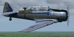
This folder contains a repaint for the A2A North American T-6 Texan/Harvard in the colors of North American T-6G F-BJBF of Air France, 1962. Originally built as 41-33931 (c/n 88-14948), it went to the RAF as EX959. It was used by the 20 Service Flying Training School in Rhodesia from January 1943 onwards. After the war, it was transported back to the UK, where it was sold to the Belgian Air Force, where it became H-9. It flew from Brustem until 1959. The Belgian Air Force then sold it to Air France, with 14 other Harvards, for use at its flight school in Pontoise Cormeilles en Vexin, west of Paris. It flew with Air France until 1965, when it was sold to Mr Urbain of Cannes, who flew it in Air Esterel colors until 1971. It then went to the UK, becoming G-AZJD. It remained based at Biggin Hill until 1984, when it went back to France as F-AZDU, being bought by Guy Robert, a former Mirage pilot who recieved his training in the '50's on a Harvard in Marocco. In 2001 it was sold to John Colors SL in Barcelona, but it retained its French registration of F-AZDU. It is still airworthy, based at Sabadell in Spain. Repaint by Jan Kees Blom, based on the paintkit by A2A.
| Filename: | North_American_T6_Texan_FBJBF_Air_France.zip |
| License: | Freeware |
| Added: | 5th October 2019, 18:05:30 |
| Downloads: | 103 |
| Author: | Jan Kees Blom |
| Size: | 26.47 MB |
| Category: Flight Simulator 2004 - Aircraft Repaints, Textures and Modifications | |
| P-51D 357th FG/ 362nd FS G4-E "Missouri Armada" |
|
File Description:
P-51D Mustang 44-14789 "Missouri Armada" flown by Capt. John "Johnny" B. England.John Brooke England was born in 1923 at Caruthersville, Missouri. His service number was O-739263 and he joined the 362nd FS of the 357th FG in April 1943 as a 1/Lt meaning that he was part of the original cadre that left the ZI in November 1943 for the UK. He was promoted to Captain and then to Major. He took command of the 362nd FS on 25 August 1944. He served two tours with the 357th FG for a total of 108 operational missions giving a total of 460 hours combat flying time. He was the second highest scorer in the 357th with a total of 17.5 victories. England finished his second tour and rotated home on 26 January 1945. He remained in the service after the war and was killed in an F-86 crash in November 1954 in France. Alexandria Air Force base in Louisiana was renamed England Air Force Base in his honor. The aircraft was later assigned to Lt. Oscar Ridley, who renamed it "Sad Sack". The a/c was lost on 18 april 1945, with Lt Ridley evading capture. Repaint for the Shockwave WWII Mustang by Jan Kees Blom, based on the paintkit by John Terrell.
| Filename: | P51D_357th_FG_362nd_FS_G4E_Missouri_Armada.zip |
| License: | Freeware |
| Added: | 6th April 2008, 13:45:28 |
| Downloads: | 227 |
| Author: | Jan Kees Blom |
| Size: | 7.23 MB |
| Category: Flight Simulator X - Utilities | |
| HUD Parameters for FSX |
|
Images related to this file:
File Description:
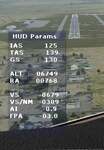
HUD_Parameters.lua is a Lua script that displays flight parameters in a small text window that pops up when the script is selected by an assigned key or button if the aircraft is in the air.
Parameters displayed are:
• Indicated Airspeed (IAS. Kts)
• True Airspeed (TAS, Kts)
• Ground Speed (GS, Kts)
• Mach# (when above a user settable altitude, currently 25000ft)
• Altitude (ALT, ft)
• Radio Altitude (RA, ft)
• Vertical Speed (VS, ft/min)
• Vertical Speed per Nautical Mile (VS/NM, ft/NM)
• Attitude Indicator pitch (AI, degrees)
• Flight Path Angle (FPA, degrees)
The top of the script contains user settable values for the size and location of the display, the altitude above which the a/c Mach# will be displayed (default is 25000ft), the data update interval in milliseconds (default is 2000),
and whether or not data is to be logged in HUD_Parameters.log (default is 0, off). These values can be set using a text editor like NotePad.
A registered copy of FSUIPC is required to execute the Lua script. Simply copy the script to the Modules folder of FSX and use FSUIPC4 to assign a key, button or switch to toggle the script on and off.
The script turns off if the aircraft is on the ground.
Al Klayton
| Filename: | HUD_Parameters_for_FSX.zip |
| License: | Freeware |
| Added: | 29th July 2017, 07:15:25 |
| Downloads: | 473 |
| Author: | Al Klayton |
| Size: | 16.82 KB |
| Category: Prepar3D V5 - AFCAD Files | |
| KMEM (Memphis Intl.) bgl/afcad for Prepar3D v5 |
|
File Description:
This is a modification of the stock Memphis afcad/bgl in Prepar3d v5 and models the airport in its state prior to the new construction occurring presently at the main terminal area. For ease of use and simplicity, gates are numbered "Gate A1, Gate A2", etc...
I tried to match as closely as possible the FedEx Terminal as close to what was shown on current Navigraph charts but it is NOT exact.
Airport Breakdown:
Passenger Terminal w/ airline codes have been added to gates.
- Concourse A: Gates 1-8
- Concourse B: Gates 1-24
- Concourse C: Gates 1-8
- FedEx Terminal - Dock numbering is based loosely on the dock numbers found on the Navigraph charts for KMEM. Not all docks are represented but there 120 spaces for parking there.
- FedEx Maintenance - Is on the East side of the airport below runway 27. It has 16 static parking areas.
- Northwest FBO - Located West of runway 18C. It has 18 parking spots.
- Northeast FBO - Located East of Runway 18C to the left of the FedEx Maint. area. It has 14 parking spots.
- South Cargo - Located next to Runway 36R. It has 5 parking spots (I am assuming UPS and other carriers).
- Military Ramp - Located next to South Cargo next to Runway 36R. It has 5 parking spots.
I hope you enjoy this enhancement of KMEM
| Filename: | KMEM_Memphis_Intl_bglafcad_for_Prepar3D_v5.zip |
| License: | Freeware |
| Added: | 28th November 2023, 01:47:55 |
| Downloads: | 63 |
| Author: | Michael Johnson |
| Size: | 47.2 KB |
| Category: Flight Simulator 2004 - Scenery | |
| Ford India Project Compilation |
|
Images related to this file:
File Description:

This zip contains the entire Ford India Project from the inception seed airfield of Pondicherry (Part1) through to the completion of Part4. A total of 24 historically rendered (1930's) airfields. This is the first 4 parts all rolled into one for a project that is planned to be 7 parts - to see detailed descriptions and images visit http://www.ford-tri-motor.net/ford-india-project.htm
Contained in the pack is the historically rendered SCENERY Only for the following airfields:PONDICHERRY, COLOMBO, HYDERABAD, BOMBAY, AHMEDABAD, KARACHI, INDORE, MADRAS (Principle), MADRAS (Alternative), CALCUTTA, ALLAHABAD, CHITTAGONG, NAGPUR, DELHI, JODHPUR, CAWNPORE, BANGKOK, BASSEIN, AKYAH, RANGOON, KUALA LUMPUR (Principle), KUALA LUMPUR (Alternative), PENANG and SINGAPORE.
There is also a comprehensive aircraft AI Pack available on the Ford-Tri-Motor.net site that has a collection of historical aircraft using the above airfields for circuits and some transit between some of the airfields. Visit http://www.ford-tri-motor.net/ford-india-project.htm to get them for Free.
For simmers that have parts of the Project this zip will ensure that they have the complete current components of the project, for new patrons this will install all of the project to date. It will be a couple of months before the remaining Parts,5,6 and 7 are completed.
Project Manager - Edward C. Moore
Project Developer- Garry J. Smith
| Filename: | Ford_India_Project_Compilation.zip |
| License: | Freeware, limited distribution |
| Added: | 16th August 2013, 20:32:47 |
| Downloads: | 295 |
| Author: | Edward Moore & Garry Smith |
| Size: | 9.79 MB |
| Category: Flight Simulator 2004 - Helicopters | |
| Sikorsky CH-3 'Jolly Green Giant'. Three detailed Sikorsky CH-3 liveries of original helicopters, used by the USAF in the early sixties. |
|
File Description:
This download, based on the original Giovanni Quai's Agusta HH-3F, contains three detailed Sikorsky CH-3 liveries of original helicopters, used by the USAF in the early sixties.
-Sikorsky CH-3E USAF/21stHeliSqdr. No.703 'DUSTY'.Vietnam War Livery.
CH-3E Jolly Green Giant heavy-lift helicopter, introduced in 1962. It was developed for aircrew rescue missions deep into enemy-held territory during the Vietnam War where the helicopters were best known as the "Jolly Green Giants". This version contains an improved and more detailed livery.
-Sikorsky CH-3 USAF 1370th Photographic Mapping Wing, MATS, APCS, Turner AFB, Albany, GA 1959-1966. Bare metal liveries around 1966, No's. 39686 and 39687.
These helicopters were used by the 1370th Photo-Mapping Wing for supply and support of geodetic ground stations in conjunction with aerial surveys. They were assigned to the wing in 1964 and replaced the H-21 "Workhorse". Both "Jollys" joined the Ethiopia-U.S. Mapping Mission (Project AF58-3), aka Project "King's Ransom " in 1964-1966. This unique mission was created in order to photograph and map the entire Empire of Ethiopia.
If you want to know more about the 1370th Photographic Mapping Wing or photomapping helicopters in general, please visit the very interesting page of Jim Kinter sr.
You can find it under: http://www.1370th.org/Helicopters_files/ch-3b,c/ch3bc.htm
| Filename: | Sikorsky_CH3_Jolly_Green_Giant__Three_detailed_Sik.zip |
| License: | Freeware |
| Added: | 6th October 2010, 08:44:11 |
| Downloads: | 1,919 |
| Author: | Andreas Becker |
| Size: | 18.55 MB |
| Category: Flight Simulator 2004 - Scenery | |
| Peace River CYPE in northwest Alberta, Canada UPDATED |
|
Images related to this file:
File Description:
This is an updated version of the original post (from 2014) made in November 2018. It provides missing textures, and deals properly with an ai problem that I thought I had already fixed. It also adds extra objects to the apron area and adds a third gate. It is complete in itself and can be installed as-is if you do not have the original post. The Peace River flows east from the Rockies, joining up with the Slave River to empty into Great Slave Lake. The town is on both banks close to a bend where the Peace turns to the north, 245 miles northwest of Edmonton. The population is 7,000 and the surrounding area is either farmland or forest. The airport is just over 3 miles west of the town. The runway is 5,000 feet of wide asphalt (150 feet) aligned 04/22, lit, and with PAPI. There is a second runway to the south of the main runway, 1,900 feet of grass and aligned 08/26. The apron is to the north of the runway at the eastern end and is large; there is a purpose-built terminal building, plus other hangar buildings along taxiway C that extends westward from the apron. The airport is experiencing an increase in scheduled and GA flights in the last few years.
| Filename: | Peace_River_CYPE_in_northwest_Alberta_Canada_UPDAT.zip |
| License: | Freeware, limited distribution |
| Added: | 10th December 2018, 17:33:25 |
| Downloads: | 128 |
| Author: | Roger Wensley |
| Size: | 24.27 MB |


© 2001-2026 AVSIM Online
All Rights Reserved
Privacy Policy |