
Where Flight Simulation Enthusiasts Gather from Around the World!
AVSIM Library - Search Results

| Category: Flight Simulator 2004 - Scenery | |
| Naknek (5NK) and Naknek South (WSN) - Alaska, USA |

|
Images related to this file:
File Description:
Naknek and Naknek South are two towns close to the mouth of the Naknek River and on opposite banks. King Salmon is approximately 15 miles to the east. The canneries on both banks of the river are the reason for the existence of both towns and airfields, with fishing for salmon being the primary industry of the area. This takes place from the beach by individuals, by small boats in the river and the immediate sea area, and offshore by larger craft. There is a picture of one boat unloading in Naknek which will be known to anyone who has watched the most famous television fishing programme of all, Deadliest Catch. Cornelia Marie is better known for the crab fishing based in Dutch Harbor, but this area too is just as productive though without the drama. Naknek 5NK has two gravel runways and a float runway in the adjoining lake; all three are just under 2,000 feet long. Naknek South WSN has two gravel runways, 12-30 being 3,300 feet long and 04-22 2,260 feet. As the road connecting to King Salmon is on the north bank it is probable that more seasonal workers are brought into the southern canneries by air, hence the longer runway (and with PAPI on 12). Grant Aviation run scheduled flights into both and there are numerous seasonal charter flights. The AI is a further modification of that posted with King Salmon PAKN and includes these flights, and presumes that you have already downloaded PAKN.
| Filename: | Naknek_5NK_and_Naknek_South_WSN__Alaska_USA.zip |
| License: | Freeware, limited distribution |
| Added: | 29th April 2015, 20:44:31 |
| Downloads: | 217 |
| Author: | Roger Wensley |
| Size: | 6.09 MB |
| Category: Flight Simulator X - Scenery | |
| Amsterdam Schiphol - EHAM Netherlands Package |
|
File Description:
This Airport package is being released in conjunction with the release of the new ADE Design Utility (Airport Design Editor) to illustrate the power and design capabilities of both the current Home Version and the future Pro Version. The main airport in my ADE BGL is the Amsterdam Schiphol EHAM Airport. I also included into the single Airport Facility data bgl 5 additional airports which are Eindhoven AB (EHEH), Groningen Eelde (EHGG), Lelystad (EHLE), Maastricht-Aache (EHBK) and Rotterdam (EHRD) for you to explore. Major key changes are all 3 parallel runways are open with restrictions and are ATC controlled Arrival runways for both the User and AI Plane Traffic. Additional runways are also working simultaneously but some runways are closed for Arrival and/or Departure as per the ATC Preferential Runway System. All Gates and Parking Spots have been updated so AI Airline Planes, Maintenance, Cargo, Commuter, and Corporate GA park in the correct places. New Approach code including the 3 STAR's, Night RNAV's and all current Transitions have been rewitten and coded properly as seen in the GPS receiver per current Jeppesen Charts. Many Scenery features have also been added at each of the Airports which also includes the new H Terminal at EHAM. AI Planes fly the true RWY 24 VORDME curved approach from the PAM VOR and RWY 04/22 is a restricted runway that FSX ATC will only vector AI/User Planes that weigh less then 74000lbs EW to this active runway. Read the included Whats New Readme txt file for all the added enhancements.
| Filename: | Amsterdam_Schiphol__EHAM_Netherlands_Package.zip |
| License: | Freeware, limited distribution |
| Added: | 4th December 2007, 12:15:13 |
| Downloads: | 45,409 |
| Author: | Jim Vile |
| Size: | 4.27 MB |
| Category: Miscellaneous Files - Demos from Commercial Vendors | |
| AirFx 06 (Commercial Demo) |
|
Images related to this file:
File Description:
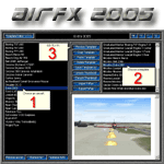
--Re-upload--
Imagine a low-level bombing run in Flightsim 02/04 only 3 MOUSE CLICKS AWAY.
The next generation of excitement is here, completely new inside and out.
Weapons, smoke writing, engine fires, and more EASY AS 1,2,3 with AirFx!
AirFx 06 makes the aircraft smoke system even easier to use.
Fully loaded with the new features everyones been asking for.
Includes a new html based help system with easy to understand graphics.
Demo includes FREE one full hour of flight-time in FlightSim with effects.
NEW AIRCRAFT EDITOR FEATURES:
Easy to use for the novice incredible time-saving features for the pro.
Import / Export FxPax effects packages for fast and easy sharing or backup.
Add your own exciting screenshots for easy template identification.
FxPax save your screenshot, effects, textures and smoke system settings.
Web enabled so you can download new effects packages, create and share your own FxPax.
NEW TEMPLATE EDITOR FEATURES:
The fastest and easiest way to position individual effects.
Revolutionary Aircraft Placement Matrix to easily place effects on your aircraft.
Error checking with auto-renumber and log for missing effect and texture files.
Copy paste cut insert functions.
Preview Multi or single line or full template.
Nudge buttons for easier effect placement.
This file is a Commercial Demo. DEMO VERSION LIMITATIONS: 1. No saving modified aircraft; 2. No FxPax Export; 3. No edit effects files; 4. 1 hour limit to FlightSim previews; 5. Nags
| Filename: | AirFx_06_Commercial_Demo.zip |
| License: | Commercial demo |
| Added: | 14th July 2010, 10:26:25 |
| Downloads: | 2,034 |
| Author: | Grant Bovee |
| Size: | 13.2 MB |
| Category: Flight Simulator 2004 - Scenery | |
| Rae Lakes CYRA at Gameti in the NW Territories Canada, corrected |
|
Images related to this file:
File Description:
This is a corrected version that rectifies the airfield elevation, which I forgot to include in the first post; 120 downloads and nobody tells me till now? The remainder of this is as first written, apart from the installation instructions: Gameti is a village in the Northwest Territories, around 65 miles north of Whati, which was recently posted. Until 2005 the village, which has a population of around 280, was known as Rae Lakes and the airfield is now renamed Gameti/Rae Lakes as shown in the 2010 version of the Nav Canada Flight Supplement, my standard reference year. Permanent settlement was established there in 1965 There is no all-weather road access and the village is reliant upon the airfield for supplies, along with an ice road in the winter months. The airfield is a mile or so east of the village, with a lit gravel runway of just over 3,000 feet aligned 14-32 and with PAPI at both ends. The airfield is served by Air Tindi from Yellowknife on an almost daily basis, included in the AI here along with some GA and a Friday delivery by a Buffalo DC3 that uses all of the runway. The runway has lake water at each end, ready for the unwary.
| Filename: | Rae_Lakes_CYRA_at_Gameti_in_the_NW_Territories_Can.zip |
| License: | Freeware, limited distribution |
| Added: | 30th November 2020, 18:04:00 |
| Downloads: | 136 |
| Author: | Roger Wensley |
| Size: | 3.9 MB |
| Category: Flight Simulator X - Scenery | |
| Iguassu Falls - Save The Planet |
|
Images related to this file:
File Description:
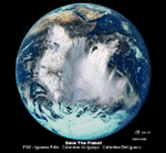
The Iguassu Falls, Itaipu Hydroelectric Power Plant, Foz do Iguassu City and Land Class Package for FSX
Save The Planet is my version of the Iguassu Falls, Itaipu Dam, bridges and landclass scenery for FSX.
Differently from my other version for MSFS 2004, I created a mesh of 5 meter resolution for Iguassu Falls area
to give me some idea how I could proceed. So, I decided to use on this addon
an image background avaliable at server (VirtualEarthSatellite). Thanks Microsoft.
Non-Airport Scenery - ICAO (SBFI). coming soon at www.Terra-Brasilis.org
Portuguese: Cataratas do Iguassu,
Spanish: Cataratas del Iguazu are waterfalls of the Iguassu River located on the border of the Brazilian state of Parana (in the Southern
Region) and the Argentinian Province of Misiones.
The Falls are shared between the Iguazu National Park (Argentina) and Iguacu
National Park (Brazil). The parks were designated UNESCO World Heritage Sites.
The Itaipu Hydroelectric Power Plant is located in the Parana River, in the stretch of the frontier between Brazil and Paraguay, 14 km north of the Friendship Bridge.
The area of the project extends from Foz do Iguassu, in Brazil, and Ciudad del Este, in Paraguay, in the south, up to Guaira (Brazil) and the Guaira Falls (Paraguay), in the north.
Enjoy FSX Iguassu Falls Scenery!
| Filename: | Iguassu_Falls__Save_The_Planet.zip |
| License: | Freeware |
| Added: | 9th December 2010, 01:57:00 |
| Downloads: | 2,849 |
| Author: | Cicero Costa |
| Size: | 31.71 MB |
| Category: Flight Simulator X - Aircraft Repaints, Textures and Modifications | |
| Royal Brunei Airlines B777-200ER (GE) (V8-BLC) ** UPDATE ** |
|
Images related to this file:
File Description:

REPAINT UPDATED FOR - new Captain Sim v1.0 folders, improved wear pattern on wings, correction to engine paint issues.
This is a repaint of a Boeing 777-200ER, registration code V8-BLC, operated by Royal Brunei Airlines, operated by Royal Brunei Airlines, the flag carrier airline of the Sultanate of Brunei. Its hub is Brunei International Airport in Berakas, just to the north of Bandar Seri Begawan, the capital of Brunei. Royal Brunei Airlines serves 14 destinations in Southeast Asia, the Middle East, Europe, and Australia and currently operates 6 Boeing 777-200ERs.
This repaint has plenty of clear markings so if you enjoy exterior detail, then you will love this repaint. You can see (and read): Door opening instructions; Static port directions; Air vent warnings; Engine hazard area; No Step warnings; RAT caution; APU intake warning; Stabilizer compartment access; Ground power supply; Forward and aft access door instructions; Pitot, ADA probe, Ice detector and TAT probe markings; Visible rivets; Enhanced window frames; Authentic Royal Brunei logo; Bold, colorful Royal Brunei livery and authentic flags; Lovely Royal Brunei flight attendant; No frame rate hit.
To use this repaint, the Captain Sim B777-200 v1.0 is required. Repainted by Garrett Rowley, [email protected]
| Filename: | Royal_Brunei_Airlines__B777200ER_GE_V8BLC___UPDATE.zip |
| License: | Freeware |
| Added: | 27th February 2013, 14:51:36 |
| Downloads: | 1,028 |
| Author: | Garrett Rowley, Captain Sim |
| Size: | 29.31 MB |
| Category: Flight Simulator 2004 - AI Aircraft | |
| Mikoyan-Gurevich MiG-23 Flogger (Part 3) |
|
Images related to this file:
File Description:

Mikoyan-Gurevich MiG-23 Flogger (Part 3). I present a comprehensive AI traffic model and texture package for this classic (and still-serving) Russian multi-role fighter. The MiG-23, with just over 5,000 built, was Russia's first production of a true multi-role aircraft with a beyond-visual-range air superiority role as its primary function. The aircraft was arguably the direct counterpart of the F-4 Phantom, although it carried about half of the ordnance load. Nevertheless, in capable hands and late versions, the Flogger has been and is a very potent adversary; having served in multiple conflicts in Europe, Asia, Africa, and the Middle East. The MiG-23 entered service in 1970, was eventually operated by 43 countries, and is still in service in 14 of them. An original 8-LOD model brings this aircraft to the flightsim world. This package contains the MiG-23ML and MiG-23P; with 10 models and 91 repaints. Included in that count is a small service pack for parts 1 and 2 of this project which fixes one texture glitch and adds three more operator countries, instructions are included in the documentation. Original aircraft model, afterburner effects, flight dynamics, and textures by Michael Pearson. Please read included documentation for credits and disclaimers.
| Filename: | MikoyanGurevich_MiG23_Flogger_Part_3.zip |
| License: | Freeware |
| Added: | 31st March 2014, 15:44:18 |
| Downloads: | 528 |
| Author: | Michael Pearson |
| Size: | 27.27 MB |
| Category: Flight Simulator X - AFCAD Files | |
| Strawberry Fields Airport (89NJ), NJ |
|
File Description:
Located 02 miles N of Mays Landing, New Jersey on 220 acres of land, Strawberry Fields Airport is a private turf/sand strip. SkyVector lists the runway as 2200' long, but as measured during development it is closer to 3000'. In addition to Runways 14 and 32, there is a second runway that is not listed in the airport directory and presumed closed. However if you need it in an emergency the numbers are 03 and 21 (no starts are available for these runways). This airport is not lit and is best used only during daytime VFR conditions. The windsock can be found at the intersection of the two runways and is also not lit. You will be landing on bare terrain so have your mesh complexity slider set as high as possible for best effect.
Scenery constructed with use of satellite images/streetview/aerial photos - the author has not been there in person.
This scenery is meant to be used in conjunction with MegaScenery Earth New Jersey/Delaware 003. It is not required, but apron use is minimized to allow satellite scenery to show through as much as possible, and objects are placed based on the MSE textures - lack of it may make scenery look out of place.
| Filename: | Strawberry_Fields_Airport_89NJ_NJ.zip |
| License: | Freeware |
| Added: | 17th February 2011, 07:55:52 |
| Downloads: | 204 |
| Author: | Drew Sikora |
| Size: | 1.75 MB |
| Category: Flight Simulator X - AFCAD Files | |
| Paramount Air Airport JY04 , NJ |
|
File Description:
Located 01 miles N of Green Creek, New Jersey on 20 acres of land, Paramount Air Airport is a private turf strip 2000' in length, although about 300' of it at the end of Runway 32 isn't in the best shape. The runway is 100' wide but closely hedged in by trees along both sides for the length of the runway. A hangar is past the end of Runway 14 but no services are offered for transient aircraft. Still, you can choose to start parked at the hangar if you wish. There is no hard surfaced runway so having your terrain mesh set as high as possible is recommended. No windsock is present, so know your weather (KWWD is very close by) and the airport is unlit so daytime VFR operations only are recommended.
Scenery constructed with use of satellite images/streetview/aerial photos - the author has not been there in person.
This scenery is meant to be used in conjunction with MegaScenery Earth New Jersey/Delaware 005. It is not required, but apron use is minimized to allow satellite scenery to show through as much as possible, and objects are placed based on the MSE textures - lack of it may make scenery look out of place.
| Filename: | Paramount_Air_Airport__JY04__NJ.zip |
| License: | Freeware |
| Added: | 20th April 2011, 16:42:48 |
| Downloads: | 179 |
| Author: | Drew Sikora |
| Size: | 418.37 KB |
| Category: Flight Simulator 2004 - Scenery | |
| Montana Unleashed! - Part One |
|
Images related to this file:
File Description:
Montana Unleashed! Part 1 is the first in a two part series of a collection of airports in Montana. The majority of airports covered in Part 1 are located in the western half of the state. THIS IS A RE-UPLOAD OF A PREVIOUS UPLOADED SCENERY THAT WAS LOST DURING THE AVSIM HACK! NOTHING HAS CHANGED!
Montana Unleashed! is a collection of 14 highly detailed airports, created using Abacus' EZ-Scenery, scattered about the state of Montana and one in Washington. Do a ZipDive and check out some of the screenshots! The state of Montana, from what I've seen, seems to have been very neglected by scenery makers over the years which is surprising considering the beautiful and varied landscapes the state has to offer. There's some very cool approaches at many of these airports. The size of the airports vary from large all the way down to small county airports meaning you can fly just about any kind and size of aircraft with these sceneries. Fly your Delta 737 from Salt Lake to Bozeman. Fly your shiny new Skywest EMB-120 from Missoula to Billings. Or fly your Piper Cub from Havre City to Choteau and on to Dillon. It's all here!
| Filename: | Montana_Unleashed__Part_One.zip |
| License: | Freeware, limited distribution |
| Added: | 18th April 2010, 09:48:54 |
| Downloads: | 7,074 |
| Author: | Lauren Robison |
| Size: | 3.81 MB |


© 2001-2026 AVSIM Online
All Rights Reserved
Privacy Policy |