
Where Flight Simulation Enthusiasts Gather from Around the World!
AVSIM Library - Search Results

| Category: Flight Simulator 2002 - Scenery | |
| Cornish Windfarms |

|
File Description:
This freeware demo is part of Nick Ryall SW England Landmark Scenery available from http://www.visualflight.co.uk/nickryall.
This scenery represents 7 Cornish windfarms in Cornwall UK, Goonhilly downs, Four Burrows, Carland cross,
Bears down, St Breock downs, Delabole and Cold Nortcott
The scenery has been designed primarily for use with addon VFR photographic scenery from Visual Flight and mesh terrain Lago's Terramesh for the UK.
It is part of a package which contains more than 50 VFR scenery Landmarks for the SW UK and is available for purchase at the Visual Flight website It does however work with Microsoft's default mesh terrain.
| Filename: | Cornish_Windfarms.zip |
| License: | Freeware |
| Added: | 10th March 2003, 16:12:55 |
| Downloads: | 1,668 |
| Author: | Nick Ryall |
| Size: | 2.28 MB |
| Category: Flight Simulator 2002 - Scenery | |
| WIEN Scenery Upgrade to v2.01 |
|
File Description:
David Morgan a scenery designer from Birmingham UK has kindly offered to make his Wien-buildings available to my Wien scenery. The Wien scenery is upgraded by his work with a lot of excellent buildings like AKH, UNO-buildings and towers, Floridotower, Ernst Happel Stadium, Rathaus, Burgtheater, Neue Hofburg (etc. etc.). I am very thankful to David for his selfless cooperation.
For all who use the Austria Professional Scenery (or another mesh scenery) find a suggestion how to solve some display problems by using the Wien scenery together with ATP2002 or mesh terrain in the "readme.txt" resp."liesmich.txt".
| Filename: | WIEN_Scenery_Upgrade_to_v201.zip |
| License: | Freeware, limited distribution |
| Added: | 8th May 2003, 19:52:54 |
| Downloads: | 2,061 |
| Author: | David Morgan |
| Size: | 2.44 MB |
| Category: Flight Simulator X - AFCAD Files | |
| CYAB/CJX7 - Arctic Bay Airport - Nunavut, Canada ***UPDATED VERSION*** |
|
File Description:
This is an update to my scenery for CYAB / CJX7 Arctic Bay airport. The new runway was added, the old runway was closed, and the taxiway, apron, apron lighting, airport beacon, windsocks, and terminal were added. This update adjusts the airport background and apron, and more importantly adds parking spots and taxipaths so that AI aircraft now takeoff, land, and park. The scenery was designed with ORBX FTX Global Vector and Pilot's Global Ultimate terrain mesh installed, so it may not work well with the default vector scenery and mesh. Please refer to the readme file for more details and installation instructions.
| Filename: | CYABCJX7__Arctic_Bay_Airport__Nunavut_Canada__UPDATED_VERSION.zip |
| License: | Freeware |
| Added: | 14th May 2016, 11:43:38 |
| Downloads: | 283 |
| Author: | David Midgett |
| Size: | 540.98 KB |
| Category: Flight Simulator X - Scenery | |
| Nellis Air Force Base - KLSV |
|
File Description:
This file contains several BGL's which enhance the default
FSX Nellis Air Force Base (KLSV ). I have added some
ramp parking for miltary aircraft. Additionally, I have added several
scenery objects to enhance the visual experience.
The other change I made was to eliminate the "mesa effect" caused by
the stock FSX airport as it sits above/below the surrounding
terrain using "sloped flattens" to blend the airport level
terrain into the surrounding terrain.
I am using the "FSX Usa 10 M terrains Project - West Coast Version 1.1"
mesh but the default FSX mesh should blend O.K.
| Filename: | Nellis_Air_Force_Base__KLSV.zip |
| License: | Freeware |
| Added: | 21st December 2007, 04:37:40 |
| Downloads: | 3,348 |
| Author: | Paul Strogen |
| Size: | 855.47 KB |
| Category: Flight Simulator 2004 - Scenery | |
| Madrid Barajas from 2005 onwards |
|
Images related to this file:
File Description:
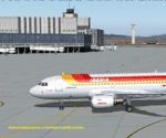
Madrid Barajas FS9 standalone airport, to substitute/update the original FS9 version with the actual 4 RWY operation and two new terminals. Resubmitted at libarian's request. You MUST have a good mesh for spanish terrain, otherwise this scenery won't look good. May I suggest a visit to AirHispania L.A.V. web site, www.airhispania.com, for a free download of their mesh from the scenery section, under "Publicaciones" (publications). Based on LEMDGB from the Zafra brothers original work to complement/update Simwings original Madrid airport, and published with their permission, this version does not require any payware. Taxiway signs now obsolete. Enjoy . Fernando de la Portilla
| Filename: | Madrid_Barajas_from_2005_onwards.zip |
| License: | Freeware |
| Added: | 21st February 2010, 01:45:52 |
| Downloads: | 8,219 |
| Author: | Fernando de la Portilla |
| Size: | 804.05 KB |
| Category: Flight Simulator 2002 - Scenery | |
| NY-New York City, Central Park Area Terrain Mesh (10m) |
|
File Description: Take a break and enjoy Sunday afternoon in the park. This high resolution mesh demonstrates the amount of detail FS2002 is able to display. But you will not see any improvement in the park if you are still using the default value of TERRAIN_MAX_VERTEX_LEVEL=19 (in the [TERRAIN] section) of your fs2002.cfg file! This value is adequate for the default mesh, but will not display all the additional detail available in mesh constructed from 30m or better source data. I recommend a value of 21 for the most detail, but a value of 20 may be preferable if FPS is a serious problem. Hop in your favorite helicopter, depart from La Guardia (KLGA) airport, and head west toward the city. (If you are new to helicopters, set your Aircraft realism to Easy and turn off Crash Detection while getting started - and relax in this scenic park!)
| Filename: | NYNew_York_City_Central_Park_Area_Terrain_Mesh_10m.zip |
| License: | Freeware, limited distribution |
| Added: | 21st July 2002, 17:35:04 |
| Downloads: | 2,845 |
| Author: | Steve Greenwood |
| Size: | 1017.33 KB |
| Category: Flight Simulator 2002 - Scenery | |
| Terrain Mesh for Canada's Maritime Provinces (2/2) |
|
File Description:
Re-upload. The files in this package contain a new 76m (LOD09) terrain mesh for Canada's Maritime Provinces. The source data is the Shuttle Radar Topography Mission (SRTM-3, 90m). All data were compiled and edited in MicroDEM 6.02, converted with BIGBSQ and resampled to LOD (Level of Detail) 9, or 76.4 meters horizontal resolution, with the Microsoft Terrain Software Developer's Kit (SDK) utilities. Two parts : Maritimes09a.zip and Maritimes09b.zip.
| Filename: | Terrain_Mesh_for_Canadas_Maritime_Provinces_22.zip |
| License: | Freeware, limited distribution |
| Added: | 29th January 2010, 00:42:41 |
| Downloads: | 238 |
| Author: | Gilles Gauthier |
| Size: | 23.59 MB |
| Category: Flight Simulator 2004 - Scenery | |
| Bella Coola Valley Terrain Mesh and Scenery Enhancements |
|
File Description:
One of the most spectacular watersheds of British Columbia's Midcoast, the Bella Coola Valley looks pretty boring in its default FS rendition. These files provide a LOD10 (38-m) mesh made from CDED1 0.75-arcsec data, a new landclass file, and accurate placements of lakes, rivers, streams, and roads. Also includes the glaciers of the Monarch Mt. Icefield and several forestry roads and clearcuts along the side valleys. Made with Ground2K4 based on Landsat 7 ETM+ satellite imagery.
| Filename: | Bella_Coola_Valley_Terrain_Mesh_and_Scenery_Enhanc.zip |
| License: | Freeware, limited distribution |
| Added: | 1st April 2004, 20:49:32 |
| Downloads: | 8,873 |
| Author: | Holger Sandmann |
| Size: | 20.74 MB |
| Category: Flight Simulator 2002 - Scenery | |
| Mount Rushmore National Memorial Area 10 M Mesh |
|
File Description:
One of America's most well-known sights, the Mount Rushmore National Memorial is located at Keystone about 35 miles from Rapid City. The granite sculptures of the heads of George Washington, Thomas Jefferson, Abraham Lincoln and Theodore Roosevelt were constructed between 1927 and 1941. Visitors can partake in ranger or self-guided tours of the mountain sculpture. Stroll along the presidential trail for an 'up-close' look. The sculptors studio contains some original sketches of the designs for the mountain. This park also contains the Lincoln Borglum Museum and a visitor's information center. Now you too - can visit the Area with Detailed 10 M mesh Terrain. Designed with Usgs 10 m dem - offers a high level of terrain Details. Coverage: N44.1132 W103.7383 - N43.7531 W103.2562.
| Filename: | Mount_Rushmore_National_Memorial_Area_10_M_Mesh.zip |
| License: | Freeware |
| Added: | 6th September 2002, 02:34:43 |
| Downloads: | 1,970 |
| Author: | Raimondo Taburet |
| Size: | 1.98 MB |
| Category: Flight Simulator 2004 - Scenery | |
| Glen Canyon / Lake Powell, Utah 38m Terrain Mesh |
|
File Description:
USGS SRTM30 1 arc-second, resampled to LOD10 (38.2 meters).
This high-resolution terrain mesh is centered at Glen Canyon
National Recreation Area in south-eastern Utah. Coverage area:
From West -111.6° to West -110.2° and North 36.8° to North 38.0°.
It includes the National Recreation Area with Lake Powell,
Navajo Mountain, the Henry Mountains, parts of Capitol Reef
National Park / Grand Staircase Escalante National Monument,
the town of Page in northern Arizona and surrounding areas.
| Filename: | Glen_Canyon__Lake_Powell_Utah_38m_Terrain_Mesh.zip |
| License: | Freeware, limited distribution |
| Added: | 25th January 2004, 20:30:45 |
| Downloads: | 5,420 |
| Author: | Andreas Trawny |
| Size: | 8.31 MB |


© 2001-2026 AVSIM Online
All Rights Reserved
Privacy Policy |