
Where Flight Simulation Enthusiasts Gather from Around the World!
AVSIM Library - Search Results

| Category: Prepar3D V1-4 - Scenery | |
| EBAV - Avernas Le Bauduin - Hannut, Belgium for P3Dv4 |

|
File Description:
EBAV - Avernas Ultra light airfield (with new runway) for P3Dv2-v3-v4 & Megascenery Belgium photoscenery (or home made photoscenery). The scenery includes the airfield (for default mesh) and its surroundings (+- 3X3 nm). A file is inclued for FSX & P3Dv1 user.
| Filename: | EBAV__Avernas_Le_Bauduin__Hannut_Belgium_for_P3Dv4.zip |
| License: | Freeware |
| Added: | 17th December 2017, 20:42:35 |
| Downloads: | 455 |
| Author: | Aimé Leclercq |
| Size: | 141.24 MB |
| Category: Flight Simulator 2004 - AFCAD Files | |
| MHTG Tegucigalpa / Toncontin |
|
File Description:
AFCAD2 file for MHTG, corrected runway length, up-to date parking positions, both based on actual airport charts as well as local reports. Suitable for real-world AI-traffic.
Recommended but not required: Central America terrain mesh by Josef Kusters.
| Filename: | MHTG_Tegucigalpa__Toncontin.zip |
| License: | Freeware, limited distribution |
| Added: | 9th March 2004, 23:56:43 |
| Downloads: | 1,098 |
| Author: | Karl F. Hajek |
| Size: | 4.33 KB |
| Category: Flight Simulator 2002 - Scenery | |
| The Eden Project |
|
File Description:
This scenery represents The Eden Project Cornwall UK it features the huge Biomes and visitor centre. Designed for use with addon mesh terrain, it doesnt realy work with the flat default scenery as it should be in a large pit.
| Filename: | The_Eden_Project.zip |
| License: | Freeware |
| Added: | 22nd October 2002, 15:21:41 |
| Downloads: | 672 |
| Author: | Nick Ryall |
| Size: | 511.7 KB |
| Category: Flight Simulator 2004 - Scenery | |
| Appalachian Mountains, Virginia / West Virginia |
|
File Description:
USGS SRTM30 1 arc-second, resampled to LOD10 (38.2 meters).
This high-resolution terrain mesh is centered in the Appalachian Mountains
between Virginia and West Virginia. Coverage area: From West -81° to West -79°
and North 37° to North 39°.
| Filename: | Appalachian_Mountains_Virginia__West_Virginia.zip |
| License: | Freeware, limited distribution |
| Added: | 10th January 2004, 18:06:59 |
| Downloads: | 3,681 |
| Author: | Andreas Trawny |
| Size: | 17.1 MB |
| Category: Flight Simulator 2004 - Scenery | |
| LWM & VTP Malaysia, Singapore & Brunei. |
|
File Description:
Enhancement of Malaysia, Singapore & Brunei LWM and VTP scenery with more rivers are visible and surrounding islets with accuracy. Scenery based on satellite images. Also include are missing mesh scenery for Pulau Jerejak and patches for my previous missing Malaysian airports.
| Filename: | LWM__VTP_Malaysia_Singapore__Brunei.zip |
| License: | Freeware |
| Added: | 17th March 2006, 02:56:29 |
| Downloads: | 7,442 |
| Author: | Mohammad Omar |
| Size: | 6.36 MB |
| Category: Flight Simulator 2004 - Scenery | |
| Mt Taranaki/Egmont, NZ, Photoreal Scenery |
|
File Description:
40 x 50 kilometres of photo-real scenery. Fully autogenned, daytime summer textures only. (It will display throughout the year though.)
This showcases the amazing volcanic Mt Taranaki. Like many New Zealand mountains it has both a Maori and European name. Mt Taranaki dominates the Taranaki landscape, and is a spectacular example of of how the central North Island has been effected by volcanic activity.
This is a remake of the original Godzone Taranaki scenery adjusted to match the new elevaton meshes. It is best with the Geographx 20m elevation mesh, and the minimum recommended mesh is the Geographx 75m.
| Filename: | Mt_TaranakiEgmont_NZ__Photoreal_Scenery.zip |
| License: | Freeware, limited distribution |
| Added: | 16th January 2006, 05:57:36 |
| Downloads: | 4,876 |
| Author: | Robin Corn |
| Size: | 40.09 MB |
| Category: Flight Simulator X - Scenery | |
| Paulinia S.P. - Complement to Americana S.P. 4/5 |
|
File Description:
4/5 - This is the complement of Americana to cover all region taht include the lake Praia Azul. This scenery is composed by five parts. Folow instructions on Readme.txt and have a nice visual flight. Is a good idea install the FSX Mesh South America parts F7 and F8 cordinates in the map to have the essential mesh terrain. There is a link to download:
www.ceaero.com.br/meshxsa/dowsa.html
Other pack that you need install if want to see all hangars in SDAI Aeroclube de Americana,
is the STATIC BJECTS LIBRARY found on RWY12 OBJECTS PLACER found in http://www.rwy12.com/rwy12/
| Filename: | Paulinia_SP__Complement_to_Americana_SP_45.zip |
| License: | Freeware |
| Added: | 8th June 2008, 14:09:41 |
| Downloads: | 1,456 |
| Author: | Gilson A. Rocchetti |
| Size: | 71.84 MB |
| Category: Prepar3D V5 - Scenery | |
| Wintervogel Airport (FAWF) – Cape Town, South Africa |
|
Images related to this file:
File Description:
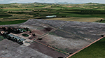
Wintervogel airport is situated just north of Cape Town (38 km / 21 NM at a heading of 37 degrees from FACT). A small private airport with interesting intersecting sloped runways that I tried to replicate in P3D to see how sloped runways work. I included some low poly custom buildings but as I did not have any good photos of the airport, I used my imagination a bit. Developed using the P3D V5 SDK and tested in P3D V5. To be used with the ORBX OpenLC Africa LC and the Pilots NG2020 mesh products (works with default P3D V5 mesh as well).
| Filename: | Wintervogel_Airport_FAWF__Cape_Town_South_Africa.zip |
| License: | Freeware |
| Added: | 3rd March 2021, 23:29:47 |
| Downloads: | 105 |
| Author: | Johan Pienaar |
| Size: | 20.87 MB |
| Category: Flight Simulator 2002 - Scenery | |
| Lower Mainland of Southern British Columbia, Canada Mesh |
|
File Description:
New high-resolution (76-m) terrain mesh of the Lower Mainland area of British Columbia, covering a 4-degree longitude by 1.5-degree latitude transect (N48.5-50, W120-124) from Bowen Island to Manning Park. It gives a much better representation of the subtle terrain in Vancouver and the Fraser Valley, the beautiful North Shore Mountains, and the extreme topography of the North Cascades southeast of Chilliwack. Made from 100-m digital elevation data, resampled to LOD9 (76-m) horizontal spacing. Designed as an add-on to my LOD7 mesh of the entire province but can be used independently. By Holger Sandmann.
| Filename: | Lower_Mainland_of_Southern_British_Columbia_Canada.zip |
| License: | Freeware, limited distribution |
| Added: | 20th January 2003, 18:17:35 |
| Downloads: | 6,160 |
| Author: | Holger Sandmann |
| Size: | 8.29 MB |
| Category: Orbiter - Miscellaneous Files | |
| Marius Hills: Apollo 18 Landing Site |
|
File Description:
This ORBITER add-on features the lunar surface mesh of the Marius Hills area of the moon, which I built up from lunar orbiter photographs of the area. This pack also contains an Alternate-History Apollo 18 Mission, containing a completely new J (or in Apollo 18's case, K) type Lunar Module 3D-mesh, which has enlarged descent quads, to house various scientific equipment and the LRV or lunar rover. Also, I included a new EVA astronaut which is more accurate compared to my earlier Apollo lunar EVA astronauts, and a new, more accurate LRV with two seated astronauts as passengers.
| Filename: | Marius_Hills_Apollo_18_Landing_Site.zip |
| License: | Freeware, limited distribution |
| Added: | 4th August 2003, 16:21:45 |
| Downloads: | 2,201 |
| Author: | Rodion M. Herrera |
| Size: | 10.27 MB |


© 2001-2026 AVSIM Online
All Rights Reserved
Privacy Policy |