
Where Flight Simulation Enthusiasts Gather from Around the World!
AVSIM Library - Search Results

| Category: Flight Simulator 2004 - Scenery | |
| Masterton, New Zealand vs.2 |

|
File Description:
Version 2. 07July 08. Added windsocks, radio-controllers meet, aerial & shack, holding points,lights on main taxiway, fence by aero club. This replaces previous version.
Made to fit Christian Stock's NZ 20-mesh and Topo. Don't know what it would be like with the 75-mesh - probably hopeless with default scenery.
| Filename: | Masterton_New_Zealand__vs2.zip |
| License: | Freeware |
| Added: | 6th July 2008, 20:24:15 |
| Downloads: | 559 |
| Author: | Godfrey Tier |
| Size: | 3.54 MB |
| Category: Flight Simulator 2002 - Scenery | |
| Seattle, WA - High Resolution Terrain Mesh |
|
File Description:
Seattle, Washington area. The modest terrain in the Seattle area provides a nice example of a less obvious benefit of high resolution terrain mesh. The rendering of many small features missing entirely in the default mesh provides much richer detail and a greater sense of realism. (30m source -> 38.2m final).
| Filename: | Seattle_WA__High_Resolution_Terrain_Mesh.zip |
| License: | Freeware, limited distribution |
| Added: | 4th July 2002, 13:32:39 |
| Downloads: | 3,621 |
| Author: | Steve Greenwood |
| Size: | 3.75 MB |
| Category: Flight Simulator 2004 - AI Aircraft | |
| World of AI Air Alps Complete AI Package v2 |
|
Images related to this file:
File Description:

World of AI welcomes you to this Air Alps Complete AI Package v2 for FS2004 and FSX. Models by Juan-Sebastian Gonzales; Repaints by Juan-Sebastian Gonzalez; Summer 2008 flightplans by Hans-Juergen Merkel. IMPORTANT! You need the World of AI Installer to make this package work! (WOAINS24.zip). This package just replaces the corrupted package due to the AVSIM hack. Nothing has changed.
| Filename: | World_of_AI_Air_Alps_Complete_AI_Package_v2.zip |
| License: | Freeware, limited distribution |
| Added: | 3rd December 2009, 19:06:10 |
| Downloads: | 62,905 |
| Author: | World of AI |
| Size: | 2.13 MB |
| Category: Flight Simulator 2004 - Scenery | |
| Valle D'Aosta part 2 (West), Alps, Italy, Photo Real |
|
Images related to this file:
File Description:
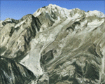
The scenery covers the western portion of the Valle D'Aosta, North Italy, Alps. The Photo Real Scenery is wide for around 2100 squared Kms. The airport of Aosta (ICAO code LIMW) is found inside the scenery (see map). The complete scenery of the valley was divided in 2 parts to fit the 100Mb file space limit: part 2 (this file) and part 1 (est side see AVSIM library - valle_aosta_est_vfr.zip). For FSX and FS9.
| Filename: | Valle_DAosta_part_2_West_Alps_Italy_Photo_Real.zip |
| License: | Freeware |
| Added: | 2nd June 2010, 13:22:39 |
| Downloads: | 14,708 |
| Author: | Fulvio Mazzokan |
| Size: | 58.15 MB |
| Category: Flight Simulator X - Scenery | |
| Valle D'Aosta part 1 (Est), Alps, Italy, Photo Real |
|
Images related to this file:
File Description:
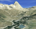
Re-upload. The scenery covers the oriental part of the Valle D'Aosta, North Italy, Alps. The Photo Real Scenery is wide for around 2200 squared Kms. The airport of Aosta (ICAO code LIMW) is found near to the scenery (see map). The complete scenery of the valley was divided in 2 parts to fit the 100Mb file space limit: part 1 (this file) and part 2 (West side see AVSIM library - valle_aosta_west_vfr.zip). For FSX and FS9.
| Filename: | Valle_DAosta_part_1_Est_Alps_Italy_Photo_Real.zip |
| License: | Freeware |
| Added: | 10th June 2010, 23:10:30 |
| Downloads: | 16,647 |
| Author: | Fulvio Mazzokan |
| Size: | 62.3 MB |
| Category: Flight Simulator 2004 - AI Aircraft | |
| Air Alps 'Sun Air Hybrid' Dornier Do 328-100 |
|
Images related to this file:
File Description:

Dornier Do328-100 in the colours of Air Alps 'Sun Air Hybrid'. These are textures only, in both 32bits and dxt3 (mipped and non-mipped) formats. You need the JBAI Dornier Do328-100. base package available separately. Repaint by Juergen Baumbusch for Alpha India Group. Visit us at www.alpha-india.net for more information. Our special thanks go to our beta testers whose sharp eyes can spot our mistakes before we can pass them on to you!
| Filename: | Air_Alps_Sun_Air_Hybrid_Dornier_Do_328100.zip |
| License: | Freeware |
| Added: | 30th November 2011, 20:58:05 |
| Downloads: | 1,102 |
| Author: | Juergen Baumbusch & Alpha India Group |
| Size: | 792.34 KB |
| Category: Flight Simulator 2004 - Scenery | |
| Clinique Belledonne Grenoble, France (Medical Clinic close to Alps) |
|
Images related to this file:
File Description:

FS2004 Scenery.
Clinique Belledonne Grenoble scenery add-on for FS2004.
By HAUGER Fredo.
| Filename: | Clinique_Belledonne_Grenoble_France_Medical_Clinic.zip |
| License: | Freeware |
| Added: | 7th June 2013, 17:38:58 |
| Downloads: | 284 |
| Author: | Hauger Fredo |
| Size: | 1.35 MB |
| Category: Flight Simulator X - Scenery | |
| La Plagne - Mâcot-la-Plagne, French Alps, France |
|
Images related to this file:
File Description:
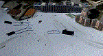
Here is a scenery like a vacation memory.
There are 3 DZ as I have seen them:
- DZ Roche de Mio;
- DZ Glacier;
- DZ La Plagne Bellecote.
They were made from my ski pictures. Just for fun.
| Filename: | La_Plagne__McotlaPlagne_French_Alps_France.zip |
| License: | Freeware |
| Added: | 4th April 2015, 11:44:11 |
| Downloads: | 819 |
| Author: | Vladimir Corre |
| Size: | 73.95 MB |
| Category: Flight Simulator 2002 - Miscellaneous Files | |
| FSGarmin/FSFlightMax - TERRAIN ELEVATION MAP - THE ALPS AND ITALLY |
|
File Description:
This is an elevation map that approximately covers the area between N49, E4.5 and N36.5, E19 to be used with FSGarmin/FSFlightMax.
| Filename: | FSGarminFSFlightMax__TERRAIN_ELEVATION_MAP___THE_A.zip |
| License: | Check within download |
| Added: | 14th October 2003, 22:42:21 |
| Downloads: | 726 |
| Author: | Aleksey Sudakov |
| Size: | 7.46 MB |
| Category: Flight Simulator 2004 - Scenery | |
| Himalayan Peaks LOD10 Mesh, Volume 1 - Mt. Everest and Kula Kangri |
|
File Description:
Highly detailed terrain mesh of the Mt. Everest and Kula Kangri areas, N26°-29° E85°-92°. The files in this package are based on Shuttle Radar (SRTM) Version 2 data but with many of the void areas, especially the most significant sections, filled with elevation data generated from topographic maps by Jonathan de Ferranti. While Jonathan's work is unrelated to flight simulation he kindly gave me permission to compile his data for use in FS. The result is a wonderful improvement in detail and accuracy over any existing mesh file, freeware or commercial, based on SRTM or DTED data alone. Due to the large area of the Himalayas I've compiled the source data as two separate series: the "Himalayan Peaks" series covers prominent mountains and ranges in higher detail and locally overrides any existing LOD9 terrain mesh. In addition, a LOD9 "base mesh" series covering the entire Himalayas will be available for those who do not yet have an add-on terrain mesh of these beautiful mountains.
| Filename: | Himalayan_Peaks_LOD10_Mesh_Volume_1__Mt_Everest_an.zip |
| License: | Freeware, limited distribution |
| Added: | 9th February 2006, 22:13:00 |
| Downloads: | 37,059 |
| Author: | Holger Sandmann and Jonathan de Ferranti |
| Size: | 52.01 MB |


© 2001-2026 AVSIM Online
All Rights Reserved
Privacy Policy |