
Where Flight Simulation Enthusiasts Gather from Around the World!
AVSIM Library - Search Results

| Category: Flight Simulator 2004 - Scenery | |
| Reichenbach LSAZ |

|
File Description:
The virtual airfield includes several buildings such as a hangar, a restaurant, a club house, military shelters, a playground and stationary cars. The surrounding area of Reichenbach has been populated with autogens: From the lake of Thoune down to Gemmi pass South of Kandersteg, and up until Adelboden to the West. Moreover, there is a high-voltage power line from Gemmi pass to the Gürbe valley, which should help during visual flight.
The scenery has been designed in Gmax and optimized for the mesh of Switzerland Professional. In order to save system performance, a series of LODS have been created.
| Filename: | Reichenbach_LSAZ.zip |
| License: | Freeware |
| Added: | 20th January 2006, 04:36:22 |
| Downloads: | 4,239 |
| Author: | Michael Röthlisberger |
| Size: | 2.95 MB |
| Category: Flight Simulator 2004 - AFCAD Files | |
| 5 New Canadian Airports |
|
File Description:
Afcads and simple scenery to create 5 aerodromes in NE Canada that Microsoft forgot, but which are regularly served by Air Labrador. ZTB/CTB6 Tete-a-la-Baleine, ZKG/CTK6 Kegashka, ZGS/CTT5 Gethsemani/La Romaine and ZLT/CTU5 La Tabatiere in Quebec, and YNP/CNH2 Natuashish in Newfoundland.
Airstrips built using current data from the Canada Flight Supplement, so locations, orientations and dimensions are as accurate as the default scenery will allow. Some default buildings added, but not accurate! These files will also increase your Air Lab traffic in Ultimate Traffic!
Tested only with FS9 default scenery and mesh.
| Filename: | 5_New_Canadian_Airports.zip |
| License: | Freeware |
| Added: | 12th February 2006, 22:10:51 |
| Downloads: | 2,113 |
| Author: | Adrian Wright |
| Size: | 13.66 KB |
| Category: Flight Simulator X - Utilities | |
| JAB FSX, the small FSX companion |
|
File Description:
This small program has three parts. 1° It allows to regularly save the current FSX flight in order to open the next session at the same point where the last session finished (just like "Previous flight" in FS9). 2° It allows TRACK-IR owners to enable Track-IR only when in virtual cockpit and disable it in outside views (to use a joystick hat for example). 3° For scenery, mesh and landclass designers, it provides a great help to get coordinates with several formats (even for direct paste in XML files).
Works in english or french.
| Filename: | JAB_FSX_the_small_FSX_companion.zip |
| License: | Freeware, limited distribution |
| Added: | 24th February 2007, 22:55:06 |
| Downloads: | 2,925 |
| Author: | Jacky Brouze |
| Size: | 462.8 KB |
| Category: Flight Simulator X - Scenery | |
| Whale Island Scenery: "Islands of the Bay of Plenty" |
|
File Description:
This scenery was created from a digital Orthorectified aerial mosaic owned by Environment Bay of Plenty (The Bay of Plenty Regional Council). The imagery has been de-sampled for use in Flight Simulator X and utilizes the default terrain mesh. The textures are intended for summer daylight flying only, although due to the sparse nature of White Islands' Evegetation, the Islands appearance remains relatively consistent throughout the year.
It includes autogen trees, a landable helicopter pad on the top of the Island, Radio masts, and the Department of Conservation (DOC) hut in the south western bay of the island.
| Filename: | Whale_Island_Scenery__Islands_of_the_Bay_of_Plenty.zip |
| License: | Freeware, limited distribution |
| Added: | 9th May 2007, 08:42:59 |
| Downloads: | 1,496 |
| Author: | Tim Barnes |
| Size: | 7.05 MB |
| Category: Flight Simulator 2004 - Scenery | |
| Fernando de Noronha, Brazil - SBFN (Photoreal for Fs9) |
|
File Description:
Photoreal Fs9 Fernando de Noronha island. This addon WAS NOT created by me,
but I was given permission to upload it. It's author is Amengol.
The island is steeped in history and has it's own connection with aviation history. For it was one of the fuel stops that were used on the very first Africa to South America trans-atlantic flight. March 30 - June 17, 1922, using three Fairey IIID floatplanes. Perhaps you might like to retrace the brave pilots route to see if you can make the trip!
Featuring: Photoreal textures, A.I. Aircraft, and Custom Terrain mesh.
| Filename: | Fernando_de_Noronha_Brazil__SBFN_Photoreal_for_Fs9.zip |
| License: | Freeware |
| Added: | 27th January 2009, 00:55:22 |
| Downloads: | 2,225 |
| Author: | Amengol and Rob Barnett |
| Size: | 2.84 MB |
| Category: Flight Simulator 2004 - Scenery | |
| Hauraki Gulf, v6 |
|
Images related to this file:
File Description:
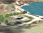
This replaces all my previous Pakatoa Island and Hauraki Gulf sceneries. You must have Christian Stock's NZ mesh in the form of "Mountains of New Zealand" and topo in the form of "Lakes and Rivers of New Zealand" (payware).
New additions...PAKIHI ISLAND: Small jetty and nearby buildings. TAKANGAROA ISLAND: House on Island. House & Jetty island north of Takangaroa Island. MOTUREKAREKA ISLAND: Wreck of the Rewa. PONUI ISLAND: Chamberlain's Bay Airstrip. Chamberlain's Donkey Farm. Third Bay Airstrip. Motunau Bay Jetty. KARAMURAMU ISLAND: Jetty and quarry. ROTOROA ISLAND: Rotoroa Jetty. MOTUIHE ISLAND: Motuihe Wharf.
| Filename: | Hauraki_Gulf_v6.zip |
| License: | Freeware |
| Added: | 17th April 2010, 16:10:12 |
| Downloads: | 218 |
| Author: | Godfrey Tier |
| Size: | 6.61 MB |
| Category: Flight Simulator 2004 - Scenery | |
| Alternates for Durban Island CWFB FOX-E DEW line station in Nunavut, Canada |
|
File Description:
These are alternative bgls that include a flatten. They will change the shape of the hill that the FOX-E station sits on top of, but they will also make sure that there are no "floating" or "buried" scenery objects. If you are having that problem then just throw these into the scenery folder that you already created when you installed Durban Island, and say Yes! to over-write or whatever the question is. If you have a mesh that is compatible with what I use then you won't be having that problem, so don't do anything.
| Filename: | Alternates_for_Durban_Island_CWFB_FOXE_DEW_line_st.zip |
| License: | Freeware, limited distribution |
| Added: | 1st July 2011, 22:12:35 |
| Downloads: | 268 |
| Author: | Roger Wensley |
| Size: | 353.65 KB |
| Category: X-Plane - Scenery | |
| WA0B Susi Air Idedua Airstrip v1.0.0 |
|
Images related to this file:
File Description:

This is an X-Plane 11 scenery for Idedua Airstrip (WA0B) in Idedua, Papua, Indonesia. This is one of the destinations for "PT ASI Pujiastuti Aviation", operating as Susi Air, an Indonesia airlines established in late 2004 by Mrs. Susi Pudjiastuti. This scenery was tested and is operational (as of January 10, 2017) in "X-Plane 11 Public Beta #5 64 bit", Windows 10 Home. It was also tested and is partially operational (as of January 10, 2017) in "X-Plane 10.51 64 bit", Windows 10 Home. XP10's runway presents a much higher runway slope, given mesh issues.
| Filename: | WA0B_Susi_Air_Idedua_Airstrip_v100.zip |
| License: | Freeware |
| Added: | 13th January 2017, 20:10:39 |
| Downloads: | 97 |
| Author: | Rui Mesquita |
| Size: | 1.99 MB |
| Category: Flight Simulator 2004 - Scenery | |
| Byron Bay, Cape Dyer, Cape Hooper, Dewar Lakes, and Durban Island adapted for the FSGenesis 76m North Canada Terrain Mesh |
|
Images related to this file:
File Description:
These are replacement bgl's to convert five northern Canada fields for use with the FSGenesis 76m terrain mesh for northern Canada. The five are Byron Bay CWBB, Cape Dyer CWFD, Cape Hooper CWFH, Dewar Lakes CWFL, and Durban Island CWFB. These are not stand-alone, and the presumption is that you have already downloaded and installed the previously posted sceneries. The installation consists solely of replacing the existing scenery bgl's with the new. There will be further posts of northern airfields in groups of five, alphabetically, and observations regarding the amendments and any further corrections that are required would be welcomed.
| Filename: | Byron_Bay_Cape_Dyer_Cape_Hooper_Dewar_Lakes_and_Du.zip |
| License: | Freeware, limited distribution |
| Added: | 3rd September 2017, 20:01:55 |
| Downloads: | 73 |
| Author: | Roger Wensley |
| Size: | 3.49 MB |
| Category: Flight Simulator 2004 - Scenery | |
| Edinburgh Island, FOX-2, Horton River, Igloolik, & Kimmirut, adapted for the FSGenesis 76m North Canada Terrain Mesh |
|
Images related to this file:
File Description:
These are replacement bgl's to convert five northern Canada fields for use with the FSGenesis 76m terrain mesh for northern Canada. The five are Edinburgh Island CWEI, the FOX-2 DEW line station, Horton River CWHR, Igloolik CYGT, and Kimmirut CYLC. These are not stand-alone, and the presumption is that you have already downloaded and installed the previously posted sceneries. This installation consists solely of replacing the existing scenery bgl's with the new. There will be further posts of northern airfields in groups of five, alphabetically, and observations regarding the amendments and any further corrections that are required would be welcomed.
| Filename: | Edinburgh_Island_FOX2_Horton_River_Igloolik__Kimmi.zip |
| License: | Freeware, limited distribution |
| Added: | 10th September 2017, 19:29:57 |
| Downloads: | 86 |
| Author: | Roger Wensley |
| Size: | 3.55 MB |


© 2001-2026 AVSIM Online
All Rights Reserved
Privacy Policy |