
Where Flight Simulation Enthusiasts Gather from Around the World!
AVSIM Library - Search Results

| Category: Flight Simulator 2004 - Scenery | |
| LOD10 (38-m) Glacier Bay National Park, Alaska |

|
File Description:
This LOD10 (38-m) add-on mesh of Glacier Bay National Park and the adjacent Lynn Canal area between Juneau and Skagway (N58-60 W134-138) is an optional (!) upgrade of gl_bay_1.zip (by Holger Sandmann and Jim Keir). It adds more detail to the mountainous areas and allows to locally override other installed Alaska add-on meshes without having to deactivate them. The USGS NED seamless digital elevation data used for this mesh have a 2-arcsec (~60-m) resolution. Thus, the compilation as LOD10 (38-m) will reveal all terrain details contained in the source data. Please read the gl_bay_1.zip read-me file for further information about the special features of the Glacier Bay Project.
| Filename: | LOD10_38m_Glacier_Bay_National_Park_Alaska.zip |
| License: | Freeware, limited distribution |
| Added: | 16th February 2004, 03:40:57 |
| Downloads: | 8,593 |
| Author: | Holger Sandmann |
| Size: | 24.98 MB |
| Category: Flight Simulator X - Scenery | |
| Quebec Scenery - Lakes and River - Baie James Hydroelectric Complex Territory |
|
File Description:
Re-uploaded file. Lakes, shorelines and rivers of the province of Quebec, Baie James hydroelectric complex territory, Canada (for FSX only)(range : N52-N55, W66-W80). For best rendering, use terrain mesh for the same territory of the province of Quebec (Canada) in LOD10 (Qc38mBJ_FSX_*de2.zip - 2 files - AVSIM library).
| Filename: | Quebec_Scenery__Lakes_and_River__Baie_James_Hydroe.zip |
| License: | Freeware, limited distribution |
| Added: | 28th May 2010, 04:17:20 |
| Downloads: | 3,864 |
| Author: | Gilles Gauthier |
| Size: | 62.77 MB |
| Category: Flight Simulator 2004 - Scenery | |
| Canada - British Columbia - Bowron Lake Provincial Park Scenery Enhancements v1.0 |
|
File Description:
Designed to compliment Ultimate Terrian Canada/Alaska and FSGenesis Cordillera or other 38.4 meter mesh (LOD10) such as Raimondo Taburet freeware mesh for BC. Patches for UT Canada have yet to repair rivers in this area. Located in Central BC, Bowron Lake is a world famous canoeing circuit. This scenery fixes two major sections of the Cariboo River that are missing from UT Canada. Includes scenery files, park documents & map and screenshots.
| Filename: | Canada__British_Columbia__Bowron_Lake_Provincial_P.zip |
| License: | Freeware, limited distribution |
| Added: | 10th October 2005, 11:46:15 |
| Downloads: | 1,377 |
| Author: | Bryan Wallis |
| Size: | 6.53 MB |
| Category: Flight Simulator 2004 - Scenery | |
| NZ Rural Airstrips Vs4 |
|
Images related to this file:
File Description:

This replaces my previous rural strips sceneries. A series of rural airstrips, (some with sloping runways), based on actual locations around New Zealand. This batch adds strips to the northern area of New Zealand's South Island. You must have Christian Stock's NZ mesh in the form of "Mountains of New Zealand" and topo in the form of "Lakes and Rivers of New Zealand".
| Filename: | NZ_Rural_Airstrips_Vs4.zip |
| License: | Freeware |
| Added: | 1st May 2010, 07:33:37 |
| Downloads: | 380 |
| Author: | Godfrey Tier |
| Size: | 2.67 MB |
| Category: Flight Simulator 2004 - Scenery | |
| Roxburgh Aerodrome - NZRX |
|
Images related to this file:
File Description:
Situated between Dunedin and Queenstown, New Zealand. An important centre during the Central Otago goldrush of the 1860s, in more recent times Roxburgh has relied on a mixture of livestock and
stone fruit production. Roxburgh Trotting Club.
Made for Christian Stock's NZ mesh in the form of "Mountains of New Zealand" and topo in the form of "Lakes and Rivers of New Zealand".
| Filename: | Roxburgh_Aerodrome__NZRX.zip |
| License: | Freeware |
| Added: | 12th January 2011, 02:59:10 |
| Downloads: | 272 |
| Author: | Godfrey Tier |
| Size: | 1.28 MB |
| Category: Flight Simulator 2004 - Scenery | |
| Organ Pipe Cactus National Monument, Arizona |
|
File Description:
USGS SRTM30 1 arc-second, resampled to LOD10 (38.2 meters). This terrain mesh is centered at Organ Pipe Cactus National Monument
in southern Arizona, bordering to Mexico. Coverage area: From West 112.4° to
West 113.3° and North 31.8° to North 32.6°. It includes the National Monument,
the Town of Ajo and surrounding mountains.
| Filename: | Organ_Pipe_Cactus_National_Monument_Arizona.zip |
| License: | Freeware, limited distribution |
| Added: | 2nd January 2004, 18:01:32 |
| Downloads: | 1,918 |
| Author: | Andreas Trawny |
| Size: | 2.24 MB |
| Category: Flight Simulator 2004 - Scenery | |
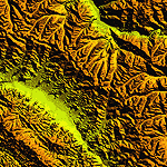
| "Himalayan Peaks" LOD10 Mesh, Volume 7 - K2 and Karakoram |
|
Images related to this file:
File Description:

Highly detailed terrain mesh of the Karakoram area, N35-37 E73-77. The files in this package are based on Shuttle Radar (SRTM) Version 2 data but with many of the void areas, especially the most significant sections, filled with elevation data generated from topographic maps by Jonathan de Ferranti. While Jonathan's work is unrelated to flight simulation he kindly gave me permission to compile his data for use in FS. The result is a wonderful improvement in detail and accuracy over any existing mesh file, freeware or commercial, based on SRTM or DTED data alone.
Due to the large area of the Himalayas I've compiled the source data as two separate series: the "Himalayan Peaks" series covers prominent mountains and ranges in higher detail and locally overrides any existing LOD9 terrain mesh. In addition, a LOD9 "base mesh" series covering the entire Himalayas will be available for those who do not yet have an add-on terrain mesh of these beautiful mountains.
| Filename: | Himalayan_Peaks_LOD10_Mesh_Volume_7__K2_and_Karako.zip |
| License: | Freeware, limited distribution |
| Added: | 30th May 2010, 09:56:27 |
| Downloads: | 9,473 |
| Author: | Holger Sandmann, Jonathan de Ferranti |
| Size: | 38.58 MB |
| Category: Flight Simulator 2004 - Scenery | |
| "Himalayan Peaks" LOD10 Mesh, Volume 6 - Jammu and Kashmir |
|
Images related to this file:
File Description:
Highly detailed terrain mesh of the Jammu and Kashmir areas, N31-36 E76-78. The files in this package are based on Shuttle Radar (SRTM) Version 2 data but with many of the void areas, especially the most significant sections, filled with elevation data generated from topographic maps by Jonathan de Ferranti. While Jonathan's work is unrelated to flight simulation he kindly gave me permission to compile his data for use in FS. The result is a wonderful improvement in detail and accuracy over any existing mesh file, freeware or commercial, based on SRTM or DTED data alone.
Due to the large area of the Himalayas I've compiled the source data as two separate series: the "Himalayan Peaks" series covers prominent mountains and ranges in higher detail and locally overrides any existing LOD9 terrain mesh. In addition, a LOD9 "base mesh" series covering the entire Himalayas will be available for those who do not yet have an add-on terrain mesh of these beautiful mountains.
| Filename: | Himalayan_Peaks_LOD10_Mesh_Volume_6__Jammu_and_Kas.zip |
| License: | Freeware, limited distribution |
| Added: | 29th May 2010, 08:55:43 |
| Downloads: | 9,661 |
| Author: | Holger Sandmann, Jonathan de Ferranti |
| Size: | 52.19 MB |
| Category: Flight Simulator 2004 - Scenery | |
| Joshua Tree + San Bernardino Mountains, California 38m Terrain Mesh |
|
File Description:
USGS SRTM30 1 arc-second, resampled to LOD10 (38.2 meters). This terrain mesh is centered at Joshua Tree National Park in southern California. Coverage area: From West 115.1° to West 117.4° and North 33.7° to North 34.3°. It includes the National Park, the Palm Springs area with Mount San Jacinto and the San Bernardino Mountains.
| Filename: | Joshua_Tree__San_Bernardino_Mountains_California_3.zip |
| License: | Freeware, limited distribution |
| Added: | 4th January 2004, 21:05:58 |
| Downloads: | 3,714 |
| Author: | Andreas Trawny |
| Size: | 4.57 MB |
| Category: Flight Simulator 2004 - Scenery | |
| Hauraki Gulf v4 |
|
File Description:
This replaces all my previous Pakatoa Island and Hauraki Gulf sceneries.You must have Christian Stock's NZ mesh in the form of "Mountains of New Zealand" and topo in the form of "Lakes and Rivers of New Zealand". Includes all previous scenery candy. New in this pack...RANGITOTO ISLAND: Rangitoto Lighthouse; Rangitoto Wharf, public conveniences and baches; Islington Bay Wharf with toilets, telephone and information stand.
| Filename: | Hauraki_Gulf_v4.zip |
| License: | Freeware |
| Added: | 9th November 2008, 08:12:31 |
| Downloads: | 298 |
| Author: | Godfrey Tier |
| Size: | 6 MB |
© 2001-2026 AVSIM Online
All Rights Reserved
Privacy Policy |