
Where Flight Simulation Enthusiasts Gather from Around the World!
AVSIM Library - Search Results

| Category: Flight Simulator 2004 - Gauges | |
| Apollo MX20 Multi-Function Display/GPS |

|
File Description:
This gauge is modeled after the Apollo MX20 Multi-Function Display. This gauge is written in XML and is designed to mesh with the default FS9GPS map input data. Compatible with FS2004 (FS9) ONLY!
Although I tried to make this gauge as close to the real Apollo MX20 as possible it is not considered to be an exact replica. It is limited to certain features that the FS9 data will provide. It does however have all the great features that the default FS9GPS offers and offers an alternative to the default GPS.
Size (pixel size) is the same as the FS9 default GPS so placement (or replacement) of the gauge is quick and easy.
| Filename: | Apollo_MX20_MultiFunction_DisplayGPS.zip |
| License: | Freeware |
| Added: | 24th December 2003, 05:29:16 |
| Downloads: | 9,187 |
| Author: | Keith Giveans |
| Size: | 156.91 KB |
| Category: Flight Simulator X - Scenery | |
| Crete Island, Version 2 |
|
Images related to this file:
File Description:
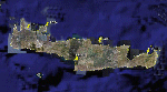
Crete is the bigger than the islands of the Greek archipelago and it is the south rampant of the Aegean sea. This scenery contains the following airports: LGIR, LGSA, LGOB, LGTL and 78 cities.
In this 2nd version I have used the mesh terrain of Yiannis Dermitzakis that offers a bigger realism to the costs. This has put under an obligation to reconstruct the entirety of the populations of the since costs they were located inside the sea. At the same time I have been able to redraw them populations with houses and real facilities that. I believe that I can offer a quite realistic scenery especially in the group of populations of the coast.
| Filename: | Crete_Island_Version_2.zip |
| License: | Freeware |
| Added: | 7th November 2009, 21:08:05 |
| Downloads: | 6,014 |
| Author: | Toni Agramont |
| Size: | 31.14 MB |
| Category: Flight Simulator 2004 - Scenery | |
| O12 - Grand Lake St. Marys Seaplane Base - Ohio, USA |
|
Images related to this file:
File Description:

Grand Lake St. Marys Seaport O12 rests in Ohio's largest inland lake at Celina, Ohio. Float and soar plane enthusiasts will find thermals (several are placed within about a 60 mile radius) and plenty of docks or moors around the lake for your Amphib and afcads. Grand Lake St. Marys Seaport O12 scenery is made to blend with autogen scenery and default mesh. I used custom made objects & default objects. Grand_thermals.BGL is the troublesome file with winds aloft for sail planning thermals. Some people may want to remove it for smoother landing at one of the airports. Airports: Lakefield KCQA - Mulholland OI99 - Fortman 1OH4 and Grand Lake St Marys O12. I pulled this from my old archives.
| Filename: | O12__Grand_Lake_St_Marys_Seaplane_Base__Ohio_USA.zip |
| License: | Freeware |
| Added: | 11th July 2015, 11:22:45 |
| Downloads: | 240 |
| Author: | Rick Connolly |
| Size: | 13.53 MB |
| Category: Flight Simulator X - Scenery | |
| Archipelago of St-pierre & Miquelon (non-flat airport) |
|
File Description:
"The archipelago of St Pierre (LFVP) and Miquelon (LFVM)".
Theses islands are situated in the south of New Foundland island, beetwin Canada and United States.
All the archipelago is made up of a new local mesh, landclass, photorealists textures in 2m/pixel in St-Pierre island (4 seasons and the night) with specific autogen, the harbour, various buildings, churches, and reference marks
visual.
The airport of St-Pierre (LFVP) is created with a non-flat runway, as it
is in reality, whith a true lenght profil.
A basic mission named "De Miquelon à St Pierre" is placed at "beginner"
level for discover easely the archipelago.
This scenery is only for FsX and is not compatible with Fs 2004 (Fs9)."
| Filename: | Archipelago_of_Stpierre__Miquelon_nonflat_airport.zip |
| License: | Freeware, limited distribution |
| Added: | 4th July 2008, 16:11:23 |
| Downloads: | 3,936 |
| Author: | Marc-henri Guitteny |
| Size: | 17.41 MB |
| Category: Flight Simulator X - Scenery | |
| MHTG - Toncontin Intl (Beta v0.6) |
|
File Description:
MHTG - Toncontin Intl (BETA v0.6). Featuring one of the most difficult approaches in the world for large jets, Toncontin Intl airport in Honduras is not well-represented in FSX default scenery. I have sought to rectify that situation with this scenery, which features several fully GMAX'ed buildings and extremely accurate positioning of all items. This scenery is more correctly called "incomplete" rather than "beta", but it is complete enough for me to release it in its present form, so that all of you can enjoy the thrill of flying into a more realistic MHTG using the infamous circling approach. I *highly* recommend you have some add-on terrain mesh installed to get the most realism out of the approach.
| Filename: | MHTG__Toncontin_Intl_Beta_v06.zip |
| License: | Freeware, limited distribution |
| Added: | 14th February 2009, 11:59:55 |
| Downloads: | 6,716 |
| Author: | Rhett Browning |
| Size: | 2.58 MB |
| Category: Flight Simulator 2004 - Scenery | |
| Alaska/BC Bush Scenery: Edgecombe Lodge, Johnny Mountain Mine, & Bob Quinn Lake |
|
File Description:
My fourth bush scenery in Alaska/British Columbia. This package includes three airstrips: the first runway at Edgecombe Lodge has an unusual inclined profile, located precariously across a ridgeline on Annette Island near Ketchikan. I've also put together a tailor-made NDB Instrument Approach plate for it. The other two, Johnny Mountain Mine and Bob Quinn Lake, are hazardous real-life airstrips along the Iskut River in BC (about 50 miles north of Ketchikan). Includes AFCAD files for FS2004 and FS2002. Although I have modified the terrain to create the runways, Eddie Denney's FS2002 mesh of Alaska is still required as a foundation for this scenery to work. Also requires Gerrish Gray's Tree Library (release 3).
| Filename: | AlaskaBC_Bush_Scenery_Edgecombe_Lodge_Johnny_Mount.zip |
| License: | Freeware, limited distribution |
| Added: | 26th January 2004, 15:42:49 |
| Downloads: | 4,432 |
| Author: | James Belk |
| Size: | 5.64 MB |
| Category: Flight Simulator X - Scenery | |
| EICM Galway Airport, Ireland |
|
File Description:
Ireland EICM Galway Airport. Galway airport is a small regional airport situated on the West coast of Ireland. The runway is 1289m(4230ft) in length and is therefore only suitable for GA and small jets. This scenery also includes EICA Connemara and the three airstrips of the Aran Islands, EIIM Inishmore, EIMN Inishmaan, and EIIR Inisheer. EICA Connemara plays host to the shortest scheduled airline service in the world, operated by Aer Arann, and appropriately using BN2 Islanders. In June of 1919, Alcock and Brown crashlanded their converted Vickers Vimy in a Connemara bog, having successfully completed the first non-stop transatlantic flight.
All the terminals and buildings are custom made and static aircraft add a sense of realism. The BGL files have been subdivided so the user can switch various elements of the scenery on or off according to preference. For added realism I have also added some sound effects, animations, people, grass, and rocks. Each airport has a complete set of night textures with wash lighting in the carparks and terminal areas.
The scenery has been primarily designed for VFR photographic scenery using 10m mesh, but will also work with the default terrain, although there are some variations with the default 38m mesh at Inishmore. All the five airports use objects from my Ireland Static object library, 3d aircrew and VFR trees. Full installation instructions are given in the Readme file. I hope you enjoy the scenery as much as I enjoyed making it.
| Filename: | EICM_Galway_Airport_Ireland.zip |
| License: | Freeware |
| Added: | 5th November 2011, 22:04:59 |
| Downloads: | 3,156 |
| Author: | George Keogh |
| Size: | 77.27 MB |
| Category: Flight Simulator X - Scenery | |
| Smithers, CYYD |
|
File Description:
Contained is an approximation of CYYD, Smithers Regional Airport, BC, made using the fsx object placement tool. Just pop it in your fsx\add on scenery\scenery folder. This scenery works well with Combat Planes Northern Adventures sampler. Notice that any xml mission file can be converted to a permanent bgl file for personal use with the bgl compiler of the SDK or Abacus Scenery Shortcut. For example, the Combat Planes Terrace Airport, CYXT. Thus, with this file and the above mentioned, one can have a nice circuit to fly from Smithers through Terrace down to Sandspit and back up to the Sitkine Area, to be improved in the future no doubt with Tongass Fjords II. FSG North America terrain mesh highly recommended.
| Filename: | Smithers_CYYD.zip |
| License: | Freeware |
| Added: | 17th February 2007, 15:36:47 |
| Downloads: | 1,451 |
| Author: | Joe Solomon |
| Size: | 26.78 KB |
| Category: Flight Simulator 2004 - Scenery | |
| UK Hospitals (Vol 1) |
|
File Description:
This scenery collection contains airfield data for 54 Helipad landing sites in Wales, Lancashire, Merseyside, Cheshire and Cumbria based on the information provided by the Confederation of Helicopter Ambulance Services. Information here http://www.chasuk.co.uk/Documentation/HospitalLandingSites/tabid/69/Default.aspx.
The scenery is intended to be used in FS2004 Century of Flight with Just Flight's VFR photographic VFR scenery installed. The height data from CHASUK has been ignored in favour of that obtained from the Just Flight default mesh.
I have started to add autogen trees etc. around some of the landing sites - but this takes a lot longer and so I'm issuing vol 1 first with autogen only added to a few of the sites in the Chester/Merseyside area.
| Filename: | UK_Hospitals_Vol_1.zip |
| License: | Freeware |
| Added: | 2nd April 2009, 16:44:10 |
| Downloads: | 1,099 |
| Author: | Russ McGinn |
| Size: | 231.54 KB |
| Category: Flight Simulator 2004 - Scenery | |
| Raiatea Airport, Uturoa, French Polynesia, NTTR |
|
File Description:
This is a total update of the airport at Raiatea in French Polynesia. It is the largest airport in the Society Islands outside of Tahiti. This scenery contains a new realistic terminal, the rustic hangar area, and the tower, along with tropical landscaping, and an afcad by Ray Smith. This island along with all of the Society Islands of French Polynesia are among the most beautiful paradises on Earth. They can all be greatly enhanced by using the terrain mesh by John Applegate, and Rolf Keibel, updated for FS2004 under the name of fpsimesh.zip. There are also some new landclass files for this area which will also greatly enhance this forgotten area in FS, and their location is available in the read me file of this scenery.
| Filename: | Raiatea_Airport_Uturoa_French_Polynesia_NTTR.zip |
| License: | Freeware |
| Added: | 21st May 2004, 15:24:33 |
| Downloads: | 10,654 |
| Author: | Bill Melichar |
| Size: | 3.15 MB |
© 2001-2026 AVSIM Online
All Rights Reserved
Privacy Policy |