
Where Flight Simulation Enthusiasts Gather from Around the World!
AVSIM Library - Search Results

| Category: X-Plane - Scenery | |
| WT75 Susi Air Yogosem Airstrip v1.0.0 |

|
Images related to this file:
File Description:
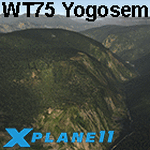
This is an X-Plane 11 scenery for Yogosem Airstrip (WT75) in Yogosem, Papua, Indonesia. This is one of the destinations for "PT ASI Pujiastuti Aviation", operating as Susi Air, an Indonesia airlines established in late 2004 by Mrs. Susi Pudjiastuti. This scenery was tested and is operational (as of January 09, 2017) in "X-Plane 11 Public Beta #5 64 bit", Windows 10 Home. It was also tested but is not really operational (as of January 09, 2017) in "X-Plane 10.51 64 bit", Windows 10 Home. The XP10.51 mesh presents trees ins the end of the runway and a very strong slope, much higher than the 12° of XP11. Quite not operational in XP10.51.
| Filename: | WT75_Susi_Air_Yogosem_Airstrip_v100.zip |
| License: | Freeware |
| Added: | 10th January 2017, 06:00:30 |
| Downloads: | 64 |
| Author: | Rui Mesquita |
| Size: | 1.64 MB |
| Category: Flight Simulator 2002 - Miscellaneous Files | |
| Phoenix Sectional Chart |
|
File Description:
Phoenix, Tucson, Tombstone... welcome to the wild west! Wether you want to fly from Los Angeles eastbound into Texas, or from Las Vegas southbound to Mexico, enjoy Arizona´s wilderness. Search the library for some third party terrain mesh and a screenshot utility and be prepared for spectacular sunsets. You may use this 5500*4200 pixel chart "as is" without any other software, but it will develop its full potential if used as moving map with SimSystem´s FSFlightMax or FSGarmin. It wouldn´t have been possible to offer this chart without Richard Harvey and his love to flightsimming, so please consider this file to be "donationware" and make a however small contribution to the Richard Harvey Endowed Scholarship.
| Filename: | Phoenix_Sectional_Chart.zip |
| License: | Check within download |
| Added: | 27th March 2003, 01:22:09 |
| Downloads: | 1,380 |
| Author: | Uwe Rademacher |
| Size: | 17.51 MB |
| Category: Orbiter - Spaceships | |
| Hubble Space Telescope Update 1 |
|
File Description:
This is an update to the Hubble Space Telescope that comes with the 031105 build of ORBITER. It has the following upgrades:
-New mesh
-Correct behaviour of the Solar Arrays
-Axial Bay1 door animation
-Berthing and Postioning System(BAPS) meshes. This is the work cradle that the HST is placed on during the service missions. I also included the BAPS config that was used on the deployment mission, STS-31.
-The Solar Arrays can now be rotated using CTRL-R.
=== Known bugs ===
-The Axial Bay1 door and the Solar Array rotation is not saved after quiting ORBITER. Why?
=== Animation keys ===
Solar Array folding: CTRL-O
Solar Array rotation: CTRL-R
Hi-gain antennas: CTRL-A
Apeture door: CTRL-H
| Filename: | Hubble_Space_Telescope_Update_1.zip |
| License: | Freeware |
| Added: | 7th November 2003, 16:44:23 |
| Downloads: | 1,185 |
| Author: | David Sundstrom (Orbiter Fan) |
| Size: | 252.96 KB |
| Category: Flight Simulator 2004 - AFCAD Files | |
| Puerto Vallarta, Mexico (MMPR) |
|
File Description:
AFCAD for the Puerto Vallarta Mexico Airport (MMPR) and Mesh released on August 19th, 2005 by José Luis Águila Boudib.
This AFCAD includes most gates and parking as close to real life as I could get it. I used some photos on the internet to get the real layout. Once you install this, the airport should come to life (provided you have the AI aircraft/schedules) with aircraft from AeroMexico, Mexicana, Aero California, Magnicharters and Azteca, as well US carriers like Delta, Continental, Alaska and American Airlines.
The G/A apron still needs expanding to look like the real MMPR, but I kept it within the fence in the scenery by Jose Luis.
| Filename: | Puerto_Vallarta_Mexico_MMPR.zip |
| License: | Freeware |
| Added: | 21st August 2005, 04:03:40 |
| Downloads: | 1,928 |
| Author: | Jeffrey S. Bryner |
| Size: | 3.47 KB |
| Category: Flight Simulator 2004 - Scenery | |
| UK Farm Strips Vol 3 |
|
File Description:
UK Farm Strips Scenery containing a further 20 private landing strips, all located within, and compatible with, the VFR GM Photoscenery coverage and prepared using the VFR Terrain Mesh. All strips reflect the topographical nature of the fields, so that users may experience the challenge of taking ofF from, and landing on, sloping runways. This scenery is not compatible with FS2002, or earlier versions. This third volume requires the presence of Vol 1 and Vol 2, since it uses objects provided with these initial versions, as well as a few additional objects.
Farms in this volume are spread across the counties of Beds, Cheshire, Gloucs, Hamps, Herts, Herts, Kent, etc. Statics now include a number of Microlights.
| Filename: | UK_Farm_Strips_Vol_3.zip |
| License: | Freeware |
| Added: | 11th September 2005, 22:50:07 |
| Downloads: | 1,596 |
| Author: | Gerry Winskill |
| Size: | 1.93 MB |
| Category: Flight Simulator X - Scenery | |
| FSX_MeSA_G08_Patch |
|
File Description:
This terrain mesh file should substitute the before one we uploaded with the same name, which presents a small area with some voids that were not detected in our tests.
Please, accept our apologies for this mistake.
It was multi-LOD compiled from 90m SRTM2 source data, reprocessed
with 3DEM to remove voids and spikes, providing a 76.4m (LOD9) horizontal
resolution topography intended for use only in FSX updated with SP1.
FSX_MeSA_G08_Patch (Column G x Row 08) covers the area inside the boundaries:
N = 22º 30' S; S = 28º 7.5' S;
W = 45º 0' W; E = 37º 30' W;
Authors:
Hely Heck Junior - Magrao ( [email protected] )
and Jose Lobo ( [email protected] )
TerraBrasilis: www.terra-brasilis.org
| Filename: | FSX_MeSA_G08_Patch.zip |
| License: | Freeware |
| Added: | 24th June 2007, 18:09:48 |
| Downloads: | 632 |
| Author: | Hely Heck Jr. and José Lôbo |
| Size: | 10.39 MB |
| Category: Flight Simulator X - Scenery | |
| Tonopah - KTPH |
|
File Description:
This file contains several BGL's which enhance the default FSX Tonopah, Nevada airport (KTPH).
Additional parking, scenery objects, and roads are added to the bland stock airport.
The "mesa" created by the stock airport backgound flatten is blended into the
surrounding terrain using "sloped flattens".
This scenery is not intended to re-create a perfect match to the real world but
to enhance the visual experience of flying into and out of the airport.
The files were tested with FSX-Acceleration\SP2 on WinXP Pro, DX9.
I used 10M mesh from the "FSX Usa 10 M terrains Project" when blending
the altitude data but the files should provide good results with the default FSX terrain.
| Filename: | Tonopah__KTPH.zip |
| License: | Freeware |
| Added: | 21st December 2007, 04:29:50 |
| Downloads: | 1,171 |
| Author: | Paul Strogen |
| Size: | 812.46 KB |
| Category: Flight Simulator 2004 - Scenery | |
| Hong Kong Kai Tak 1963 |
|
File Description:
This is Kai Tak airport as it was in 1963. Kowloon Bay has yet to be filled in, and the runway is only 8405 ft long. Includes mesh files by Holger Sandmann and charts of the era scanned by Chic Eather. Navaids backdated to the early 60's, except the IGS for runway 13 is included although not actually installed until 1974. Curving approach lights will help you find the runway. Chek Lap Kok airport has been removed. The IGS and other approaches created by Jim Vile. The AI aircraft will follow the curved approach to runway 13 in good weather or bad. Please note that Jim Vile has produced a modern version of this airport (kaitak98.zip).
| Filename: | Hong_Kong_Kai_Tak_1963.zip |
| License: | Freeware, limited distribution |
| Added: | 27th April 2006, 02:02:13 |
| Downloads: | 15,205 |
| Author: | Tom Gibson and Jim Vile |
| Size: | 5.74 MB |
| Category: Flight Simulator X - Scenery | |
| WA67 - Green Mountain Airport - Vancouver, Washington |
|
Images related to this file:
File Description: This is a revision of an airport originally included in my Oregon GA package.
This is a complete airport and can be installed alone, or you can add this
to the original and overwrite the older files. A member of the community
alerted me to elevation discrepancies; I had been using a 3rd party mesh when I
made this airport, which masked the discrepancy. This version will work
universally and also includes corrected approaches wherein I removed the default
ones and aligned these correctly to the current runway position; I added custom
runways lights to more accurately reflect reality and also made several relevant
detail changes.
| Filename: | WA67__Green_Mountain_Airport__Vancouver_Washington.zip |
| License: | Freeware, limited distribution |
| Added: | 6th January 2014, 16:28:32 |
| Downloads: | 637 |
| Author: | Rick Keller |
| Size: | 146.81 MB |
| Category: Flight Simulator 2004 - Gauges | |
| Apollo MX20 Multi-Function Display/GPS |
|
File Description:
This gauge is modeled after the Apollo MX20 Multi-Function Display. This gauge is written in XML and is designed to mesh with the default FS9GPS map input data. Compatible with FS2004 (FS9) ONLY!
Although I tried to make this gauge as close to the real Apollo MX20 as possible it is not considered to be an exact replica. It is limited to certain features that the FS9 data will provide. It does however have all the great features that the default FS9GPS offers and offers an alternative to the default GPS.
Size (pixel size) is the same as the FS9 default GPS so placement (or replacement) of the gauge is quick and easy.
| Filename: | Apollo_MX20_MultiFunction_DisplayGPS.zip |
| License: | Freeware |
| Added: | 24th December 2003, 05:29:16 |
| Downloads: | 9,187 |
| Author: | Keith Giveans |
| Size: | 156.91 KB |
© 2001-2026 AVSIM Online
All Rights Reserved
Privacy Policy |