
Where Flight Simulation Enthusiasts Gather from Around the World!
AVSIM Library - Search Results

| Category: Flight Simulator 2004 - Flight Plans | |
| OB-97 Fayetteville Arkansas |

|
Images related to this file:
File Description:
FS2004 Flight Plan for OB-97 Fayetteville Arkansas IFR high speed low altitude military training route. This is the sixteenth in a series of FS2004 flight plans I have uploaded. This route goes through mostly flat and rolling terrain in Arkansas, Texas, Oklahoma and Kansas. This route has two different sets of targets. These are great routes for B-52, F-111, B-1B, B-2 A6, A4, Vulcan and any fighter or bomber enthusiasts. Of course you can fly the route with any aircraft of your choice. Included in this package is a gauge by Karol Chlebowski for TFR flying at very low altitude. This gauge will greatly enhance your ability to fly these challenging routes and is a great companion of the flight plans. Another option to download Version 2.0 of my FS2004 mini panel which has all this functionality and more.
| Filename: | OB97_Fayetteville_Arkansas.zip |
| License: | Freeware |
| Added: | 28th July 2011, 09:22:42 |
| Downloads: | 64 |
| Author: | Bill McClellan |
| Size: | 489.81 KB |
| Category: Flight Simulator 2004 - Flight Plans | |
| OB-98 Rapid City South Dakota |
|
Images related to this file:
File Description:
FS2004 Flight Plan for OB-98 Rapid City South Dakota IFR high speed low altitude military training route. This is the seventeenth in a series of FS2004 flight plans I have uploaded. This route goes through both mountainous and flat and rolling terrain in South Dakota, Nebraska, Wyoming and Montana. This route has two different sets of targets. These are great routes for B-52, F-111, B-1B, B-2 A6, A4, Vulcan and any fighter or bomber enthusiasts. Of course you can fly the route with any aircraft of your choice. Included in this package is a gauge by Karol Chlebowski for TFR flying at very low altitude. This gauge will greatly enhance your ability to fly these challenging routes and is a great companion of the flight plans. Another option to download Version 2.0 of my FS2004 mini panel which has all this functionality and more.
| Filename: | OB98_Rapid_City_South_Dakota.zip |
| License: | Freeware |
| Added: | 28th July 2011, 09:23:26 |
| Downloads: | 76 |
| Author: | Bill McClellan |
| Size: | 360.49 KB |
| Category: Flight Simulator 2004 - Flight Plans | |
| OB-27 Ashland Maine and Fort Drum New York |
|
Images related to this file:
File Description:
FS2004 Flight Plan for OB-27 Ashland ME and Fort Drum NY IFR high speed low altitude military training route. This is the tenth in a series of FS2004 flight plans I am uploading. This route goes through both flat and rolling and mountainous terrain in Maine, New Hampshire, Vermont and New York. These are great routes for B-52, F-111, B-1B, B-2 A6, A4, Vulcan and any fighter or bomber enthusiasts. Of course you can fly the route with any aircraft of your choice. Included in this package is a gauge by Karol Chlebowski for TFR flying at very low altitude. This gauge will greatly enhance your ability to fly these challenging routes and is a great companion of the flight plans. Another option to download Version 2.0 of my FS2004 mini panel which has all this functionality and more.
| Filename: | OB27_Ashland_Maine_and_Fort_Drum_New_York.zip |
| License: | Freeware |
| Added: | 27th July 2011, 23:07:39 |
| Downloads: | 100 |
| Author: | Bill McClellan |
| Size: | 522.79 KB |
| Category: Flight Simulator 2004 - Flight Plans | |
| OB-53 Minneapolis Minnesota |
|
Images related to this file:
File Description:
FS2004 Flight Plan for OB-53 Minneapolis Minnesota IFR high speed low altitude military training route. This is the fourteenth in a series of FS2004 flight plans I have uploaded. This route goes through mostly flat and rolling terrain in Minnesota, North Dakota and South Dakota. This route has three different sets of targets. These are great routes for B-52, F-111, B-1B, B-2 A6, A4, Vulcan and any fighter or bomber enthusiasts. Of course you can fly the route with any aircraft of your choice. Included in this package is a gauge by Karol Chlebowski for TFR flying at very low altitude. This gauge will greatly enhance your ability to fly these challenging routes and is a great companion of the flight plans. Another option to download Version 2.0 of my FS2004 mini panel which has all this functionality and more.
| Filename: | OB53_Minneapolis_Minnesota.zip |
| License: | Freeware |
| Added: | 27th July 2011, 23:10:27 |
| Downloads: | 77 |
| Author: | Bill McClellan |
| Size: | 366.29 KB |
| Category: Flight Simulator X - Gauges | |
| A330/A340 Gauge Upgrade v2 |
|
File Description:
This is v2 of the OVERLAND SMS gauges upgrade pack.
It fixes several problems found on the first package and adds a few more features.
NEW FEATURES
1. It adds TERRAIN ON ND function, i.e. you can see the map at the ND (see screenshots). It is not very realistic, compered to the real thing, however it does add more realism and eliminates the use of the GPS for ground reference.
2. It adds a complete ILS CAT II & III autoland function to the aircraft. The original file belongs to Stefan Liebe, being modified by Francois
Dore, and finally being fine tuned for use with SMS A330 and A340 by me. It has been tested many times and this is the closest it can get
to the real thing. Now you can have a completely zero visibility landing performed automatically.
3. It provides new style square monitor 2d panels.
| Filename: | A330A340_Gauge_Upgrade_v2.zip |
| License: | Freeware |
| Added: | 9th June 2012, 06:29:25 |
| Downloads: | 3,146 |
| Author: | Dimitrios Moschos |
| Size: | 6.06 MB |
| Category: Flight Simulator 2004 - Scenery | |
| Inuvik CYXT in the Northwest Territories, Canada |
|
Images related to this file:
File Description:
Inuvik is a town of 3,500 or so inhabitants at N68 18 W133 29, which puts it 120 miles inside the Arctic Circle on the east side of the Mackenzie River delta and around 90 miles from where the Mackenzie meets the Beaufort Sea. There is a Canadian Forces base at the eastern end of the field, with shelters for six F18 fighters; the base in one form or another has been there for a while and is the reason for the generous length of asphalt runway.
Inuvik was established in the early 1960's as a replacement regional center for Aklavik which is 40 miles to the west across the delta and which flooded on a regular and inconvenient basis. This probably works without Ultimate Terrain but I haven't tested it. I also haven't tested it in FSX but I was told it works there too.
| Filename: | Inuvik_CYXT_in_the_Northwest_Territories_Canada.zip |
| License: | Freeware, limited distribution |
| Added: | 6th October 2010, 13:22:04 |
| Downloads: | 943 |
| Author: | Roger Wensley |
| Size: | 4.12 MB |
| Category: X-Plane - Scenery | |
| BR RJ SBME - Macae Airport v1.0.0 |
|
Images related to this file:
File Description:
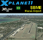
This is an X-Plane 11 and X-Plane 10 scenery package for Benedito Lacerda Airport (IATA: MEA, ICAO: SBME) is the airport serving Macaé, RJ, in Brazil. It includes corrected aprons, ramps, gates, taxiways, lighting system, city buildings, ortho-photoscenery for the airfield area, and (XP11 only) airport ground services (like push back). The airport was established in the 1960s as an airfield for general aviation and a Flying club. In the 1980s the runway was paved and an apron and a terminal with 941 m² were constructed, enabling Macaé Airport to fully support the operations related to the Campos basin (off shore oil platform in the costal area of the state of Rio de Janeiro). In fact, most of its movement (98%) is related to helicopter flights to/from offshore oil platforms of the Campos basin. It features a lot of apron positions for rotorcrafts. This scenery was tested and is operational (as of March 26, 2017) in "X-Plane 11 Public Beta #17 64 bit", Windows 10 Home. It was also tested and is also operational (as of March 26, 2017) in "X-Plane 10.51 64 bit", Windows 10 Home. Only the default X-Plane 11 libraries, by Laminar Research, are needed. No third party libraries are used.
| Filename: | BR_RJ_SBME__Macae_Airport_v100.zip |
| License: | Freeware |
| Added: | 29th March 2017, 03:50:00 |
| Downloads: | 80 |
| Author: | Rui Mesquita |
| Size: | 14.62 MB |
| Category: Flight Simulator X - Scenery | |
| YMNG - Mangalore Airport - Victoria, Australia |
|
Images related to this file:
File Description:
Mangalore Airport is located in central Victoria, Australia and provides pilot training services and facilities for student pilots.
This airport has been modeled from photographs freely available off the internet. This package has two versions. One is for anyone who has the orbxAU/Blue package installed and the other is for generic fsx landscape. The two options are provided as the blending of the airport into the surrounding scenery is different for each. I have modeled the main terminal building and a couple of buildings close to it and the control tower so as to look something like the actual ones but I have used generic textures in addition to some of my own. All the other buildings are generic ones and chosen for their size and architectural resemblance (albeit rather vague because of the generic library lack of choice) to the actual ones. I have included two hangars of my own but these are not exactly like those at the actual airport but
are similar in size and shape. This means that the overall layout reflects the actual airport but
the finer detail does not. In any event its an improvement on what came with the default version.
| Filename: | YMNG__Mangalore_Airport__Victoria_Australia.zip |
| License: | Freeware |
| Added: | 6th March 2016, 19:16:13 |
| Downloads: | 566 |
| Author: | Robert Budd |
| Size: | 1.42 MB |
| Category: Flight Simulator X - Scenery | |
| Lelystad airport_EHLE_FSX_new_layout |
|
File Description:
Because the Netherlands 2000 Scenery Design Team no longer releases a new version for the FSX,
this version has been compiled based on nl2k_v4_EHLE_5 with the permission of the the Netherlands 2000 Scenery Design Team.
- Various buildings have been modelled and items from various sources have been added to the airport.
- The EHLElib.BGL file contains all the items that have been used and the textures are complete.
As a result, the airport can be installed without the use of the installation of the Netherlands 2000 Scenery Design Team.
- The airport is surrounded by more trees than the version nl2k_v4_EHLE_5.
- Lampposts have been added to the highway of the approach path of Runway 23 and parking places.
- By means of Airport Design Editor the airport can be changed.
- In the Effects folder, there are effects that should be added to the FSX (SE) folder.
- In the selection folder you will find two options. One is the choice where the new section is active and two where it is inactive.
By placing a copy of one of these in the scenery folder and deleting it already in the scenery.
It will become active after you restart the flight sim.
Enjoy and Happy flying
Jan Zijlstra from the Netherlands
| Filename: | Lelystad_airport_EHLE_FSX_new_layout.zip |
| License: | Freeware |
| Added: | 20th March 2024, 23:09:06 |
| Downloads: | 167 |
| Author: | Jan Zijlstra |
| Size: | 255.22 MB |
| Category: Flight Simulator 2002 - Flight Plans | |
| Cape Town to Cairo Flight Plans |
|
File Description:
From Cape Town to Cairo
4563 n/miles through the Africa continent. Fly it in 12 stages. All 12 flightplans included for FS2002, FSNavigator and every airport has a face-lift with LAGO's FSSE so that you will not land on a strip in the middle of nowhere! Read the txt files for detail.
| Filename: | Cape_Town_to_Cairo_Flight_Plans.zip |
| License: | Freeware |
| Added: | 14th March 2003, 19:16:23 |
| Downloads: | 522 |
| Author: | Terblanche Jordaan |
| Size: | 230.14 KB |


© 2001-2026 AVSIM Online
All Rights Reserved
Privacy Policy |