
Where Flight Simulation Enthusiasts Gather from Around the World!
AVSIM Library - Search Results

| Category: Civil Flight Simulators - Looking Glass Flight Unlimited 3 | |
| New Outer Terrain Textures - Version 2 |

|
File Description:
A set of 26 textures for the Outer Terrain. This is a second 'beta' version of my new textures: transition and variation textures are provided for all 25 land textures, but water transitions are NOT yet included. Also included is a texture transition spreadsheet and artwork (as TarGA image files) for the 26 base textures.
| Filename: | New_Outer_Terrain_Textures__Version_2.zip |
| License: | Freeware |
| Added: | 10th March 2010, 22:44:01 |
| Downloads: | 52 |
| Author: | Jonathan Stonehouse |
| Size: | 8.8 MB |
| Category: Flight Simulator X - Scenery | |
| Detailed Terrain Features for Southern Africa |
|
Images related to this file:
File Description:
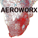
Scenery consist of coastlines, rivers, dams, streams, roads, traffic, railroads, power lines and extrusion bridges for Southern Africa countries South of the Equator. The scenery was design by utilizing Satellite image backgrounds.
This scenery is important and will be needed with release of future scenery by Aeroworx.
| Filename: | Detailed_Terrain_Features_for_Southern_Africa.zip |
| License: | Freeware |
| Added: | 25th August 2012, 18:43:04 |
| Downloads: | 8,914 |
| Author: | Hannes Steyn, Aeroworx |
| Size: | 27.79 MB |
| Category: Flight Simulator 2004 - Scenery | |
| Scotts Bluff, Nebraska 19m Terrain Mesh |
|
File Description:
LOD 11 (19 m resolution) terrain mesh of Scotts Bluff National Monument in the panhandle of Nebraska and surrounding area. Compiled from NED 1/3" (10 m) elevation data. Proprietary software was used to smooth the terrain near KBFF and KIBM airports to eliminate the "runway plateau" side effects induced by high-resolution mesh.
| Filename: | Scotts_Bluff_Nebraska_19m_Terrain_Mesh.zip |
| License: | Freeware, limited distribution |
| Added: | 22nd April 2004, 18:16:00 |
| Downloads: | 1,332 |
| Author: | John K. Taylor |
| Size: | 6.69 MB |
| Category: Flight Simulator 2004 - Scenery | |
| Lake Simcoe Regional for Ultimate Terrain |
|
File Description:
Located sixty miles north of Toronto equidistant between the Cities of Barrie and Orillia, Lake Simcoe Regional CNB9 is situated adjacent to Lake Simcoe in one of the fastest growing areas in Canada. Welcome to the gateway to “Cottage Country”
www.flightontario.com
| Filename: | Lake_Simcoe_Regional_for_Ultimate_Terrain.zip |
| License: | Freeware |
| Added: | 8th January 2006, 04:19:49 |
| Downloads: | 3,456 |
| Author: | Jim Kanold - Flight Ontario |
| Size: | 12.35 MB |
| Category: Flight Simulator 2002 - Scenery | |
| Eastern Australia, New Zealand Terrain Mesh |
|
File Description:
GTOPO30 Tile: E140S10 to E180S60.
This data adds a small but pleasant increase in visual detail in most areas.
Constructed from GTOPO30 data (3 arcsec, ~1000m) and converted at LOD7 to 305.8m.
Production procedures used result in coverage of 98% (!) of the source Tile.
| Filename: | Eastern_Australia_New_Zealand__Terrain_Mesh.zip |
| License: | Freeware, limited distribution |
| Added: | 19th August 2002, 23:32:34 |
| Downloads: | 2,325 |
| Author: | Steve Greenwood |
| Size: | 10.5 MB |
| Category: Flight Simulator 2002 - Scenery | |
| Seattle, WA - High Resolution Terrain Mesh |
|
File Description:
Seattle, Washington area. The modest terrain in the Seattle area provides a nice example of a less obvious benefit of high resolution terrain mesh. The rendering of many small features missing entirely in the default mesh provides much richer detail and a greater sense of realism. (30m source -> 38.2m final).
| Filename: | Seattle_WA__High_Resolution_Terrain_Mesh.zip |
| License: | Freeware, limited distribution |
| Added: | 4th July 2002, 13:32:39 |
| Downloads: | 3,621 |
| Author: | Steve Greenwood |
| Size: | 3.75 MB |
| Category: Flight Simulator 2004 - Scenery | |
| Devils Tower Terrain Mesh (ver 2) |
|
File Description:
This terrain mesh covers most of Crook County, Wyoming which contains Devils Tower National Monument. This terrain mesh was obtained from NED 1 arc second data and resampled to LOD10 resolution (38.2m). The area near the Devils Tower was obtained from NED 1/3 arc second data and resampled to LOD11 resolution (19.1m). The exact coverage is everything between W105* 7' 30" to W104* 0' 0" by N45* 0' 0" to N44* 15' 0". Devils Tower can be found by starting at Ipy Ranch (WY14) and traveling on a track of 194 degrees for 3 nautical miles. This version corrects a major positional error that was present in the first release and includes higher resolution data near the Devils Tower.
| Filename: | Devils_Tower_Terrain_Mesh_ver_2.zip |
| License: | Freeware |
| Added: | 26th November 2003, 00:25:13 |
| Downloads: | 3,558 |
| Author: | Joshua Robertson, 3D Softworks Design Studios |
| Size: | 4.54 MB |
| Category: Flight Simulator 2004 - Scenery | |
| Terrain Mesh of Glacier National Park |
|
File Description:
New and updated scenery enhancements for the mountain ranges of southeastern British Columbia and parts of the Alberta Rocky Mountains. They require an existing installation of my files bcmesh9d.zip and/or bcmesh9e.zip. Scenery coverage follows the Trans-Canada Highway from Banff National Park to west of Revelstoke (~350km), with accurate transportation network, rivers and lakes, hydro dams, ski hills, glaciers, and landclass/waterclass updates based on satellite imagery. Also, similar enhancements to the parks and towns of the southern Kootenay, Selkirk, and Monashee mountains. The mesh source data are 0.75-arcsec (~23-m) CDED files, compiled at LOD10 (38-m) resolution. Due to significant changes in FS2004 to vector layering and autogen features, the special scenery enhancements cannot be used with FS2002. However, terrain mesh, new lakes and land/waterclass replacements will work well in FS2002.
| Filename: | Terrain_Mesh_of_Glacier_National_Park.zip |
| License: | Freeware, limited distribution |
| Added: | 18th December 2003, 23:17:35 |
| Downloads: | 8,858 |
| Author: | Holger Sandmann |
| Size: | 12.79 MB |
| Category: Flight Simulator 2002 - Scenery | |
| Dominica Scenery (Mesh Terrain and Landclass) |
|
File Description:
This is a Mesh Terrain / Landlcass scenery addon for the Caribbean island of Dominica. The FS2002 default scenery is flat in the area although Dominica is a mountainous and very picturesque island.
| Filename: | Dominica_Scenery_Mesh_Terrain_and_Landclass.zip |
| License: | Freeware |
| Added: | 23rd December 2002, 18:39:44 |
| Downloads: | 2,250 |
| Author: | David Maldonado, Rainer Labie |
| Size: | 486.91 KB |
| Category: Flight Simulator 2004 - Scenery | |
| Replacement Landclass for Atlanta / Ultimate Terrain |
|
File Description:
Landclass adjustment for the Atlanta metro area, primarily for use with Ultimate Terrain. This will change the majority of the "grid" urban and suburban tiles to "non-grid" versions, resulting in a much more realistic look around Atlanta, as most roads twist and turn in a seemingly random fashion. The core downtown / midtown areas are transparent to allow the original UT grid landclass to show through.
| Filename: | Replacement_Landclass_for_Atlanta__Ultimate_Terrai.zip |
| License: | Freeware |
| Added: | 7th August 2006, 03:02:04 |
| Downloads: | 1,183 |
| Author: | Guy Elden Jr. |
| Size: | 1.38 MB |


© 2001-2026 AVSIM Online
All Rights Reserved
Privacy Policy |