
Where Flight Simulation Enthusiasts Gather from Around the World!
AVSIM Library - Search Results

| Category: Flight Simulator 2004 - Scenery | |
| Dutch Harbour PADU in Alaska PLUS AI Air & Sea |

|
Images related to this file:
File Description:
This is a revised and much-added-to update of my earlier Dutch Harbor post, adding more Air & Sea AI. It is complete in itself and does not require you to have previously installed the original. New parking is for a civilian freighter, a Coast Guard C-130, and Coast Guard helicopters that fly from St Paul Island.
There is also a daily flight from Dutch Harbor to Akutan that will be by the amphibious Goose as there is no land runway at Akutan [more posts follow].
The official airport name is Unalaska, but a seat booked with airlines will be to Dutch Harbor, known from the tv series as a fishing centre with major fish and crab processing plants. In town the largest company is Unisea, taking up all of what was once Expedition Island and the adjacent shoreline. The out-of-town expansion is taking place along the shore of Captains Bay to the southwest, and here the largest is Westward with the uniform green roof for the plant and the residential buildings for seasonal workers.
The airport has just over 3,900 feet of 100 feet wide asphalt, aligned 30/12, lit, and between sea and hill with two aprons at the southeast end. There is no control tower at the airport, so don't be surprised when you are required to contact Cold Bay USAF for landing permission. Runway 30 has at its threshold a road; when a plane is landing or taking off traffic is stopped by barriers and lights. To encourage full use of the runway the fence is made up of plastic rods that bend on impact instead of chainlink topped with barbed wire that will turn a light plane upside down.
| Filename: | Dutch_Harbour_PADU_in_Alaska_PLUS_AI_Air__Sea.zip |
| License: | Freeware, limited distribution |
| Added: | 7th August 2012, 20:56:03 |
| Downloads: | 1,535 |
| Author: | Roger Wensley |
| Size: | 13.4 MB |
| Category: Flight Simulator X - Original Aircraft | |
| TU-95MS Bear H |
|
Images related to this file:
File Description:
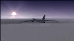
The Russian Air Force 37th Air Army operates the TU-95MS (TU-95M 55 Bear H) from the 182th TBAP unit based in Zavitinsk and 6213 BKHUAT based at Engels Air Base in the Moscow Region. It's use is primarily in maritime operations. She carries cruise missiles even if only used for submarine comms. Her initial design is a competitor with the B-52, but uses 4 Turboprop engines with 8 contra-rotating props. She can fly about as far as, but not as high as the B-52, nor can she fly as fast. She is often monitored off the coast of Alaska and easily met with F-22 Raptors every time. She is also often met by NATO fighters near European borders. Since 45,000 feet is about the highest she can cruise, most fighters can meet her. Her real danger is the cruise missiles which, if launched, have a range more than 1,500 nm and can pinpoint any directed target using GPS ground control. She is normally flown in formations of 3 or more, but sometimes only 2 are observed. She is not designed to fly fast over low terrain, like the B-52, but can do-so if necessary, and dangerously. The aircraft has not seen any major improvements or modifications since the cold war era, and several have crashed due to lack of maintenance. It is currently unknown how many are in service condition. Since much is unknown about this aircraft, yet enough is known to re-create an authentically working model, I have done-so here. Every bit of the aircraft.cfg file and associated .air file has been re-worked to match what known data can offer, and known aerodynamic formulas can equate. The most difficult aspect is the Turboprop aspect, since Turboprop engines do not work like jet engines in any way. Luckily for the simmer, there is no need to adjust feathering or anything like that would be necessary in a normal Turboprop because these engines are self-adjusting. Even though they meet the full known specs of the real engines, I have actually worked all the math to make them actual Turboprop engines (not pseudo-jet engines). That may sound exciting, but you must remember that she is a prop-driven aircraft, and not a jet. Even though you can fly her like a jet, the engines do not adjust like a jet. All aspects have been configured to meet realistic standards, including the MOI factors, weight/balance (including payload positions), gear locations, aircraft dimensions, light positions, engine smoke locations and operations, and weight. I did not simply throw this together, but have been perfecting her for many years. Original Modeler/Sounds: Vladimir Zhyhulskiy (2006); Panel: Marco Spada; Auto Smoke Effects: Richard Wisman; Aero/Engine Dynamics, effects, and details: Douglas E. Trapp, FS Flight Dynamics Engineer, [email protected], November 2018. The use of this model, and the configuration of such, is designed for free educational purposes, and protected by the Free Use Act: (https://www.law.cornell.edu/uscode/text/17/107). This model and/or aspects of such cannot be used for monetary purposes!
| Filename: | TU95MS_Bear_H.zip |
| License: | Freeware |
| Added: | 3rd November 2018, 23:28:41 |
| Downloads: | 744 |
| Author: | Douglas E. Trapp |
| Size: | 42.71 MB |
| Category: Miscellaneous Files - General Utilities | |
| Random Airport Generator |
|
Images related to this file:
File Description:
I can be contacted at [email protected] for any help required or different drive versions needed.
[ABOUT THE PROGRAM]
This program will read a text file from the route of your hard drive depending on the version you run, and select a random line and display that line. The file must be a text file named "Airports.txt". This program was designed with ease of use in mind for selecting a random airport for the Flight Sim community, though can be used for any purpose with any text file called "Airports.txt". The program will display the airport ICAO code then co-ordinates.
[ABOUT ME]
I am a 16 year old aviation enthusiast that loves flying and ATC, but hate having to choose an airport to depart from and arrive at, or to controll. This program has now removed this to make my flight more random with less decisions to make. I also like to explore areas I haven't been before, again this selects a random airport, from thousands of different ones, so exploring is inevitable.
[INSTALLATION]
The only installation required is to copy the Airports.txt file to the route of your hard drive C: or D: (for more drives e-mail me as above), then run the respective program for that drive from any folder you wish.
[ABOUT THE AIRPORTS.TXT FILE]
This file was collected from my FS2004 and contains every airport in it. Currently the program selects a line at random and displays it, whether a large international airport or small grass field. You could edit the file just to contain your favourite airports and it will NOT affect the running of the program as long as the file remains as Airports.txt. I am hoping in future versions to allow you to select a type of airfield, i.e. large, medium or small or select from runway length, though this will take a while to produce, if ever.
For now i hope everyone enjoys the program and happy flying :)
| Filename: | Random_Airport_Generator.zip |
| License: | Freeware |
| Added: | 9th June 2010, 02:41:14 |
| Downloads: | 211 |
| Author: | Alexander Aschacher |
| Size: | 254.45 KB |
| Category: Flight Simulator X - Scenery | |
| KLGB Long Beach Airport - Modernized terminal |
|
File Description:
The airport I chose is Long Beach Airport. This airport has been around for
many years and has had everything from the Air Force One to the 787 Dreamliner land here!
The airport is located between downtown Los Angeles and Orange County and offers a great
landing for tourists that do not want to land in the fifth busiest airport in the world,
Los Angeles International.

The reason why I decided to create this airport was because it is my home airport
and I am located only about five miles from it. Also, there is no good freeware FSX scenery for this airport.
Features included!:
- Modern Terminal with correct gate placements
- changed and edited roads and other buildings around airport
- added the jetBlue offices on the airport
- Cars added (all over the place!!!)
- trees added near drop off (California Palm trees)!
- baggage cars and other airport cars added.
- buses and car parking lots added
- "spring street" flight schools and private terminal added.
- Vehicles, AI aircraft, grave yard aircraft, and many other static joys throughout the airport!
- "Runup" aircraft near runway 34R.
- Boeing C-17 facility (no aircraft C17 there)
- updated taxi ways and heliports
- Airport Service vehicle roads updates and made with help from Google Earth.
- Accurate fence, jetblast fence, and boarders of airport.
- Cargo terminals added for ups and dhl
- Private (gulfstream and other private) jet spots added.
- Flight Schools such as Long Beach Flight Academy (one I go to!!!) accurately made.
- New taxi ways and terrain
- Aflite fuel truck spaces added
- Correct runway lengths of 25L
- More items you just need to see to believe!!!
Distribution limits (MUST CONTACT ME FOR REDISTRIBUTION).
| Filename: | KLGB_Long_Beach_Airport__Modernized_terminal.zip |
| License: | Freeware, limited distribution |
| Added: | 26th March 2012, 11:10:01 |
| Downloads: | 2,717 |
| Author: | Rohan Patel |
| Size: | 3.57 MB |
| Category: Flight Simulator X - Aircraft Repaints, Textures and Modifications | |
| Canadian Airlines Airbus A380 |
|
Images related to this file:
File Description:

This is a repaint for Project Airbus' Airbus A380 in a fictional Canadian Airlines livery. Includes base model, high-quality textures, and updated VC.
*Mask Options*
This livery also includes cockpit window "Mask Options". Please see the included readme in the .zip file for instructions for applying these options.
Canadian Airlines never flew the A380, as by the time the company was absorbed by Air Canada in 1999, the aircraft did not exist. The largest aircraft flown by Canadian Airlines was the Boeing 747-427. However, in our new universe, Canadian Airlines has taken delivery of one single Airbus A380, available to fly any route of your choice. It flies under the registration C-CSPN and the tail number 383.
*Livery Info*
Upon its founding in 1987, Canadian Airlines revealed its new livery using the colours light grey, dark grey, navy blue, and red. The paint scheme was an adaptation of the recently introduced livery from its predecessor Canadian Pacific Airlines. The lower half of the aircraft's body was navy blue, topped with light grey and red stripes, while the tail was blue, with approximately one-third taken up by the carrier's new logo. The new Canadian Airlines logo was a combination of Canadian Pacific's five grey stripes, representing the five continents served by the carrier. Over these stripes was a thick, bright red chevron. The chevron was a simplification of the Pacific Western Airlines logo. The chevron was placed over the stripes, which then represented "Wings over 5 continents". It was also an ingenious and subtle way to represent the takeover of CP by PWA. The same logo, in a square form, became a clever alternative to a true bilingual name on the fuselage replacing the French "e", and the third "a" in English (Canadian/Canadien).
Model by The Project Airbus Team Textures by Julian Flight - March 31st, 2024 Virtual Cockpit by Thomas Ruth Virtual Cockpit updated by Chris Evans and Louis Quintero
| Filename: | Canadian_Airlines_Airbus_A380.zip |
| License: | Freeware, limited distribution |
| Added: | 5th April 2024, 17:19:08 |
| Downloads: | 52 |
| Author: | Julian Flight |
| Size: | 65.85 MB |
| Category: Flight Simulator 2004 - Scenery | |
| PAEN, PAEX, 3AK4, 30AK, 52AK - Alaska, USA |
|
Images related to this file:
File Description:
The town of Kenai is on the east coast of Cook Inlet, 60 miles southwest of Anchorage. The airport is in the northern part of the town, with a runway aligned 1-19, 7,550 feet long and 150 feet wide (with an ILS on 19). A second runway is gravel, 2,000 feet long and for winter use by ski planes. There is also a water runway, and all three are aligned the same and called "1 left-19 right" (the main runway) "1 right-19 left" (gravel) and "1 water-19 water". The taxiways are extensive and designed for a far larger traffic than the airport has today, though even now the airport is fairly busy. In FS9 a water runway for AI cannot work with an ATC control tower; the water part of PAEN has therefore been separated into another call sign PAEX which has ONLY the water runway; the tower will therefore direct the plane that makes contact to use the water runway. The PAEN airport runway has taxiway connections at each end and also two intermediates; at the northern end there are in fact two so a total of 5; B, C, D, E, and F; there is an airport diagram included. GA traffic goes to one of two parking aprons, both at the southern end, and at the far southern end there is the hangar for the Civil Air Patrol. The AI includes aircraft from my previous Alaska posts, as Kenai is where I sent them when they departed from, for instance, Palmer. Airlines and cargo companies that operate from and to Kenai are included in the AI: ERA (which has recently changed it's name), Grant Aviation, Air North, Wings of Alaska, North Star Air, and a small local company Air Supply Alaska, along with Fedex, UPS, Everts, and Northern Air Cargo. There is also GA and float AI. Nearby smaller airfields are included, partly because one of them was dramatically misaligned in FS9.
| Filename: | PAEN_PAEX_3AK4_30AK_52AK___Alaska_USA.zip |
| License: | Freeware, limited distribution |
| Added: | 26th December 2015, 15:33:19 |
| Downloads: | 485 |
| Author: | Roger Wensley |
| Size: | 23.08 MB |
| Category: Flight Simulator 2004 - Scenery | |
| 8AK7 - Bullen Point - Alaska North Slope 7 |
|
Images related to this file:
File Description:
The town of Barrow is in the far north of Alaska, and these are coastal villages or radar installations to the west, south, and now east of Barrow. There will be further additions. Bullen Point is a DEW station Air Force base 240 miles east of Barrow and 75 miles east of Oliktok. The runway is just under 4,000 feet of gravel and aligned 05-23; this is approximately at right angles to the default FS9 alignment and how that came about is something I doubt Bill Gates could explain. Most of the DEW buildings have now been removed (including the large hangar, which is unusual) but as I had a layout I made the whole site as it was originally, way back in the days when the north slope was still a wilderness. The AI is one day a C-130, on another a Cessna, and on a third a DC3. When I started this North Slope series it was my intention to create the full monty and make all the oil and gas installations and Deadhorse airport etc. I have come to realise that the oil side is impossible to make. There is so much of it and each bit is as time consuming as Heathrow while the actual airfields are more like Rockcliffe CYRO, so a lot of effort for what is just background to an adjoining airfield. But at the same time, if I make the new airstrips it is impossible NOT to make the oil installations as they are the dominating feature. So no new airstrips, and this is going to be just the 1960's or 1970's, when the oil business was only exploratory and the airfields were for villages or DEW stations, and Harmon Helmerick had his dirt strip on the Colville River estuary and was guiding hunters and fishermen and had just started to help out Sinclair Oil with oil exploration in 1966. Read his book. Download my previous post of his field.
| Filename: | 8AK7__Bullen_Point__Alaska_North_Slope_7.zip |
| License: | Freeware, limited distribution |
| Added: | 15th July 2016, 17:46:54 |
| Downloads: | 279 |
| Author: | Roger Wensley |
| Size: | 2.5 MB |
| Category: Flight Simulator 2004 - AI Aircraft | |
| 43 x Boeing 737-200 (replacement of lost files) |
|
File Description:
Here are some of my repaints of B737-200 that got lost through the attack on AVSIM file library. You'll find zip-files corresponding t0 the registration numbers of the aircraft. readme-files are included in every zip-file. Just unzip the b732.zip and use what you like. Following aircraft are included:
AerolÃ�ÂÂnea Principal 737-236 Adv (CC-CZO) Chile /
Africa Charter Airline 737-200 (ZS-SIL) South Africa /
Air Corridor 737-200 (C9-BAM) Mozambique /
Air Inuit 737-200C (C-GAIG) Canada /
Air Malawi 737-200 (ZS-PUI) Malawi /
Airfast Indonesia 737-200 (PK-OCP) Indonesia /
Avolar Aerolineas 737-200 (XA-UHY) Mexico /
Best Aviation 737-200 (S2-AAI) Bangladesh /
Bionic Aviation 737-200 (ZS-PVU) South Africa /
CityLine Hungary 737-200C (HA-LEW) Hungary /
Delta Connection 737-200 (5Y-JAP) Kenya /
East Air 737-200 (EY-533) Tajikistan /
Eastok Avia 737-200 (EX-736) Kyrgyzstan /
EuroLine 737-200 (4L-EUL) Georgia /
Flying Carpet 737-200 (OD-LMB) Lebanon /
Inter Air Airlines 737-200 (ZS-SIH) South Africa /
Inter Air Airlines 737-200C (ZS-IJJ) South Africa /
Jatayu Airlines 737-200 (PK-JTY) Indonesia /
Kartika Airlines 737-200 (PK-KAD) Indonesia /
Marsland Aviation 737-200 (ST-SDA) Sudan /
NasAir 737-200 (E3-NAD) Eritrea /
NasAir 737-200 (E3-NAS) Eritrea /
National Airways Cameroon 737-200 (XU-UHZ) Cameroon /
Norse Air 737-200 (PK-YGF) South Africa /
Pacific Pearl Airways 737-232 (RP-C8777) Philippines /
Pamir Airways 737-232Adv (YA-PIR) Afghanistan /
Pamir Airways 737-268 (EX-311) Afghanistan /
PMT Air 737-200 (XU-U4F) Cambodia /
Principal Airlines 737-236 Adv (CC-CZK) Chile /
Regional Paraguaya 737-200 (ZP-CAJ) Paraguay /
Rollins Air 737-200 (N332DL) Honduras /
SAT Airlines 737-200 (RA-73003) Russia /
SCAT Airlines 737-200 (UN-B3707) Kazakhstan /
Slok Air International 737-200 (C5-NYA) Gambia /
Tahmid Air 737-200 (EY-533) Kazakhstan /
Tahmid Air 737-200 (UN-B3709) Kazakhstan /
Tahmid Air 737-200 (UP-B3703) Kazakhstan /
Tajik Air 737-200 (EY-532) Tajikistan /
Top Air 737-200 (PK-BPW) Indonesia /
Transworld Aviation 737-200C (JY-TWC) Jordan /
Weststar Aviation 737-200 (N413JG) Malaysia /
Xpress Air 737-200 (PK-TXF) Indonesia /
Zara Airways 737-200 (ZS-SIL) Tanzania /
| Filename: | 43_x_Boeing_737200_replacement_of_lost_files.zip |
| License: | Freeware, limited distribution |
| Added: | 6th June 2010, 09:00:58 |
| Downloads: | 3,437 |
| Author: | Uwe Hoffmann |
| Size: | 20.21 MB |
| Category: Flight Simulator 2004 - Aircraft Repaints, Textures and Modifications | |
| Louisiana State Police Texture Updates Bell/Textron 430 |
|
File Description:
FS2004 Bell/Textron 430 Helicopter Louisiana State Police Updates
This package contains 2 revised texture sets for: N810SP & N918SP which are based here in Baton Rouge.
These fixes add the gold stripe on the tail and reflect the readjusted bottom
gold cheat stripe and a few more small tweaks that make the textures more accurate.
There is a well known member of the FS Community that is also painting up more LSP Bell430s.I believe that his will feature 430s from LSP Troop I,B and C.
Giving you all more N#'s to fly based on your preference of which Troop you want to fly for.So keep an eye out for more LSP Bell 430s in the near future!!
As always....Enjoy!!
**P.S.***
I am finishing up on a custom scenery to compliment these repaints.
The scenery will feature a large photoreal terrain area of the Independence Park area here in Baton Rouge wich houses on its grounds the following:
Louisiana State Police Headquarters,Louisiana Statepolice Training acadamy,various State Gov't offices such as Dept. of Motor Vehicles,Louisiana State Office of Emergency Managment,State fire Marshals Offices,e.t.c.....
The main Helipad is set up as a runway..rwys 9-27 which feature their own ILS systems with outermarkers,an NDB,Fictioal Airport Designation of 1LSP.Trees,Military Landing Zones,resturants,minmalls,gas stations along the perimeter,the main Fire House/Fire Station for that area.the Main branch of the Public Library and the big school bus transfer area on the west side.Street lights along the roadways,and much more.With minimal impact of FPS.
This will be a great add-on tool for the real LSP and AIr Med pilots who fly into this place everyday.Now you guys/gals can practice approaches in inclement weather conditions without fear of ruining a 5 million dollar chopper,all the while honing your IMC skills.
This scenery will integrate seemlessly with the upcoming release of KBTR v2.
The screenshots in this archive are from KBTRv2 Beta and the 1LSP beta sceneries!!
Keep an eye out at the BSMP forum for updates and preview screenshots... www.bsmp.co.nz
| Filename: | Louisiana_State_Police_Texture_Updates_BellTextron.zip |
| License: | Freeware |
| Added: | 25th May 2008, 19:00:07 |
| Downloads: | 358 |
| Author: | Joe DeGregorio / Alan Devins / Rory Kelly / Keith Devins |
| Size: | 2.96 MB |
| Category: Prepar3D V1-4 - Utilities | |
| Flightplan Visualizer 1.10 |
|
Images related to this file:
File Description:
Flightplan Visualizer (FV) version 1.10.0. Copyright 2018-2019 by Pelle F. S. Liljendal ([email protected]), all rights reserved.
FV comes with 300 Commercial-, and +380 BizJet AI pre-imported flightplans which the creators of those flightplans have gracefully allowed me to include with the installer, however you are able to import additional (AI) flightplans if you want to. Once imported these (AI) flightplans can be visualized on a map-view, and the user will be able to search accross all these. Hence you can use the program as inspiration as to which routes to fly. E.g. you can search across all imported flightplans to find all flights in an A321 flying into/out from LDDU, or simply to look for all flights in a Boeing 747-8F.
Simply run the included installer to install the software. The program will be installed into "C:\Program Files (x86)\Flightplan Visualizer" and all datafiles will be installed into: "C:\Users\[UserName]\AppData\Roaming\FlightplanVisualizer". The program comes with a full manual explaining everything, and a 3 page quick manual to get you started. The first 3 times you run the program the quick manual will automatically open. The forum is hosted here: https://forum.aerosoft.com/index.php?/forum/919-flightplan-visualizer/
Version 1.10 Contains the following changes: In the flightplan combo-box at the bottom of the main-form, "Active Search" have been renamed into "Last Search". Picking "Last Search" from the flightplan combo-box, will re-execute the last performed search, and populate the map accordingly. A new entry called "None", have been added flightplan combo-box (at the top of the list). Chosing this item will "deselect" the otherwise current search or selected flightplan, and clear the map of routes. A form have been added to assist enabling/disabling flightplans. Gate-letters/numbers are now by default written using a (5x7) Matrix-"font". If you want to revert to the segment-"font", used in previous versions, simply set the value of the "UseMatrixGateChars" tag in the settings-file to false. changed how the Gate-letters/numbers are written in the round gate-markers on the map. Previously all "chars" had the same width. Now the width is dependant on which sub-elements are in use by each "char" (e.g. a "1" is not as wide as an "8"), as a result the gate letter/number are more easy to read. Zulu- and local-time added to the "Selected airport" group-box in the upper/right corner of the main form. If no airport is selected, or no time-zone is registred for the selected airport, only zulu-time will be displayed. Selections of favorite aircraft can now be saved and loaded.⦠This selection of aircraft can be loaded as a selection of aircraft in the "Search leg" form. Video tutorials can now be accessed from the "Help" menu. These are simply "links" to the actual videos on YouTube, hence will launch the default browser. If you hold SHIFT the url will in stead be copied to the clipboard (e.g. in case you want to upen the link in another browser). In the same manner the "Help" menu now contains a link to the forum. The form with decoded METAR/TAF-messages now shows: name, city, and country/state for the selected station in the caption. This text will also be embedded when copying the content to the clipboard. Likewise UTC/Local-time is also embedded when copying the content to the clipboard as it can be used to show the "age" of the report and convert between UTC and Local -times (based on the difference of UTC- and local-time). The info presented when pressing the "Show Scenery Gates" button on the Airport Info form, can now be copied to the clipboard. Various minor "behind the scenes" changes and optimizations. Added support for additional aircraft: Airbus A220-100 (CS100), Airbus A220-300 (CS300), Boeing 777-8 and Boeing 777-9. Listviews containing both (aircraft) IATA and ICAO-codes now all list them in the following order: IATA, ICAO (both individual sortable). Hovering the mouse over gate-markers the hint window will no show the radius both in meters and feet. Editing gate-info you will now see more info for the gate being edited: Type, Size (meters and feet) and if applicable: airlines. Fixed: Minor bug in relation to how the airport size was calculated. Fixed: IATA/ICAO columns were swapped when choosing Favorite Aircraft. Fixed: Typo on the METAR/TAF-decoder form.
| Filename: | Flightplan_Visualizer_110.zip |
| License: | Freeware, limited distribution |
| Added: | 5th June 2019, 21:20:51 |
| Downloads: | 319 |
| Author: | Pelle Liljendal |
| Size: | 24.81 MB |


© 2001-2026 AVSIM Online
All Rights Reserved
Privacy Policy |