
Where Flight Simulation Enthusiasts Gather from Around the World!
AVSIM Library - Search Results

| Category: Flight Simulator 2004 - Scenery | |
| Fort Resolution CYFR in the Northwest Territories, Canada |

|
Images related to this file:
File Description:
Fort Resolution is on the south side of Great Slave Lake, 75 miles east of Hay River and just west of where the Slave River flows into the lake from Fort Smith. Fort Resolution, the oldest community in the Territories and once a vital link in the fur trade business, is a small town with a population of around 500. It was not included in the original FS9 or Ultimate Terrain so I have added it here.
The airfield is next to the town on the lakeshore. The runway is 4,000 feet of gravel with a displaced threshold at the southern (town) end; it is lit and there is PAPI. There are no scheduled flights to Fort Resolution, just occasional charters; the AI includes a stock FS9 Cessna and a Wasaya Airways PC12.
| Filename: | Fort_Resolution_CYFR_in_the_Northwest_Territories_.zip |
| License: | Freeware, limited distribution |
| Added: | 4th October 2013, 22:11:26 |
| Downloads: | 294 |
| Author: | Roger Wensley |
| Size: | 2.31 MB |
| Category: Flight Simulator 2004 - Panels | |
| Display My Favorite Picture |
|
File Description:
MyPix Panel addon. Have you been flying so long that you have forgotton what your wife, husband, girfriend, significant other or mother-in-law looks like? This little panel addition allows you to display your favorite picture (.bmp format) by clicking on a panel icon. This can be added to virtually any panel - setups for the default b737-400 and Cessna 172sp are included. This can be used to display any .bmp formatted picture so in addition to your favorite pin-up, a chart or runway layout could be displayed - the possibilities are limited only by your imagination. Unzip to a temporary folder (use folders option checked) and follow the install instructions. Compiled by David Marshall, Plano, Texas. Note: I am not responsible for how you fly if your mother-in-law's picture is displayed!
| Filename: | Display_My_Favorite_Picture.zip |
| License: | Freeware |
| Added: | 15th November 2004, 14:01:14 |
| Downloads: | 1,213 |
| Author: | David Marshall |
| Size: | 1.53 MB |
| Category: Flight Simulator 2004 - Aircraft Repaints, Textures and Modifications | |
| Black Version of the Flight1 172R |
|
File Description:
This is a Black repaint of the Flight1 Cessna 172R for those secret missions you might have to do at night. It does have the call letters on the side. But in a very dark red to make it difficult to see.
I use the call letters "N826SA" when asked during install process..
Please download my blank modified template on AVSIM and start doing some repaints. I am very new at this and I am still having some problems with different areas of the paint jobs. Mainly the rudder and the right side of the plane. If you look at it at a certain angle you can see the reflective lines of the original Flight1 body stripe lines. Any suggestions on making it easier to do the repaints or solutions please email me below !
| Filename: | Black_Version_of_the_Flight1_172R.zip |
| License: | Freeware |
| Added: | 6th February 2005, 19:45:31 |
| Downloads: | 232 |
| Author: | Lawrence Dorries |
| Size: | 846.9 KB |
| Category: Flight Simulator 2004 - Flight Plans | |
| World Challenge Western Brazil |
|
File Description:
In this challenge you need to pack a lunch with you. There are some long hauls in this challenge and you start at night with with your light fully on. You will have to get above 3000 feet quickly to keep for hitting the egde of the mountain.
For this challenge you will need to use the Beechcrafts King Air, Baron 58, Cessna C182S Skylane, and Mooney Bravo. These are the only aircrafts you can use for this challenge. I have included a NAV Log so you know what airfield to fly to. You are going deep into the Amazon Jungle and then from there into Paraguay where the challenge dont stop there. So get ready for some fun and Oh watch the tree top when you land.
| Filename: | World_Challenge_Western_Brazil.zip |
| License: | Freeware |
| Added: | 29th June 2007, 07:08:18 |
| Downloads: | 309 |
| Author: | Hosea Robertson |
| Size: | 2.81 KB |
| Category: Flight Simulator X - Flight Plans | |
| Flying the Island Paradise - Archipielago Las Perlas, Panama |
|
File Description:
So you are both a Pilot and a Real State Investor! Good for you. Now that you know that Panama is the fastest growing Democratic country in Latin America you will come down and check on some land. The "Pearl" Islands are just a few miles away from Panama City so you eagerly fly to MPTO and catch the shuttle to Jesus Lopez "Rent-a-Plane" FBO. Once in your rental Cessna you are on your own, you have a map and great blue skies, its the rainy season so you might get some thunderstorms, but so what!!! you are a good pilot. Oh, as you fly the over the blue waters do check the burning fishing boat off Coco´s. Don´t forget to return the plane by 4:00 PM, Wet!
| Filename: | Flying_the_Island_Paradise__Archipielago_Las_Perla.zip |
| License: | Freeware, limited distribution |
| Added: | 12th September 2008, 18:33:33 |
| Downloads: | 822 |
| Author: | Gera Godoy Canova |
| Size: | 1.5 MB |
| Category: Flight Simulator 2004 - Scenery | |
| Bank Farm Farm Field CF09 near Ottawa in Ontario, Canada |
|
Images related to this file:
File Description:
Bank Farm field is in Ontario and around 11 miles south and a bit east of Ottawa airport, just west of Bank Street that wriggles its way south out of Ottawa. There is a grass runway 08/26 (actually 085/265) that is 2,600 feet long, and the grass could not possibly be better. A small (and old) hangar is now only used to house the farm owner's Cessna 172 during the winter. There is a large (and also old) barn and the house is right on the approach to the runway from the east; approach 08 between the barn and the house and straightens it out on very short finals.
The hangar, barn, and house are modeled specifically for this scenery, as was the log pile.
| Filename: | Bank_Farm_Farm_Field_CF09_near_Ottawa_in_Ontario_C.zip |
| License: | Freeware, limited distribution |
| Added: | 9th February 2010, 13:36:59 |
| Downloads: | 403 |
| Author: | Roger Wensley |
| Size: | 4.13 MB |
| Category: Flight Simulator 2004 - Flight Plans | |
| Flight Through The Grand Canyon |
|
Images related to this file:
File Description:
FS2004 Flight Plan for a flight through the Grand Canyon. If you want some spectacular views and fun flying try out this flight plan. There are over 800 waypoints used that take you through most of the canyon. Two flights included. One going eastbound and the other going westbound. You will be flying in the default Cessna 172 with the autopilot connected. Just sit back and watch the scenery go by. Don't get too relaxed because there are a couple of turns that you will have to take control of the aircraft. Included in this package is a gauges by Karol Chlebowski for TFR flying which enhance the sight seeing experience. Another option to download Version 2.0 of FS2004 my mini panel which has all this functionality included and more.
| Filename: | Flight_Through_The_Grand_Canyon.zip |
| License: | Freeware |
| Added: | 17th July 2011, 01:54:59 |
| Downloads: | 286 |
| Author: | Bill McClellan |
| Size: | 1.86 MB |
| Category: Flight Simulator X - AI Aircraft | |
| Cape Air BN Islanders AI Pack |
|
Images related to this file:
File Description:
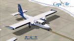
Cape Air operates a fleet of over 83 Cessna 402s, 4 Britten-Norman Islanders and 2 ATRs, with up to 525 flights per day during high season.
Here is their AI Model(Artificial Intelligence Model) for FSX-FSX Steam Version. Model by HTAI (Henry Tomkiewicz) is included in this Pack,
FSX-FSX Steam Props Textures by Tom Tiedman,repaints by Rafael "Fefi" Ortiz and Xtra files folder included for those who wishes to add something else to their model.
You may also find their FS2004 Version as well as the Caribbean Flight Plans for all versions here on this website.
Installation instructions included on the AI 9K BN IslandersX Readme file. Video of this project with more info,pics and a description of what AI Traffic is and what it does here:
http://youtu.be/Dv4HD0P3cbw
| Filename: | Cape_Air_BN_Islanders_AI_Pack.zip |
| License: | Freeware |
| Added: | 1st February 2015, 13:39:52 |
| Downloads: | 912 |
| Author: | Rafael Ortiz |
| Size: | 3.33 MB |
| Category: Flight Simulator 2004 - AI Flight Plans | |
| Default AI General Aviation V2 |
|
File Description:
These files are the default AI flight plans for all the general aviation flights as delivered in Flight Simulator 2004. They have been separated by aircraft and sorted by departure region/country.
These flightplans may be used as a basis for more realistic GA traffic. From replacing the tail numbers with realistic regionally accurate numbers to completely replacing the default flights with more realistic AI GA traffic on a regional basis. These files will also make it easier to shift GA traffic out of major commercial hub airports (so you won't be running over a Cessna 172 while on final approach into JFK any more).
This second version is to correct the Beech King Air 350 (AC#2). In the first version all the flight plans had somehow been doubled in the file.
| Filename: | Default_AI_General_Aviation_V2.zip |
| License: | Freeware |
| Added: | 9th January 2005, 17:53:58 |
| Downloads: | 3,610 |
| Author: | James Whitaker |
| Size: | 728.1 KB |
| Category: Miscellaneous Files - Demos from Commercial Vendors | |
| QuickPlan for Windows |
|
Images related to this file:
File Description:

QuickPlan for Windows is a visual point and click flight planner that makes it easy to generate flight plans in native FSX, FS2004 or X-Plane formats.
The entire route is generated visually, by tapping the map to add the departure airport, intermediate waypoints and arrival airport in the same order that you intend flying the plan.
During plan creation and after adding the final arrival waypoint you also have the opportunity to remove any of the intermediate waypoints before saving the plan in your preferred format.
QuickPlan utilises a new mapping engine and includes 12 world-wide map styles and has support for FSWidgets Cloud Based Aero Charts (free Cuba/Puerto Rico WAC Cloud Based Chart included) and FSWidgets Cloud Based World Nav Data (Free KSFO - San Francisco Bay area Nav Data included).
QuickPlan can be used in Freeform Mode, Advanced Mode, or a combination of both.
FREEFORM MODE: Simply click anywhere on the map and QuickPlan will allow you to add it as a generic waypoint. VFR pilots often use towns, lakes and other unique geographic features and with QuickPlan you can add any geographical location shown on the base map. Plans created this way label the waypoints automatically with generic names (e.g. DEP, WP1, WP2, ARR).
If desired, the entire route from departure to arrival can be created without reference to any navigational aids or official airports. This is handy for bush pilots who often use unlicensed airfields and small landing strips (or seaplane landing areas). Helicopter pilots can also quickly create plans that depart from off-airport locations like building rooftops or land on a road.
ADVANCED MODE: If you own the FSWidgets Cloud Based World Nav Data product you can create more advanced flight plans by clicking on any of the icons displayed on the map to add them as waypoints - airports, VOR's, NDB's and intersections (data for the KSFO area is included free). Plans created this way label the waypoints automatically with airport and navigational aid identifiers taken from the Nav Data (e.g. KSFO, OSI, LV, FABLA). FEATURE LIST:
- Generates native FSX (.pln), FS2004 (.pln) and X-Plane (.fms) format flight plans
- Saves flight plans to any folder (preferred folder set in Preferences)
- Search for airport by ICAO identifier
- Map powered by CloudMade Leaflet API (using OpenStreetMap data)
- Includes 12 world-wide maps styles
- Supports FSWidgets Cloud Based AERO CHARTS
- Free Cuba/Puerto Rico WAC Cloud Based Chart included
- Supports FSWidgets Cloud Based WORLD NAV DATA
- Free KSFO (San Francisco Bay) area Nav Data included
- World-wide Metar and TAF Data icons
- US Nexrad (Next-Gen Radar) Data
| Filename: | QuickPlan_for_Windows.zip |
| License: | Commercial demo |
| Added: | 27th October 2012, 09:22:33 |
| Downloads: | 523 |
| Author: | Fermin Fernandez - FSWidgets |
| Size: | 1.95 MB |


© 2001-2026 AVSIM Online
All Rights Reserved
Privacy Policy |