
Where Flight Simulation Enthusiasts Gather from Around the World!
AVSIM Library - Search Results

| Category: Flight Simulator 2004 - AI Aircraft | |
| World of AI Royal Jordanian Complete AI Package |

|
Images related to this file:
File Description:

World of AI welcomes you to this Royal Jordanian Complete AI Package for FS2004 and FSX. Models by AI Aardvark, DJC, FS Painter, The Fruit Stand; Repaints by Federico Permutti, Dave Wilkins; Winter 2007 flightplans by Tamas Mezei. does not include South African - registered leased a/c IMPORTANT! You need the World of AI Installer to make this package work! (WOAINS24.zip). This package just replaces the corrupted package due to the AVSIM hack. Nothing has changed.
| Filename: | World_of_AI_Royal_Jordanian_Complete_AI_Package.zip |
| License: | Freeware, limited distribution |
| Added: | 21st January 2010, 11:00:24 |
| Downloads: | 68,547 |
| Author: | World of AI |
| Size: | 7 MB |
| Category: Flight Simulator 2004 - AI Aircraft | |
| World of AI Swiss Complete AI Package v2 |
|
Images related to this file:
File Description:

World of AI welcomes you to this Swiss Complete AI Package v2 for FS2004 and FSX. Models by AI Aardvark, Craig Ritchie, The Fruit Stand, Fernando Martinez; Repaints by Phillip Tan, Denis Schranz, Brian Mitchell, Thomas Lo Gerfo, Alexis Solvay; Summer 2008 flightplans by Mischa Faulstich. IMPORTANT! You need the World of AI Installer to make this package work! (WOAINS24.zip). This package just replaces the corrupted package due to the AVSIM hack. Nothing has changed.
| Filename: | World_of_AI_Swiss_Complete_AI_Package_v2.zip |
| License: | Freeware, limited distribution |
| Added: | 4th January 2010, 15:04:44 |
| Downloads: | 125,921 |
| Author: | World of AI |
| Size: | 7.65 MB |
| Category: Flight Simulator 2004 - Utilities | |
| FlightSim Manager 2.5.1 |
|
File Description:
Compatible with both FS2002 and FS2004
FlightSim Manager is a great tool for managing add-ons to Microsoft Flight Simulator. Using easy to Wizard - FSM can install aircraft, panels, textures and scenery directly from distribution ZIP files you may have downloaded, with proper uninstallation of add-ons. From an easy to use Aircraft editor to add or remove aircraft variants, to an comprehensive Hangar management allows you to manage and configure your add-ons off your live FS installation.
You can now create Virtual Fleets, and enable/disable the complete fleet with ease. For serious pilots, FSM also offers a complete Logbook.
Using FSM, you can create Texture Sets - i.e.. different Tree Sets, and you can install any set with a single click, capture screenshots from Flight Simulator, Benchmark with log, launch it with Random Splash Screens, and fly from anywhere in the world using an map view.
You can also control Flight Simulator with speech commands using FSM. It also supports auto-saving flight, warning sytem, and custom event sounds.
Finally with a comprehensive Diagnostic Tools and Repository feature, FSM keeps your FS installation clean. Apart from the usual Missing and unused gauges, FSM can also locate Aircraft problems, Missing and unused effects, Scenery Problems with a LandClass File relocate feature - say bye-bye to all the memory leaks.
To provide you - the user with the best Freeware FS-Addon, I need your help... if you have any suggestions, recommendations or problem using this software, please contact me through our Forum at:
http://softwares.ranainside.com/forum/
You can find the latest version from -
http://www.ranainside.com/
| Filename: | FlightSim_Manager_251.zip |
| License: | Freeware |
| Added: | 27th August 2004, 17:26:52 |
| Downloads: | 4,306 |
| Author: | Rana Hossain |
| Size: | 4.3 MB |
| Category: Flight Simulator X - Scenery | |
| RAF Bottlesford - Lincolnshire, England |
|
File Description:
Royal Air Force Station Bottesford or more simply RAF Bottesford is a former Royal Air Force station located on the Leicestershire-Lincolnshire county border, 6.8 miles (10.9 km) north west of Grantham, Lincolnshire and 7.6 miles (12.2 km) south of Newark-on-Trent, Nottinghamshire and about 107 miles (172 km) north-northwest of London, England.
Opened in 1942, it was used by both the Royal Air Force (RAF) and United States Army Air Forces (USAAF). During the war it was used primarily as a troop carrier airfield for paratroopers and as a bomber airfield before closing in 1948.
Today the remains of the airfield are located on private property with the technical site being used as an industrial estate.
Third party add-on's will be required to see all the building included in the scenery, you will need Ted Andrews RAF Small Buildings and his hanger library, for the vehicles Ian Pearson FSX Object library will be required, the RAF Ensign hedges are the from Mike Hudson's scenery. All of which are available from Ian Pearsons' website; www.ianpsdarkcorner.co.uk.
| Filename: | RAF_Bottlesford___Lincolnshire_England.zip |
| License: | Freeware |
| Added: | 10th October 2015, 11:37:40 |
| Downloads: | 345 |
| Author: | Terry Boissel |
| Size: | 15.94 KB |
| Category: Flight Simulator X - Scenery | |
| RAF Metheringham - Lincoln, Lincolnshire, England **FIX** |
|
File Description:
This is a fix which will sort out the scenery configuration error which prevented the scenery from showing.
Metheringham airfield is located two miles to the east of Metheringham village on the B1189. The airfield opened in October 1943 as a Class 'A' bomber airfield within 5 Group. The standard three intersecting concrete runways were provided as were two T2 hangars and a B1. One of the T2s was on the technical site to the south-west, which straddled the B1189 and the other was located off the eastern perimeter track. The bomb stores were to the north and between these and the north-west runway head stood the B1 hangar. The communal and accommodation sites were located in fields to the south and west. Metheringham was also equipped with FIDO fog dispersal equipment. The station closed in 1951 and very little remains of the station now although a small visitors centre with a little museum on site.
You will require third party add-ons - details in the included Read-me.txt file.
| Filename: | RAF_Metheringham__Lincoln_Lincolnshire_England__FI.zip |
| License: | Freeware |
| Added: | 15th November 2015, 14:25:30 |
| Downloads: | 206 |
| Author: | Terry Boissel |
| Size: | 95.84 KB |
| Category: Orbiter - Spaceships | |
| LC-39 with VAB SCA-747 and MDD Part2 |
|
File Description:
Part 2 of the New Launch Complex 39A&B with new VAB, MDD and OPF.*Important* ,you must have the K-SCA-VAB-MDD-LC39.zip file installed first before you install this add-on.It can be found at www.avsim.com ..Part 2 includes a Tail-Cone for the SCA with Shuttle,Orbiter Transporter and Fuel Tank Tansporter...For the Mate Demate Scenario - Press G to lower your Gear,then switch to MDD using F3.Press A then quickly press K and hold Left Shift and press 0 on the numpad..Press K to operate the MDD.Press G to open the Orbiter entry Door on the VAB.Press K to open the Tank entry door on the VAB.
Take off in the SCA-747 with Default Atlantis Shuttle Attached from KSC airport.Press G to raise your gear.Press + and CTRL to engage your thrust..Uses Vinka's new Spacecraft3.DLL.(included)..Has Engine Sounds (needs OrbiterSound 3.0 or higher installed).Unzip into your Orbiter folder.Click Yes for All when asked to overwrite.(Make sure - Use Folder names is ticked when using winzip.)
| Filename: | LC39_with_VAB_SCA747_and_MDD_Part2.zip |
| License: | Freeware |
| Added: | 27th July 2006, 04:14:10 |
| Downloads: | 818 |
| Author: | Kev Shanow |
| Size: | 614.29 KB |
| Category: Prepar3D V1-4 - Scenery | |
| LGLR military base (P3D4) |
|
File Description:
Hi there !!
My name is Dimitri.
This is my FIRST EVER creation for flight simulation. And i like to share it with you all.
It's my hometown airport LGLR military base, Larissa city, here in central Greece.
When microsoft released FSX, i noticed that THIS airport was COMPLETLY ruined, empty .. and completly
misplaced at the wrong place on the map !! I tried for years, to find a good add-on but ....
nothing good so far ... Then lockheed martin toke over the code from microsoft and created P3D.
But still, this airport remained as it was before, nothing changed... I was SO mad, that i thought
I should do something about it my self.. so, here we are, i fixed it.
This airport was created with "Airport design editor version.177" and SbuilderX v.315
I was using ORBX base pack, with ORBX Europe LC and ORBX vector during the creation.
Keep in mind that i am using some small ORBX library objects like, grass, bushes and so on...
If you don't have ORBX installed, i don't know if this is gonna work.
| Filename: | LGLR_military_base_P3D4.zip |
| License: | Freeware |
| Added: | 4th August 2019, 17:25:21 |
| Downloads: | 698 |
| Author: | Dimitris P. Mylonas |
| Size: | 12.24 MB |
| Category: Flight Simulator 2004 - Scenery | |
| "Himalayan Peaks" LOD10 Mesh, Volume 8 - Tirich Mir and Pamir |
|
Images related to this file:
File Description:
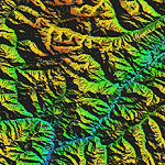
Highly detailed terrain mesh of the Tirich Mir and Pamir areas, N36-39 E71-74. The files in this package are based on Shuttle Radar (SRTM) Version 2 data but with many of the void areas, especially the most significant sections, filled with elevation data generated from topographic maps by Jonathan de Ferranti. While Jonathan's work is unrelated to flight simulation he kindly gave me permission to compile his data for use in FS. The result is a wonderful improvement in detail and accuracy over any existing mesh file, freeware or commercial, based on SRTM or DTED data alone.
Due to the large area of the Himalayas I've compiled the source data as two separate series: the "Himalayan Peaks" series covers prominent mountains and ranges in higher detail and locally overrides any existing LOD9 terrain mesh. In addition, a LOD9 "base mesh" series covering the entire Himalayas will be available for those who do not yet have an add-on terrain mesh of these beautiful mountains.
| Filename: | Himalayan_Peaks_LOD10_Mesh_Volume_8__Tirich_Mir_an.zip |
| License: | Freeware, limited distribution |
| Added: | 29th May 2010, 08:52:47 |
| Downloads: | 9,103 |
| Author: | Holger Sandmann, Jonathan de Ferranti |
| Size: | 47.94 MB |
| Category: Flight Simulator 2004 - Scenery | |
| Himalayas LOD9 Base Mesh, Volume 1 - Southeastern Ranges |
|
Images related to this file:
File Description:
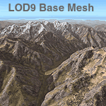
Detailed terrain mesh of the Southeastern Himalayan Ranges, N26-32 E90-98. The files in this package are based on Shuttle Radar (SRTM) Version 2 data but with many of the void areas, especially the most significant sections, filled with elevation data generated from topographic maps by Jonathan de Ferranti. While Jonathan's work is unrelated to flight simulation he kindly gave me permission to compile his data for use in FS. The result is a wonderful improvement in detail and accuracy over any existing mesh file, freeware or commercial, based on SRTM or DTED data alone.
Due to the large area of the Himalayas I've compiled the source data as two separate series: the "Himalayan Peaks" series covers prominent mountains and ranges in higher detail and locally overrides any existing LOD9 terrain mesh. In addition, a LOD9 "base mesh" series, with LOD8 and LOD7 "buffer" mesh files, covering the entire Himalayas, is meant for those who do not yet have an add-on terrain mesh of these beautiful mountains.
| Filename: | Himalayas_LOD9_Base_Mesh_Volume_1__Southeastern_Ra.zip |
| License: | Freeware, limited distribution |
| Added: | 29th May 2010, 09:01:26 |
| Downloads: | 10,298 |
| Author: | Holger Sandmann, Jonathan de Ferranti |
| Size: | 71.82 MB |
| Category: Flight Simulator 2004 - Scenery | |
| Himalayas LOD9 Base Mesh, Volume 4 - Kashmir and Jammu |
|
File Description:
Detailed terrain mesh of the Kashmir and Jammu Ranges, N30-39 E76-78. The files in this package are based on Shuttle Radar (SRTM) Version 2 data but with many of the void areas, especially the most significant sections, filled with elevation data generated from topographic maps by Jonathan de Ferranti. While Jonathan's work is unrelated to flight simulation he kindly gave me permission to compile his data for use in FS. The result is a wonderful improvement in detail and accuracy over any existing mesh file, freeware or commercial, based on SRTM or DTED data alone.
Due to the large area of the Himalayas I've compiled the source data as two separate series: the "Himalayan Peaks" series covers prominent mountains and ranges in higher detail and locally overrides any existing LOD9 terrain mesh. In addition, the LOD9 "base mesh" series, with LOD8 and LOD7 "buffer" mesh files, covering the entire Himalayas, is meant for those who do not yet have an add-on terrain mesh of these beautiful mountains.
| Filename: | Himalayas_LOD9_Base_Mesh_Volume_4__Kashmir_and_Jam.zip |
| License: | Freeware, limited distribution |
| Added: | 22nd February 2006, 20:32:50 |
| Downloads: | 7,503 |
| Author: | Holger Sandmann, Jonathan de Ferranti |
| Size: | 29.24 MB |
© 2001-2026 AVSIM Online
All Rights Reserved
Privacy Policy |